|
Noshki
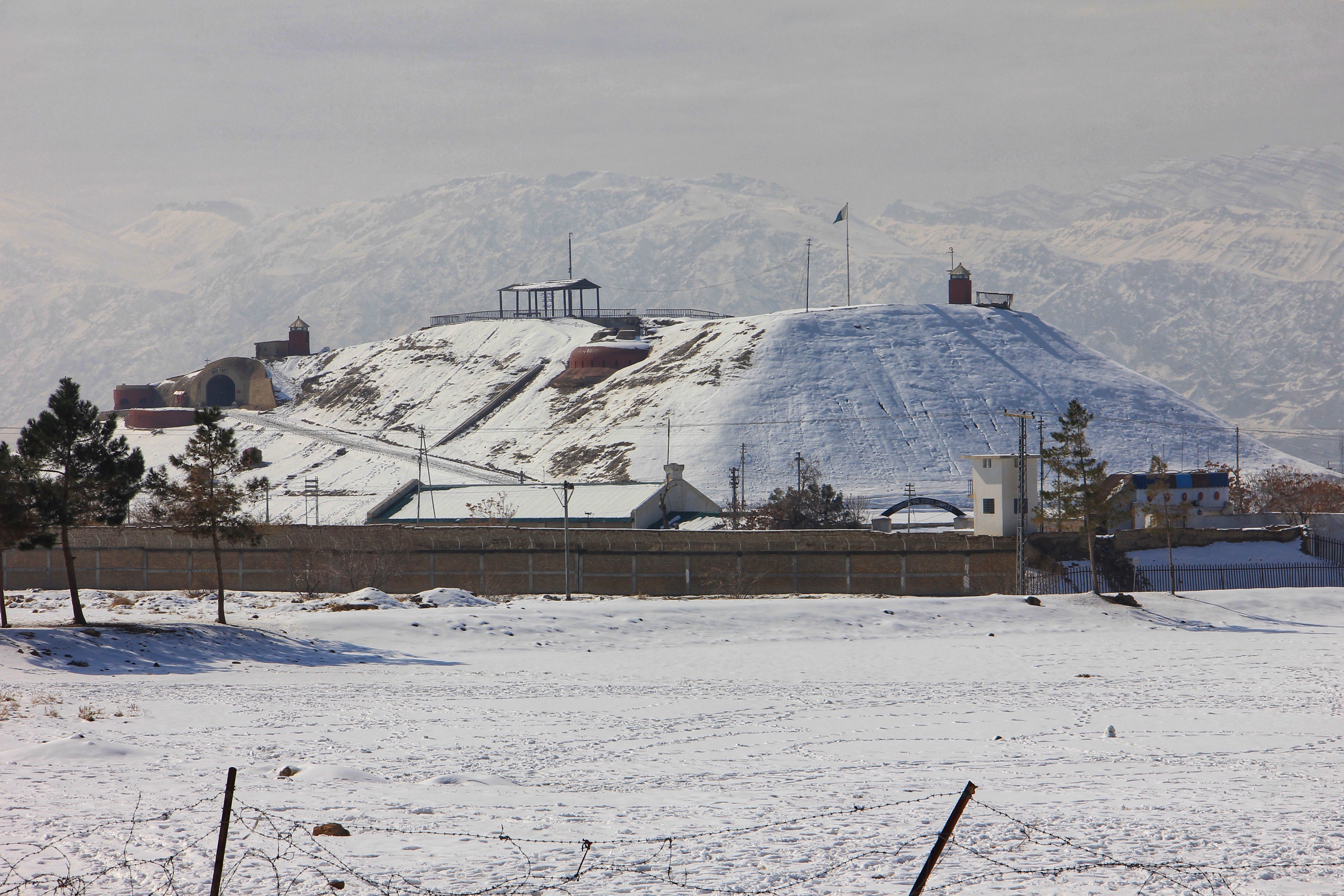
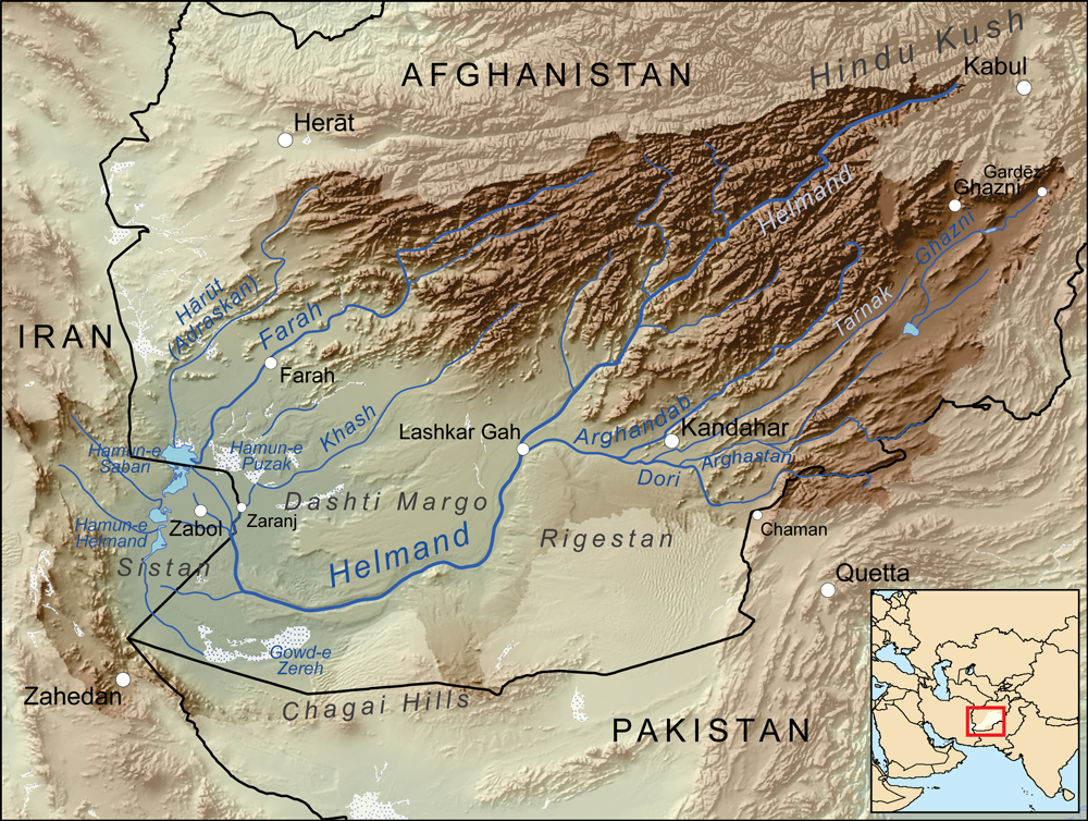
Nushki (Urdu , ) is a town and district in Balochistan, Pakistan. It lies in a plain south-west of Quetta, at an elevation of above sea level. From Nushki, the flat Balochistan desert stretches away northward and westward to the Helmand River. History Nushki was a starting off point for the British exploration of Central Asia. The British, concerned that their colonies in India would be attacked overland by either Napoleon or the Russians, sent two British officers, Captain Charles Christie and Lieutenant Henry Pottinger, to explore the regions between Balochistan and Persia, which was then allied with the British. Christie and Pottinger traveled from the coast to Kelat (now Kalat) and separated at Nushki on March 22, 1810, with Christie going northwest to Herat and Pottinger traveling west across the deserts. It was unlikely that either of the two men would be accepted by the locals, and they concealed their identities by posing as horse-traders or holy men during their respe ... [...More Info...] [...Related Items...] OR: [Wikipedia] [Google] [Baidu] |
Nushki District
Nushki District ( ur, ) is one of the districts of Balochistan province, Pakistan. The administration of the Nushki district was taken over from the Khan of Kalat by the British government in 1896, and was leased from him on a perpetual quit rent in 1899. Etymology Nushki drew from two Balochi words "Nosh-Koh" which stands for finishing work. In fact from 852 till 1764, the ancient Baloch tribe Mandai was ruling over Nushki. In 1546-47, Mandai along with Rakhshani tribes including Jamaldini, Hooth, Badini, Jeehandzai, Makaki, Lajahi and Badozai fought against Kamran Mirza the brother of Humayun, where they defeated Mughals under the leading of Mir Mandai Khan and Mir Bijar Khan. When they came back from battle field, people asked them "What happened? They answered, we finished them", means (Nosh-Koh) with the passage of time, this word converted in "Nushki". History Mandai tribe ruled over Nushki for approximately 1000 years. In 1763-64, Mir Naseer Khan Noori was leaving fo ... [...More Info...] [...Related Items...] OR: [Wikipedia] [Google] [Baidu] |
Balochistan, Pakistan
Balochistan (; bal, بلۏچستان; ) is one of the four provinces of Pakistan. Located in the southwestern region of the country, Balochistan is the largest province of Pakistan by land area but is the least populated one. It shares land borders with the Pakistani provinces of Khyber Pakhtunkhwa and Punjab to the north-east and Sindh to the south-east. It shares International borders with Iran to the west and Afghanistan to the north; It is also bound by the Arabian Sea to the south. Balochistan is an extensive plateau of rough terrain divided into basins by ranges of sufficient heights and ruggedness. It has the world's largest deep sea port, The Port of Gwadar lying in the Arabian Sea. Balochistan shares borders with Punjab and the Khyber Pakhtunkhwa to the northeast, Sindh to the east and southeast, the Arabian Sea to the south, Iran ( Sistan and Baluchestan) to the west and Afghanistan (Helmand, Nimruz, Kandahar, Paktika and Zabul Provinces) to the north and northwe ... [...More Info...] [...Related Items...] OR: [Wikipedia] [Google] [Baidu] |
Districts Of Pakistan
The Districts of Pakistan ( ur, ); are the third-order administrative divisions of Pakistan, below provinces and divisions, but forming the first-tier of local government. In total, there are 169 districts in Pakistan including the Capital Territory and the districts of Azad Kashmir and Gilgit Baltistan. These districts are further divided into ''Tehsils, Union Councils''. History In 1947, when Pakistan gained independence there were 124 districts. In 1969, 2 new districts (Tangail and Patuakhali) in East Pakistan were formed totalling to 126. After the Independence of Bangladesh, Pakistan lost 20 of its districts and so there were 106 districts. In 2001, the number was reduced to 102 by the merger of the 5 districts of Karachi Central, Karachi East, Karachi South, Karachi West and Malir to form Karachi District. The number of districts rose to 106 again in December 2004, when four new districts were created in the province of Sindh of which one (Umerkot) had existed until ... [...More Info...] [...Related Items...] OR: [Wikipedia] [Google] [Baidu] |
Balochistan (Pakistan)
Balochistan (; bal, بلۏچستان; ) is one of the four provinces of Pakistan. Located in the southwestern region of the country, Balochistan is the largest province of Pakistan by land area but is the least populated one. It shares land borders with the Pakistani provinces of Khyber Pakhtunkhwa and Punjab to the north-east and Sindh to the south-east. It shares International borders with Iran to the west and Afghanistan to the north; It is also bound by the Arabian Sea to the south. Balochistan is an extensive plateau of rough terrain divided into basins by ranges of sufficient heights and ruggedness. It has the world's largest deep sea port, The Port of Gwadar lying in the Arabian Sea. Balochistan shares borders with Punjab and the Khyber Pakhtunkhwa to the northeast, Sindh to the east and southeast, the Arabian Sea to the south, Iran ( Sistan and Baluchestan) to the west and Afghanistan (Helmand, Nimruz, Kandahar, Paktika and Zabul Provinces) to the north and northwe ... [...More Info...] [...Related Items...] OR: [Wikipedia] [Google] [Baidu] |
Administrative Units Of Pakistan
The administrative units of Pakistan comprise four provinces, one federal territory, and two disputed territories: the provinces of Punjab, Sindh, Khyber Pakhtunkhwa, and Balochistan; the Islamabad Capital Territory; and the administrative territories of Azad Jammu and Kashmir and Gilgit–Baltistan. As part of the Kashmir conflict with neighbouring India, Pakistan has also claimed sovereignty over the Indian-controlled territories of Jammu and Kashmir and Ladakh since the First Kashmir War of 1947–1948, but has never exercised administrative authority over either region. All of Pakistan's provinces and territories are subdivided into divisions, which are further subdivided into districts, and then tehsils, which are again further subdivided into union councils. History of Pakistan Early history Pakistan inherited the territory comprising its current provinces from the British Raj following the Partition of India on 14 August 1947. Two days after independence, t ... [...More Info...] [...Related Items...] OR: [Wikipedia] [Google] [Baidu] |
Pakistan
Pakistan ( ur, ), officially the Islamic Republic of Pakistan ( ur, , label=none), is a country in South Asia. It is the world's List of countries and dependencies by population, fifth-most populous country, with a population of almost 243 million people, and has the world's Islam by country#Countries, second-largest Muslim population just behind Indonesia. Pakistan is the List of countries and dependencies by area, 33rd-largest country in the world by area and 2nd largest in South Asia, spanning . It has a coastline along the Arabian Sea and Gulf of Oman in the south, and is bordered by India to India–Pakistan border, the east, Afghanistan to Durand Line, the west, Iran to Iran–Pakistan border, the southwest, and China to China–Pakistan border, the northeast. It is separated narrowly from Tajikistan by Afghanistan's Wakhan Corridor in the north, and also shares a maritime border with Oman. Islamabad is the nation's capital, while Karachi is its largest city and fina ... [...More Info...] [...Related Items...] OR: [Wikipedia] [Google] [Baidu] |
Quetta
Quetta (; ur, ; ; ps, کوټه) is the tenth List of cities in Pakistan by population, most populous city in Pakistan with a population of over 1.1 million. It is situated in Geography of Pakistan, south-west of the country close to the Durand line, International border with Afghanistan. It is the capital of the Administrative units of Pakistan, province of Balochistan, Pakistan, Balochistan where it is the largest city. Quetta is at an average elevation of above sea level, making it Pakistan's only high-altitude major city. The city is known as the ''"Fruit Garden of Pakistan"'' due to the numerous fruit orchards in and around it, and the large variety of fruits and dried fruit products produced there. Located in northern Balochistan near the Durand line, Pakistan-Afghanistan border and the road across to Kandahar, Quetta is a trade and communication centre between the two countries. The city is near the Bolan Pass route which was once one of the major gateways from Ce ... [...More Info...] [...Related Items...] OR: [Wikipedia] [Google] [Baidu] |
Helmand River
The Helmand River (also spelled Helmend, or Helmund, Hirmand; Pashto/Persian: ; Greek: ' (''Etýmandros''); Latin: ') is the longest river in Afghanistan and the primary watershed for the endorheic Sistan Basin. It emerges in the Sanglakh Range of the Hindu Kush mountains in the northeastern part of Maidan Wardak Province, where it is separated from the watershed of the Kabul River by the Unai Pass. The Helmand feeds into the Hamun Lake on the border between Afghanistan and Iran. Etymology The name comes from the Avestan ''Haētumant'', literally "dammed, having a dam", which referred to the Helmand River and the irrigated areas around it. Geography The Helmand River stretches for . It rises in the northeastern part of Maidan Wardak Province in the Hindu Kush mountains, about 40 km west of Kabul (), flowing southwestward through Daykundi Province and Uruzgan Province. After passing through the city of Lashkargah in Helmand Province, it enters the desert of Dashti Ma ... [...More Info...] [...Related Items...] OR: [Wikipedia] [Google] [Baidu] |
Charles Christie (officer)
Charles Christie (died 1812) was a British officer, mostly remembered for his endeavours in Qajar Iran. A member of the first British military mission to Iran (1810), he was killed in action while serving on the Iranian side during the Russo-Persian War of 1804–1813. Biography Charles Christie was the son of James Christie, the founder of Christie's Auction House. Originally a captain of the Bombay Regiment of the Anglo-Indian army, in 1810, Christie and Lieutenant Henry Pottinger were ordered by Sir John Malcolm to explore the route from Bombay to Baluchistan, Sistan and the Makran. These areas were thought to hold a possible overland route by which a European army could invade India. Christie and Pottinger disguised themselves as horse dealers, and travelled north from the Makran coast to Nushki, where the two separated in March of 1810. Christie moved north through Sistan to Herat and thereafter across the central Iranian desert to Yazd and Isfahan. A manuscript of Christie' ... [...More Info...] [...Related Items...] OR: [Wikipedia] [Google] [Baidu] |
Populated Places In Balochistan, Pakistan
Population typically refers to the number of people in a single area, whether it be a city or town, region, country, continent, or the world. Governments typically quantify the size of the resident population within their jurisdiction using a census, a process of collecting, analysing, compiling, and publishing data regarding a population. Perspectives of various disciplines Social sciences In sociology and population geography, population refers to a group of human beings with some predefined criterion in common, such as location, race, ethnicity, nationality, or religion. Demography is a social science which entails the statistical study of populations. Ecology In ecology, a population is a group of organisms of the same species who inhabit the same particular geographical area and are capable of interbreeding. The area of a sexual population is the area where inter-breeding is possible between any pair within the area and more probable than cross-breeding with ind ... [...More Info...] [...Related Items...] OR: [Wikipedia] [Google] [Baidu] |


.png)


