|
Northland Rugby Union Team
The Northland Rugby Union is the governing body for rugby union in Northland, New Zealand; Northland is a region of New Zealand that covers areas in the districts of Far North, Kaipara, and Whangārei. Established in 1920, they represent the Bunnings NPC side, Northland Taniwha, and Farah Palmer Cup side, Northland Kauri. It is also affiliated with the Blues Super Rugby franchise. Their home playing colours are sky blue and they play their home games at Semenoff Stadium in Morningside. Affiliated clubs There are currently 39 registered clubs incorporated and secondary schools affiliated with the Northland Rugby Union, most of which have teams at both senior and junior levels. *Awanui Rugby Football Club *Dargaville High School *Eastern United Rugby & Sports Club * The Hora Hora Rugby Union Football Club *Kaeo Rugby and Sports Club *Kaihu Valley Rugby Football Club *Kaikohe Rugby Football and Sports Club *Kaitaia City Rugby Union Football Club * Kaitaia College *Kamo Hig ... [...More Info...] [...Related Items...] OR: [Wikipedia] [Google] [Baidu] |
Rugby Union
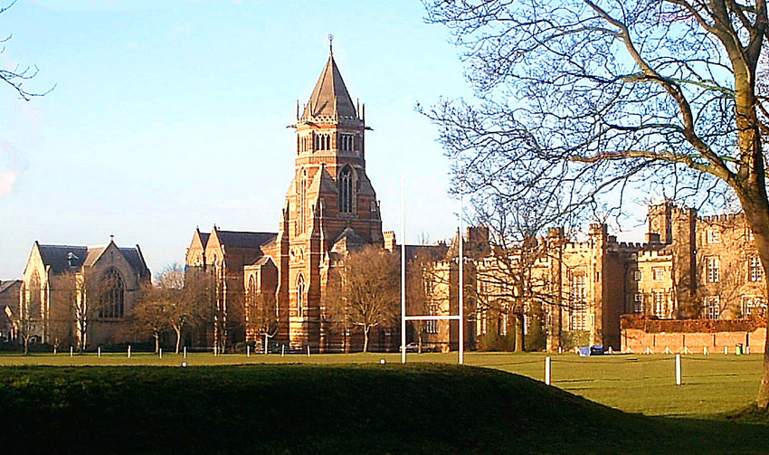
Rugby union, commonly known simply as rugby, is a close-contact team sport that originated at Rugby School in the first half of the 19th century. One of the two codes of rugby football, it is based on running with the ball in hand. In its most common form, a game is played between two teams of 15 players each, using an oval-shaped ball on a rectangular field called a pitch. The field has H-shaped goalposts at both ends. Rugby union is a popular sport around the world, played by people of all genders, ages and sizes. In 2014, there were more than 6 million people playing worldwide, of whom 2.36 million were registered players. World Rugby, previously called the International Rugby Football Board (IRFB) and the International Rugby Board (IRB), has been the governing body for rugby union since 1886, and currently has 101 countries as full members and 18 associate members. In 1845, the first laws were written by students attending Rugby School; other significant even ... [...More Info...] [...Related Items...] OR: [Wikipedia] [Google] [Baidu] |
Dargaville High School
Dargaville ( mi, Takiwira) is a town located in the North Island of New Zealand. It is situated on the bank of the Northern Wairoa River in the Kaipara District of the Northland region. The town is located 55 kilometres southwest of Whangārei. Dargaville is 174 kilometres north of Auckland. It is noted for the high proportion of residents of Croatian descent. The area around it is one of the chief regions in the country for cultivating kumara ( sweet potato) and so Dargaville is known by many locals as the Kumara Capital of New Zealand. History and culture The town was named after timber merchant and politician Joseph Dargaville (1837–1896). Dargaville was founded in 1872, during the 19th-century kauri gum and timber trade, it briefly had New Zealand's largest population. Dargarville was made a borough in 1908. The area became known for a thriving industry that included gum digging and kauri logging, which was based mainly at Te Kōpuru, several kilometres south of Da ... [...More Info...] [...Related Items...] OR: [Wikipedia] [Google] [Baidu] |
Rodney District
Rodney District was a local government area in the northernmost part of New Zealand's Auckland Region from 1989 to 2010. It included Kawau Island. It was created from the amalgamation of Helensville, Helensville Borough and Rodney County, New Zealand, Rodney County in 1989. The seat of Rodney District Council was at Orewa. Rodney District and Rodney County each took their names from Cape Rodney (opposite Little Barrier Island), which Captain James Cook named on 24 November 1769 after Admiral Sir George Brydges Rodney, 1st Baron Rodney, George Brydges Rodney. Auckland Council has governed the area since 1 November 2010. The Rodney ward of the Auckland Region now covers much of the land area, but not the Hibiscus Coast or the former council seat of Orewa, which are in the Albany ward (local government), Albany ward. The district was, in the final electoral term (2007–2010) of its existence, led by mayor Penny Webster and 12 councillors. Mayors During its 21-year existence, Rodn ... [...More Info...] [...Related Items...] OR: [Wikipedia] [Google] [Baidu] |
Whangaroa
Whangaroa is a settlement on Whangaroa Harbour in the Far North District of New Zealand. It is 8 km north-west of Kaeo and 35 km north-west of Kerikeri. The harbour is almost landlocked and is popular both as a fishing spot in its own right and as a base for deep-sea fishing. History The harbour was the scene of one of the most notorious incidents in early New Zealand history, the Boyd massacre. In December 1809 almost all the crew and 70 passengers were killed as ''utu'' (revenge) for the mistreatment of Te Ara, the son of a Ngāti Uru chief, who had been in the crew of the ship. Several days later the ship was burnt out after gunpowder was accidentally ignited. Relics of the ''Boyd'' are now in a local museum. On 16 July 1824 on a voyage to Sydney from Tahiti, the crew and passengers of the colonial schooner ''Endeavour'' (Capt John Dibbs) stopped in Whangaroa Harbour. An altercation with the local Māori Ngāti Pou hapū (subtribe) of the Ngā Puhi iwi resulted in ... [...More Info...] [...Related Items...] OR: [Wikipedia] [Google] [Baidu] |
Hokianga
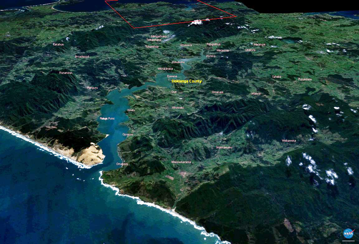
The Hokianga is an area surrounding the Hokianga Harbour, also known as the Hokianga River, a long estuarine drowned valley on the west coast in the north of the North Island of New Zealand. The original name, still used by local Māori, is ''Te Kohanga o Te Tai Tokerau'' ("the nest of the northern people") or ''Te Puna o Te Ao Marama'' ("the wellspring of moonlight"). The full name of the harbour is Te Hokianga-nui-a-Kupe — "the place of Kupe's great return". Geography The Hokianga is in the Far North District, which is in the Northland Region. The area is northwest of Whangarei—and west of Kaikohe—by road. The estuary extends inland for from the Tasman Sea. It is navigable for small craft for much of its length, although there is a bar across the mouth. In its upper reaches the Rangiora Narrows separate the mouths of the Waihou and Mangamuka Rivers from the lower parts of the harbour. 12,000 years ago, the Hokianga was a river valley flanked by steep bu ... [...More Info...] [...Related Items...] OR: [Wikipedia] [Google] [Baidu] |
Taipa-Mangonui
Taipa-Mangonui or Taipa Bay-Mangonui is a string of small resort settlements – Taipa, Cable Bay, Coopers Beach, and Mangōnui – that lie along the coast of Doubtless Bay and are so close together that they have run together to form one larger settlement. The miniature conurbation lies 150 kilometres by road northwest of Whangārei (and 100 kilometres as the crow flies), 20 kilometres northeast of Kaitaia, and nearly 100 kilometres southeast of the northernmost tip of the North Island. It is the northernmost centre in New Zealand with a population of more than 1000. The New Zealand Ministry for Culture and Heritage gives a translation of "great shark" for ''Mangōnui''. Demographics Taipa-Mangonui, called Taumarumaru for census purposes, covers and had an estimated population of as of with a population density of people per km2. Taumarumaru had a population of 2,193 at the 2018 New Zealand census, an increase of 381 people (21.0%) since the 2013 census, and an increase ... [...More Info...] [...Related Items...] OR: [Wikipedia] [Google] [Baidu] |
Bay Of Islands
The Bay of Islands is an area on the east coast of the Far North District of the North Island of New Zealand. It is one of the most popular fishing, sailing and tourist destinations in the country, and has been renowned internationally for its big-game fishing since American author Zane Grey publicised it in the 1930s. It is north-west of the city of Whangarei. Cape Reinga, at the northern tip of the country, is about by road further to the north-west. Geography The bay itself is an irregularly-shaped -wide, drowned valley system and a natural harbour. It contains 144 islands, of which the largest is Urupukapuka, and numerous peninsulas and inlets. The three largest inlets are Waikare Inlet in the south, and Kerikeri and Te Puna (Mangonui) inlets in the north-west. The Purerua Peninsula, north of Te Puna Inlet, separates the north-western part of the bay from the Pacific Ocean, and Cape Brett Peninsula extends into the ocean at the eastern end of the bay. The biggest t ... [...More Info...] [...Related Items...] OR: [Wikipedia] [Google] [Baidu] |
Wairoa
Wairoa is a town and territorial authority district in New Zealand's North Island. The town is the northernmost in the Hawke's Bay region, and is located on the northern shore of Hawke Bay at the mouth of the Wairoa River and to the west of Māhia Peninsula. It is on State Highway 2, northeast of Napier, and southwest of Gisborne. Wairoa is the nearest town to the Te Urewera protected area and former national park that is accessible from Wairoa via State Highway 38. It is the largest town in the district of Wairoa, and is one of three towns in New Zealand where Māori outnumber other ethnicities, with 62.29% of the population identifying as Māori. History Early history Te Wairoa was originally a Māori settlement. The ancestral waka (canoe) Tākitimu travelled up the river and landed at Mākeakea, near where Tākitimu meeting house stands today. The Wairoa river (full name: Te Wairoa Hōpūpū Hōnengenenge Matangirau) was an important source of food as well as a t ... [...More Info...] [...Related Items...] OR: [Wikipedia] [Google] [Baidu] |
Rodney College
Wellsford ( Māori: ''Whakapirau'') is a town on the Northland Peninsula in the northern North Island of New Zealand. It is the northernmost major settlement in the Auckland Region, and is 77 kilometres northwest of the Auckland CBD. Wellsford is close to a narrowing of the Northland Peninsula caused by an arm of the Kaipara Harbour on the west coast extending inland for 20 kilometres from the body of the harbour, stretching to within 15 kilometres of the east (Pacific Ocean) coast. It is a major regional centre, being located at the junction of State Highways 1 and 16, almost halfway between Auckland and the Northland city of Whangārei. It is on the North Auckland Line railway, which has been goods-only since the last regular passenger service ceased in 1975. It is the rural service town for the local areas of Tauhoa, Tapora, Wharehine, Port Albert, Te Hana, Tomarata, Te Arai, Whangaripo and Pakiri. The local Ōruawharo Marae is a traditional meeting ground for Te Uri o ... [...More Info...] [...Related Items...] OR: [Wikipedia] [Google] [Baidu] |
Northland College, Kaikohe
Northland College is a small co-educational secondary school in Kaikohe. History Utilising buildings built for a military hospital during the Second World War, the school was opened in 1947. Originally called the Northland Agricultural and Technical College, the school was established with a farm and forestry block to provide financial support into the future. Over its first twenty years new buildings were gradually added, and by 1968 the school had moved out of the original hospital buildings which remained a hostel. Houses Like many New Zealand schools, Northland College groups students into Houses for pastoral support and internal competitions. The names of the Houses have changed over the years. First names: ''Clendon, Hobson, Maning, Marsden, Pompallier, Williams''. Second names: ''Pouerua, Putahi, Ramaroa, Whakatere'' Third names: ''Rata, Tawa, Rimu, Kowhai'' Current names: ''Kauri, Matai, Totara''. New school buildings In August 2015 the Ministry of Education ... [...More Info...] [...Related Items...] OR: [Wikipedia] [Google] [Baidu] |
Kerikeri High School
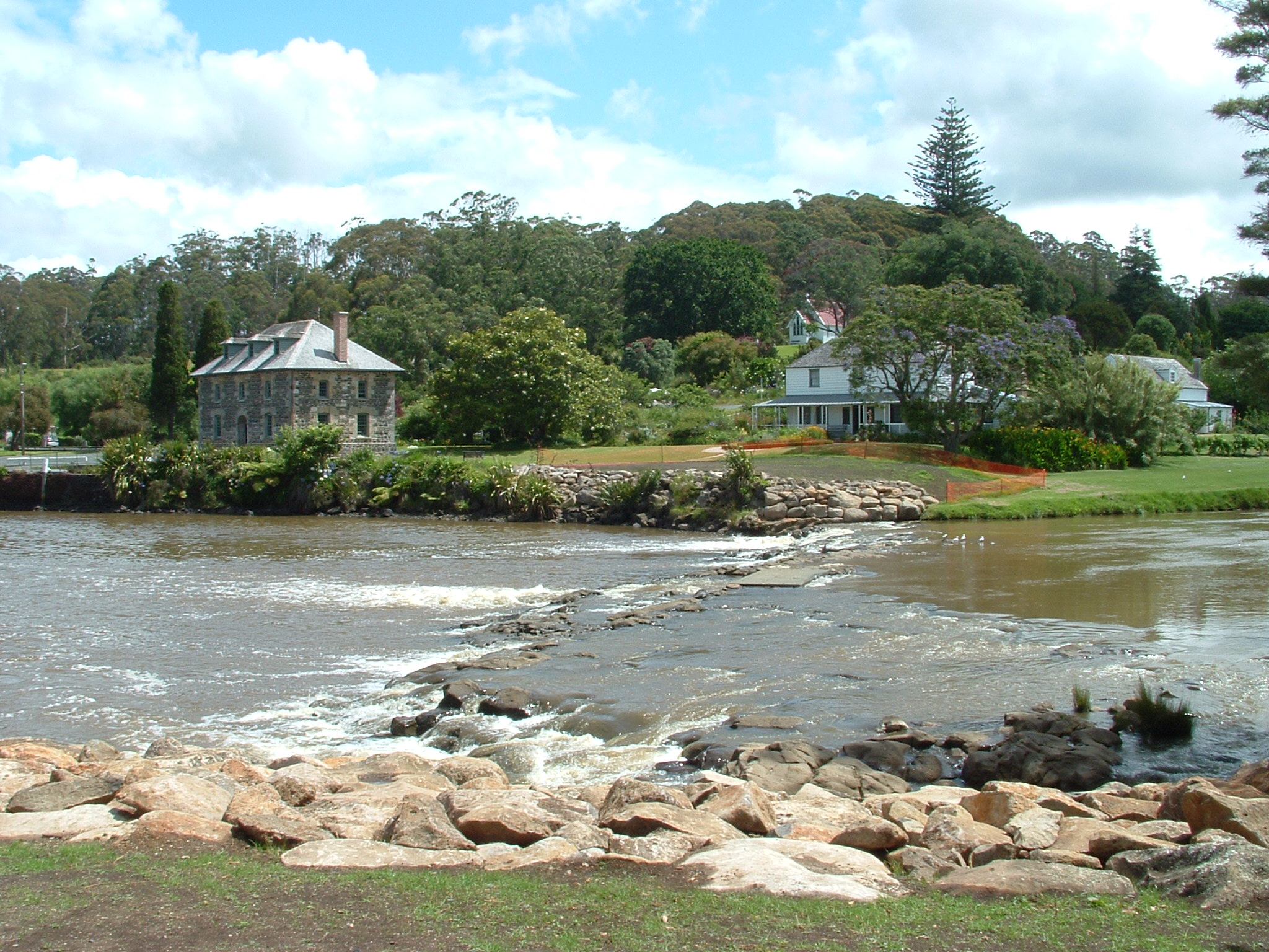
Kerikeri () is the largest town in Northland, New Zealand. It is a tourist destination north of Auckland and north of the northern region's largest city, Whangarei. It is sometimes called the Cradle of the Nation, as it was the site of the first permanent mission station in the country, and it has some of the most historic buildings in the country. A rapidly expanding centre of subtropical and allied horticulture, Kerikeri is in the Far North District of the North Island and lies at the western extremity of the Kerikeri Inlet, a northwestern arm of the Bay of Islands, where fresh water of the Kerikeri River enters the Pacific Ocean. The village was established by New Zealand's pioneering missionaries, who called it Gloucester Town, but the name did not endure. The Māori word ''Kerikeri'' was interpreted by said missionaries as Keddi Keddi or Kiddeekiddee, before the romanisation methods they used were revised to what is used today. In 1814, Samuel Marsden acquired l ... [...More Info...] [...Related Items...] OR: [Wikipedia] [Google] [Baidu] |


