|
North Channel (Ontario)
The North Channel is the body of water along the north shore of Lake Huron, in the Canadian province of Ontario. It stretches approximately 160 nautical miles (300 km) and is bordered on the east by Georgian Bay, on the west by the St. Marys River, to the north by the eastern Algoma District and part of the Sudbury District, and to the south by the islands of Manitoulin, Cockburn, Drummond and St. Joseph. At its widest point it is over 30 km (20 miles) wide. In addition to Georgian Bay, the North Channel is connected to the main body of Lake Huron by the False Detour Channel and the Mississagi Strait, which separate the above-noted islands. The channel is recognized as one of the best freshwater cruising grounds in the world. There are full-service marinas in various small communities along the shore providing sufficient provisions. A large section of the north shore is bordered by La Cloche Provincial Park providing for a scenic environment. [...More Info...] [...Related Items...] OR: [Wikipedia] [Google] [Baidu] |
Great Lakes Lake Huron North Channel
Great may refer to: Descriptions or measurements * Great, a relative measurement in physical space, see Size * Greatness, being divine, majestic, superior, majestic, or transcendent People * List of people known as "the Great" *Artel Great (born 1981), American actor Other uses * ''Great'' (1975 film), a British animated short about Isambard Kingdom Brunel * ''Great'' (2013 film), a German short film * Great (supermarket), a supermarket in Hong Kong * GReAT, Graph Rewriting and Transformation, a Model Transformation Language * Gang Resistance Education and Training Gang Resistance Education And Training, abbreviated G.R.E.A.T., provides a school-based, police officer instructed program that includes classroom instruction and various learning activities. Their intention is to teach the students to avoid gang ..., or GREAT, a school-based and police officer-instructed program * Global Research and Analysis Team (GReAT), a cybersecurity team at Kaspersky Lab *'' Great!'', a 20 ... [...More Info...] [...Related Items...] OR: [Wikipedia] [Google] [Baidu] |
La Cloche Mountains
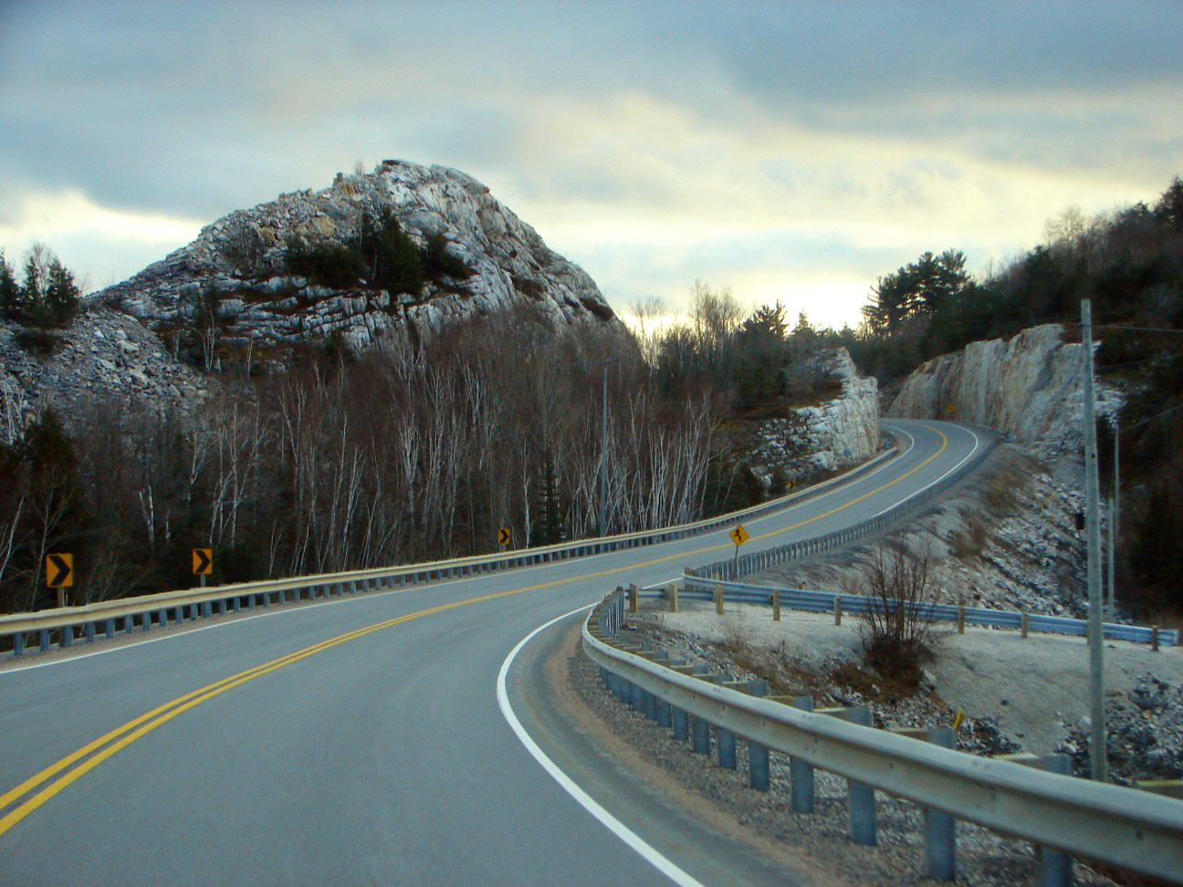
The La Cloche Mountains, also called the La Cloche Range, are a range of mountains in Northern Ontario, Canada, along the northern shore of Lake Huron near Manitoulin Island. The mountains are located in the Canadian Shield, and are composed primarily of white quartzite. They extend roughly from La Cloche Provincial Park, south of Massey, to Killarney Provincial Park, southwest of Sudbury. The communities of West River, Willisville and Whitefish Falls are located directly within the range; the town of Espanola and the municipality of Killarney are located nearby, however they can be seen (from some vantage points) as far away as Manitoulin Island. Ontario Highway 6 is the principal transportation route through the range. Killarney Provincial Park is located in the range and is very popular among tourists. Another feature includes the "Heaven's Gate Trail" which traverses the length of the range from Willisville in the east to Massey in the west. Thought to be an old abo ... [...More Info...] [...Related Items...] OR: [Wikipedia] [Google] [Baidu] |
Landforms Of Manitoulin District
A landform is a natural or anthropogenic land feature on the solid surface of the Earth or other planetary body. Landforms together make up a given terrain, and their arrangement in the landscape is known as topography. Landforms include hills, mountains, canyons, and valleys, as well as shoreline features such as bays, peninsulas, and seas, including submerged features such as mid-ocean ridges, volcanoes, and the great ocean basins. Physical characteristics Landforms are categorized by characteristic physical attributes such as elevation, slope, orientation, stratification, rock exposure and soil type. Gross physical features or landforms include intuitive elements such as berms, mounds, hills, ridges, cliffs, valleys, rivers, peninsulas, volcanoes, and numerous other structural and size-scaled (e.g. ponds vs. lakes, hills vs. mountains) elements including various kinds of inland and oceanic waterbodies and sub-surface features. Mountains, hills, plateaux, and plains are the fou ... [...More Info...] [...Related Items...] OR: [Wikipedia] [Google] [Baidu] |
Landforms Of Algoma District
A landform is a natural or anthropogenic land feature on the solid surface of the Earth or other planetary body. Landforms together make up a given terrain, and their arrangement in the landscape is known as topography. Landforms include hills, mountains, canyons, and valleys, as well as shoreline features such as bays, peninsulas, and seas, including submerged features such as mid-ocean ridges, volcanoes, and the great ocean basins. Physical characteristics Landforms are categorized by characteristic physical attributes such as elevation, slope, orientation, stratification, rock exposure and soil type. Gross physical features or landforms include intuitive elements such as berms, mounds, hills, ridges, cliffs, valleys, rivers, peninsulas, volcanoes, and numerous other structural and size-scaled (e.g. ponds vs. lakes, hills vs. mountains) elements including various kinds of inland and oceanic waterbodies and sub-surface features. Mountains, hills, plateaux, ... [...More Info...] [...Related Items...] OR: [Wikipedia] [Google] [Baidu] |
Nairn And Hyman, Ontario
Nairn and Hyman is a township in the Canadian province of Ontario. The township, located in the Sudbury District, borders on the southwestern city limits of Greater Sudbury west of the city's Walden district. The township had a population of 342 in the Canada 2016 Census. The township contains the communities of Nairn Centre and Prospect Hill. History Indigenous people have inhabited the Lake Huron north shore and Manitoulin area for millennia, and historically used the nearby Spanish (''Skiminitigan'' in Ojibwe) and Vermilion rivers as transportation and economic corridors which connected Lake Huron's North Channel with the interior to the north (through the Spanish) and through the river system around Lake Wanapitei, ultimately to the Ottawa River (through the Vermilion). The non-indigenous communities in the township were a result of the Canadian Pacific Railway's development of its Algoma extension from Sudbury to Sault Ste. Marie in the 1880s. The first two buildings in ... [...More Info...] [...Related Items...] OR: [Wikipedia] [Google] [Baidu] |
Tarbutt, Ontario
Tarbutt (formerly known as Tarbutt and Tarbutt Additional) is a township in the Canadian province of Ontario, located within the Algoma District. The township is about east of Sault Ste. Marie. Its population centres are Port Findlay and MacLennan. It is the only municipality along the North Channel of Lake Huron which includes no residential communities located directly along Highway 17; MacLennan is located north of the highway at the intersection of MacLennan Road and Government Road, while Port Findlay is located at the south end of MacLennan Road along the waterfront. In December 2016, the municipal council adopted a by-law to change the name of the township from The Corporation of the Township of Tarbutt & Tarbutt Additional to the Corporation of the Township of Tarbutt, effective in January 2017. Demographics In the 2021 Census of Population conducted by Statistics Canada, Tarbutt and Tarbutt Additional had a population of living in of its total private dwellings, ... [...More Info...] [...Related Items...] OR: [Wikipedia] [Google] [Baidu] |
Georgian Bay Land Trust
The Georgian Bay Land Trust is a registered charity dedicated to protecting wilderness lands along eastern Georgian Bay and the North Channel, through strategic conservation planning, land securement, stewardship, research, and education. The Land Trust currently protects 64 ecologically significant properties stretching from Port Severn to the North Channel, totaling over 7,500 acres. The Georgian Bay Land Trust’s properties protect a range of wetlands, forests, rock barrens, and islands, which provide key habitat for 50 species at risk. They also provide sites for scientific studies in collaboration with universities and fellow conservation organizations, including the Motus Wildlife Tracking System (used to study migratory birds Bird migration is the regular seasonal movement, often north and south along a flyway, between breeding and wintering grounds. Many species of bird migrate. Migration carries high costs in predation and mortality, including from hunting . ... [...More Info...] [...Related Items...] OR: [Wikipedia] [Google] [Baidu] |
Highway 548 (Ontario)
This is a list of secondary highways in Algoma District, most of which serve as logging roads or provide access to isolated and sparsely populated areas in the Algoma District of northeastern Ontario. Some of the shorter ones are also access routes for communities with moderate amounts of tourism, most famously St. Joseph Island's highway 548. Highway 519 Secondary Highway 519, commonly referred to as Highway 519, is a provincially maintained highway in the Canadian province of Ontario. The highway is in length, connecting Highway 17 near Obatanga Provincial Park with Dubreuilville station. A private logging road continues east from there. Highway 519 was assumed in 1956, and has remained unchanged since then. The route is gravel surface throughout its length and encounters no communities of any size along its length, aside from Dubreuilville. Highway 532 Secondary Highway 532, commonly referred to as Highway 532, is a provincially maintained secondary highway in th ... [...More Info...] [...Related Items...] OR: [Wikipedia] [Google] [Baidu] |
Northern Ontario
Northern Ontario is a primary geographic and quasi-administrative region of the Canadian province of Ontario, the other primary region being Southern Ontario. Most of the core geographic region is located on part of the Superior Geological Province of the Canadian Shield, a vast rocky plateau located mainly north of Lake Huron (including Georgian Bay), the French River, Lake Nipissing, and the Mattawa River. The statistical region extends south of the Mattawa River to include all of the District of Nipissing. The southern section of this district lies on part of the Grenville Geological Province of the Shield which occupies the transitional area between Northern and Southern Ontario. The extended federal and provincial quasi-administrative regions of Northern Ontario have their own boundaries even further south in the transitional area that vary according to their respective government policies and requirements. Ontario government departments and agencies such as the Growt ... [...More Info...] [...Related Items...] OR: [Wikipedia] [Google] [Baidu] |
Highway 6 (Ontario)
King's Highway 6, commonly referred to as Highway 6, is a provincially maintained highway in the Canadian province of Ontario. It crosses a distance of between Port Dover, on the northern shore of Lake Erie, and Espanola, on the northern shore of Lake Huron, before ending at the Trans-Canada Highway ( Highway 17) in McKerrow. Highway 6 was one of several routes established when Ontario first introduced a highway network on February 26, 1920, following several pioneer wagon trails. The original designation, not numbered until 1925, connected Port Dover with Owen Sound via Hamilton and Guelph. When the Department of Highways (DHO) took over the Department of Northern Development (DND) in 1937, Highway 6 was extended north through the Bruce Peninsula to Tobermory. In 1980, the entire length of Highway 68 on Manitoulin Island and north to Highway 17 became a northern extension of Highway 6. Small modifications were made to the route of Highw ... [...More Info...] [...Related Items...] OR: [Wikipedia] [Google] [Baidu] |
Little Current Swing Bridge
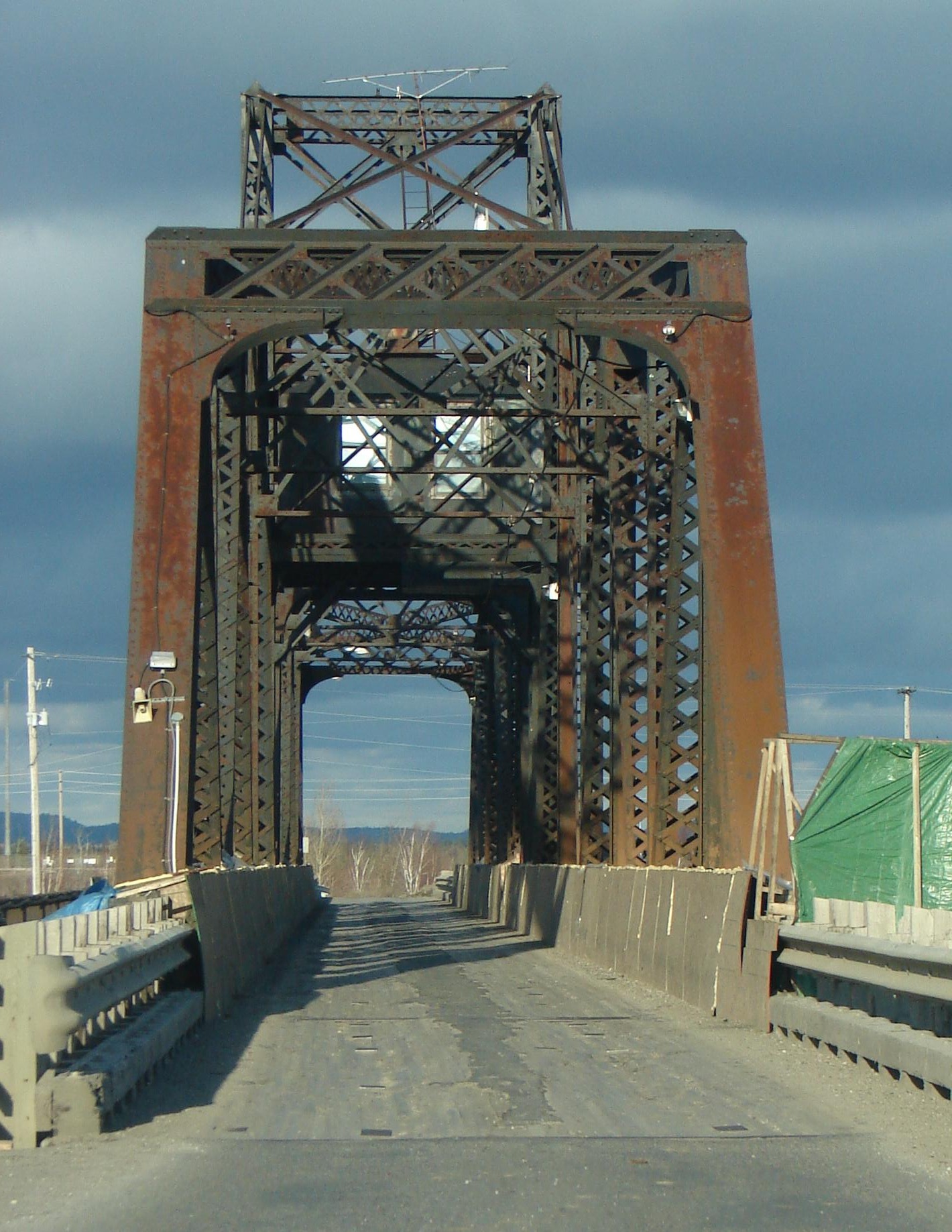
The Little Current Swing Bridge is a swing bridge in the Canadian province of Ontario, located at the community of Little Current in the town of Northeastern Manitoulin and the Islands. Design The bridge carries Highway 6 (formerly Highway 68) across a narrow channel separating Manitoulin Island from the much smaller Goat Island, forming the only land access. It consists of two 21 m (70 ft) deck plate girder approaches on the north end (Goat Island) and a single 18 m (60 ft) deck plate girder approach on the south end (Manitoulin Island), with a 112 m (368 ft) through swing bridge span. The swing bridge sits 5.3 m (17.5 ft) above mean water level, and provides a 48 m (160 ft) opening on either side of the central pier for water passage. The width of the bridge is 15’1” for loads. Construction and operation Construction of the bridge was started by the Algoma Eastern Railway with the abutments and piers being built in 1912 an ... [...More Info...] [...Related Items...] OR: [Wikipedia] [Google] [Baidu] |
Little Current ON
Little is a synonym for small size and may refer to: Arts and entertainment * ''Little'' (album), 1990 debut album of Vic Chesnutt * ''Little'' (film), 2019 American comedy film *The Littles, a series of children's novels by American author John Peterson ** ''The Littles'' (TV series), an American animated series based on the novels Places *Little, Kentucky, United States *Little, West Virginia, United States Other uses *Clan Little, a Scottish clan *Little (surname), an English surname *Little (automobile), an American automobile manufactured from 1912 to 1915 *Little, Brown and Company, an American publishing company * USS ''Little'', multiple United States Navy ships See also * * *Little Mountain (other) *Little River (other) *Little Island (other) Little Island can refer to: Geographical areas Australia * Little Island (South Australia) * Little Island (Tasmania) * Little Island (Western Australia) Canada * Little Island (Lake Kagawong), Ontario ... [...More Info...] [...Related Items...] OR: [Wikipedia] [Google] [Baidu] |

.jpg)


