|
Norfolk And Petersburg Railroad
The Norfolk and Petersburg Railroad was built between Norfolk and Petersburg, Virginia and was completed by 1858. The line was of track gauge. It played a role on the American Civil War (1861–1865), and became part of the Atlantic, Mississippi and Ohio Railroad (AM&O) in 1870. The AM&O became the Norfolk and Western (N&W) in 1881. About 100 years later, the Norfolk and Western was combined with the Southern Railway, another profitable carrier, to form the Norfolk Southern Railway in 1982. In the 21st century, almost all of the original well-engineered N&P, including the corduroy roadbed through the Great Dismal Swamp and 52-mile tangent alignment is still in service. It forms part of a major coal export route terminating at Lambert's Point near Hampton Roads. In addition to coal, most of the route is in active use in the 20th century for intermodal container and automobile parts and completed vehicle shipments. A railroad for Norfolk Although railroads emerged as a ne ... [...More Info...] [...Related Items...] OR: [Wikipedia] [Google] [Baidu] |
Virginia
Virginia, officially the Commonwealth of Virginia, is a state in the Mid-Atlantic and Southeastern regions of the United States, between the Atlantic Coast and the Appalachian Mountains. The geography and climate of the Commonwealth are shaped by the Blue Ridge Mountains and the Chesapeake Bay, which provide habitat for much of its flora and fauna. The capital of the Commonwealth is Richmond; Virginia Beach is the most-populous city, and Fairfax County is the most-populous political subdivision. The Commonwealth's population was over 8.65million, with 36% of them living in the Baltimore–Washington metropolitan area. The area's history begins with several indigenous groups, including the Powhatan. In 1607, the London Company established the Colony of Virginia as the first permanent English colony in the New World. Virginia's state nickname, the Old Dominion, is a reference to this status. Slave labor and land acquired from displaced native tribes fueled the ... [...More Info...] [...Related Items...] OR: [Wikipedia] [Google] [Baidu] |
Richmond, Virginia
(Thus do we reach the stars) , image_map = , mapsize = 250 px , map_caption = Location within Virginia , pushpin_map = Virginia#USA , pushpin_label = Richmond , pushpin_map_caption = Location within Virginia##Location within the contiguous United States , pushpin_relief = yes , coordinates = , subdivision_type = Country , subdivision_name = , subdivision_type1 = U.S. state, State , subdivision_name1 = , established_date = 1742 , , named_for = Richmond, London, Richmond, United Kingdom , government_type = , leader_title = List of mayors of Richmond, Virginia, Mayor , leader_name = Levar Stoney (Democratic Party (United States), D) , total_type = City , area_magnitude = 1 E8 , area_total_sq_mi = 62.57 , area_land_sq_mi = 59.92 , area_ ... [...More Info...] [...Related Items...] OR: [Wikipedia] [Google] [Baidu] |
Tangent
In geometry, the tangent line (or simply tangent) to a plane curve at a given point is the straight line that "just touches" the curve at that point. Leibniz defined it as the line through a pair of infinitely close points on the curve. More precisely, a straight line is said to be a tangent of a curve at a point if the line passes through the point on the curve and has slope , where ''f'' is the derivative of ''f''. A similar definition applies to space curves and curves in ''n''-dimensional Euclidean space. As it passes through the point where the tangent line and the curve meet, called the point of tangency, the tangent line is "going in the same direction" as the curve, and is thus the best straight-line approximation to the curve at that point. The tangent line to a point on a differentiable curve can also be thought of as a '' tangent line approximation'', the graph of the affine function that best approximates the original function at the given point. Similarly, t ... [...More Info...] [...Related Items...] OR: [Wikipedia] [Google] [Baidu] |
Swamp
A swamp is a forested wetland.Keddy, P.A. 2010. Wetland Ecology: Principles and Conservation (2nd edition). Cambridge University Press, Cambridge, UK. 497 p. Swamps are considered to be transition zones because both land and water play a role in creating this environment. Swamps vary in size and are located all around the world. The water of a swamp may be fresh water, brackish water, or seawater. Freshwater swamps form along large rivers or lakes where they are critically dependent upon rainwater and seasonal flooding to maintain natural water level fluctuations.Hughes, F.M.R. (ed.). 2003. The Flooded Forest: Guidance for policy makers and river managers in Europe on the restoration of floodplain forests. FLOBAR2, Department of Geography, University of Cambridge, Cambridge, UK. 96 p. Saltwater swamps are found along tropical and subtropical coastlines. Some swamps have hammock (ecology), hammocks, or dry-land protrusions, covered by aquatic vegetation, or vegetation that tolerates ... [...More Info...] [...Related Items...] OR: [Wikipedia] [Google] [Baidu] |
Corduroy
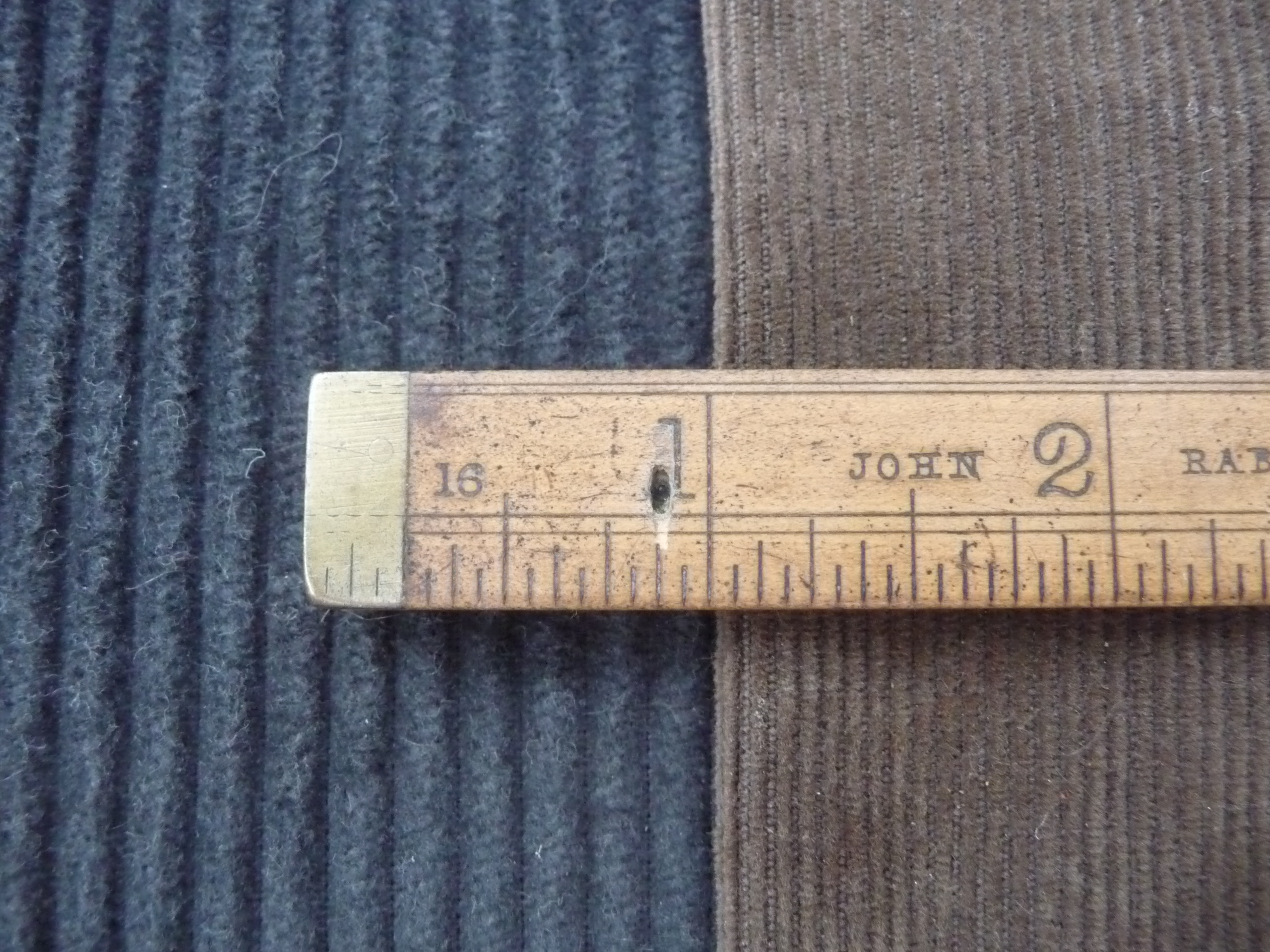
Corduroy is a textile with a distinctively raised "cord" or wale texture. Modern corduroy is most commonly composed of tufted cords, sometimes exhibiting a channel (bare to the base fabric) between them. Both velvet and corduroy derive from fustian fabric. Corduroy looks as if it is made from multiple cords laid parallel to each other. Etymology The word ''corduroy'' is from ''cord'' and ''duroy'', a coarse woollen cloth made in England in the 18th century. Although the origin of ''duroy'' is not attested and although its likely meaning is ''du roi'' (''of the King''), it does not follow that the full phrase ''corde du roi'' derives from ''the cord of the King''. This is probably a false etymology. Variations Corduroy is made by weaving extra sets of fibre into the base fabric to form vertical ridges called ''wales''. The wales are built so that clear lines can be seen when they are cut into pile. Corduroy is considered a durable cloth, and is found in the construction of tro ... [...More Info...] [...Related Items...] OR: [Wikipedia] [Google] [Baidu] |
Elizabeth River (Virginia)
The Elizabeth River is a U.S. Geological Survey. National Hydrography Dataset high-resolution flowline dataThe National Map , accessed April 1, 2011 tidal estuary forming an arm of Hampton Roads harbor at the southern end of Chesapeake Bay in southeast Virginia in the United States. It is located along the southern side of the mouth of the James River, between the cities of Portsmouth, Norfolk, and Chesapeake. Forming the core of the Hampton Roads harbor, it is heavily supported by its tributaries which depend upon it. Through its Southern Branch and the Albemarle and Chesapeake Canal, the Elizabeth River also is a gateway to points to the south for the Atlantic Intracoastal Waterway, an inland path from the ocean providing a more sheltered navigable waterway to Florida for commercial and recreational boating. History The Elizabeth River was named by the Jamestown colonists in the early 17th century for Princess Elizabeth Stuart, She was the daughter of King James I of England ... [...More Info...] [...Related Items...] OR: [Wikipedia] [Google] [Baidu] |
Southern Branch Elizabeth River
The Southern Branch Elizabeth River is a ,U.S. Geological Survey. National Hydrography Dataset high-resolution flowline dataThe National Map accessed April 1, 2011 primarily tidal river in the U.S. state of Virginia. It flows from south to north through the city of Chesapeake and forms the boundary between the cities of Portsmouth and Chesapeake for its northernmost . It is a tributary of the Elizabeth River, connecting to the harbor of Hampton Roads to the north. It is part of the Intracoastal Waterway of the Atlantic coast of the United States, connecting by it to the North Landing River, which flows into North Carolina. See also *List of rivers of Virginia *Atlantic Reserve Fleet, Norfolk USS ''Albany'' (CG-10) laid up at the Norfolk Naval Shipyard in 1983 Atlantic Reserve Fleet, Norfolk was a part of the United States Navy reserve fleets, also called a ''mothball fleet'', and was used to store the many surplus ships after Worl ... References * *USGS Hydrologic Unit M ... [...More Info...] [...Related Items...] OR: [Wikipedia] [Google] [Baidu] |
Eastern Branch Elizabeth River
The Eastern Branch Elizabeth River is a U.S. Geological Survey. National Hydrography Dataset high-resolution flowline dataThe National Map , accessed April 1, 2011 tidal river in the Hampton Roads area of the U.S. state of Virginia. The river flows from east to west, starting in Virginia Beach. At its crossing by Interstate 64 it becomes the boundary between Virginia Beach and the city of Norfolk, and farther west it is the boundary between Norfolk and the city of Chesapeake. For its final it is entirely within the city of Norfolk. See also *List of rivers of Virginia This is a list of rivers in the U.S. state of Virginia. By drainage basin This list is arranged by drainage basin, with respective tributaries, arranged in the order of their confluence from mouth to source, indented under each larger stream's nam ... References * *USGS Hydrologic Unit Map - State of Virginia (1974) * Rivers of Virginia Bodies of water of Virginia Beach, Virginia Rivers of Norfolk, Virgi ... [...More Info...] [...Related Items...] OR: [Wikipedia] [Google] [Baidu] |
Drawbridge
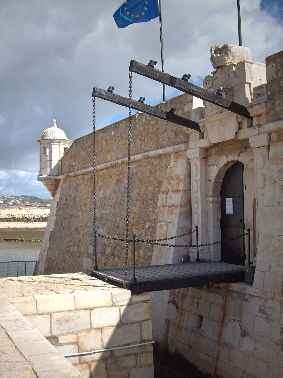
A drawbridge or draw-bridge is a type of moveable bridge typically at the entrance to a castle or tower surrounded by a moat. In some forms of English, including American English, the word ''drawbridge'' commonly refers to all types of moveable bridges, such as bascule bridges, vertical-lift bridges and swing bridges, but this article concerns the narrower historical definition of the term where the bridge is used in a defensive structure. As used in castles or defensive structures, drawbridges provide access across defensive structures when lowered, but can quickly be raised from within to deny entry to an enemy force. Castle drawbridges Medieval castles were usually defended by a ditch or moat, crossed by a wooden bridge. In early castles the bridge might be designed to be destroyed or removed in the event of an attack, but drawbridges became very common. A typical arrangement would have the drawbridge immediately outside a gatehouse, consisting of a wooden deck with one ed ... [...More Info...] [...Related Items...] OR: [Wikipedia] [Google] [Baidu] |
Virginia Military Institute
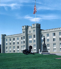
la, Consilio et Animis (on seal) , mottoeng = "In peace a glorious asset, In war a tower of strength""By courage and wisdom" (on seal) , established = , type = Public senior military college , accreditation = SACS , endowment = $696.8 million (2021) , superintendent = Cedric T. Wins , faculty = 143 full-time and 55 part-time (Fall 2019) , students = 1,685 , city = Lexington , state = Virginia , country = United States , pushpin_map = Shenandoah Valley#USA Virginia#USA , pushpin_map_caption = Location in Shenandoah Valley##Location in Virginia##Location in United States , coordinates = , campus = Distant Town , campus_size= , colors = Red, Yellow, & White , nickname = Keydets , mascot = Moe the Kangaroo , sporting_affiliations = , website = , logo = Virginia Military Institute full logo.png , logo_size = 150 , free_label=Newspaper , free='' The Cadet'' Virginia Military Institute (VMI) is a public senior military college in Lexington, Virginia. It was ... [...More Info...] [...Related Items...] OR: [Wikipedia] [Google] [Baidu] |
Civil Engineer
A civil engineer is a person who practices civil engineering – the application of planning, designing, constructing, maintaining, and operating infrastructure while protecting the public and environmental health, as well as improving existing infrastructure that may have been neglected. Civil engineering is one of the oldest engineering disciplines because it deals with constructed environment including planning, designing, and overseeing construction and maintenance of building structures, and facilities, such as roads, railroads, airports, bridges, harbors, channels, dams, irrigation projects, pipelines, power plants, and water and sewage systems. The term "civil engineer" was established by John Smeaton in 1750 to contrast engineers working on civil projects with the military engineers, who worked on armaments and defenses. Over time, various sub-disciplines of civil engineering have become recognized and much of military engineering has been absorbed by civil engineering. ... [...More Info...] [...Related Items...] OR: [Wikipedia] [Google] [Baidu] |
Southampton County, Virginia
Southampton County is a county located on the southern border of the Commonwealth of Virginia. North Carolina is to the south. As of the 2020 census, the population was 17,996. Its county seat is Courtland. History In the early 17th century, the explorer Captain John Smith founded the settlement of Jamestown; in the next decades of the colony's history, Jamestown settlers explorer and began settling the regions adjacent to Hampton Roads. The Virginia Colony was divided into eight shires (or counties) with a total population of approximately 5,000 inhabitants in 1634. Most of Southampton County was originally part of Warrosquyoake Shire. The shires were soon to be called counties. In 1637 Warrosquyoake Shire was renamed Isle of Wight County. In 1749, the portion of Isle of Wight County west of the Blackwater River was organized as Southampton County. Later, part of Nansemond County, which is now the Independent City of Suffolk, was added to Southampton County. This ar ... [...More Info...] [...Related Items...] OR: [Wikipedia] [Google] [Baidu] |


