|
Nokia Lumia 625
The Nokia Lumia 625 is a Windows Phone with a 4.7-inch IPS LCD WVGA (480x800) screen and 4G support. It was presented on July 23, 2013. It can be loaded up with the latest software update for Windows Phone 8.1, as well as Nokia's firmware update 'Denim' (excluding some features). It borrows features from the Nokia Lumia 1520, the Lumia 1020 and the Lumia 925. Release It is set to cost €220 or £200 in Europe. $300–$350 CAD It was released in China, Europe, Asia Pacific, India, Middle East, Africa and Latin America initially, starting September. Specifications/features It features: * Support for up to 128 GB external memory via microSD card * Choice of colors - black, white plus translucent shades of orange, green, yellow * Signature Camera Apps - Smart Cam, Cinemagraph and Panorama * FM Radio It has one of the lowest pixel densities seen in recent smartphones, as it uses the standard Windows Phone 8 resolution (800×480) but using a large display. So the screen will not a ... [...More Info...] [...Related Items...] OR: [Wikipedia] [Google] [Baidu] |
Nokia
Nokia Corporation (natively Nokia Oyj, referred to as Nokia) is a Finnish multinational corporation, multinational telecommunications industry, telecommunications, technology company, information technology, and consumer electronics corporation, established in 1865. Nokia's main headquarters are in Espoo, Finland, in the greater Helsinki Greater Helsinki, metropolitan area, but the company's actual roots are in the Tampere region of Pirkanmaa.HS: Nokian juuret ovat Tammerkosken rannalla (in Finnish) In 2020, Nokia employed approximately 92,000 people across over 100 countries, did business in more than 130 countries, and reported annual revenues of around €23 billion. Nokia is a public limited company listed on the Helsinki Stock Exchange and New York Stock Exchange. [...More Info...] [...Related Items...] OR: [Wikipedia] [Google] [Baidu] |
Evolved HSPA
Evolved High Speed Packet Access, HSPA+, HSPA (Plus) or HSPAP, is a technical standard for wireless broadband telecommunication. It is the second phase of HSPA which has been introduced in 3GPP release 7 and being further improved in later 3GPP releases. HSPA+ can achieve data rates of up to 42.2 Mbit/s. It introduces antenna array technologies such as beamforming and multiple-input multiple-output communications (MIMO). Beam forming focuses the transmitted power of an antenna in a beam towards the user's direction. MIMO uses multiple antennas at the sending and receiving side. Further releases of the standard have introduced dual carrier operation, i.e. the simultaneous use of two 5 MHz carriers. HSPA+ is an evolution of HSPA that upgrades the existing 3G network and provides a method for telecom operators to migrate towards 4G speeds that are more comparable to the initially available speeds of newer LTE networks without deploying a new radio interface. HSPA+ should n ... [...More Info...] [...Related Items...] OR: [Wikipedia] [Google] [Baidu] |
Megapixel
In digital imaging, a pixel (abbreviated px), pel, or picture element is the smallest addressable element in a raster image, or the smallest point in an all points addressable display device. In most digital display devices, pixels are the smallest element that can be manipulated through software. Each pixel is a sample of an original image; more samples typically provide more accurate representations of the original. The intensity of each pixel is variable. In color imaging systems, a color is typically represented by three or four component intensities such as red, green, and blue, or cyan, magenta, yellow, and black. In some contexts (such as descriptions of camera sensors), ''pixel'' refers to a single scalar element of a multi-component representation (called a ''photosite'' in the camera sensor context, although ''sensel'' is sometimes used), while in yet other contexts (like MRI) it may refer to a set of component intensities for a spatial position. Etymology The w ... [...More Info...] [...Related Items...] OR: [Wikipedia] [Google] [Baidu] |
Accelerometer
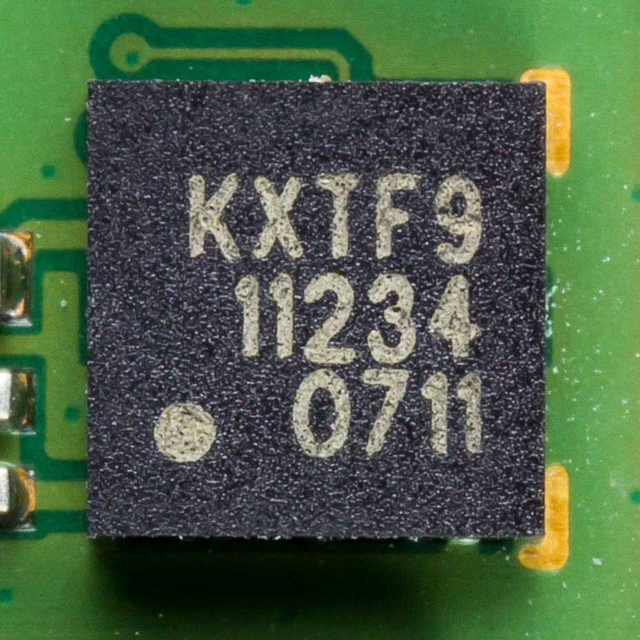
An accelerometer is a tool that measures proper acceleration. Proper acceleration is the acceleration (the rate of change of velocity) of a body in its own instantaneous rest frame; this is different from coordinate acceleration, which is acceleration in a fixed coordinate system. For example, an accelerometer at rest on the surface of the Earth will measure an acceleration due to Earth's gravity, straight upwards (by definition) of g ≈ 9.81 m/s2. By contrast, accelerometers in free fall (falling toward the center of the Earth at a rate of about 9.81 m/s2) will measure zero. Accelerometers have many uses in industry and science. Highly sensitive accelerometers are used in inertial navigation systems for aircraft and missiles. Vibration in rotating machines is monitored by accelerometers. They are used in tablet computers and digital cameras so that images on screens are always displayed upright. In unmanned aerial vehicles, accelerometers help to stabilise flight. ... [...More Info...] [...Related Items...] OR: [Wikipedia] [Google] [Baidu] |
Magnetometer
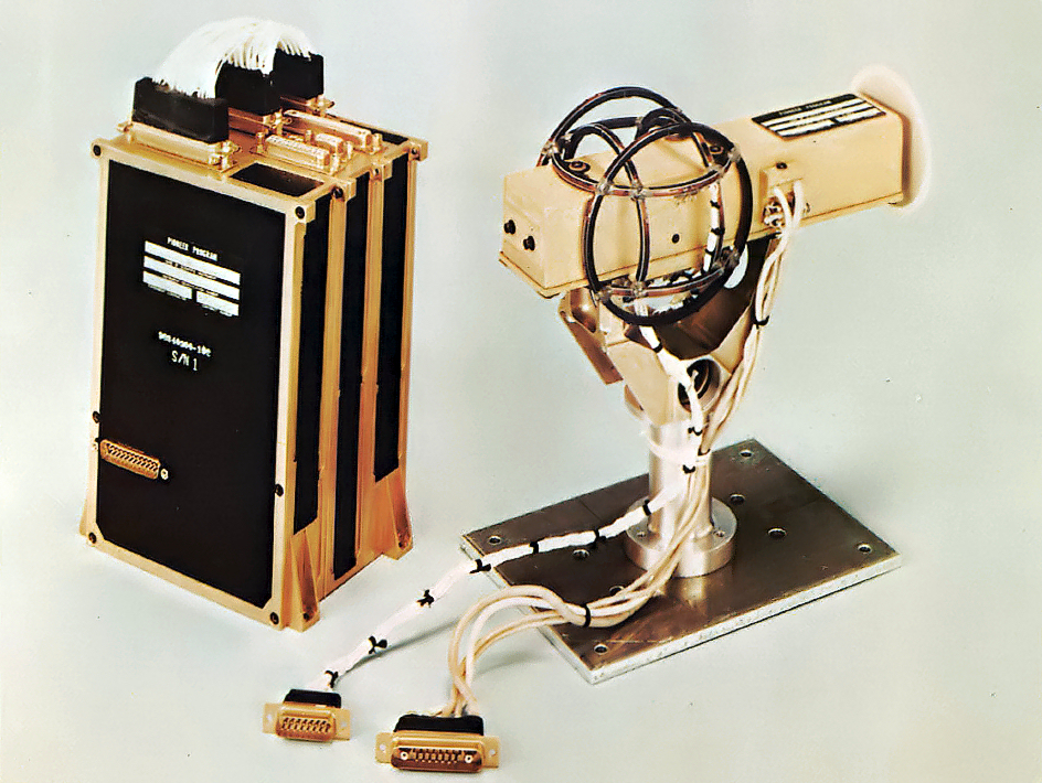
A magnetometer is a device that measures magnetic field or magnetic dipole moment. Different types of magnetometers measure the direction, strength, or relative change of a magnetic field at a particular location. A compass is one such device, one that measures the direction of an ambient magnetic field, in this case, the Earth's magnetic field. Other magnetometers measure the magnetic dipole moment of a magnetic material such as a ferromagnet, for example by recording the effect of this magnetic dipole on the induced current in a coil. The first magnetometer capable of measuring the absolute magnetic intensity at a point in space was invented by Carl Friedrich Gauss in 1833 and notable developments in the 19th century included the Hall effect, which is still widely used. Magnetometers are widely used for measuring the Earth's magnetic field, in geophysical surveys, to detect magnetic anomalies of various types, and to determine the dipole moment of magnetic materials. In an air ... [...More Info...] [...Related Items...] OR: [Wikipedia] [Google] [Baidu] |
Gyroscope
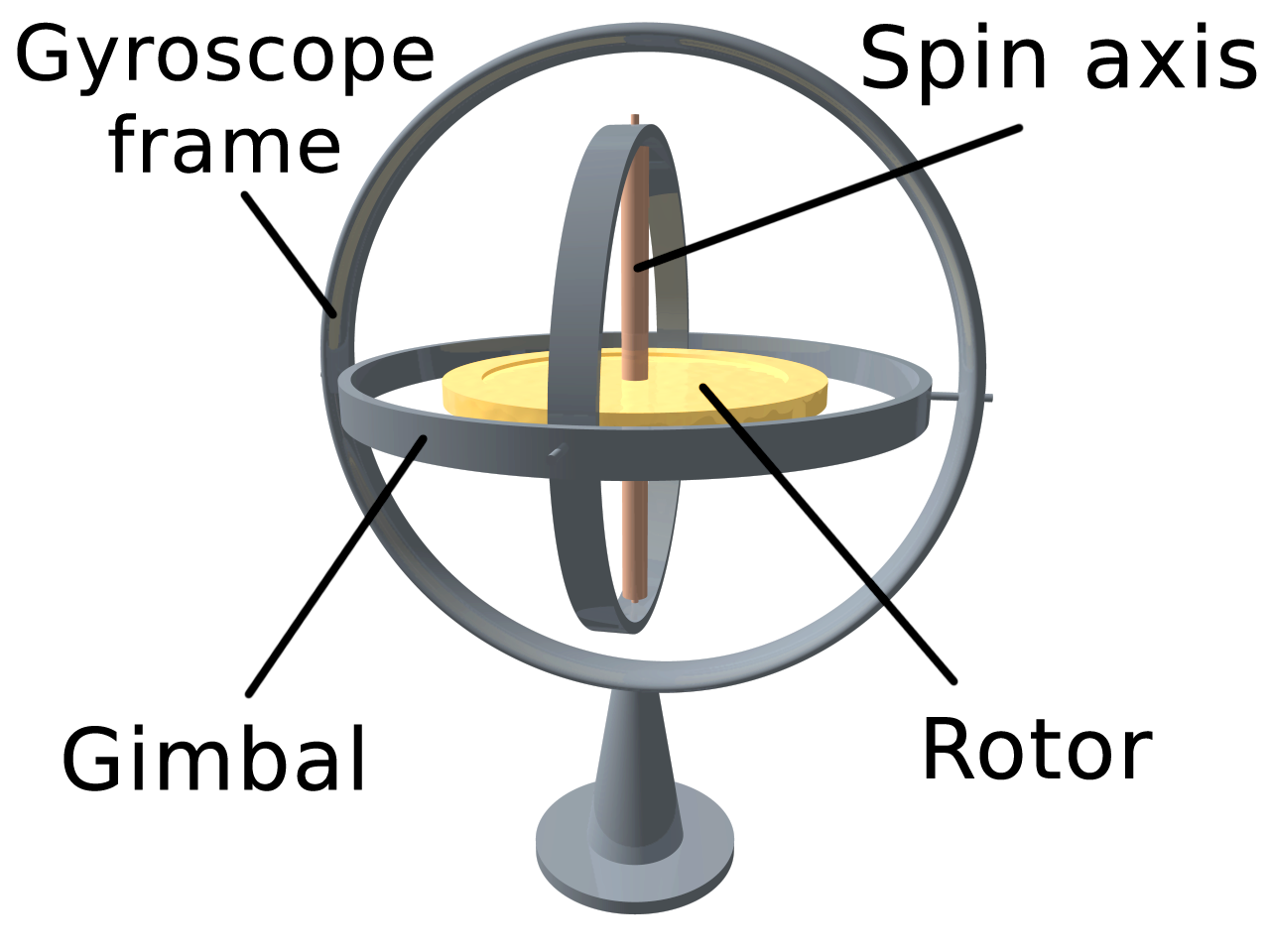
A gyroscope (from Ancient Greek γῦρος ''gŷros'', "round" and σκοπέω ''skopéō'', "to look") is a device used for measuring or maintaining orientation and angular velocity. It is a spinning wheel or disc in which the axis of rotation (spin axis) is free to assume any orientation by itself. When rotating, the orientation of this axis is unaffected by tilting or rotation of the mounting, according to the conservation of angular momentum. Gyroscopes based on other operating principles also exist, such as the microchip-packaged MEMS gyroscopes found in electronic devices (sometimes called gyrometers), solid-state ring lasers, fibre optic gyroscopes, and the extremely sensitive quantum gyroscope. Applications of gyroscopes include inertial navigation systems, such as in the Hubble Space Telescope, or inside the steel hull of a submerged submarine. Due to their precision, gyroscopes are also used in gyrotheodolites to maintain direction in tunnel mining. Gyroscopes ca ... [...More Info...] [...Related Items...] OR: [Wikipedia] [Google] [Baidu] |
Bluetooth 4
Bluetooth is a short-range wireless technology standard that is used for exchanging data between fixed and mobile devices over short distances and building personal area networks (PANs). In the most widely used mode, transmission power is limited to 2.5 milliwatts, giving it a very short range of up to . It employs UHF radio waves in the ISM bands, from 2.402GHz to 2.48GHz. It is mainly used as an alternative to wire connections, to exchange files between nearby portable devices and connect cell phones and music players with wireless headphones. Bluetooth is managed by the Bluetooth Special Interest Group (SIG), which has more than 35,000 member companies in the areas of telecommunication, computing, networking, and consumer electronics. The IEEE standardized Bluetooth as IEEE 802.15.1, but no longer maintains the standard. The Bluetooth SIG oversees development of the specification, manages the qualification program, and protects the trademarks. A manufacturer must meet Blue ... [...More Info...] [...Related Items...] OR: [Wikipedia] [Google] [Baidu] |
Bluetooth
Bluetooth is a short-range wireless technology standard that is used for exchanging data between fixed and mobile devices over short distances and building personal area networks (PANs). In the most widely used mode, transmission power is limited to 2.5 milliwatts, giving it a very short range of up to . It employs UHF radio waves in the ISM bands, from 2.402GHz to 2.48GHz. It is mainly used as an alternative to wire connections, to exchange files between nearby portable devices and connect cell phones and music players with wireless headphones. Bluetooth is managed by the Bluetooth Special Interest Group (SIG), which has more than 35,000 member companies in the areas of telecommunication, computing, networking, and consumer electronics. The IEEE standardized Bluetooth as IEEE 802.15.1, but no longer maintains the standard. The Bluetooth SIG oversees development of the specification, manages the qualification program, and protects the trademarks. A manufacturer must meet ... [...More Info...] [...Related Items...] OR: [Wikipedia] [Google] [Baidu] |
Global Positioning System
The Global Positioning System (GPS), originally Navstar GPS, is a satellite-based radionavigation system owned by the United States government and operated by the United States Space Force. It is one of the global navigation satellite systems (GNSS) that provides geolocation and time information to a GPS receiver anywhere on or near the Earth where there is an unobstructed line of sight to four or more GPS satellites. It does not require the user to transmit any data, and operates independently of any telephonic or Internet reception, though these technologies can enhance the usefulness of the GPS positioning information. It provides critical positioning capabilities to military, civil, and commercial users around the world. Although the United States government created, controls and maintains the GPS system, it is freely accessible to anyone with a GPS receiver. The GPS project was started by the U.S. Department of Defense in 1973. The first prototype spacecraft was lau ... [...More Info...] [...Related Items...] OR: [Wikipedia] [Google] [Baidu] |
Selective Availability
The error analysis for the Global Positioning System is important for understanding how GPS works, and for knowing what magnitude of error should be expected. The GPS makes corrections for receiver clock errors and other effects but there are still residual errors which are not corrected. GPS receiver position is computed based on data received from the satellites. Errors depend on geometric dilution of precision and the sources listed in the table below. Overview User equivalent range errors (UERE) are shown in the table. There is also a numerical error with an estimated value, \ \sigma_ , of about . The standard deviations, \ \sigma_R, for the coarse/acquisition (C/A) and precise codes are also shown in the table. These standard deviations are computed by taking the square root of the sum of the squares of the individual components (i.e., RSS for root sum squares). To get the standard deviation of receiver position estimate, these range errors must be multiplied by the app ... [...More Info...] [...Related Items...] OR: [Wikipedia] [Google] [Baidu] |
GLONASS
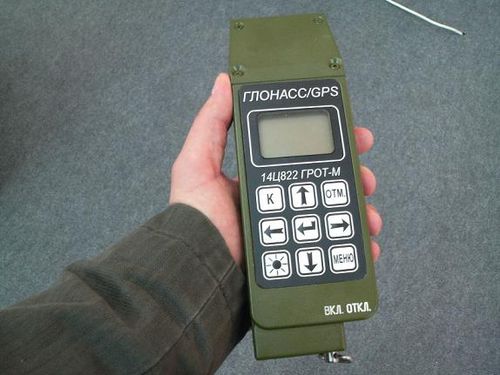
GLONASS (russian: ГЛОНАСС, label=none, ; rus, links=no, Глобальная навигационная спутниковая система, r=Global'naya Navigatsionnaya Sputnikovaya Sistema, t=Global Navigation Satellite System) is a Russian satellite navigation system operating as part of a radionavigation-satellite service. It provides an alternative to Global Positioning System (GPS) and is the second navigational system in operation with global coverage and of comparable precision. Satellite navigation devices supporting both GPS and GLONASS have more satellites available, meaning positions can be fixed more quickly and accurately, especially in built-up areas where buildings may obscure the view to some satellites. GLONASS supplementation of GPS systems also improves positioning in high latitudes (north or south). Development of GLONASS began in the Soviet Union in 1976. Beginning on 12 October 1982, numerous rocket launches added satellites to the system, unti ... [...More Info...] [...Related Items...] OR: [Wikipedia] [Google] [Baidu] |


