|
Ni'lin
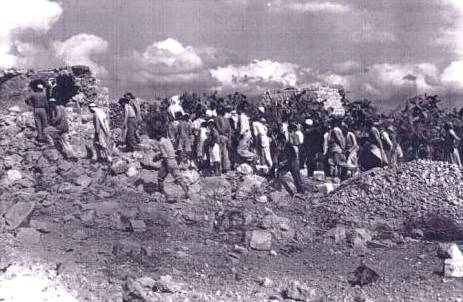
Ni'lin ( ar, نعلين) is a Palestinian town in the Ramallah and al-Bireh Governorate in the central West Bank, located west of Ramallah. Ni'lin is about east of the 1949 Armistice Line (Green Line) bordered by Deir Qaddis, the Israeli settlements of Nili and Na'ale to the northeast, the village of al-Midya and Modi'in Illit (Kiryat Sefer) settlement bloc are to the south, Budrus (4 km) and Qibya (5 km) villages are located to the northwest. The town's total land area consists of approximately 15,000 dunams of which 660 is urban. Under the Oslo II agreement, 93% of town lands has been classed as ' Area C'. An Ottoman village list of about 1870 showed that Ni'lin had 156 houses and a population of 493, though the population count included only men. It was described as bordering Deir Qaddis. In 1882, the PEF's '' Survey of Western Palestine'' described Ni'lin (called ''N'alin'') as a "large village on high ground, surrounded by olives, and supplied by cister ... [...More Info...] [...Related Items...] OR: [Wikipedia] [Google] [Baidu] |
Budrus
Budrus ( ar, بٌدرُس) is a Palestinian village in the Ramallah and al-Bireh Governorate, located 31 kilometers northwest of Ramallah in the northern West Bank. According to the Palestinian Central Bureau of Statistics (PCBS), the village had a population of 1,399 inhabitants in 2007. Location Budrus is located north-west of Ramallah. It is bordered by Qibya and Ni'lin to the east, Qibya to the north, the Green line to the west, and Ni'lin to the south. History "Budrus" is Arabic for "Peter" and in ancient times the village was known as ''Patris''. The site of the modern village is just east of the 1949 armistice line, while the ancient village was probably 2 km away at Khirbet Budrus, on the west side of the line.Dauphin, 1998, p. 831Tsafrir, Di Segni and Green, 1994, p. 200 It was mentioned in the Jewish Tosefta ( Demai 1) as being included in the boundary of the southern mountains of Judea.Conder and Conder, 1880, p307/ref> Archeological remains from the ... [...More Info...] [...Related Items...] OR: [Wikipedia] [Google] [Baidu] |
Modi'in Illit
Modi'in Illit ( he, מוֹדִיעִין עִלִּית; ar, موديعين عيليت, lit. "Upper Modi'in") is a Haredi Israeli settlement and city in the West Bank, situated midway between Jerusalem and Tel Aviv. Modi'in Illit was granted city status by the Israeli government in 2008. It is located six kilometres () northeast of Modi'in-Maccabim-Re'ut and is often referred to as Kiryat Sefer (lit. "Book Town"), the name of its first neighborhood, established in 1994. It was built on the land of five Palestinian villages: Ni'lin, Kharbata, Saffa, Bil'in and Dir Qadis. Modi'in Illit encompasses the neighborhoods of Kiryat Sefer and Achuzat Brachfeld (Brachfeld Estates). In it had a total population of , making it the largest Jewish settlement in the area.Cook, 2008, p. 92. The international community considers Israeli settlements illegal under international law, but the Israeli government disputes this. History A place named Kiryat Sefer (also called Dvir) is mentioned s ... [...More Info...] [...Related Items...] OR: [Wikipedia] [Google] [Baidu] |
Qibya
Qibya ( ar, قبية) is a Palestinian village in the West Bank, located northwest of Ramallah and exactly north of the large Israeli city of Modi'in. It is part of the Ramallah and al-Bireh Governorate, and according to the Palestinian Central Bureau of Statistics, it had a population of approximately 4,901 in 2007. It is known for the 1953 Qibya massacre. Location Qibya is located (horizontally) northwest of Ramallah. It is bordered by Ni'lin to the east, Shuqba to the north, the Green line to the west, and Budrus and Ni'lin to the south. History A Bar Kokhba Revolt coin dated to between 134 and 136 was found in a Karst cave near this village, suggesting that Jews who rebelled against the Roman Empire had found refuge in this cave. Potsherds from the Roman/Byzantine, Byzantine Empire, Mamluk and early Ottoman period have been found in the village.Finkelstein et al, 1997, p. 174 A building, possibly dating to the Crusader era have been found here. Ottoman period Qibya ... [...More Info...] [...Related Items...] OR: [Wikipedia] [Google] [Baidu] |
Deir Qaddis
Deir Qaddis ( ar, دير قديس) is a Palestinian town in the Ramallah and al-Bireh Governorate of the State of Palestine, in the central West Bank, located sixteen kilometers west of Ramallah. In 1863 Guérin estimated that ''Deir Kaddis'' had about 350 inhabitants,Guérin, 1875, p85/ref> while an Ottoman village list of about 1870 showed ''Der Kaddis'' had 36 houses and a population of 112, though the population count included only the men. In 1883, the PEF's ''Survey of Western Palestine'' described ''Deir el Kuddis'' as a "small hamlet on a high hill-top, with gardens to the north .There is a well on the east."Conder and Kitchener, 1882, p297/ref> British Mandate era In the 1922 census of Palestine, conducted by the British Mandate authorities, Dair Qaddis had a population of 299 inhabitants, all Muslims,Barron, 1923, Table VII, Division Jaffa, Sub-district of Ramleh, p 22/ref> increasing in the 1931 census to a population of 368, still all Muslim, in 82 houses.Mi ... [...More Info...] [...Related Items...] OR: [Wikipedia] [Google] [Baidu] |
Ramallah And Al-Bireh Governorate
The Ramallah and al-Bireh Governorate ( ar, محافظة رام الله والبيرة ') is one of 16 governorates of Palestine. It covers a large part of the central West Bank, on the northern border of the Jerusalem Governorate. Its district capital or ''muhfaza'' (seat) is the city of al-Bireh. According to the Palestinian Central Bureau of Statistics (PCBS), the district had a population of 279,730 in 2007. Its governor is Dr Laila Ghannam, the first female governor. Localities According to PCBS, the governorate has 78 localities, including refugee camps, in its jurisdiction. 13 localities have the status of municipality. Cities * Al-Bireh: 45,975 *Ramallah: 38,998 * Beitunia: 26,604 * Rawabi: 710 Municipalities The following localities in the Ramallah and al-Bireh Governorate have populations over 5,000. * Bani Zeid * Bani Zeid al-Sharqiya * Beit Liqya *Bir Zeit * Deir Ammar * Deir Dibwan *Deir Jarir *al-Ittihad * Kharbatha al-Misbah * al-Mazra'a ash-Sharqiya * Ni' ... [...More Info...] [...Related Items...] OR: [Wikipedia] [Google] [Baidu] |
Al-Midya
al-Midya ( ar, المدية) is a Palestinian village in the Ramallah and al-Bireh Governorate in the western West Bank, located west of Ramallah. According to the Palestinian Central Bureau of Statistics, the village had a population of over 1,301 inhabitants in 2007. Location Al Midya is located (horizontally) west of Ramallah. It is bordered by Ni'lin to the east and north, the Green Line (the Armistice Line 1949) to the west, and Saffa to the south. History The ancient village site is located at ''Ras al-Midya'', S-E of the village, where pottery from the Iron Age and later periods has been found. Al-Midya was apparently mentioned by Ishtori Haparchi during the Mamluk era. Ottoman era Al-Midya was incorporated into the Ottoman Empire in 1517 with all of Palestine, and in the 1596 tax−records it appeared under the name of ''Midya as-Sarqiyya'' as being in the ''Nahiya'' of Ramla, part of Gaza Sanjak. It had a population of 25 Muslim households and paid a f ... [...More Info...] [...Related Items...] OR: [Wikipedia] [Google] [Baidu] |
Mamluk
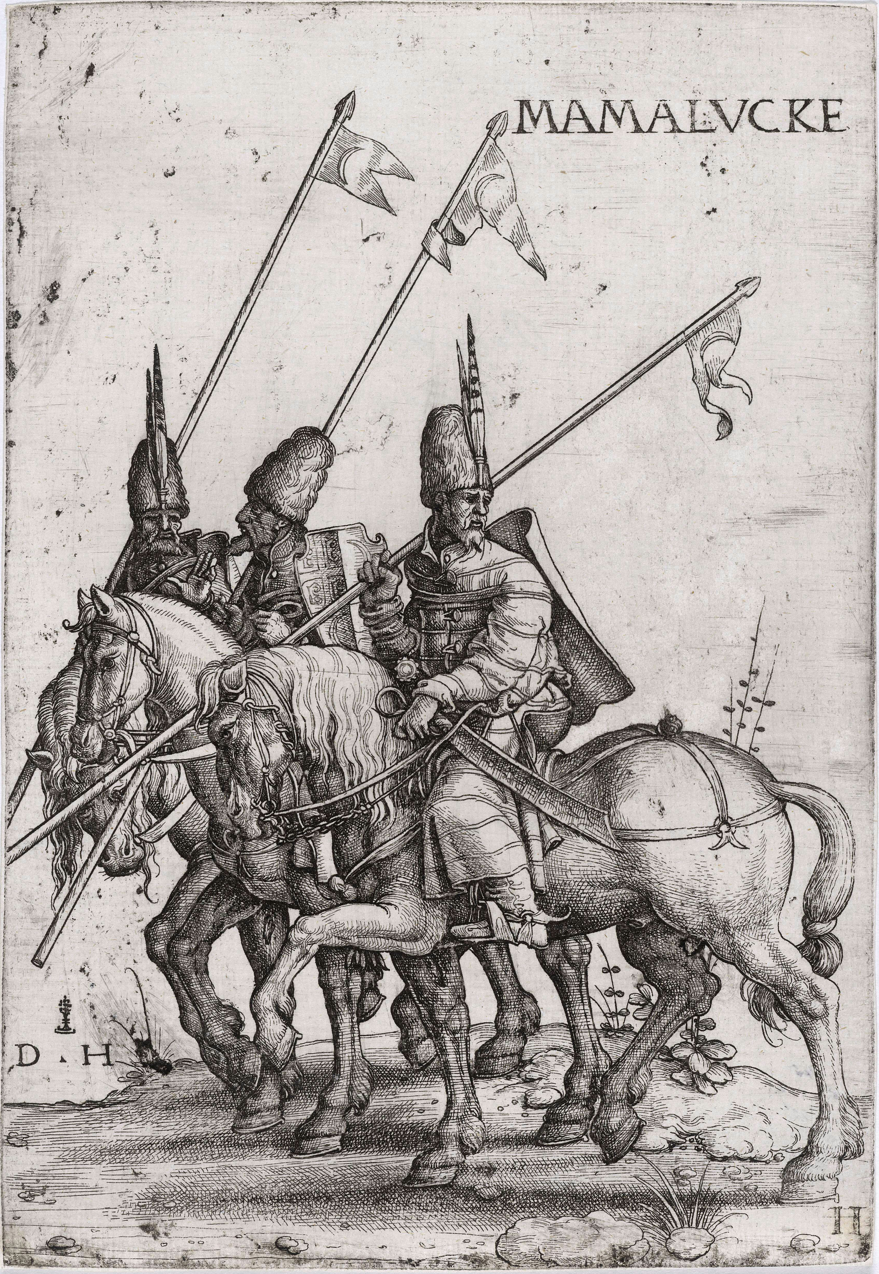
Mamluk ( ar, مملوك, mamlūk (singular), , ''mamālīk'' (plural), translated as "one who is owned", meaning " slave", also transliterated as ''Mameluke'', ''mamluq'', ''mamluke'', ''mameluk'', ''mameluke'', ''mamaluke'', or ''marmeluke'') is a term most commonly referring to non-Arab, ethnically diverse (mostly Southern Russian, Turkic, Caucasian, Eastern and Southeastern European) slave-soldiers and freed slaves who were assigned military and administrative duties, serving the ruling Arab dynasties in the Muslim world. The most enduring Mamluk realm was the knightly military class in Egypt in the Middle Ages, which developed from the ranks of slave-soldiers. Originally the Mamluks were slaves of Turkic origin from the Eurasian Steppe, but the institution of military slavery spread to include Circassians, Abkhazians, Georgians,"Relations of the Georgian Mamluks of Egypt with Their Homeland in the Last Decades of the Eighteenth Century". Daniel Crecelius and Gotc ... [...More Info...] [...Related Items...] OR: [Wikipedia] [Google] [Baidu] |
Ayyubid Dynasty
The Ayyubid dynasty ( ar, الأيوبيون '; ) was the founding dynasty of the medieval Sultanate of Egypt established by Saladin in 1171, following his abolition of the Fatimid Caliphate of Egypt. A Sunni Muslim of Kurdish origin, Saladin had originally served Nur ad-Din of Syria, leading Nur ad-Din's army in battle against the Crusaders in Fatimid Egypt, where he was made Vizier. Following Nur ad-Din's death, Saladin was proclaimed as the first Sultan of Egypt, and rapidly expanded the new sultanate beyond the frontiers of Egypt to encompass most of the Levant (including the former territories of Nur ad-Din), in addition to Hijaz, Yemen, northern Nubia, Tarabulus, Cyrenaica, southern Anatolia, and northern Iraq, the homeland of his Kurdish family. By virtue of his sultanate including Hijaz, the location of the Islamic holy cities of Mecca and Medina, he was the first ruler to be hailed as the Custodian of the Two Holy Mosques, a title that would be held by all subseque ... [...More Info...] [...Related Items...] OR: [Wikipedia] [Google] [Baidu] |
Crusader States
The Crusader States, also known as Outremer, were four Catholic realms in the Middle East that lasted from 1098 to 1291. These feudal polities were created by the Latin Catholic leaders of the First Crusade through conquest and political intrigue. The four states were the County of Edessa (10981150), the Principality of Antioch (10981287), the County of Tripoli (11021289), and the Kingdom of Jerusalem (10991291). The Kingdom of Jerusalem covered what is now Israel and Palestine, the West Bank, the Gaza Strip, and adjacent areas. The other northern states covered what are now Syria, south-eastern Turkey, and Lebanon. The description "Crusader states" can be misleading, as from 1130 very few of the Frankish population were crusaders. The term Outremer, used by medieval and modern writers as a synonym, is derived from the French for ''overseas''. In 1098, the armed pilgrimage to Jerusalem passed through Syria. The crusader Baldwin of Boulogne replaced the Greek Orthodox ... [...More Info...] [...Related Items...] OR: [Wikipedia] [Google] [Baidu] |
Byzantine Empire
The Byzantine Empire, also referred to as the Eastern Roman Empire or Byzantium, was the continuation of the Roman Empire primarily in its eastern provinces during Late Antiquity and the Middle Ages, when its capital city was Constantinople. It survived the fragmentation and fall of the Western Roman Empire in the 5th century AD and continued to exist for an additional thousand years until the fall of Constantinople to the Ottoman Empire in 1453. During most of its existence, the empire remained the most powerful economic, cultural, and military force in Europe. The terms "Byzantine Empire" and "Eastern Roman Empire" were coined after the end of the realm; its citizens continued to refer to their empire as the Roman Empire, and to themselves as Romans—a term which Greeks continued to use for themselves into Ottoman times. Although the Roman state continued and its traditions were maintained, modern historians prefer to differentiate the Byzantine Empire from Ancient Rome a ... [...More Info...] [...Related Items...] OR: [Wikipedia] [Google] [Baidu] |
Hellenistic Period
In Classical antiquity, the Hellenistic period covers the time in Mediterranean history after Classical Greece, between the death of Alexander the Great in 323 BC and the emergence of the Roman Empire, as signified by the Battle of Actium in 31 BC and the conquest of Ptolemaic Egypt the following year. The Ancient Greek word ''Hellas'' (, ''Hellás'') was gradually recognized as the name for Greece, from which the word ''Hellenistic'' was derived. "Hellenistic" is distinguished from "Hellenic" in that the latter refers to Greece itself, while the former encompasses all ancient territories under Greek influence, in particular the East after the conquests of Alexander the Great. After the Macedonian invasion of the Achaemenid Empire in 330 BC and its disintegration shortly after, the Hellenistic kingdoms were established throughout south-west Asia ( Seleucid Empire, Kingdom of Pergamon), north-east Africa ( Ptolemaic Kingdom) and South Asia ( Greco-Bactrian Kingdom, Indo-Gree ... [...More Info...] [...Related Items...] OR: [Wikipedia] [Google] [Baidu] |
Oslo II Accord
The Interim Agreement on the West Bank and the Gaza Strip commonly known as Oslo II or Oslo 2, was a key and complex agreement in the Israeli–Palestinian peace process. Because Oslo II was signed in Taba, it is sometimes called the Taba Agreement. The Oslo Accords envisioned the establishment of a Palestinian interim self-government in the Palestinian territories. Oslo II created the Areas A, B and C in the West Bank. The Palestinian Authority was given some limited powers and responsibilities in the Areas A and B and a prospect of negotiations on a final settlement based on Security Council Resolutions 242 and 338. The Accord was officially signed on 28 September 1995. Historical context The Oslo II Accord was first signed in Taba (in the Sinai Peninsula, Egypt) by Israel and the PLO on 24 September 1995 and then four days later on 28 September 1995 by Israeli Prime Minister Yitzhak Rabin and PLO Chairman Yasser Arafat and witnessed by US President Bill Clinton as well ... [...More Info...] [...Related Items...] OR: [Wikipedia] [Google] [Baidu] |


