|
Nhieu Loc–Thi Nghe Channel
The Nhieu Loc–Thi Nghe Channel (Vietnamese: ''Kênh Nhiêu Lộc – Thị Nghè'') is a waterway in Ho Chi Minh City, Vietnam. The 9 km (6-mile) long canal passes through the districts of 1, 3, Phú Nhuận, Tân Bình and Bình Thạnh and flows into the confluence of Văn Thánh Canal and Saigon River at where used to be the Saigon Naval Shipyard. Restoration The canal became heavily polluted following intense urban development in Ho Chi Minh City after 1975. Buildings dumped domestic trash and wastewater into the canal, leading to a dark appearance and noxious odor. A World Bank-funded project to restore the canal commenced in 2002, with the installation of sewers, dredging, and relocation of slums that bordered the canal. Truong Sa and Hoang Sa streets, which line the canal, were landscaped with trees and walking paths. Road traffic Currently, two roads running along the Nhieu Loc – Thi Nghe canal are named after the Vietnamese name of two archipelagos in the Sou ... [...More Info...] [...Related Items...] OR: [Wikipedia] [Google] [Baidu] |
Ho Chi Minh City
Ho Chi Minh City (HCMC) ('','' TP.HCM; ), commonly known as Saigon (; ), is the most populous city in Vietnam with a population of around 14 million in 2025. The city's geography is defined by rivers and canals, of which the largest is Saigon River. As a Municipalities of Vietnam, municipality, Ho Chi Minh City consists of 16 List of urban districts of Vietnam, urban districts, five Huyện, rural districts, and one Municipal city (Vietnam), municipal city (sub-city). As the largest financial centre in Vietnam, Ho Chi Minh City has the largest gross regional domestic product out of all Vietnam provinces and municipalities, contributing around a quarter of the Economy of Vietnam, country's total GDP. Ho Chi Minh City metropolitan area, Ho Chi Minh City's metropolitan area is List of ASEAN country subdivisions by GDP, ASEAN's 5th largest economy, also the biggest outside an ASEAN country capital. The area was initially part of Cambodian states until it became part of the Vietna ... [...More Info...] [...Related Items...] OR: [Wikipedia] [Google] [Baidu] |
Saigon Naval Shipyard
Saigon Naval Shipyard is a former French Navy, Republic of Vietnam Navy (RVNN) and Vietnam People's Navy (VPN) base in Saigon Vietnam. The base, located on the southwest bank of the Saigon River about from the South China Sea, represented the largest single industrial complex in South East Asia. Officially known as the Ba Son Corporation (), the modern incarnation of the shipyard is now based in the Bà Rịa–Vũng Tàu province, being one of the major shipyards in Vietnam. History The shipyard was originally created around 1788 by Lord (''Chúa'') Nguyễn Phúc Ánh as the Chu Sư Naval workshop (Vietnamese: ''Xưởng Chu Sư''). With help from French engineers Lord Nguyen built a fleet of ships that helped him defeat the Tây Sơn dynasty and establish him as Emperor Gia Long. The naval workshop was progressively expanded and after the French conquered Cochinchina in 1862 they expanded the area as the Port de la Marine (Naval Port) under the control of the French Navy ... [...More Info...] [...Related Items...] OR: [Wikipedia] [Google] [Baidu] |
Paracel Islands
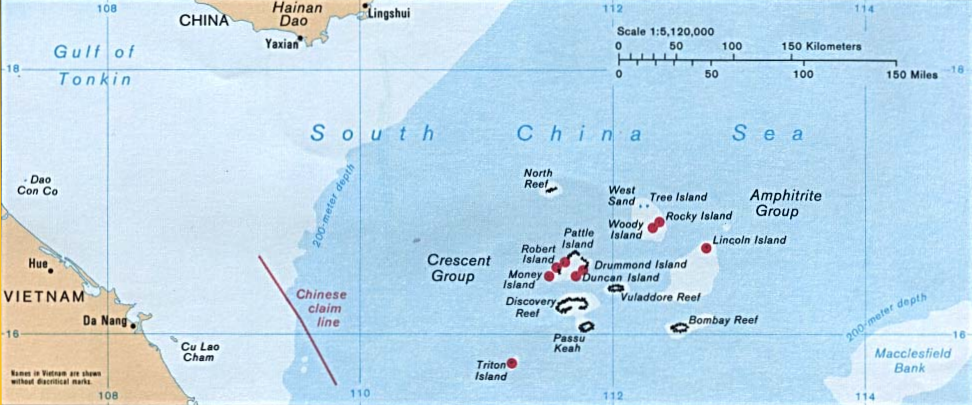
The Paracel Islands, also known as the Xisha Islands () and the Hoàng Sa Archipelago (), are a disputed archipelago in the South China Sea and currently controlled by the People's Republic of China. The word ''paracel'' is of Portuguese origin, meaning placer (a submerged bank or reef), and appears on 16th-century Portuguese maps. The archipelago includes about 130 small coral islands and reefs, most grouped into the northeastern Amphitrite Group or the western Crescent Group. They are distributed over a maritime area of around , with a land area of approximately . The archipelago is located about 220 miles (350 km) southeast of Hainan Island, equidistant from the coastlines of the People's Republic of China (PRC) and Vietnam, and approximately one-third of the way between central Vietnam and the northern Philippines. A feature of the Paracel Islands is Dragon Hole, the second deepest blue hole (underwater sinkhole) in the world. Sea turtles and seabirds are nati ... [...More Info...] [...Related Items...] OR: [Wikipedia] [Google] [Baidu] |
Spratly Islands
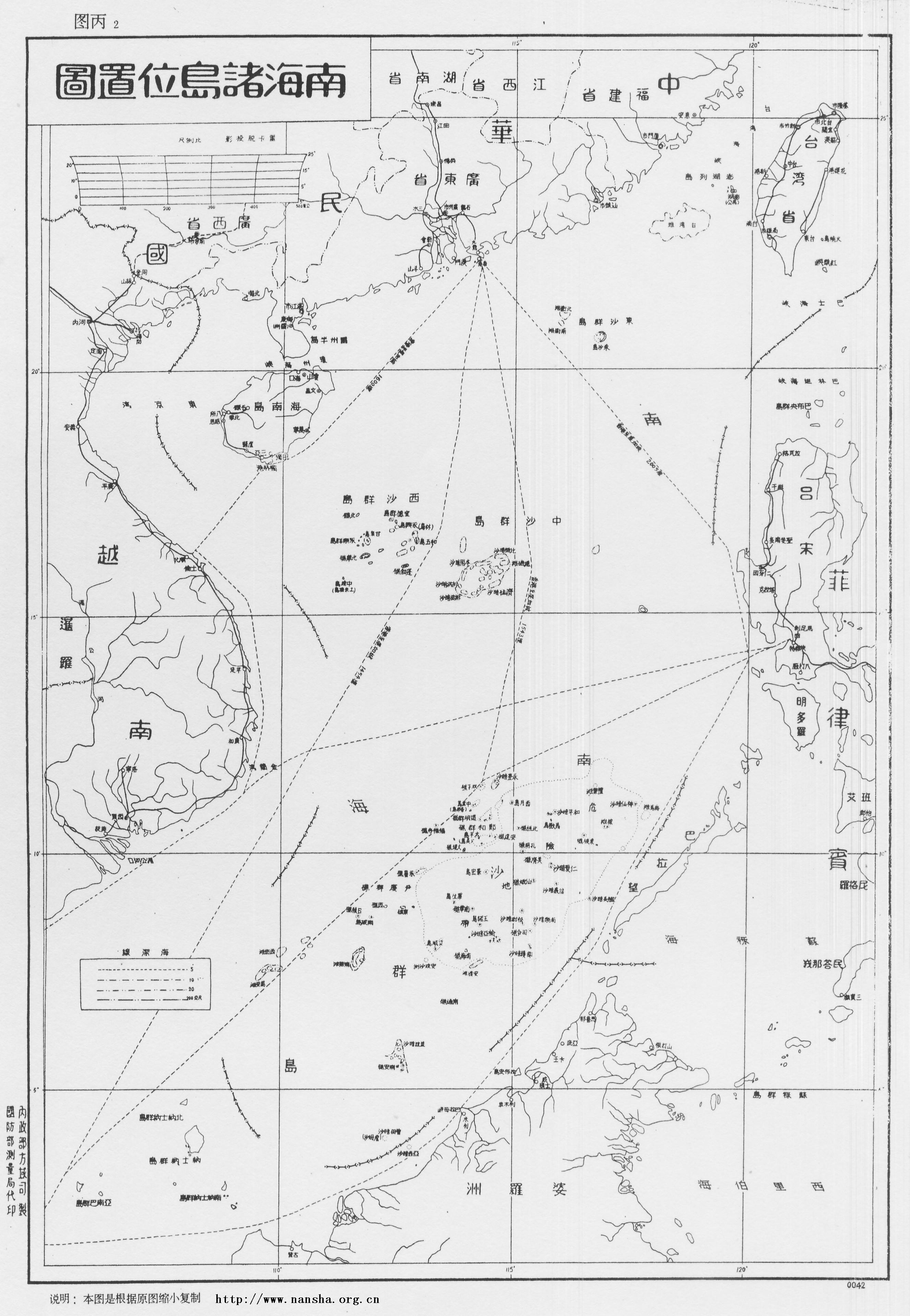
The Spratly Islands (; zh, s=南沙群岛, t=南沙群島, p=Nánshā Qúndǎo; ; ) are a disputed archipelago in the South China Sea. Composed of islands, islets, cays, and more than 100 reefs, sometimes grouped in submerged old atolls, the archipelago lies off the coasts of the Philippines, Malaysia, and southern Vietnam. Named after the 19th-century British whaling captain Richard Spratly who sighted Spratly Island in 1843, the islands contain less than of naturally occurring land area that is spread over hundreds of square km of the South China Sea. The Spratly Islands are one of the major archipelagos in the South China Sea which complicate governance and economics in this part of Southeast Asia due to their location in strategic shipping lanes. The islands are largely uninhabited, but offer rich fishing grounds and may contain significant oil and natural gas reserves, and as such are important to the claimants in their attempts to establish international bounda ... [...More Info...] [...Related Items...] OR: [Wikipedia] [Google] [Baidu] |
Territorial Disputes In The South China Sea
Brunei, Indonesia, Malaysia, the Philippines, the People's Republic of China (PRC), Taiwan (Republic of China/ROC), and Vietnam have conflicting island and maritime claims in the South China Sea. The disputes involve the islands, reefs, banks, and other features of the region, including the Spratly Islands, Paracel Islands, Scarborough Shoal, and various boundaries in the Gulf of Tonkin. The waters near the Indonesian Natuna Islands, which some regard as geographically part of the South China Sea, are disputed as well. An estimated US$3.36 trillion worth of global trade passes through the South China Sea annually, which accounts for a third of the global maritime trade. 80 percent of China's energy imports and 40 percent of China's total trade passes through the South China Sea. Claimant states are interested in retaining or acquiring the rights to fishing stocks, the exploration and potential exploitation of crude oil and natural gas in the seabed of various parts of the Sout ... [...More Info...] [...Related Items...] OR: [Wikipedia] [Google] [Baidu] |
South China Sea
The South China Sea is a marginal sea of the Western Pacific Ocean. It is bounded in the north by South China, in the west by the Indochinese Peninsula, in the east by the islands of Taiwan island, Taiwan and northwestern Philippines (mainly Luzon, Mindoro and Palawan Island, Palawan), and in the south by Borneo, eastern Sumatra and the Bangka Belitung Islands, encompassing an area of around . It communicates with the East China Sea via the Taiwan Strait, the Philippine Sea via the Luzon Strait, the Sulu Sea via the straits around Palawan, the Java Sea via the Karimata Strait, Karimata and Bangka Straits and directly with Gulf of Thailand. The Gulf of Tonkin is part of the South China Sea. $3.4 trillion of the world's $16 trillion Maritime transport, maritime shipping passed through South China Sea in 2016. Oil and natural gas reserves have been found in the area. The Western Central Pacific accounted for 14% of world's commercial fishing in 2010. The South China Sea Islands, ... [...More Info...] [...Related Items...] OR: [Wikipedia] [Google] [Baidu] |
World Bank
The World Bank is an international financial institution that provides loans and Grant (money), grants to the governments of Least developed countries, low- and Developing country, middle-income countries for the purposes of economic development. The World Bank is the collective name for the International Bank for Reconstruction and Development (IBRD) and International Development Association (IDA), two of five international organizations owned by the World Bank Group. It was established along with the International Monetary Fund at the 1944 Bretton Woods Conference. After a slow start, its first loan was to France in 1947. In its early years, it primarily focused on rebuilding Europe. Over time, it focused on providing loans to developing world countries. In the 1970s, the World Bank re-conceptualized its mission of facilitating development as being oriented around poverty reduction. For the last 30 years, it has included NGOs and environmental groups in its loan portfolio. Its ... [...More Info...] [...Related Items...] OR: [Wikipedia] [Google] [Baidu] |
Night In Saigon (13913458452)
Night, or nighttime, is the period of darkness when the Sun is below the horizon. Sunlight illuminates one side of the Earth, leaving the other in darkness. The opposite of nighttime is daytime. Earth's rotation causes the appearance of sunrise and sunset. Moonlight, airglow, starlight, and light pollution dimly illuminate night. The duration of day, night, and twilight varies depending on the time of year and the latitude. Night on other celestial bodies is affected by their Rotation period (astronomy), rotation and orbital periods. The planets Mercury (planet), Mercury and Venus have much longer nights than Earth. On Venus, night lasts about 58 Earth days. The Moon's rotation is tidally locked, rotating so that near side of the Moon, one of the sides of the Moon always faces Earth. Nightfall across portions of the near side of the Moon results in lunar phases visible from Earth. Organisms respond to the changes brought by nightfall: darkness, increased humidity, and lower ... [...More Info...] [...Related Items...] OR: [Wikipedia] [Google] [Baidu] |


