|
Newtonville, Massachusetts
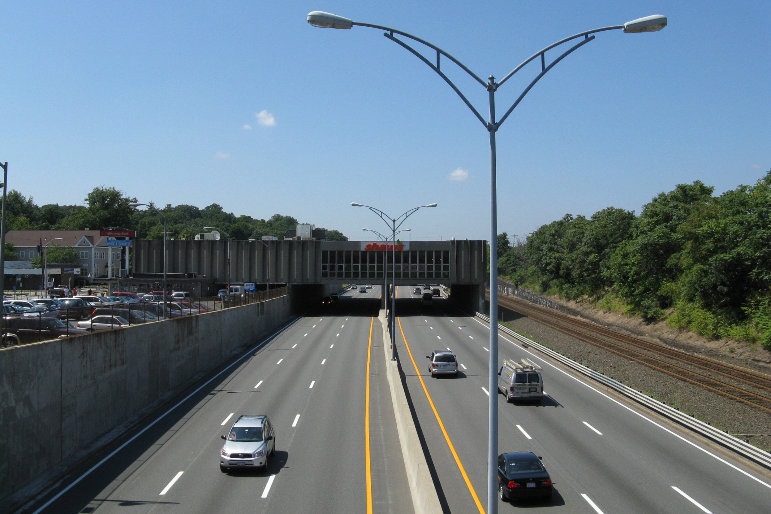
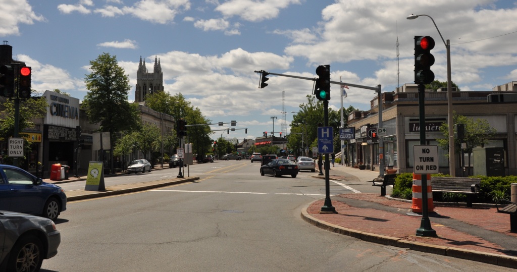
Newtonville is one of the thirteen villages within the city of Newton in Middlesex County, Massachusetts, United States. Geography Newtonville is a predominantly residential neighborhood. It is divided into two parts by the Massachusetts Turnpike and the MBTA Commuter Rail running through an open trench below grade, and requiring reconnection via several bridges over the trench. At the core of the village is the Newtonville Historic District. The Washington Park Historic District and many individual residential structures also have notable architectural features and history and appear on the National Register of Historic Places listings in Newton, Massachusetts. The Star Market on Austin Street (briefly renamed "Shaw's") was one of the first projects in the country to acquire air rights for construction; the supermarket is built over the Massachusetts Turnpike. Newtonville was once served by the now defunct Newton Nexus bus, a free service provided by the city of Newton. ... [...More Info...] [...Related Items...] OR: [Wikipedia] [Google] [Baidu] |
Shaw's Over The Massachusetts Turnpike, Newtonville MA
Shaw's and Star Market are two American supermarket chains under united management based in West Bridgewater, Massachusetts, employing about 30,000 associates in 150 total stores; 129 stores are operated under the Shaw's banner in Maine, Massachusetts, New Hampshire, Rhode Island, and Vermont, while Star Market operates 21 stores in Massachusetts, most of which are in or near Boston. Until 2010, Shaw's operated stores in all six New England states, and as of 2021 Shaw's remained the only supermarket chain with stores in five of the six, after it sold its Connecticut operations. The chain's largest competitors are Hannaford Bros. Co., Hannaford, DeMoulas Market Basket, Market Basket, Price Chopper Supermarkets, Price Chopper, Roche Bros., Wegmans, and Stop & Shop. Star Market is a companion store to Shaw's, Shaw's having purchased the Star Market, competing chain in 1999. Shaw's and Star Market are wholly owned subsidiaries of the Boise, Idaho–based Albertsons. The combined chai ... [...More Info...] [...Related Items...] OR: [Wikipedia] [Google] [Baidu] |
Bullough's Pond
Bullough's Pond, a former mill pond located in Newton, Massachusetts, is now a decorative pond in a suburban neighborhood, used for bird watching and walking. In the nineteenth century it was the site of a commercial ice business. Since the early 2000s, temperatures have warmed to the point that its winter ice is no longer thick enough to support skating safely. Books *''Once Around Bullough's Pond: A Native American Epic'', Douglas Worth, 1987 *''Reflections in Bullough's Pond: Economy and Ecosystem in New England'', Diana Muir, University Press of New England, 2000. Winner of the Massachusetts Book Award, 2001 Films A scene from " The Women," starring Annette Bening and Meg Ryan, was filmed on the pond. |
Watertown Square
Watertown Square is the main square of Watertown, Massachusetts, located at the confluence of North Beacon Street and Main Street ( US-20), Mt. Auburn Street ( MA-16), Pleasant Street, Arsenal Street, and Charles River Road. The Armenian Library and Museum of America is located in the square; Watertown Dam is to the west. Bus service Watertown Square is a minor transfer point for MBTA bus services. Two routes terminate at a two-lane bus loop that forms the west side of the square; the 71 is one of four trolleybus routes operated from the Harvard bus tunnel and a key bus route. *: –Watertown Square *: Watertown Square– One additional route passes on the north side of the square on US-20; it serves a westbound stop just north of Watertown Square, and an eastbound stop a block to the west. *: Market Place Drive or Waltham Center– Central Square, Cambridge , located to the south across the Watertown Bridge, is also a bus transfer point. Trolleybus wires for the 71 run to ... [...More Info...] [...Related Items...] OR: [Wikipedia] [Google] [Baidu] |
List Of MBTA Bus Routes
The Massachusetts Bay Transportation Authority bus division operates bus routes in the Boston, Massachusetts metropolitan area. All routes connect to MBTA subway, MBTA Commuter Rail, and/or other MBTA bus services. Many routes are descendants of the streetcar routes of the Boston Elevated Railway, or of suburban companies including the Eastern Massachusetts Street Railway, Middlesex and Boston Street Railway, and Newton and Boston Street Railway. A number of routes have been temporarily suspended or placed on modified routings during the COVID-19 pandemic. While overall service levels were restored to pre-COVID levels in 2021, some routes remain modified or suspended. Since 2018, the MBTA has been planning a major bus network overhaul, with implementation expected to complete in 2028. Key Silver Line The Silver Line is a bus rapid transit system marketed as rapid transit. It is divided into two branches: Waterfront service (SL1, SL2, SL3, and the rush-hour Shuttle) t ... [...More Info...] [...Related Items...] OR: [Wikipedia] [Google] [Baidu] |
MBTA Bus
The Massachusetts Bay Transportation Authority (MBTA) operates 170 bus routes in the Greater Boston area. The MBTA has a policy objective to provide transit service within walking distance (defined as ) for all residents living in areas with population densities greater than within the MBTA's service district. Much of this service is provided by bus. In , the system had a ridership of , or about per weekday as of . Most MBTA bus routes are local service operated in Boston and its inner suburbs and connect to MBTA subway stations. Fifteen high-ridership local routes are designated as key routes, with higher frequency at all operating hours. The MBTA operates a five-route bus rapid transit service branded as the Silver Line, as well as two limited-stop crosstown routes. Three smaller local networks are based in the nearby cities of Lynn, Waltham, and Quincy. Several express routes operate from suburbs to downtown Boston. The MBTA has an active bus fleet around 1,140 buse ... [...More Info...] [...Related Items...] OR: [Wikipedia] [Google] [Baidu] |
Newtonville Station
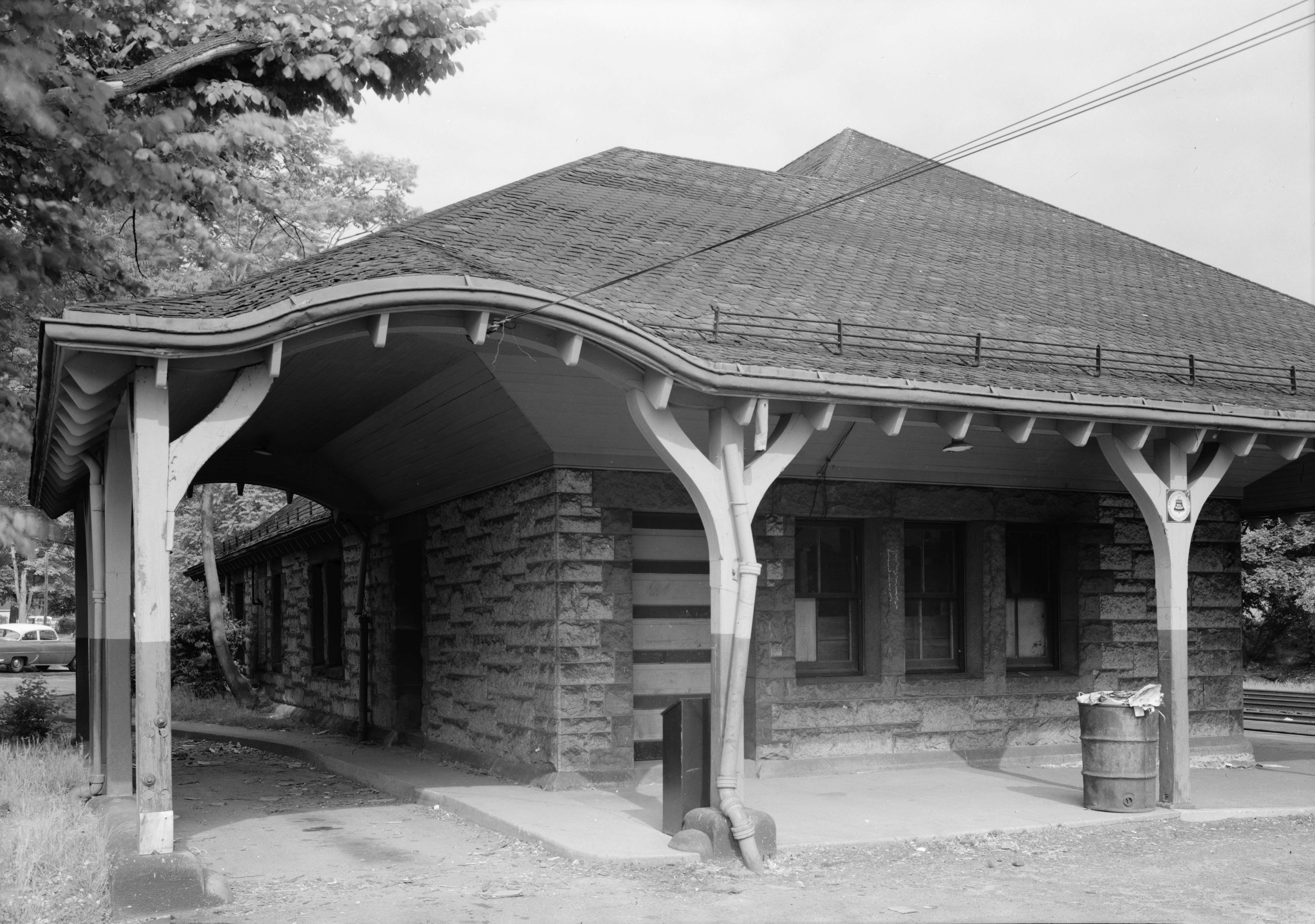
Newtonville station is a commuter rail station on the MBTA Commuter Rail Framingham/Worcester Line, located between the Massachusetts Turnpike and Washington Street at Newtonville Square in the village of Newtonville in Newton, Massachusetts. Stairway entrances are located on the bridges over the Turnpike at Walnut Street and Harvard Street. Newtonville station is not accessible; renovations for accessibility are planned. History Hulls Crossing station opened as a flag stop on the Boston and Worcester Railroad in 1842. It was first located on the south side of the tracks on the west side of Harvard Street, then later moved to the east side. The first station agent, Joshua Ramsdell, worked at Newtonville from 1844 to 1889, by which time he was "probably the oldest station agent in New England". A red brick station was constructed slightly to the east in the 1870s, one of a small number of B&A stations built that decade. It ultimately became the first stop outside Boston for long- ... [...More Info...] [...Related Items...] OR: [Wikipedia] [Google] [Baidu] |
Framingham/Worcester Line
The Framingham/Worcester Line of the MBTA Commuter Rail system runs west from Boston, Massachusetts to Worcester, Massachusetts through the MetroWest region, serving 17 station stops in Boston, Newton, Wellesley, Natick, Framingham, Ashland, Southborough, Westborough, Grafton, and Worcester. The third-longest and second-busiest line on the system, the Framingham/Worcester Line contends with interference from freight trains, and a number of non-handicapped-accessible stations. Service on the line is a mix of local and express trains serving Worcester plus short-turn Framingham locals. The Framingham/Worcester Line was one of the first commuter rail lines, with daily commuter-oriented service to West Newton beginning in 1834. Originally the Boston and Worcester Railroad, service has been operated by the Boston and Albany Railroad, New York Central, Penn Central, and since 1964 by Boston and Maine Railroad, Amtrak, and the MBCR until 2014 under contract to the MBTA. Since ... [...More Info...] [...Related Items...] OR: [Wikipedia] [Google] [Baidu] |
Boston
Boston (), officially the City of Boston, is the state capital and most populous city of the Commonwealth of Massachusetts, as well as the cultural and financial center of the New England region of the United States. It is the 24th- most populous city in the country. The city boundaries encompass an area of about and a population of 675,647 as of 2020. It is the seat of Suffolk County (although the county government was disbanded on July 1, 1999). The city is the economic and cultural anchor of a substantially larger metropolitan area known as Greater Boston, a metropolitan statistical area (MSA) home to a census-estimated 4.8 million people in 2016 and ranking as the tenth-largest MSA in the country. A broader combined statistical area (CSA), generally corresponding to the commuting area and including Providence, Rhode Island, is home to approximately 8.2 million people, making it the sixth most populous in the United States. Boston is one of the oldest ... [...More Info...] [...Related Items...] OR: [Wikipedia] [Google] [Baidu] |
Newton City Hall And War Memorial
The Newton City Hall and War Memorial is a historic city hall and war memorial building located in the village of Newton Centre in Newton, Massachusetts. Built in 1932 in the Colonial Revival style, the building was designed by Allen and Collens, with landscaping by the renowned Olmsted Brothers. The building's purpose was to serve as a new city hall, and as a memorial to the city's soldiers of the First World War. On February 16, 1990, it was added to the National Register of Historic Places. Description and history Newton City Hall is located in central Newton, and occupies a large triangular lot bounded on the north by Commonwealth Avenue, on the southwest by Homer Street, and on the east by Walnut Street. Walnut Street and Commonwealth Avenue are major roadways providing access to other parts of the city, and Homer Street is a largely residential street that roughly parallels Commonwealth Avenue. The Newton Free Library is located across Homer Street to the south. The buil ... [...More Info...] [...Related Items...] OR: [Wikipedia] [Google] [Baidu] |
West Newton, Massachusetts
West Newton is one of the thirteen villages within the city of Newton in Middlesex County, Massachusetts, United States. Among the oldest of the thirteen Newton villages, the West Newton Village Center is a National Register Historic District. The postal ("Zip") code 02465 roughly matches the village limits. Location West Newton is located in the north central part of Newton and is bordered by the town of Waltham on the north and by the villages of Auburndale on the west, Newton Lower Falls on the extreme southwest, Newtonville on the east, and Waban on the south. Railroad Station The West Newton train stop is located near an inn (now small shops) that served as a stagecoach stop. The original station structure was destroyed in the construction of the Massachusetts Turnpike, although the station itself still exists as a stop on the commuter rail. West Newton Square West Newton Square, the town center of West Newton, is home to many local businesses and venues. These ... [...More Info...] [...Related Items...] OR: [Wikipedia] [Google] [Baidu] |
Newton Centre
Newton Centre is one of the thirteen villages within the city of Newton in Middlesex County, Massachusetts, United States. The main commercial center of Newton Centre is a triangular area surrounding the intersections of Beacon Street, Centre Street, and Langley Road. It is the largest downtown area among all the villages of Newton, and serves as a large upscale shopping destination for the western suburbs of Boston. The Newton City Hall and War Memorial is located at 1000 Commonwealth Avenue, and the Newton Free Library is located at 330 Homer Street in Newton Centre. The Newton Centre station of the MBTA Green Line "D" branch is located on Union Street. The Crystal Lake and Pleasant Street Historic District is roughly bounded by the Sudbury Aqueduct, Pleasant Avenue, Lake Avenue, and Crystal Street and Webster Court. This area and its surrounding neighborhoods exemplify the distinct styles of the late 19th century and early 20th century. Crystal Lake, a 33-acre natural la ... [...More Info...] [...Related Items...] OR: [Wikipedia] [Google] [Baidu] |
Newton Corner
Newton Corner is one of the thirteen villages within the city of Newton in Middlesex County, Massachusetts, United States. Newton Corner borders Brighton, a neighborhood of Boston, as well as the city of Watertown, Massachusetts. Newton Corner is divided by the Massachusetts Turnpike ( I-90), it has on-off access in both directions at Exit 17. Newton Corner station formerly saw streetcar and commuter rail service; it now serves as a busy bus depot serving downtown express routes as well as local buses. History Newton Corner sprang up in the late 1600s, when a village grew at the intersection of Washington and Centre street, then rural roads. Stores, farm stands, and a tavern came to service the steady stream of traffic. A railway came through in 1834. The Massachusetts Turnpike was built through the center of Newton Corner in the 1960s, along the line of the former railroad. An interchange was also added. According to author Yanni Tsipis, "Newton Corner really ceased to be ... [...More Info...] [...Related Items...] OR: [Wikipedia] [Google] [Baidu] |


