|
Newlay
Newlay is a suburb of Horsforth, in West Yorkshire, England. Originally a hamlet, it is now part of Horsforth parish in the City of Leeds District, and has its own conservation area. Newlay is situated on the Leeds and Liverpool Canal and the River Aire, some north west of Leeds city centre. History Newlay (or sometimes Newlay Bridge) was a hamlet historically in the wapentake of Skyrack, and was listed as ''Newlath'', ''New Laith'', or ''New Laithes'', which was the name of the grange in the area. The site is possibly the location of the original ''Horse Ford'' across the River Aire, which gave the town of Horsforth its name. The site has also been recorded as ''Newlaithbrigge'' in 1587, indicating the existence of a bridge in the 16th century. The modern suburb of Newlay is considered part of Horsforth, (adjacent to Newlay to the north), and is north west of the city centre in Leeds. Newlay is part of the parish and ward of Horsforth, although anything on the south side of t ... [...More Info...] [...Related Items...] OR: [Wikipedia] [Google] [Baidu] |
|
 |
Newlay And Horsforth Railway Station
Newlay and Horsforth railway station, until 1889 and from 1961 called Newlay station, was a station on the route of the former Leeds and Bradford Railway (now part of the Airedale Line and the Wharfedale Line), located on the right bank of the River Aire and on the left bank of the Leeds and Liverpool canal between Horsforth in the north and Bramley in the south. It was accessed from Pollard Lane, which still crosses the railway on a bridge there, and served mainly the southern parts of Horsforth in West Yorkshire, England. History The Leeds and Bradford Railway between and Bradford (Forster Square) stations was opened in June 1846. Intermediate stations were opened later and Newlay was opened by the in September 1846. The latter was later absorbed by the Midland Railway, which became part of the London, Midland and Scottish Railway upon the 1923 Grouping. In 1905 the station was expanded with a second pair of tracks and a goods shed south of the line. During World War I ... [...More Info...] [...Related Items...] OR: [Wikipedia] [Google] [Baidu] |
 |
Horsforth
Horsforth is a town and civil parish within the City of Leeds, in West Yorkshire, England, lying about five miles north-west of Leeds city centre. Historically a village within the West Riding of Yorkshire, it had a population of 18,895 at the 2011 Census. It became part of the City of Leeds metropolitan borough in 1974. In 1999 a civil parish was created for the area, and the parish council voted to rename itself a town council. The area sits within the Horsforth ward of Leeds City Council, which also includes the southern part of Rawdon. History Horsforth was recorded in the ''Domesday Book'' of 1086 as ''Horseford'', ''Horseforde'', ''Hoseforde''; but late-ninth-century coins with the legend ''ORSNA FORD'' and ''OHSNA FORD'' may have come from Horsforth. The name derives from Old English ''hors'' or, to judge from the coins, *''horsa'' ('horse') in the genitive plural form ''horsa''/''horsna'' + ''ford'' 'ford', thus meaning 'horses' ford'. This refers to a river crossing ... [...More Info...] [...Related Items...] OR: [Wikipedia] [Google] [Baidu] |
 |
Bramley, Leeds
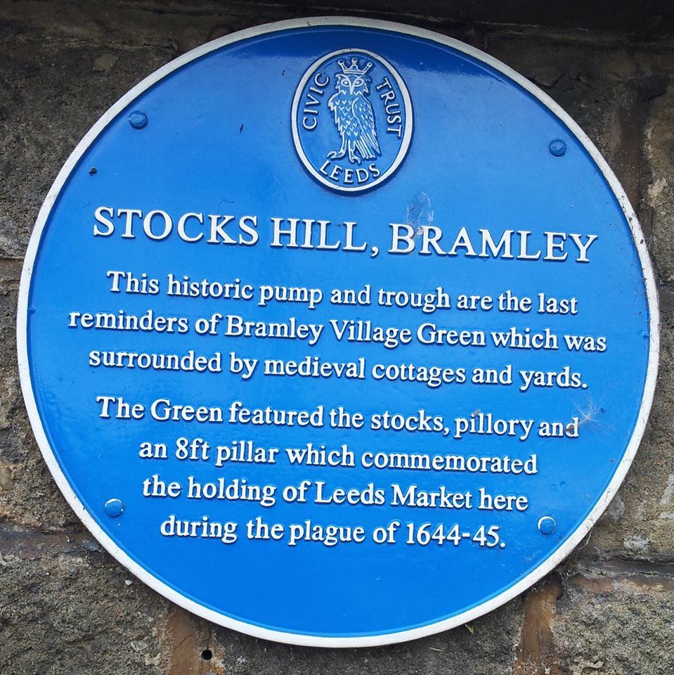
Bramley is a district in west Leeds, West Yorkshire, England. It is part of the City of Leeds Ward of Bramley and Stanningley with a population of 21,334 at the 2011 Census. The area is an old industrial area with much 19th century architecture and 20th century council housing in the east and private suburban housing in the west. Etymology The name of Bramley is first attested in the 1086 Domesday Book as ''Brameleia'' and ''Bramelei''. The name derives from the Old English words ''brōm'' ('broom') and ''lēah'' ('open land in a wood'). Thus the name once meant 'open land characterised by broom'. History At the time of the Domesday survey, the nucleus of the settlement was probably located at Stocks Hill, and it developed in a linear fashion along today's Town Street. The surviving water pump and stone water trough on Stocks Hill remain from Bramley's medieval past. The accompanying blue plaque states "Stocks Hill, Bramley. This historic pump and trough are ... [...More Info...] [...Related Items...] OR: [Wikipedia] [Google] [Baidu] |
|
River Aire
The River Aire is a major river in Yorkshire, England, in length. The ''Handbook for Leeds and Airedale'' (1890) notes that the distance from Malham to Howden is direct, but the river's meanderings extend that to . Between Malham Tarn and Airmyn, the river drops . Part of the river below Leeds is canalised, and is known as the Aire and Calder Navigation. Course The Aire starts at Malham Tarn and becomes a subterranean stream at 'Water Sinks' about one mile (1.6 km) before the top of Malham Cove, it then flows underground to Aire Head, just below Malham, in North Yorkshire, and then flows through Gargrave and Skipton. After Cononley, the river enters West Yorkshire where it passes through the former industrial areas of Keighley, Bingley, Saltaire and Shipley. It then passes through Leeds and on to Swillington and Woodlesford. At Castleford is the confluence of the Aire and Calder; just downstream of the confluence was the ford where the ancient British r ... [...More Info...] [...Related Items...] OR: [Wikipedia] [Google] [Baidu] |
|
.jpg) |
Kirkstall Forge
Kirkstall Forge is a 57-acre mixed-use development located in Kirkstall in Leeds, West Yorkshire. The site is one of the oldest most continuously used industrial sites in England. It was operated by Kirkstall Forge Engineering, a metalworking business. It was a working forge until 1995 when the site was bought by Commercial Estates Group who have had plans approved to build 1,050 homes, 300,000 sq ft of office space, 100,000 sq ft of leisure and retail and a primary school. In June 2016 a railway station was opened on the site served by trains between Leeds and Bradford. In the 19th century, as well as ironforging, the metalworking business produced axles for horse-drawn vehicles. As motor vehicles became more common, in the early 20th century, the forge specialised in motor vehicle axles and in steel bar. During the First World War, forging was stopped, allowing the business to concentrate on axle production. During the Second World War, production expanded to meet the demand for ... [...More Info...] [...Related Items...] OR: [Wikipedia] [Google] [Baidu] |
|
Chiltern Hundreds
The Chiltern Hundreds is an ancient administrative area in Buckinghamshire, England, composed of three " hundreds" and lying partially within the Chiltern Hills. "Taking the Chiltern Hundreds" refers to one of the legal fictions used to effect resignation from the British House of Commons. Since Members of Parliament are not permitted to resign, they are instead appointed to an "office of profit under the Crown", which requires MPs to vacate their seats. The ancient office of Crown Steward and Bailiff of the Chiltern Hundreds, having been reduced to a mere sinecure by the 17th century, was first used by John Pitt (of Encombe) in 1751 to vacate his seat in the House of Commons. Other titles were also later used for the same purpose, but only those of the Chiltern Hundreds and the Crown Steward and Bailiff of the Manor of Northstead are still in use. Three Chiltern Hundreds A hundred is a traditional division of an English county: the ''Oxford English Dictionary'' says th ... [...More Info...] [...Related Items...] OR: [Wikipedia] [Google] [Baidu] |
|
 |
Grade II* Listed
In the United Kingdom, a listed building or listed structure is one that has been placed on one of the four statutory lists maintained by Historic England in England, Historic Environment Scotland in Scotland, in Wales, and the Northern Ireland Environment Agency in Northern Ireland. The term has also been used in the Republic of Ireland, where buildings are protected under the Planning and Development Act 2000. The statutory term in Ireland is " protected structure". A listed building may not be demolished, extended, or altered without special permission from the local planning authority, which typically consults the relevant central government agency, particularly for significant alterations to the more notable listed buildings. In England and Wales, a national amenity society must be notified of any work to a listed building which involves any element of demolition. Exemption from secular listed building control is provided for some buildings in current use for wor ... [...More Info...] [...Related Items...] OR: [Wikipedia] [Google] [Baidu] |
 |
Low Moor Ironworks
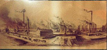
The Low Moor Ironworks was a wrought iron foundry established in 1791 in the village of Low Moor about south of Bradford in Yorkshire, England. The works were built to exploit the high-quality iron ore and low-sulphur coal found in the area. Low Moor made wrought iron products from 1801 until 1957 for export around the world. At one time it was the largest ironworks in Yorkshire, a major complex of mines, piles of coal and ore, kilns, blast furnaces, forges and slag heaps connected by railway lines. The surrounding countryside was littered with waste, and smoke from the furnaces and machinery blackened the sky. Today Low Moor is still industrial, but the pollution has been mostly eliminated. Background The ironworks depended on the excellent resources of high-quality coal and iron ore found in the vicinity. The "better bed" coal came from a seam about thick resting on hard sandstone. This coal is particularly low in sulphur. About above this coal seam there is a layer of "bla ... [...More Info...] [...Related Items...] OR: [Wikipedia] [Google] [Baidu] |
 |
Anglo-Saxons
The Anglo-Saxons were a cultural group who inhabited England in the Early Middle Ages. They traced their origins to settlers who came to Britain from mainland Europe in the 5th century. However, the ethnogenesis of the Anglo-Saxons happened within Britain, and the identity was not merely imported. Anglo-Saxon identity arose from interaction between incoming groups from several Germanic tribes, both amongst themselves, and with indigenous Britons. Many of the natives, over time, adopted Anglo-Saxon culture and language and were assimilated. The Anglo-Saxons established the concept, and the Kingdom, of England, and though the modern English language owes somewhat less than 26% of its words to their language, this includes the vast majority of words used in everyday speech. Historically, the Anglo-Saxon period denotes the period in Britain between about 450 and 1066, after their initial settlement and up until the Norman Conquest. Higham, Nicholas J., and Martin J. Ryan. ''The An ... [...More Info...] [...Related Items...] OR: [Wikipedia] [Google] [Baidu] |
 |
Grade II Listed
In the United Kingdom, a listed building or listed structure is one that has been placed on one of the four statutory lists maintained by Historic England in England, Historic Environment Scotland in Scotland, in Wales, and the Northern Ireland Environment Agency in Northern Ireland. The term has also been used in the Republic of Ireland, where buildings are protected under the Planning and Development Act 2000. The statutory term in Ireland is "protected structure". A listed building may not be demolished, extended, or altered without special permission from the local planning authority, which typically consults the relevant central government agency, particularly for significant alterations to the more notable listed buildings. In England and Wales, a national amenity society must be notified of any work to a listed building which involves any element of demolition. Exemption from secular listed building control is provided for some buildings in current use for worship ... [...More Info...] [...Related Items...] OR: [Wikipedia] [Google] [Baidu] |
 |
Kirkstall Abbey
Kirkstall Abbey is a ruined Cistercian monastery in Kirkstall, north-west of Leeds city centre in West Yorkshire, England. It is set in a public park on the north bank of the River Aire. It was founded ''c.'' 1152. It was disestablished during the Dissolution of the Monasteries under Henry VIII. The picturesque ruins have been drawn and painted by artists such as J. M. W. Turner, Thomas Girtin and John Sell Cotman. Kirkstall Abbey was acquired by the Leeds Corporation as a gift from Colonel North and opened to the public in the late 19th century. The gatehouse became a museum, which is now part of the Leeds Museums & Galleries group. Foundation Henry de Lacy (1070, Halton, – 1123), Lord of the manor of Pontefract, 2nd Lord of Bowland, promised to dedicate an abbey to the Virgin Mary should he survive a serious illness. He recovered and agreed to give the Abbot of Fountains Abbey land at Barnoldswick in the West Riding of Yorkshire (now in Lancashire) on which to found a da ... [...More Info...] [...Related Items...] OR: [Wikipedia] [Google] [Baidu] |
 |
Goit
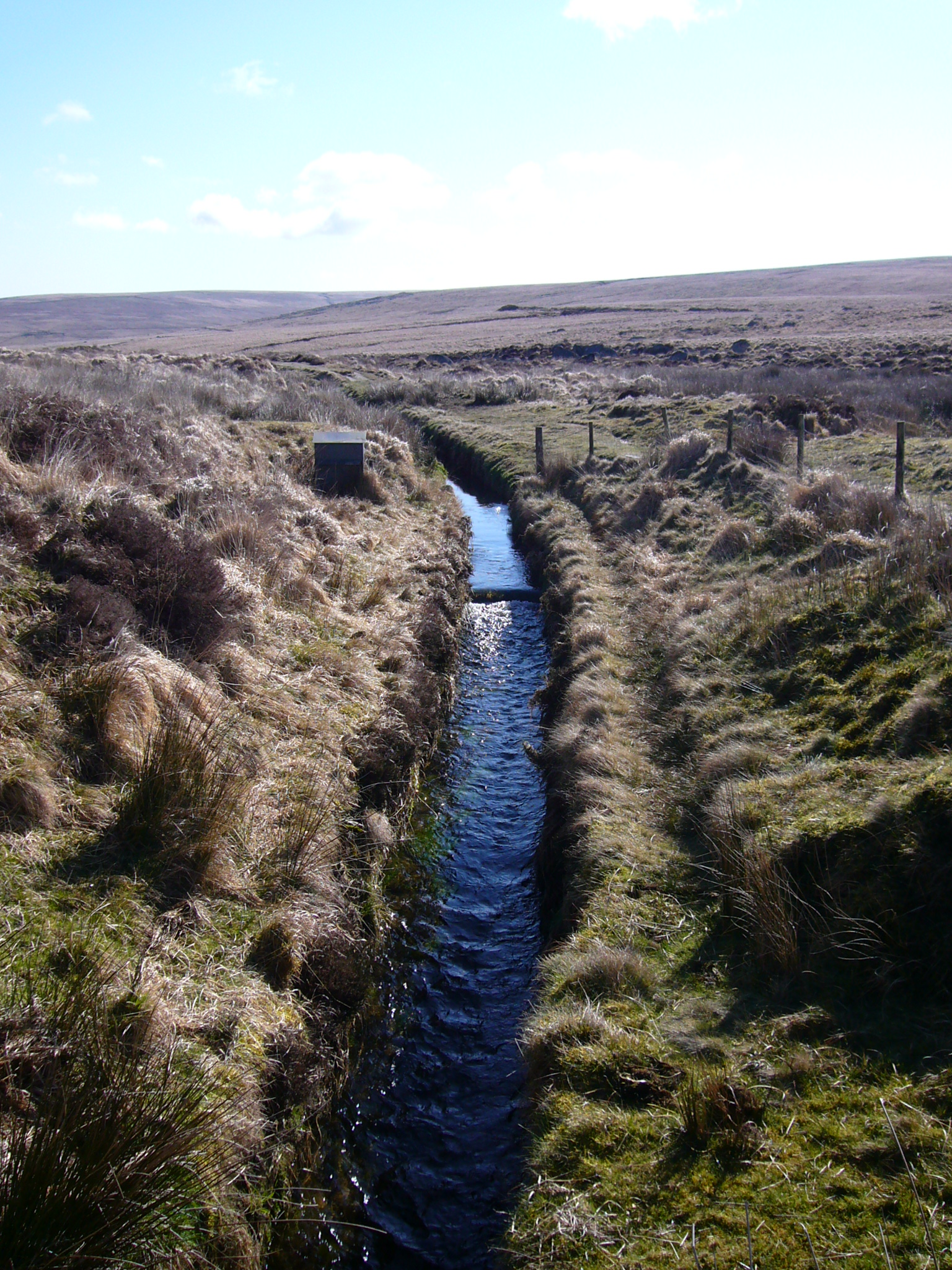
A leat (; also lete or leet, or millstream) is the name, common in the south and west of England and in Wales, for an artificial watercourse or aqueduct dug into the ground, especially one supplying water to a watermill or its mill pond. Other common uses for leats include delivery of water for hydraulic mining and mineral concentration, for irrigation, to serve a dye works or other industrial plant, and provision of drinking water to a farm or household or as a catchment cut-off to improve the yield of a reservoir. According to the ''Oxford English Dictionary'', ''leat'' is cognate with ''let'' in the sense of "allow to pass through". Other names for the same thing include ''fleam'' (probably a leat supplying water to a mill that did not have a millpool). In parts of northern England, for example around Sheffield, the equivalent word is ''goit''. In southern England, a leat used to supply water for water-meadow irrigation is often called a ''carrier'', ''top carrier'', or ''m ... [...More Info...] [...Related Items...] OR: [Wikipedia] [Google] [Baidu] |