|
New Zealand Bravery Decoration
__NOTOC__ The New Zealand Bravery Decoration (NZBD) is the third-level civil decoration of New Zealand. It was instituted by royal warrant on 20 September 1999 as part of the move to replace British bravery awards with an indigenous New Zealand Bravery system. The medal, which may be awarded posthumously, is granted in recognition of "acts of exceptional bravery in situations of danger". The medal is primarily a civilian award, but it is also awarded to members of the armed forces who perform acts of bravery in non-operational circumstances (given that the New Zealand gallantry awards may only be awarded "while involved in war and warlike operational service (including peacekeeping)". Bars are awarded to the NZBD in recognition of the performance of further acts of bravery meriting the award. Recipients are entitled to the postnominal letters ''NZBD''. The medal replaced the award of the Queen's Gallantry Medal, Air Force Cross, and Air Force Medal in respect of acts of brave ... [...More Info...] [...Related Items...] OR: [Wikipedia] [Google] [Baidu] |
Morrinsville
Morrinsville is a provincial town in the Waikato region of New Zealand's North Island, with an estimated population of as of The town is located at the northern base of the Pakaroa Range, and on the south-western fringe of the Hauraki Plains. Morrinsville is around 33 kilometres east of Hamilton and 22 kilometres west of Te Aroha. The town is bordered by the Piako River to the east and the Waitakaruru Stream to the south. History and Culture Pre-European settlement Prior to European settlement of New Zealand, the hills around present-day Morrinsville were occupied by the Ngati Werewere Māori people of the Ngati Haua Iwi, and the site of the present-day town was on or near to an old Māori route between the upper Waihou-Piako basin and the Ngāruawāhia area. Following European settlement, some early European traders are believed to have traversed this route prior to 1834 when the Rev. J. Morgan travelled up the Piako River to near the future town site and crossed west ... [...More Info...] [...Related Items...] OR: [Wikipedia] [Google] [Baidu] |
Whakatāne
Whakatāne ( , ) is the seat of the Bay of Plenty region in the North Island of New Zealand, east of Tauranga and north-east of Rotorua, at the mouth of the Whakatāne River. Whakatāne District is the encompassing territorial authority, which covers an area to the south and west of the town, excluding the enclave of Kawerau District. Whakatāne has an urban population of , making it New Zealand's 33rd-largest urban area, and the Bay of Plenty's third-largest urban area (behind Tauranga and Rotorua). Another people live in the rest of the Whakatāne District. Around 42% of the population identify as having Māori ancestry and 66% as having European/Pākehā ancestry, compared with 17% and 72% nationally (some people identify with multiple ethnicities). Whakatāne forms part of the parliamentary electorate of East Coast, currently represented by Kiri Allan of the New Zealand Labour Party. The town is the main urban centre of the eastern Bay of Plenty sub-region, which incor ... [...More Info...] [...Related Items...] OR: [Wikipedia] [Google] [Baidu] |
Mount Albert, New Zealand
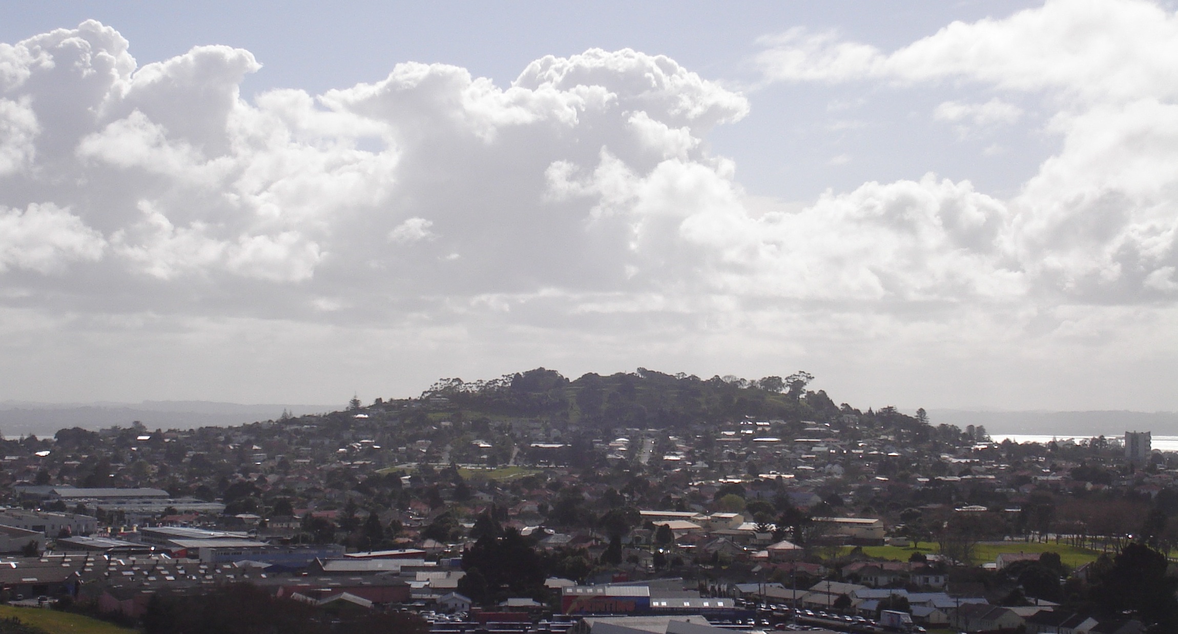
Mount Albert is an inner suburb of Auckland, New Zealand, which is centred on Ōwairaka / Mount Albert, a local volcanic peak which dominates the landscape. In the past Mt Albert also referred to the 2,500 acre borough that was created in 1911 on the outskirts of Auckland City. Mt Albert was also one of the original five wards within the Mt Albert Borough. The suburb is located seven kilometres to the southwest of the Auckland CBD, Central Business District (CBD). Volcano The peak, in parkland at the southern end of the suburb, is 135 metres in height, and is one of the many extinct cones which dot the city of Auckland, all of which are part of the Auckland volcanic field. Suburb Mount Albert suburb was the second that developed in Auckland, after Remuera. It was mostly settled by well-off families in the late 1800s and early 1900s. Significant growth occurred between the two world wars. It is surrounded by the neighbouring suburbs of Owairaka, Sandringham, New Zealand, Sandr ... [...More Info...] [...Related Items...] OR: [Wikipedia] [Google] [Baidu] |
Henderson, New Zealand
Henderson ( mi, Ōpanuku) is a major suburb of West Auckland, in the North Island of New Zealand. It is west of Auckland city centre, and west of the Whau River, a southwestern arm of the Waitematā Harbour. The suburb is located within the Henderson-Massey Local Board of the Waitākere Ward, one of the thirteen administrative divisions of Auckland Council. Geography Henderson is located between the Waitākere Ranges to the west, and the Te Atatū Peninsula in the east. The area is within the catchment of Te Wai-o-Pareira / Henderson Creek, an estuarial arm of the upper Waitematā Harbour. The Opanuku, Oratia, Swanson, Momutu and Paremuka streams meet at Te Wai-o-Pareira / Henderson Creek, to the north of Henderson. Between 3 and 5 million years ago, tectonic forces uplifted the Waitākere Ranges and central Auckland, while subsiding the Manukau and upper Waitematā Harbours. The land at Henderson is formed from Waitemata Group sandstone, which was previously found at th ... [...More Info...] [...Related Items...] OR: [Wikipedia] [Google] [Baidu] |
Dunedin
Dunedin ( ; mi, Ōtepoti) is the second-largest city in the South Island of New Zealand (after Christchurch), and the principal city of the Otago region. Its name comes from , the Scottish Gaelic name for Edinburgh, the capital of Scotland. The city has a rich Scottish, Chinese and Māori heritage. With an estimated population of as of , Dunedin is both New Zealand's seventh-most populous metro and urban area. For historic, cultural and geographic reasons the city has long been considered one of New Zealand's four main centres. The urban area of Dunedin lies on the central-eastern coast of Otago, surrounding the head of Otago Harbour, and the harbour and hills around Dunedin are the remnants of an extinct volcano. The city suburbs extend out into the surrounding valleys and hills, onto the isthmus of the Otago Peninsula, and along the shores of the Otago Harbour and the Pacific Ocean. Archaeological evidence points to lengthy occupation of the area by Māori prior to the ar ... [...More Info...] [...Related Items...] OR: [Wikipedia] [Google] [Baidu] |
Yandina, Solomon Islands
Yandina is the principal town on Mbanika Island in the Russell Islands, located on the east coast of the island, in the Central Province (Solomon Islands), Central Province of Solomon Islands. It is a port, and an airport (ICAO code: AGGY, IATA code: XYA). Yandina is the site of a copra and cocoa plantation and has basic services such as a store, post office, and rest house. The Yandina police station was the scene of one of the opening events of the ethnic tensions, where a group of men raided the armoury and stole high powered weapons and ammunition. The group involved became known as the Guadalcanal Revolutionary Army, and later as Isatabu Freedom Movement. Yandina is the site of one of the RAMSI posts. Yandina is also known as a diving destination. Climate References Populated places in Central Province (Solomon Islands) {{Solomons-geo-stub ... [...More Info...] [...Related Items...] OR: [Wikipedia] [Google] [Baidu] |
South Auckland
South Auckland is an imprecisely defined urban area of Auckland, New Zealand, with a young population, a relatively large Polynesian and Māori demographic, and lower incomes than other parts of Auckland. The name ''South Auckland'', though not an official place name, has come into common use For example: among New Zealanders. It also appears in the names of some organisations and companies. Since the 1970s the term "South Auckland" has developed negative connotations with outsiders, being associated with deprivation, crime and violence. When street crime occurs in the area, the mass media tend to use the generic "South Auckland" phrase, with its vague and unfortunate stereotypes, rather than a more precise name of a suburb or territorial authority. Barry Curtis, mayor of Manukau City from 1983 to 2007, tried to discourage use of the name "South Auckland" because of its negative connotations. History The area between Manurewa and Clevedon was historically a large swampland ... [...More Info...] [...Related Items...] OR: [Wikipedia] [Google] [Baidu] |
Tapanui
Tapanui is a small town in West Otago in New Zealand's South Island, close to the boundary with Southland region. It is a forestry town at the foot of the Blue Mountains and the Pomahaka River. Popular pastimes include deer stalking and trout fishing. Nearby locations include Landslip Hill, a fossil-bearing geologic feature. History For almost a hundred years, the town was serviced by the Tapanui Branch railway line, which despite its name never actually terminated in Tapanui. This line was formally opened in late 1880 and closed after being damaged by severe flooding in the region in October 1978. , which links at McNab, near Gore, to at Raes Junction, passes through Tapanui. In 2015, Tapanui was a filming location for the Disney production '' Pete's Dragon'', with the main street and old timber mill serving as their equivalents in the fictional town of Millhaven. Tapanui flu In New Zealand the name Tapanui is closely associated with the mysterious ailment chronic f ... [...More Info...] [...Related Items...] OR: [Wikipedia] [Google] [Baidu] |
Kaimanawa Range
The Kaimanawa Range of mountains (often known as the ''Kaimanawas'') is located in the central North Island of New Zealand. They extend for 50 kilometres in a northeast/southwest direction through largely uninhabited country to the south of Lake Taupō, east of the "Desert Road". Their slopes form part of the North Island Volcanic Plateau. The New Zealand Ministry for Culture and Heritage gives a translation of "breath for food" for ''Kaimanawa''. The lands around the mountains are scrubby. To the west, where the Rangipo Desert is located, the soils are poor quality. To the east, the soils are more fertile, but the land is very rough. A feral horse, the Kaimanawa horse. roams free on the ranges. Unlike the majority of mountain ranges in New Zealand, the Kaimanawa Range is divided into private land. Considerable areas of the Rangipo Desert are used by the New Zealand Army for training. Demographics Kaimanawa covers and had an estimated population of as of with a population den ... [...More Info...] [...Related Items...] OR: [Wikipedia] [Google] [Baidu] |
Matauri Bay
Matauri Bay ( mi, Mātauri) is a bay in New Zealand, situated 30 km north of Kerikeri, in Whangaroa county, just north of the Bay of Islands. It has over a kilometre of white sand and crystal clear water, making it a popular summer destinations for surfers, divers, fishers and holidaymakers. History and culture Early history Some of the first Polynesian navigators to New Zealand landed at Matauri Bay. It was a site of early Maori contact with Europeans, such as with the missionary Samuel Marsden in 1814. Rainbow Warrior The ''Rainbow Warrior'' was given a final resting place near Matauri Bay, at the Cavalli Islands. It has become a living reef, attracting marine life and recreational divers. The idea was first proposed by the New Zealand Underwater Association. It seemed a fitting end for a ship that had spent its time protecting the marine environment. It was towed north with a patched hull on 2 December 1987. Ten days later, a crowd of well-wishers looked on as i ... [...More Info...] [...Related Items...] OR: [Wikipedia] [Google] [Baidu] |
Whanganui
Whanganui (; ), also spelled Wanganui, is a city in the Manawatū-Whanganui region of New Zealand. The city is located on the west coast of the North Island at the mouth of the Whanganui River, New Zealand's longest navigable waterway. Whanganui is the 19th most-populous urban area in New Zealand and the second-most-populous in Manawatū-Whanganui, with a population of as of . Whanganui is the ancestral home of Te Āti Haunui-a-Pāpārangi and other Whanganui Māori tribes. The New Zealand Company began to settle the area in 1840, establishing its second settlement after Wellington. In the early years most European settlers came via Wellington. Whanganui greatly expanded in the 1870s, and freezing works, woollen mills, phosphate works and wool stores were established in the town. Today, much of Whanganui's economy relates directly to the fertile and prosperous farming hinterland. Like several New Zealand urban areas, it was officially designated a city until an administrativ ... [...More Info...] [...Related Items...] OR: [Wikipedia] [Google] [Baidu] |


.jpg)