|
New Jersey State Route 37
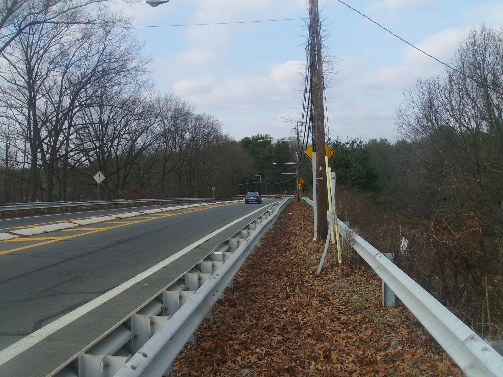
Route 37 is a state highway located in Ocean County, New Jersey, United States. The route runs from Lakehurst at a traffic circle with Route 70 to an interchange with Route 35 in Seaside Heights. A two– to six–lane divided highway its entire length, Route 37 serves as the major east–west route through the Toms River area as well as a main route to the Barnegat Peninsula, crossing the Barnegat Bay on the Thomas A. Mathis and J. Stanley Tunney Bridges. The route through Toms River Township is lined with many businesses and named Little League World Champions Boulevard in honor of Toms River East Little League's victory in the 1998 Little League World Series. Route 37 intersects many major roads in the Toms River area, including County Route 527 (CR 527), the Garden State Parkway/U.S. Route 9 (US 9), Route 166, CR 549, and CR 571. The route experiences congestion from both development in the area and from traffic bound for the barrier ... [...More Info...] [...Related Items...] OR: [Wikipedia] [Google] [Baidu] |
New Jersey Department Of Transportation
The New Jersey Department of Transportation (NJDOT) is the agency responsible for transportation issues and policy in New Jersey, including maintaining and operating the state's highway and public road system, planning and developing transportation policy, and assisting with rail, freight, and intermodal transportation issues. It is headed by the Commissioner of Transportation. The present Commissioner is Diane Gutierrez-Scaccetti. History The agency that became NJDOT began as the New Jersey State Highway Department (NJSHD) circa 1920. NJDOT was established in 1966 as the first State transportation agency in the United States. The Transportation Act of 1966 (Chapter 301, Public Laws, 1966) established the NJDOT on December 12, 1966. Since the late 1970s, NJDOT has been phasing out or modifying many list of traffic circles in New Jersey, traffic circles in New Jersey. In 1979, with the establishment of New Jersey Transit, NJDOT's rail division, which funded and supported State-s ... [...More Info...] [...Related Items...] OR: [Wikipedia] [Google] [Baidu] |
County Route 527 (New Jersey)
County Route 527 (CR 527) is a county highway in the U.S. state of New Jersey. The highway extends from Main Street ( Route 166 and CR 549) in Toms River Township to Pompton Avenue ( Route 23) in Cedar Grove. It passes through more counties (six) than any other county route in New Jersey. CR 527 is also the second longest 500-series county route in New Jersey after Route 519. The county route traverses through the northernmost stretches of the Pine Barrens, much of the Raritan Valley and Rahway Valley regions (the route provides access to Monmouth Battlefield State Park, Rutgers University–New Brunswick, Delaware and Raritan Canal State Park, Watchung Reservation, and South Mountain Reservation), and the First and Second Watchung Mountains. It passes through Ocean, Monmouth, Middlesex, Somerset, Union, and Essex counties on the eastern side of the state. It has a 2.48 mile concurrency with Route 18 in Middlesex County in addition to other minor state highways and county ... [...More Info...] [...Related Items...] OR: [Wikipedia] [Google] [Baidu] |
Lakehurst Circle
This is a list of traffic circles in New Jersey. The U.S. state of New Jersey at one point had a total of 101 traffic circles, 44 of which were part of state roads. However, the number has shrunk as traffic circles have been phased out by the New Jersey Department of Transportation. In the 1920s and 1930s, New Jersey felt that traffic circles were an efficient way for moving traffic through three or more intersecting roads. Built in 1925, the first traffic circle in New Jersey was the Airport Circle in Pennsauken. Many of these interchanges are rotaries in design, as opposed to the more successful modern roundabout. As suburban and rural populations grew New Jersey's traffic circles became outdated. The increased number of drivers on the roads resulted in traffic circles being more likely to hinder traffic than help it. Increased number of vehicles and faster traffic speeds made traffic circles more dangerous and accidents common. Many traffic circles became notorious for ... [...More Info...] [...Related Items...] OR: [Wikipedia] [Google] [Baidu] |
Wall Township, New Jersey
Wall Township is a township in Monmouth County, New Jersey, United States. It is located in the New York Metropolitan Area and is a bedroom community of New York. As of the 2010 United States Census, the township's population was 26,164, reflecting an increase of 903 (+3.6%) from the 25,261 counted in the 2000 Census, which had in turn increased by 5,017 (+24.8%) from the 20,244 counted in the 1990 Census. Wall Township was formally incorporated as a township by an act of the New Jersey Legislature on March 7, 1851. Over the years, portions of the township have been taken to form North Spring Lake (May 1884), Ocean Beach (March 9, 1885, now Belmar), Manasquan (December 30, 1887), Spring Lake (March 14, 1892), Sea Girt (March 29, 1917), Brielle (April 10, 1919), South Belmar (March 12, 1924, now Lake Como) and Spring Lake Heights (March 19, 1927).Snyder, John P''The Story of New Jersey's Civil Boundaries: 1606–1968'' Bureau of Geology and Topography; Trenton, New Jersey ... [...More Info...] [...Related Items...] OR: [Wikipedia] [Google] [Baidu] |
Interstate 195 (New Jersey)
Interstate 195 (I-195) is an auxiliary route of the Interstate Highway System located in the U.S. state of New Jersey. Its western end is at I-295 and Route 29 just south of Trenton, New Jersey, in Hamilton Township, Mercer County, while its eastern end is at the Garden State Parkway, Route 34 and Route 138 in Wall Township, Monmouth County. I-195 is in length. The route is mostly a four-lane highway that mainly runs through agrarian and wooded areas in Central Jersey. It has an interchange with the New Jersey Turnpike (I-95) in Robbinsville Township and serves as a main access road to New Jersey's state capital of Trenton, the Horse Park of New Jersey, Six Flags Great Adventure amusement park, and the Jersey Shore. I-195 is occasionally referred to as the Central Jersey Expressway. On April 6, 1988, President Ronald Reagan signed H.R. 4263 naming Interstate 195 in New Jersey the James J. Howard Interstate Highway, in honor of the late James J. Howard. The current I-19 ... [...More Info...] [...Related Items...] OR: [Wikipedia] [Google] [Baidu] |
Freeway
A controlled-access highway is a type of highway that has been designed for high-speed vehicular traffic, with all traffic flow—ingress and egress—regulated. Common English terms are freeway, motorway and expressway. Other similar terms include '' throughway'' and '' parkway''. Some of these may be limited-access highways, although this term can also refer to a class of highways with somewhat less isolation from other traffic. In countries following the Vienna convention, the motorway qualification implies that walking and parking are forbidden. A fully controlled-access highway provides an unhindered flow of traffic, with no traffic signals, intersections or property access. They are free of any at-grade crossings with other roads, railways, or pedestrian paths, which are instead carried by overpasses and underpasses. Entrances and exits to the highway are provided at interchanges by slip roads (ramps), which allow for speed changes between the highway and arter ... [...More Info...] [...Related Items...] OR: [Wikipedia] [Google] [Baidu] |
Pre-1927 Route 18 (New Jersey)
Pre-1927 Route 18 was a route in New Jersey that ran from Camden east to Toms River, existing from 1923 to 1927. Today, it is part of the following routes: * New Jersey Route 38 * New Jersey Route 37 Route 37 is a state highway located in Ocean County, New Jersey, United States. The route runs from Lakehurst at a traffic circle with Route 70 to an interchange with Route 35 in Seaside Heights. A two– to six–lane divided highway ... {{roadindex 18 (pre-1927) ... [...More Info...] [...Related Items...] OR: [Wikipedia] [Google] [Baidu] |
Point Pleasant, New Jersey
Point Pleasant is a borough in Ocean County, New Jersey, United States. As of the 2010 United States Census, the borough's population was down from 19,306 in 2000 but still up from 18,177 in 1990. The Borough is a Jersey Shore community situated south of the Manasquan River and north and east of the Beaverdam Creek and its confluence with the Metedeconk River. Point Pleasant was incorporated as a borough by an act of the New Jersey Legislature on April 21, 1920, from portions of Brick Township, based on the results of a referendum held on May 19, 1920. The borough was reincorporated on March 12, 1928.Snyder, John P''The Story of New Jersey's Civil Boundaries: 1606–1968'' Bureau of Geology and Topography; Trenton, New Jersey; 1969. p. 205. Accessed July 12, 2012. Point Pleasant is distinct from Point Pleasant Beach, which is a separate community. [...More Info...] [...Related Items...] OR: [Wikipedia] [Google] [Baidu] |
Pre-1927 Route 2 (New Jersey)
Route 25 was a major state highway in New Jersey, United States prior to the 1953 renumbering, running from the Benjamin Franklin Bridge in Camden to the Holland Tunnel in Jersey City. The number was retired in the renumbering, as the whole road was followed by various U.S. Routes: US 30 coming off the bridge in Camden, US 130 from the Camden area north to near New Brunswick, US 1 to Tonnele Circle in Jersey City, and US 1 Business (since renamed Route 139) to the Holland Tunnel. Route 1 largely became Route 25 in the 1927 renumbering. Route 25 was best known for the Route 1 Extension, which became the first controlled-access highway or "super-highway" in the United States that also connected the high traffic volume from the Holland Tunnel to the rest of New Jersey (with roads to other state destinations). The Holland Tunnel was the first vehicular connection between New York City and New Jersey, which are separated by the Hudson River. T ... [...More Info...] [...Related Items...] OR: [Wikipedia] [Google] [Baidu] |
White Horse, New Jersey
White Horse is an unincorporated community and census-designated place (CDP) located within Hamilton Township, in Mercer County, New Jersey, United States.New Jersey: 2010 - Population and Housing Unit Counts - 2010 Census of Population and Housing (CPH-2-32) , August 2012. Accessed January 13, 2013. As of the , the CDP's population was 9,494. [...More Info...] [...Related Items...] OR: [Wikipedia] [Google] [Baidu] |
Trenton, New Jersey
Trenton is the capital city of the U.S. state of New Jersey and the county seat of Mercer County. It was the capital of the United States from November 1 to December 24, 1784.New Jersey County Map New Jersey Department of State. Accessed July 10, 2017. The city's metropolitan area, including all of Mercer County, is grouped with the New York combined statistical area by the |
County Route 571 (New Jersey)
County Route 571 (CR 571) is a county highway in the U.S. state of New Jersey. The highway extends from Route 37 in Toms River Township to Route 27 in Princeton. Though it is designated a north–south county route by the New Jersey Department of Transportation (NJDOT), it is signed both as north–south and east–west inconsistently. Route description Ocean and Monmouth counties CR 571 begins at an intersection with Route 37 in Toms River, Ocean County, heading north on four-lane divided Fischer Boulevard concurrent with CR 549 Spur. The road continues north through business areas, with the median turning into a center left-turn lane. The routes turn northwest through residential and commercial areas along with some marshland from the adjacent Barnegat Bay to the east, with alternating segments of median and center left-turn lane. CR 571 splits from CR 549 Spur by heading west onto two-lane undivided Bay Avenue into areas of homes. The road intersects CR 627 before turning ... [...More Info...] [...Related Items...] OR: [Wikipedia] [Google] [Baidu] |


