|
Nevada State Route 140
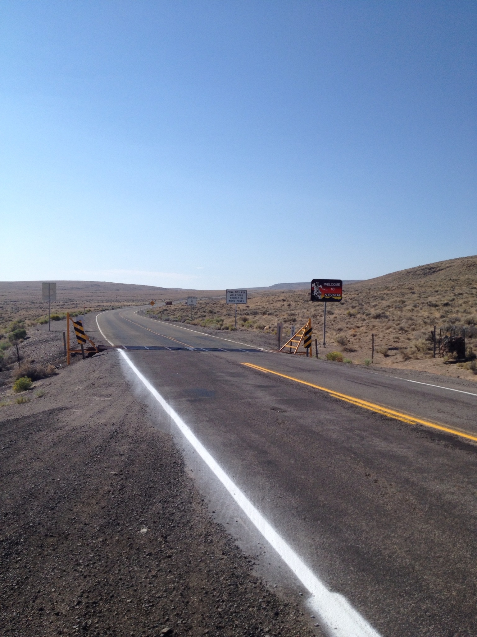
State Route 140 (SR 140) is a two-lane state highway in Humboldt County, Nevada. It serves a sparsely populated section of the state, connecting northwestern Nevada to southern Oregon. Most of the highway was originally part of State Route 8A, and was later improved through an effort to provide an all-weather highway linking northern Nevada to the Pacific Northwest. Route description State Route 140 begins at a junction with U.S. Route 95 about north of Winnemucca in the Quinn River Valley. From this point, the highway heads west towards the sparsely populated regions of northwestern Nevada. SR 140 crosses into the Desert Valley before entering a branch of the Fort McDermitt Indian Reservation. Inside the reservation, the route crosses the Quinn River. Upon exiting the Indian territory, SR 140 curves northwest to parallel the Quinn River for about as it rounds the northern edge of the Jackson Mountains. As the river turns southeast towards the Black Rock Desert, the highw ... [...More Info...] [...Related Items...] OR: [Wikipedia] [Google] [Baidu] |
Winnemucca, Nevada
Winnemucca () is the only incorporated city in, and is the county seat of, Humboldt County, Nevada, United States. As of the 2010 census, the city had a total population of 8,431, up 14.0 percent from the 2010 census figure of 7,396. Interstate 80 passes through the city, where it meets U.S. Route 95. History and culture The town was named for the 19th-century Chief Winnemucca of the local Northern Paiute tribe, who traditionally lived in this area. Winnemucca, loosely translated, means "one moccasin." The chief's daughter, Sarah Winnemucca, was an advocate for education and fair treatment of the Paiute and Shoshone tribes in the area. Their family all learned to speak English, and Sarah worked as an interpreter, scout and messenger for the United States Army during the Bannock War of 1878. In 1883, Sarah Winnemucca published the first autobiography written by a Native American woman, [...More Info...] [...Related Items...] OR: [Wikipedia] [Google] [Baidu] |
Nevada Department Of Transportation
The Nevada Department of Transportation (Nevada DOT or NDOT) is a government agency in the U.S. state of Nevada. NDOT is responsible for maintaining and improving Nevada's highway system, which includes U.S. highways and Interstate highways within the state's boundaries. The department is notable for its aggressively proactive approach to highway maintenance. Nevada state roads and bridges have also been named some of the nation's best. The state of Nevada is facing a multibillion-dollar transportation funding deficit, and NDOT is developing potential transportation funding sources through the Pioneer Program and Vehicle Miles Traveled Fee Study. For those driving in Nevada, NDOT offers updated road conditions and construction reports through the 511 Nevada Travel Info system. NDOT headquarters is located on Stewart Street (former State Route 520) in Carson City, Nevada. History Although the department has existed since 1917 as the Department of Highways, its current structur ... [...More Info...] [...Related Items...] OR: [Wikipedia] [Google] [Baidu] |
Vya, Nevada
Vya is a small ghost town located in Washoe County, in northwestern Nevada, United States. It is about east of the California state line, north of Forty Nine Canyon. Not much remains of the small town, which essentially died in the 1920s. Just two wooden buildings can still be seen—the Vya Post Office and Library. The Vya Post Office was in operation from September 1910 until October 1941. The settlement was named for Vya Wimer, the first European heritage baby born in the valley. The vicinity of Vya has since evolved into the Old Yella Dog Ranch, a working guest ranch, with facilities for RVs and camping. In the winter of 1993, a young man named Jim Stolpa, his wife, and baby, became snowbound while driving through northern Nevada. After an almost 30-hour, walk, Stolpa was found near Vya. The Stolpas' ordeal was made into a movie, '' Snowbound: The Jim and Jennifer Stolpa Story.'' Vya remains a ghost town to this day. See also *List of ghost towns in Nevada Most ghost ... [...More Info...] [...Related Items...] OR: [Wikipedia] [Google] [Baidu] |
Washoe County, Nevada
Washoe County () is a county in the U.S. state of Nevada. As of the 2020 census, the population was 486,492, making it Nevada's second-most populous county. Its county seat is Reno. Washoe County is included in the Reno, NV Metropolitan Statistical Area. History Washoe County was created on November 25, 1861, as one of the original nine counties of the Nevada Territory. It is named after the Washoe people who originally inhabited the area. It was consolidated with Roop County in 1864. Washoe City was the first county seat in 1861 and was replaced by Reno in 1871. In 1911, a small band of Shoshone and Bannock led by Mike Daggett killed four stockmen in Washoe County. A posse was formed, and on February 26, 1911, at the Battle of Kelley Creek, eight of Daggett's band were killed, along with one member of the posse, Ed Hogle. Three children and a woman who survived the battle were captured. The remains of some of the members of the band were repatriated from the Smithsonian Ins ... [...More Info...] [...Related Items...] OR: [Wikipedia] [Google] [Baidu] |
Nevada 8A
Nevada ( ; ) is a state in the Western region of the United States. It is bordered by Oregon to the northwest, Idaho to the northeast, California to the west, Arizona to the southeast, and Utah to the east. Nevada is the 7th-most extensive, the 32nd-most populous, and the 9th-least densely populated of the U.S. states. Nearly three-quarters of Nevada's people live in Clark County, which contains the Las Vegas–Paradise metropolitan area, including three of the state's four largest incorporated cities. Nevada's capital is Carson City. Las Vegas is the largest city in the state. Nevada is officially known as the "Silver State" because of the importance of silver to its history and economy. It is also known as the "Battle Born State" because it achieved statehood during the Civil War (the words "Battle Born" also appear on its state flag); as the "Sagebrush State", for the native plant of the same name; and as the " Sage-hen State". The name means "snowy" in Spanish, refe ... [...More Info...] [...Related Items...] OR: [Wikipedia] [Google] [Baidu] |
Lakeview, Oregon
Lakeview is a town in Lake County, Oregon, United States. The population was 2,418 at the 2020 census. It is the county seat of Lake County. The city bills itself as the "Tallest Town in Oregon" because of its elevation, above sea level. Lakeview is situated in the Goose Lake Valley at the foot of the Warner Mountains and at the edge of Oregon's high desert country. Its economy is based on agriculture, lumber production, and government activities. In addition, tourism is an increasingly important part of the city's economy. Oregon's Outback Scenic Byway passes through Lakeview. History Native Americans probably occupied the area around Lakeview for as early as 14,000 years ago, as evidenced by artifacts found in the Paisley Caves north of Lakeview."Lake County History" Oregon Historical County Rec ... [...More Info...] [...Related Items...] OR: [Wikipedia] [Google] [Baidu] |
Adel, Oregon
Adel is an unincorporated community in southeastern Lake County, in the U.S. state of Oregon. The community is in an arid, sparsely populated part of the state, along Oregon Route 140, about east of Lakeview. The Warner Valley surrounding Adel contains many marshes and shallow lakes, most of them intermittent. Frequented by Native Americans for many thousands of years, the valley became a region of sheep grazing and cattle ranching by the late 19th century. Adel's infrastructure includes a combined store/restaurant/bar, a post office (serving Zip Code 97620), an elementary school, and a church. Hot springs and related geological features have made one of the nearby ranches a potential site for a geothermal power station. History People have lived in the Warner Valley for more than 10,000 years. Evidence of Native American occupation includes petroglyphs, hunting blinds, flakes from obsidian tools, and other material artifacts. By historic times, the Kidütökadö band ... [...More Info...] [...Related Items...] OR: [Wikipedia] [Google] [Baidu] |
Oregon Route 140
Oregon Route 140 (OR 140) is a state highway in southern Oregon, United States. It is the longest state highway in Oregon, running from the community of White City, Oregon (just north of Medford), through Klamath Falls and on to Lakeview. It then continues east, eventually descending into the state of Nevada. Route description OR 140 begins in White City at a junction with Oregon Route 62 (which runs between Medford and Crater Lake National Park). OR 140 is the primary connection between Medford and Klamath Falls. The stretch of OR 140 between the two cities is known as the Lake of the Woods Highway No. 270 (see Oregon highways and routes), as it passes by the scenic Lake of the Woods and Mount McLoughlin in the Sky Lakes Wilderness. It then runs along the southwestern shore of Upper Klamath Lake, where it is part of the Volcanic Legacy Scenic Byway. Upon entering the Klamath Falls area, it joins together with Oregon Route 66 (which runs between Klamath Falls and Ashland ... [...More Info...] [...Related Items...] OR: [Wikipedia] [Google] [Baidu] |
Pronghorn
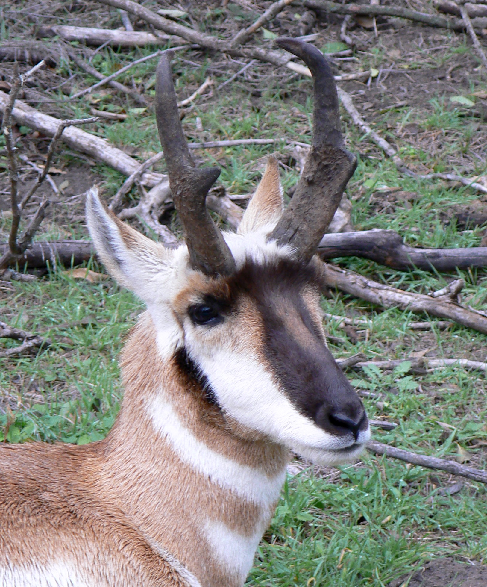
The pronghorn (, ) (''Antilocapra americana'') is a species of artiodactyl (even-toed, hoofed) mammal indigenous to interior western and central North America. Though not an antelope, it is known colloquially in North America as the American antelope, prong buck, pronghorn antelope and prairie antelope, because it closely resembles the antelopes of the Old World and fills a similar ecological niche due to parallel evolution. It is the only surviving member of the family Antilocapridae. During the Pleistocene epoch, about 11 other antilocaprid species existed in North America.Smithsonian Institution. North American MammalsPronghorn ''Antilocapra americana''/ref> Three other genera (''Capromeryx'', '' Stockoceros'' and ''Tetrameryx'') existed when humans entered North America but are now extinct. As a member of the superfamily Giraffoidea, the pronghorn's closest living relatives are the giraffe and okapi. See Fig. S10 in Supplementary Information. The Giraffoidea are in tu ... [...More Info...] [...Related Items...] OR: [Wikipedia] [Google] [Baidu] |
Sheldon National Wildlife Refuge
The Sheldon National Wildlife Refuge is a national wildlife refuge on the northern border of the U.S. state of Nevada. A very small part extends northward into Oregon. It is managed by the United States Fish and Wildlife Service (USFWS) as the Nevada component of the Sheldon-Hart Mountain National Wildlife Refuge Complex, which is headquartered in Lakeview, Oregon. The Sheldon Refuge was noted for its population of wild horses, now all removed. History In 1931, the refuge was established under executive order to carry out three central goals: First, the refuge was to provide a habitat for the "antelope" (more properly called the pronghorn), an animal whose population was in decline during the early 1900s. Second, conservation efforts were put forth to protect native fish, wildlife, and plants. The refuge contains the Virgin Valley Opal Mining District which was grandfathered-in with its mineral rights. Finally, the refuge was to serve as an inviolate migratory bird sanctuary. D ... [...More Info...] [...Related Items...] OR: [Wikipedia] [Google] [Baidu] |

.png)


