|
Nederlandsche Centraal-Spoorweg-Maatschappij
The Nederlandsche Centraal-Spoorweg-Maatschappij (NCS) was founded on 20 February 1860 in Amsterdam and established in Utrecht from 1876 and was dissolved on 23 May 1934. The Central Railway Utrecht – Amersfoort – Zwolle – Kampen was constructed by the NCS. History The Utrecht – Amersfoort – Hattem line section was opened on 16 July 1863. Hattem – Zwolle, with the crossing of the IJssel, followed on 6 June 1864. The Kamperlijntje (Zwolle – Kampen) was closed after delay due to the flooding of the Mastenbroekerpolder on 10 May. Officially opened in 1865. The NCS also opened a number of branchlines railways in the province of Utrecht, Den Dolder – Baarn on 27 June 1898 and Bilthoven – Zeist on 29 August 1901. The starting point for the branchline trains was Utrecht from 1904 the Buurtstation, just north of the main station of the NRS and separated from it by the Leidse Vaart. The renovation of Utrecht Central Station in 1936, made this station had which 4 line ... [...More Info...] [...Related Items...] OR: [Wikipedia] [Google] [Baidu] |
Utrecht
Utrecht ( , , ) is the List of cities in the Netherlands by province, fourth-largest city and a List of municipalities of the Netherlands, municipality of the Netherlands, capital and most populous city of the Provinces of the Netherlands, province of Utrecht (province), Utrecht. It is located in the eastern corner of the Randstad conurbation, in the very centre of mainland Netherlands, about 35 km south east of the capital Amsterdam and 45 km north east of Rotterdam. It has a population of 361,966 as of 1 December 2021. Utrecht's ancient city centre features many buildings and structures, several dating as far back as the High Middle Ages. It has been the religious centre of the Netherlands since the 8th century. It was the most important city in the Netherlands until the Dutch Golden Age, when it was surpassed by Amsterdam as the country's cultural centre and most populous city. Utrecht is home to Utrecht University, the largest university in the Netherlands, as well as seve ... [...More Info...] [...Related Items...] OR: [Wikipedia] [Google] [Baidu] |
Baarn
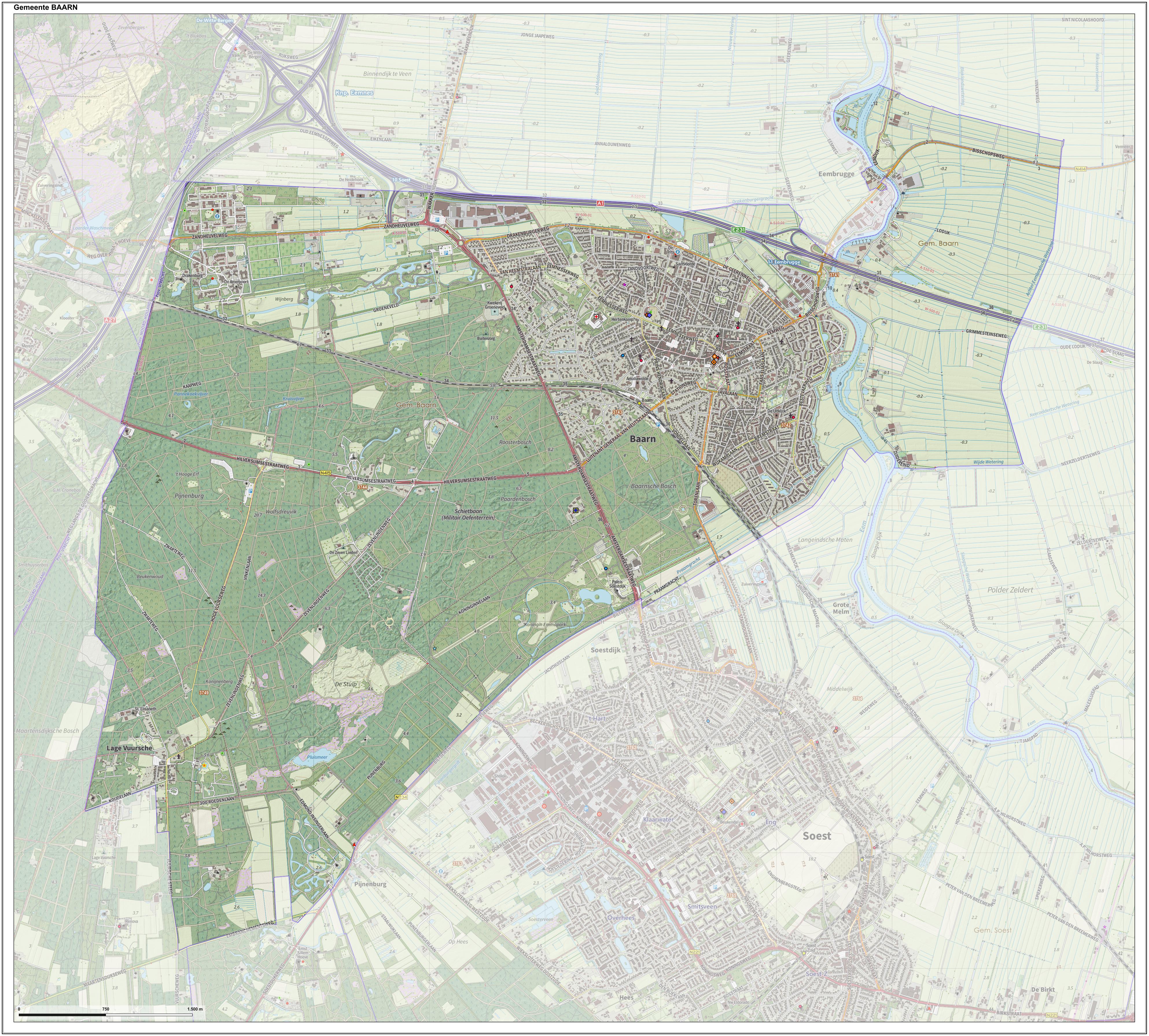
Baarn () is a municipality and a town in the Netherlands, near Hilversum in the province of Utrecht. The municipality of Baarn The municipality of Baarn consists of the following towns: Baarn, Eembrugge, Lage Vuursche. The town of Baarn Baarn, the main town of the municipality, received city rights in 1391. The town lies about 8 km east of Hilversum. In 2001, the town of Baarn had a population of 22,871. The urban area of the town was , and consisted of 10,076 residences.Statistics Netherlands (CBS), ''Bevolkingskernen in Nederland 2001'' . Statistics are for the continuous built-up area. The royal family owns several houses around Baarn. The Soestdijk Palace in Baarn was the home of Queen Emma, Queen Juliana and Juliana's husband prince Bernard. Crown prince Willem Alexander and his brothers attended school ('' Nieuwe Baarnse School'' and '' Het Baarnsch Lyceum'') in Baarn when Queen Beatrix (then princess) and her family lived at Castle Drakesteijn in the village ... [...More Info...] [...Related Items...] OR: [Wikipedia] [Google] [Baidu] |
Hollandsche IJzeren Spoorweg-Maatschappij
The Hollandsche IJzeren Spoorweg-Maatschappij () or HSM (''Hollands Iron Railway-Company'') was the first railway company in the Netherlands founded on 8 August 1837 as a private company, starting operation in 1839 with a line between Amsterdam and Haarlem. The company remained operational until 1938, when it merged with the Maatschappij tot Exploitatie van Staatsspoorwegen (SS) to form the Nederlandse Spoorwegen (NS). History The first line constructed was a line following the straight route of the Haarlemmertrekvaart canal, connecting Amsterdam with Haarlem, which opened on 20 September 1839. The line was quickly expanded to follow the Leidsevaart canal and reached Leiden in 1842, The Hague in 1843, and Rotterdam in 1847. Because this line is the oldest line in the Netherlands, it is now known as the Old Line. This line was originally built to Dutch broad gauge , but was converted to in 1866. The line started at the Amsterdam d'Eenhonderd Roe station on the west side of A ... [...More Info...] [...Related Items...] OR: [Wikipedia] [Google] [Baidu] |
Maatschappij Tot Exploitatie Van Staatsspoorwegen
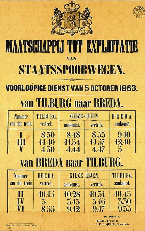
The Maatschappij tot Exploitatie van Staatsspoorwegen () or SS (''Company for the Exploitation of the State Railways'') was a private railroad founded to use the government funded railways. The company existed until 1938, when it formally merged with the Hollandsche IJzeren Spoorweg-Maatschappij (HSM) to form the Nederlandse Spoorwegen. The SS was, along with the HSM, the largest railroad company in the Netherlands. In the 19th century, the government constructed a number of state railroads, the '' staatslijnen'', to (major) cities and regions not yet served by the other railroads, but for which it was deemed important to connect them to the country's rail network. These lines were primarily located outside of the relatively densely populated Holland region, where the HSM ran services on the main lines. The SS was then founded as a private company to use these lines. In 1890 the SS began to use the lines previously run by the defunct Nederlandsche Rhijnspoorweg-Maatschappij, and ... [...More Info...] [...Related Items...] OR: [Wikipedia] [Google] [Baidu] |
Blokzijl
Blokzijl is a small city located southwest of Steenwijk in the province of Overijssel, the Netherlands. The city is a major tourist destination near the De Weerribben-Wieden National Park and attracts many water sports enthusiasts. Blokzijl was founded in the 1580s as a trading post for peat. After the Siege of Steenwijk (1580–81) in the Eighty Years' War, the Dutch built a fortified lock or in local dialect ''zijl'' or ''siel''. The monumental houses around the picturesque harbour were built during 17th century. Blokzijl received city rights in 1672, but was stripped of them a few years later. Until 1973, it was a separate municipality, when it became a component of the new municipality Brederwiede; it is now part of Steenwijkerland. One the interesting sights of the city is an old cannon, located on the harbour quay. This cannon was not used for defense purposes, but as a warning device during storm and high tide. Flooding was a real danger before the Noordoostpolder an ... [...More Info...] [...Related Items...] OR: [Wikipedia] [Google] [Baidu] |
Zwartsluis
Zwartsluis is a small city in the Dutch province of Overijssel. It is located in the municipality of Zwartewaterland, at the mouth of the Zwarte Water river and the . History Zwartsluis's history started in the Eighty Years' War (1568–1648): it developed around the Swartersluys fortress, which controlled traffic on the Zwartewater inlet leading to Hasselt and Zwolle. Zwartsluis attracted some trade and a fishing fleet in later centuries. Zwartsluis also served as a consolidation point for the peat-fuel trade, but was surpassed in importance by its neighbours, especially downstream Genemuiden. The Dutch Reformed Church of Zwartsluis is a historic Dutch Reformed church building located on the Kerkstraat and the organ in the church is a designated Rijksmonument A rijksmonument (, ) is a national heritage site of the Netherlands, listed by the agency Rijksdienst voor het Cultureel Erfgoed (RCE) acting for the Dutch Ministry of Education, Culture and Science. At the end of Fe ... [...More Info...] [...Related Items...] OR: [Wikipedia] [Google] [Baidu] |
Nunspeet
Nunspeet () is a municipality and town in the central Netherlands. It has been an agricultural site since prehistoric times. The municipality contains a number of villages, namely Hulshorst, Elspeet, and Vierhouten. Nunspeet has a vivid historical foundation, called Nuwenspete. In 1972 Nunspeet became a separate municipality after having been part of Ermelo before. Recreation Nunspeet is a popular tourist area because it is surrounded by woods, holiday resorts and the former sea. Nunspeet has a town center which is located around the main market square. Nunspeet is situated on the shore of the Veluwemeer (''Veluwe lake)'' which makes it popular for water leisure. There is also a small lake called "de Zandenplas" which is a popular recreational area in wooded sandy terrain. Other tourist attractions include the weekly market and the town festival, ''De nacht van Nunspeet'' (Nunspeet Night) and the ''Eibertjesmarkt'' (Eibertjes market), as well as an annual sporting event cal ... [...More Info...] [...Related Items...] OR: [Wikipedia] [Google] [Baidu] |
Nijkerk
Nijkerk (; Dutch Low Saxon: ''Niekark'') is a municipality and a city located in the middle of the Netherlands, in the province of Gelderland. Population centres Some people state that ''Groot Corlaer'' is a population centre on its own, but it is officially part of Nijkerk. Transportation Railway station: Nijkerk The city of Nijkerk The name Nijkerk stems from Nieuwe Kerk (Dutch for New Church). This new church was built after the old chapel had been destroyed by fire in 1221. Nijkerk was strategically located between the Duchy of Guelders ''(Dutch: Hertogdom Gelre)'' and the Bishopric of Utrecht. Because of this strategic location Nijkerk regularly was the scene of war, and in 1412 the village was completely destroyed. It was restored and Nijkerk received city rights in 1413. In 1421 the church that gave Nijkerk its name burnt down and was replaced; this happened several times, until a new church, the ''Grote-of-Sint-Catharinakerk''; was built in the 18th century. It sti ... [...More Info...] [...Related Items...] OR: [Wikipedia] [Google] [Baidu] |
Barneveld (town)
Barneveld is a town in the Dutch province of Gelderland and also the administrative center of the eponymous municipality. Transport Barneveld is served by Connexxion at three train stations. Barneveld Centrum is in the centre of Barneveld and the Barneveld Noord railway station in the village of Harselaar, where there is a Park & Ride facility and Barneveld Zuid railway station in the newly constructed area known as Veller Barneveld is also connected by the A1 and A30 motorways, as well as provincial roads N301, N344, N800, N802, and N805. Economy Due to the central geographic location of the city and its close proximity to major transport routes Barneveld has become a foundry for innovative industry. Moba, the world's largest manufacturer of egg grading and packing machines. Baan was a longtime leader in the ERP market before it almost collapsed due to "creative" revenue manipulation. Bettink Service en Onderhoud, which is the biggest brand independent wind turbine servi ... [...More Info...] [...Related Items...] OR: [Wikipedia] [Google] [Baidu] |
Ede, Netherlands
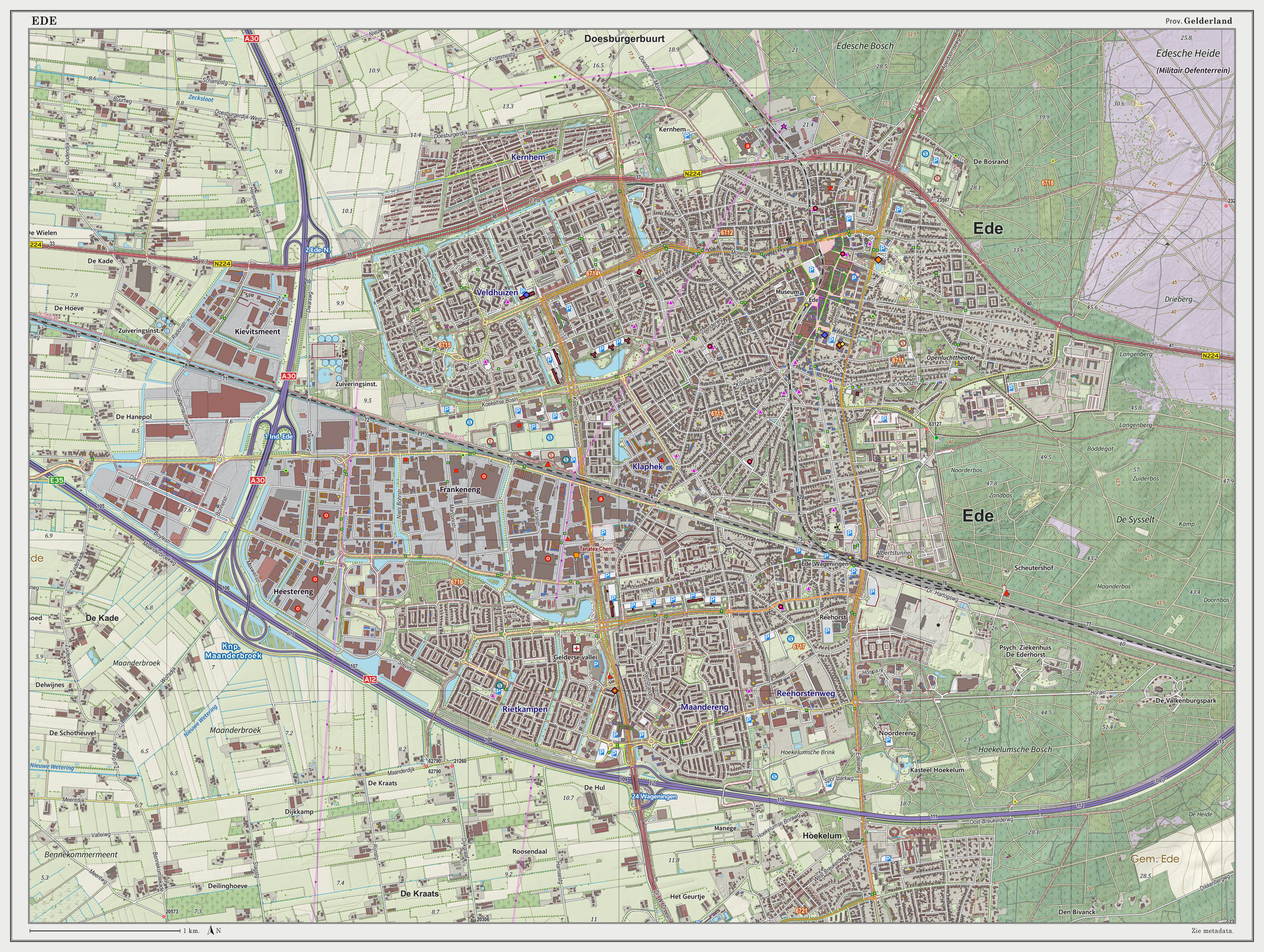
Ede () is a Municipalities of the Netherlands, municipality and a town in the centre of the Netherlands, in the province of Gelderland. Ede had 119,186 inhabitants. Population centres Community: * Bennekom * De Klomp * Deelen * Ede (town) * Ederveen * Harskamp * Hoenderloo * Lunteren * Otterlo (Kröller-Müller Museum) * Wekerom The village of Ede Location The village itself is situated halfway between the larger cities of Arnhem and Utrecht (city), Utrecht, with direct rail and road connections to both cities. There are no connections to any water nearby; however, there also is a direct road connection to the city of Wageningen which hosts a small industrial port on the river Rijn and a direct road and rail connection to the city of Arnhem, which features a larger port at a greater distance. The environment is clean and green due to the fact that Ede is partly built in a forest and partly on the central Dutch plains in the national park called Nationaal Park De Hoge Vel ... [...More Info...] [...Related Items...] OR: [Wikipedia] [Google] [Baidu] |
Leidsevaart
The Leidsevaart (also known as Leidse trekvaart, Dutch for "Leiden's Pull-Canal") is a canal between the cities of Haarlem and Leiden in the Netherlands. It was dug in 1657, making it one of the oldest canals in the Netherlands. It was the major means of transport between Leiden and Haarlem for almost two centuries until the rail connection was established in the 19th century. The original stops along the railway mirrored the toll bridges of the canal. The canal runs through or borders the municipalities of Haarlem, Heemstede, Bloemendaal, Hillegom, Noordwijkerhout, Lisse, Teylingen, Oegstgeest, and Leiden. History The Leidsevaart was the extension of the ''Haarlemmertrekvaart'' (Haarlem's Pull-Canal) connecting Amsterdam to Haarlem. Travel on these canals was done by trekschuit for people, and by barge for goods, which were pulled by animals (and sometimes by man-power) on a towpath along the canal's edge. It was reliable, comfortable and cheap. The speed was about 7 kilometers ... [...More Info...] [...Related Items...] OR: [Wikipedia] [Google] [Baidu] |
Zeist
Zeist () is the capital and largest town of the municipality of Zeist. The town is located in the Utrecht province of the Netherlands, east of the city of Utrecht. History The town of "Seist" was first mentioned in a charter in the year 838. The original settlement was located at the present ''Dorpsstraat''. In the late 12th century, a church was built here. Its tower is now a part of the Reformed Church, the remainder of which was built in the 19th century. Until medieval times, a branch of the river Rhine flowed close to the centre of the town. Three mansions were built near the village: the ''Huis te Zeist'', Kersbergen, and Blikkenburg. From 1677 to 1686, the "Slot Zeist" was built on or near the ruins of "Kasteel Zeist", the original castle (donjon) of Rodgar van Zeist. There is very little documentation on the family that lived there, but a few names are found: in the 12th century a ''Godefridus de Seist'' and in the late 13th century another Godefridus, a knight, wi ... [...More Info...] [...Related Items...] OR: [Wikipedia] [Google] [Baidu] |
.jpg)


