|
Necho I
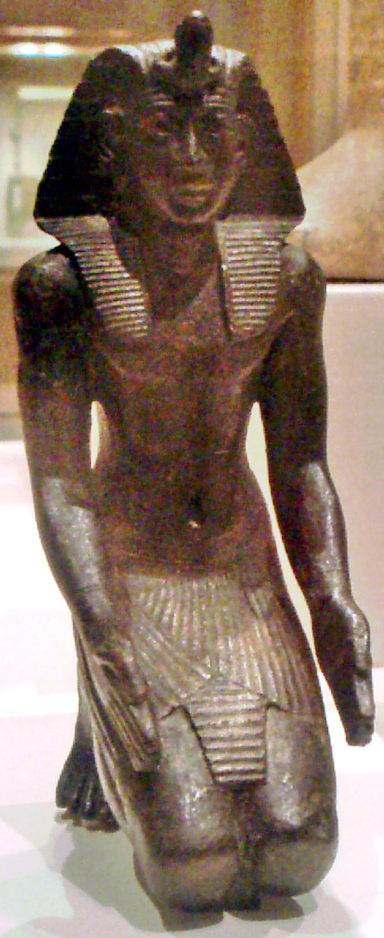
Menkheperre Necho I (Egyptian: Nekau, Greek: Νεχώς Α' or Νεχώ Α', Akkadian: Nikuu or Nikû) (? – near Memphis) was a ruler of the ancient Egyptian city of Sais. He was the first securely attested local Saite king of the 26th Dynasty of Egypt who reigned for 8 years (672–) according to Manetho's '' Aegyptiaca''. Egypt was reunified by his son Psamtik I. Biography In Necho became ruler of Sais, assuming the pharaonic titulary, and a year later the Assyrians led by Esarhaddon invaded Egypt. Necho became one of Esarhaddon's vassals, and the latter confirmed Necho's office and his possessions, as well as giving him new territories, possibly including the city of Memphis. In , King Taharqa of the 25th Dynasty was advancing from the south toward the Nile Delta principalities which were formally under Assyrian control; Esarhaddon prepared himself to return to Egypt to repel the invader, but died suddenly. Esarhaddon's death led to a political crisis in the Neo-As ... [...More Info...] [...Related Items...] OR: [Wikipedia] [Google] [Baidu] |
Petrie Museum
The Petrie Museum of Egyptian Archaeology in London is part of University College London Museums and Collections. The museum contains over 80,000 objects and ranks among some of the world's leading collections of Egyptian and Sudanese material. History The museum was established as a teaching resource for the Department of Egyptian Archaeology and Philology at University College at the same time as the department was established in 1892. The initial collection was donated by the writer Amelia Edwards. The first Edwards Professor, William Matthew Flinders Petrie, conducted many important excavations, and in 1913 he sold his collections of Egyptian antiquities to University College, creating the Flinders Petrie Collection of Egyptian Antiquities, and transforming the museum into one of the leading collections outside Egypt. The collection was first put on display in June 1915. Petrie excavated dozens of major sites in the course of his career, including the Roman Period ceme ... [...More Info...] [...Related Items...] OR: [Wikipedia] [Google] [Baidu] |
Taharqa
Taharqa, also spelled Taharka or Taharqo ( Egyptian: 𓇿𓉔𓃭𓈎 ''tꜣ-h-rw-k'', Akkadian: ''Tar-qu-u2'', , Manetho's ''Tarakos'', Strabo's ''Tearco''), was a pharaoh of the Twenty-fifth Dynasty of Egypt and qore (king) of the Kingdom of Kush (present day Sudan), from 690 to 664 BC. He was one of the " Kushite Pharaohs" who ruled over Egypt for nearly a century. Early life Taharqa was the son of Piye, the Nubian king of Napata who had first conquered Egypt. Taharqa was also the cousin and successor of Shebitku. The successful campaigns of Piye and Shabaka paved the way for a prosperous reign by Taharqa. Ruling period Taharqa's reign can be dated from 690 BC to 664 BC. Evidence for the dates of his reign is derived from the Serapeum stele, catalog number 192. This stela records that an Apis bull born and installed (fourth month of Season of the Emergence, day 9) in year 26 of Taharqa died in Year 20 of Psamtik I (4th month of Shomu, day 20), ... [...More Info...] [...Related Items...] OR: [Wikipedia] [Google] [Baidu] |
Tantamani
Tantamani ( egy, tnwt-jmn, Neo-Assyrian: , grc, Τεμένθης ), also known as Tanutamun or Tanwetamani (d. 653 BC) was ruler of the Kingdom of Kush located in Northern Sudan, and the last pharaoh of the Twenty-fifth Dynasty of Egypt. His prenomen or royal name was Bakare, which means "Glorious is the Soul of Re." Filiation He was the son of King Shabaka and the nephew of his predecessor Taharqa. In some sources he is said to be the son of Shebitku. Assyrian records call Tantamani a son of Shabaka and refer to his mother, Qalhata, as a sister of Taharqa. Some Egyptologists interpreted the Assyrian text as stating that Tantamani was a son of Shebitku, but it is now more common to consider Tantamani a son of Shabaka. Conflict with Ashurbanipal of Assyria Soon after the Assyrians had appointed Necho I as king and left, Tantamani invaded Egypt in hopes of restoring his family to the throne. Tantamani marched down the Nile from Nubia and reoccupied all of Egypt, includi ... [...More Info...] [...Related Items...] OR: [Wikipedia] [Google] [Baidu] |
Kingdom Of Kush
The Kingdom of Kush (; Egyptian: 𓎡𓄿𓈙 𓈉 ''kꜣš'', Assyrian: ''Kûsi'', in LXX grc, Κυς and Κυσι ; cop, ''Ecōš''; he, כּוּשׁ ''Kūš'') was an ancient kingdom in Nubia, centered along the Nile Valley in what is now northern Sudan and southern Egypt. The region of Nubia was an early cradle of civilization, producing several complex societies that engaged in trade and industry. The city-state of Kerma emerged as the dominant political force between 2450 and 1450 BC, controlling the Nile Valley between the first and fourth cataracts, an area as large as Egypt. The Egyptians were the first to identify Kerma as "Kush" and over the next several centuries the two civilizations engaged in intermittent warfare, trade, and cultural exchange. Much of Nubia came under Egyptian rule during the New Kingdom period (1550–1070 BC). Following Egypt's disintegration amid the Late Bronze Age collapse, the Kushites reestablished a kingdom in Napata (no ... [...More Info...] [...Related Items...] OR: [Wikipedia] [Google] [Baidu] |
Athribis
Athribis ( ar, أتريب; Greek: , from the original Egyptian ''Hut-heryib'', cop, Ⲁⲑⲣⲏⲃⲓ) was an ancient city in Lower Egypt. It is located in present-day Tell Atrib, just northeast of Benha on the hill of Kom Sidi Yusuf. The town lies around 40 km north of Cairo, on the eastern bank of the Damietta branch of the Nile. It was mainly occupied during the Ptolemaic, Roman, and Byzantine eras. Background Athribis was once the capital of the tenth Lower Egyptian nome. The Palermo stone indicates Egyptian occupation of the site dating back to the Old Kingdom, with the earliest mention of Athribis dating to the reign of Sahure. This could perhaps have been confirmed in 2010, with the discovery of a mastaba dating to the late Third Dynasty to early Fourth Dynasty in nearby Quesna. After this, archeological evidence exists for an occupation during the 12th Dynasty of the Middle Kingdom period. Today, much of the preexisting artifacts are being lost every year b ... [...More Info...] [...Related Items...] OR: [Wikipedia] [Google] [Baidu] |
Nineveh
Nineveh (; akk, ; Biblical Hebrew: '; ar, نَيْنَوَىٰ '; syr, ܢܝܼܢܘܹܐ, Nīnwē) was an ancient Assyrian city of Upper Mesopotamia, located in the modern-day city of Mosul in northern Iraq. It is located on the eastern bank of the Tigris River and was the capital and largest city of the Neo-Assyrian Empire, as well as the largest city in the world for several decades. Today, it is a common name for the half of Mosul that lies on the eastern bank of the Tigris, and the country's Nineveh Governorate takes its name from it. It was the largest city in the world for approximately fifty years until the year 612 BC when, after a bitter period of civil war in Assyria, it was sacked by a coalition of its former subject peoples including the Babylonians, Medes, Persians, Scythians and Cimmerians. The city was never again a political or administrative centre, but by Late Antiquity it was the seat of a Christian bishop. It declined relative to Mosul during the ... [...More Info...] [...Related Items...] OR: [Wikipedia] [Google] [Baidu] |
Pelusium
Pelusium ( Ancient Egyptian: ; cop, /, romanized: , or , romanized: ; grc, Πηλουσιον, Pēlousion; la, Pēlūsium; Arabic: ; Egyptian Arabic: ) was an important city in the eastern extremes of Egypt's Nile Delta, 30 km to the southeast of the modern Port Said. It became a Roman provincial capital and Metropolitan archbishopric and remained a multiple Catholic titular see and an Eastern Orthodox active archdiocese. Location Pelusium lay between the seaboard and the marshes of the Nile Delta, about two-and-a-half miles from the sea. The port was choked by sand as early as the first century BC, and the coastline has now advanced far beyond its ancient limits that the city, even in the third century AD, was at least four miles from the Mediterranean. The principal product of the neighbouring lands was flax, and the ''linum Pelusiacum'' (Pliny's Natural History xix. 1. s. 3) was both abundant and of a very fine quality. Pelusium was also known for being an ... [...More Info...] [...Related Items...] OR: [Wikipedia] [Google] [Baidu] |
Šarru-lu-dari
Šarru-lu-dari ( akk, ', meaning "May the king be everlasting") was a king of Ashkelon during the reign of the Neo-Assyrian emperors Sennacherib, Esarhaddon, and Ashurbanipal. His father was named '' Rukibtu'', who ruled Ashkelon before Šarru-lu-dari's predecessor, the rebellious king Sidqa. Though he was implicitly a Philistine, his name is uniquely Assyrian. During Sennacherib's reign, the Levant suffered multiple rebellions against Assyrian rule. Sidqa had incited rebellion in Ashkelon, alongside the nobles of Ekron and Hezekiah of Judah. Ultimately, Sidqa was defeated after the Assyrians sacked Joppa and the surrounding cities in 701 BC. Following this, Sennacherib removed Sidqa from the throne, and replaced him with Šarru-lu-dari. Šarru-lu-dari was then forced to pay tribute to Sennacherib, as was the standard procedure in Assyria. During the reign of Sennacherib's son, Esarhaddon, Šarru-lu-dari is mentioned alongside the pharaoh Necho I in several highly fragmen ... [...More Info...] [...Related Items...] OR: [Wikipedia] [Google] [Baidu] |
Per-Sopdu
Saft el-Hinna ( ar, صفط الحنا, translit=Ṣafṭ al-Ḥinnā), also written as Saft el-Hinneh, Saft el-Henna, Saft el-Henneh, is a village and an archaeological site in Egypt. It is located in the modern Al Sharqia Governorate, in the Nile Delta, about 7 km southeast of Zagazig. The 1885 Census of Egypt recorded Saft el-Hinna as a nahiyah in the district of Bilbeis in Sharqia Governorate; at that time, the population of the town was 664 (306 men and 358 women). Name The modern village of Saft el-Hinna lies on the ancient Egyptian town of Per-Sopdu or Pi-Sopt, meaning "House of Sopdu", which was the capital of the 20th nome of Lower Egypt and one of the most important cult centers during the Late Period of ancient Egypt. As the ancient name implies, the town was consecrated to Sopdu, god of the eastern borders of Egypt. During the late Third Intermediate Period, Per-Sopdu – called ''Pishaptu'' or ''Pisapti'', in Akkadian, by the Neo-Assyrian invaders – ... [...More Info...] [...Related Items...] OR: [Wikipedia] [Google] [Baidu] |
Lower Egypt
Lower Egypt ( ar, مصر السفلى '; ) is the northernmost region of Egypt, which consists of the fertile Nile Delta between Upper Egypt and the Mediterranean Sea, from El Aiyat, south of modern-day Cairo, and Dahshur. Historically, the Nile River split into seven branches of the delta in Lower Egypt. Lower Egypt was divided into nomes and began to advance as a civilization after 3600 BC. Today, it contains two major channels that flow through the delta of the Nile River – Mahmoudiyah Canal (ancient Agathos Daimon) and Muways Canal (, "waterway of Moses"). Name In Ancient Egyptian, Lower Egypt was as ''mḥw'' and means ''"north"''. Later on, during Antiquity and the Middle Ages, Greeks and Romans called it ''Κάτω Αἴγυπτος'' or ''Aegyptus Inferior'' both meaning "Lower Egypt", but Copts carried on using the old name related to the north – ''Tsakhet'' () or ''Psanemhit'' () meaning the "Northern part". It was further divided into number of re ... [...More Info...] [...Related Items...] OR: [Wikipedia] [Google] [Baidu] |
Thebes, Egypt
, image = Decorated pillars of the temple at Karnac, Thebes, Egypt. Co Wellcome V0049316.jpg , alt = , caption = Pillars of the Great Hypostyle Hall, in '' The Holy Land, Syria, Idumea, Arabia, Egypt, and Nubia'' , map_type = Egypt , map_alt = , map_size = , relief = yes , coordinates = , location = Luxor, Luxor Governorate, Egypt , region = Upper Egypt , type = Settlement , part_of = , length = , width = , area = , height = , builder = , material = , built = , abandoned = , epochs = , cultures = , dependency_of = , occupants = , event = , excavations = , archaeologists = , condition = , ownership = , management = , public_access = , website = , notes = , designation1 = WHS , designation1_offname = Ancient ... [...More Info...] [...Related Items...] OR: [Wikipedia] [Google] [Baidu] |
Counter-offensive
In the study of military tactics, a counter-offensive is a large-scale strategic offensive military operation, usually by forces that had successfully halted the enemy's offensive, while occupying defensive positions. The counter-offensive is executed after exhausting the enemy's front line troops and after the enemy reserves had been committed to combat and proven incapable of breaching defenses, but ''before'' the enemy has had the opportunity to assume new defensive positions. Sometimes the counter-offensive can be of a more limited operational maneuver nature, with more limited objectives rather than those seeking attainment of a strategic goal. A counter-offensive as considered by Clausewitz to be the most efficient means of forcing the attacker to abandon offensive plans.p.540, Briggs Counter-offensives can be executed not only on land, but also by the naval forces and air forces. Strategic counter-offensives have been recorded by military historians in many wars throu ... [...More Info...] [...Related Items...] OR: [Wikipedia] [Google] [Baidu] |


