|
National Sea Rescue Institute
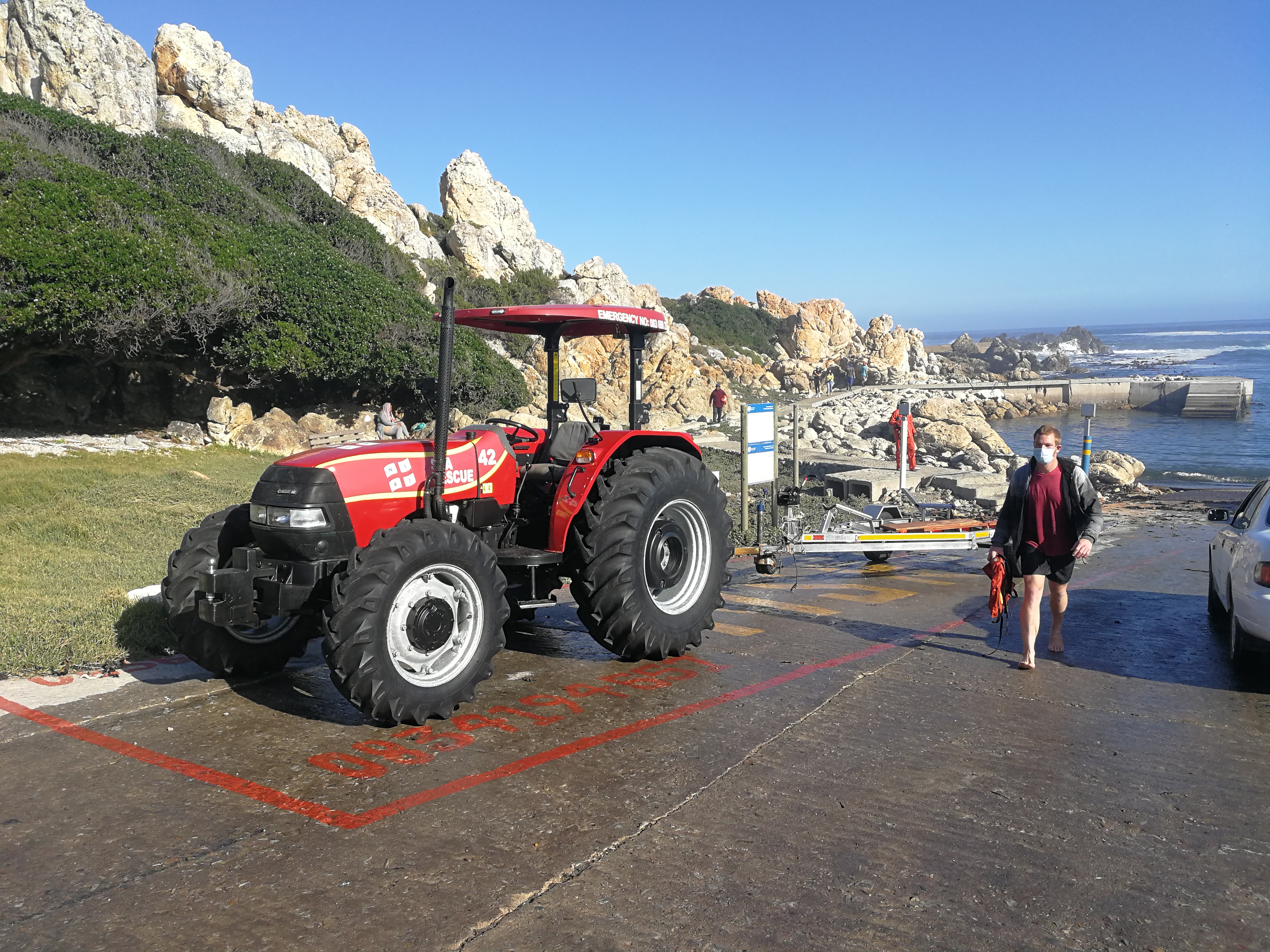
The National Sea Rescue Institute (NSRI) is a voluntary non-profit organization in South Africa tasked with saving lives through drowning prevention. It operates 41 bases (as of 2020) comprising coastal stations and inland stations on dams. There are crews on standby at all hours. There are over 1000 volunteers equipped with sponsored rescue craft, rescue vehicles, quad bikes and tractors, supported by an operations department at the head office. The NSRI works closely with other Search and Rescue organisations in South Africa. History Following an incident at Stilbaai near Mossel Bay on the south coast of South Africa in 1966, in which 17 fishermen drowned after three fishing boats sank in a storm, Miss Pattie Price of Simon’s Town whose own life had been saved by a RNLI lifeboat in the English Channel, wrote a series of letters to the newspapers to advocate for the formation of a sea rescue organisation in South Africa. Captain Bob Deacon and Ray Lant were the first v ... [...More Info...] [...Related Items...] OR: [Wikipedia] [Google] [Baidu] |
Non-profit Organization
A nonprofit organization (NPO) or non-profit organisation, also known as a non-business entity, not-for-profit organization, or nonprofit institution, is a legal entity organized and operated for a collective, public or social benefit, in contrast with an entity that operates as a business aiming to generate a profit for its owners. A nonprofit is subject to the non-distribution constraint: any revenues that exceed expenses must be committed to the organization's purpose, not taken by private parties. An array of organizations are nonprofit, including some political organizations, schools, business associations, churches, social clubs, and consumer cooperatives. Nonprofit entities may seek approval from governments to be tax-exempt, and some may also qualify to receive tax-deductible contributions, but an entity may incorporate as a nonprofit entity without securing tax-exempt status. Key aspects of nonprofits are accountability, trustworthiness, honesty, and openness to eve ... [...More Info...] [...Related Items...] OR: [Wikipedia] [Google] [Baidu] |
Société Nationale De Sauvetage En Mer
The Société Nationale de Sauvetage en Mer (SNSM) is a French voluntary organisation founded in 1967 by merging the Société Centrale de Sauvetage des Naufragés (founded in 1865) and the Hospitaliers Sauveteurs Bretons (1873). Its task is saving lives at sea around the French coast, including the overseas départments and territories. In 2009 the SNSM was responsible for about half of all sea rescue operations and saved 5,400 lives in 2,816 call-outs and assisted 2,140 boats in distress. 65% of funding comes from the private sector (donations, bequests and sponsorship) and 35% comes from the national government, the regions, the départements and the local communities. Fleet The SNSM has the following boats: :40 All weather lifeboats :34 Class 1 lifeboats (up to 40 knots/force 8) :76 Class 2 lifeboats (up to 33 knots/force 7) :20 Class 4 lifeboats :425 Inshore lifeboats (including jetskis) All these boats are unsinkable by injection into the hull of closed cell polyureth ... [...More Info...] [...Related Items...] OR: [Wikipedia] [Google] [Baidu] |
Sea Rescue Organizations
The sea, connected as the world ocean or simply the ocean, is the body of salty water that covers approximately 71% of the Earth's surface. The word sea is also used to denote second-order sections of the sea, such as the Mediterranean Sea, as well as certain large, entirely landlocked, saltwater lakes, such as the Caspian Sea. The sea moderates Earth's climate and has important roles in the water, carbon, and nitrogen cycles. Humans harnessing and studying the sea have been recorded since ancient times, and evidenced well into prehistory, while its modern scientific study is called oceanography. The most abundant solid dissolved in seawater is sodium chloride. The water also contains salts of magnesium, calcium, potassium, and mercury, amongst many other elements, some in minute concentrations. Salinity varies widely, being lower near the surface and the mouths of large rivers and higher in the depths of the ocean; however, the relative proportions of dissolved salts va ... [...More Info...] [...Related Items...] OR: [Wikipedia] [Google] [Baidu] |
Melkbosstrand
Melkbosstrand (Afrikaans for " Milkbush beach") is a coastal town located on the South West Coast of South Africa, 30 km north of Cape Town. It forms part of the City of Cape Town Metropolitan Municipality, the municipality governing Cape Town and its greater metropolitan area. Named after the species of Euphorbiaceae bushes which grow on the dunes and give off a milky latex like substance, it is commonly referred to simply as Melkbos. The town and its 7 kilometre stretch of white sand beach is situated on the Atlantic coast with the Blouberg mountain to the east. The beach is popular with surfers. It is one of the landing points for the South Africa-Far East, South Atlantic/West Africa and Equinao submarine cable systems. Melkbosstrand is along the Blaauwberg region of the City of Cape Town within which it became incorporated when metropolitan boundaries were redrawn, following the advent of democracy in 1994. Its nearest neighbouring towns are Bloubergstrand to the sou ... [...More Info...] [...Related Items...] OR: [Wikipedia] [Google] [Baidu] |
Richards Bay
Richards Bay ( af, Richardsbaai) is a town in KwaZulu-Natal, South Africa. It is situated on a 30 square kilometre lagoon of the Mhlatuze River, which makes it one of the country's largest harbours. Richards Bay also has the deepest natural harbour on the African continent. History The town began as a makeshift harbour that was set up by Commodore of the Cape, Sir Markus Eugene Brown, during the Anglo-Zulu War of 1879. In 1902, Cathcart Methven, the harbour engineer for the Natal Government, in his ''Zululand Port Survey'' recognized the potential of Richards Bay as a new harbour for the eastern shore. In 1935 the Richards Bay Game Sanctuary was created to protect the ecology around the lagoon and by 1943 it expanded into Richards Bay Park. The town was laid out on the shores of the lagoon in 1954 and proclaimed a town in 1969. In 1965, the South African Government under Minister of Transport Ben Schoeman decided to build a deep water harbour at Richards Bay. Construction wo ... [...More Info...] [...Related Items...] OR: [Wikipedia] [Google] [Baidu] |
Plettenberg Bay
Plettenberg Bay, nicknamed Plet or Plett, is the primary town of the Bitou Local Municipality in the Western Cape Province of South Africa. As of the census of 2001, there were 29,149 population. It was originally named Bahia Formosa ("beautiful bay") by early Portuguese explorers and lies on South Africa's Garden Route 210 km from Port Elizabeth and about 600 km from Cape Town. History Middle and Later Stone Age Nelson Bay Cave on Robberg and Matjies River Cave at nearby Keurboomstrand were inhabited for over 100,000 years by Middle Stone Age man and then later by ancestors of the Khoisan, who were possibly the same people who traded with the Portuguese survivors of the Sao Goncalves shipwreck. Their tools, ornaments and food debris can be viewed in these caves, which are still being excavated. Colonial period Long before Jan van Riebeeck landed at the Cape, Portuguese explorers charted the bay in the 15th and 16th centuries, the first being Bartolomeu Dias i ... [...More Info...] [...Related Items...] OR: [Wikipedia] [Google] [Baidu] |
Knysna
Knysna () is a town with 76,150 inhabitants (2019 mid-year estimates) in the Western Cape province of South Africa. and is one of the destinations on the loosely defined Garden Route tourist route. It lies at 34° 2' 6.3168'' S and 23° 2' 47.2884'' E., and is situated 60 kilometres east of the city of George on the N2 highway, and 33 kilometres west of the Plettenberg Bay on the same road. History Early history Forty fossilised hominid footprints, dating to about 90,000 years ago, along with various other archaeological discoveries suggest that humans have lived in Knysna for well over 300,000 years. The first of these were various San Hunter-gatherer peoples who inhabited most of Southern Africa in paleolithic. The San were gradually displaced and absorbed by south migrating Khoekhoe peoples. Houtunqua (Outeniqua) Khoe The indigenous inhabitants of the Knysna area are a southern Khoekhoe people called the Houtunqua or Outeniqua. Their name means "The People Who Bear Honey" ... [...More Info...] [...Related Items...] OR: [Wikipedia] [Google] [Baidu] |
Simon's Town
Simon's Town ( af, Simonstad), sometimes spelled Simonstown, is a town in the Western Cape, South Africa and is home to Naval Base Simon's Town, the South African Navy's largest base. It is located on the shores of False Bay, on the eastern side of the Cape Peninsula. For more than two centuries it has been a naval base and harbour (first for the British Royal Navy and now the South African Navy). The town is named after Simon van der Stel, an early governor of the Cape Colony. Topography The land rises steeply from near the water's edge and the town is boxed in along the shoreline by the heights above. The small harbour itself is protected from swells by a breakwater that was built with thousands of huge blocks of sandstone quarried out of the face of the mountain above. Simon's Town is now in effect a suburb of the City of Cape Town Metropolitan Municipality. The Simon's Town railway station is the terminus of the Southern Line, a railway line that runs south of the central ... [...More Info...] [...Related Items...] OR: [Wikipedia] [Google] [Baidu] |
Hout Bay
Hout Bay ( af, Houtbaai, meaning "Wood Bay") is a harbour town in the Western Cape province of South Africa. It is situated in a valley on the Atlantic seaboard of the Cape Peninsula, twenty kilometres south of Cape Town. The name "Hout Bay" can refer to the town, the bay on which it is situated, or the entire valley. The area was originally made up of two farms, which were slowly subdivided to make way for urban expansion. While still maintaining its rural atmosphere, the area of Hout Bay has more than 5,960 residences inhabited by a population of at least 17,900 people (as of 2011). Pronunciation The pronunciation of "Hout Bay" varies: * Afrikaans Pronunciation: ''həʊ-'t bʌɪ / hoe-'t'' (contracted "t") bye. * English Pronunciation: ''həʊ-'t beɪ / hoe-'t'' (contracted "t") bay. * Adapted English Pronunciation: ''haʊ-'t beɪ / how-'t'' (contracted "t") bay. History Pre-colonisation From remains found in a cave, we know that people lived in this cave between 100 AD and 5 ... [...More Info...] [...Related Items...] OR: [Wikipedia] [Google] [Baidu] |
Bakoven
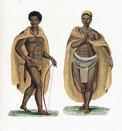
Bakoven is a small residential suburb on the west coast of the Cape Peninsula, in the southwest of Camps Bay. It is positioned between Victoria Road and the sea. South of Bakoven and Camps Bay the coastline is protected, with thousands of acres of mountain Nature Reserve. This scenic drive from Bakoven and Camps Bay to Llandudno and Hout Bay is one of the most visited in the Cape. It has a quiet beach atmosphere, good conditions for snorkeling, boating and fishing, as well as the Nature Reserve in the South, with trendy Camps Bay to the north and east. Named "Baking oven", possibly after an off shore rock of that shape; the name is Dutch in origin. Bakoven has two popular beaches, Beta Beach and Oudekraal - which were an old settlement of Khoi San people there, the original people in the Cape. at afristay.com, accessed on Feb 21, 2019 [...More Info...] [...Related Items...] OR: [Wikipedia] [Google] [Baidu] |
Norsk Selskab Til Skibbrudnes Redning
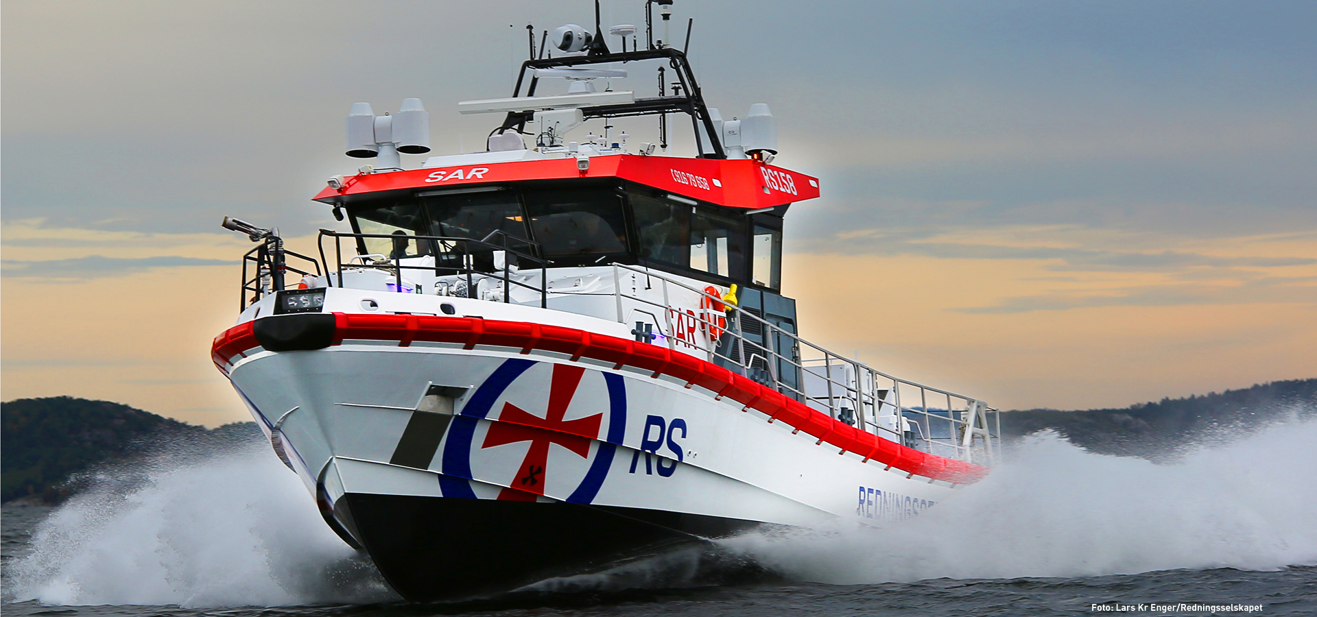
The Norwegian Society for Sea Rescue (Redningsselskapet in Norwegian, commonly shortened to RS) is the only organization wholly dedicated to assisting people and vessels at sea along the extensive Norwegian coastline. Overview Norwegian Society for Sea Rescue is a charity organization funded partly by membership fees, partly by donations, and partly by government subsidies. It employs 197 professional seamen, 60 at the head office in Oslo, and 14 in the regional branches. The organization has 4,200 volunteers, and around 111,000 paying members. Pleasure craft owners can sign up for a "totalmedlemsskap" (Total Membership), a service and assistance package deal. The organization's vision is "None Shall Drown". The organization publishes the quarterly magazine ''RS-Magasinet''. Vessels The organization operates 51 vessels stationed along the Norwegian coastline, as well as one each stationed on the lakes of Femunden and Mjøsa. 26 of the rescue craft along the coast are large ... [...More Info...] [...Related Items...] OR: [Wikipedia] [Google] [Baidu] |


