|
National Highway 216 (India)
National Highway 216 (NH 216) (previously: NH 214 and NH 214A) is a National Highway in the Indian state of Andhra Pradesh. The former highways of NH 214 and 214A were merged and renumbered as NH 216. It starts from NH 16 junction at Kattipudi and passes through Kakinada, Amalapuram, Digamarru (Palakollu), Narasapuram, Machilipatnam, Repalle, Cherukupalle, Bapatla, Chirala before it junctions NH 16 again at Ongole. Visakhapatnam–Kakinada Petro Chemical Corridor'','' is a proposed project along the highway. Route The highway has a total route length of . It passes through the districts of Kakinada, East Godavari, West Godavari, Krishna, Bapatla and Prakasam of Andhra Pradesh. National Highway 216 starts from NH16 at Kathipudi village and it passes through towns and cities like Gollaprolu, Pithapuram, Kakinada, Yanam, Mummidivaram, Amalapuram, Razole, Digamarru (Palakollu), Narsapuram, Pedana, Machilipatnam, Repalle, Cherukupalle, Bapatla, Chirala Chirala ( ... [...More Info...] [...Related Items...] OR: [Wikipedia] [Google] [Baidu] |
Kattipudi
Kattipudi is a village in the East Godavari district of Andhra Pradesh State, India. Geography The main village is centered at , which is approximately 47 m above sea level. Kattipudi is the origin of National Highway NH 216. References Villages in East Godavari district Road junctions in India {{EastGodavari-geo-stub ... [...More Info...] [...Related Items...] OR: [Wikipedia] [Google] [Baidu] |
Bapatla
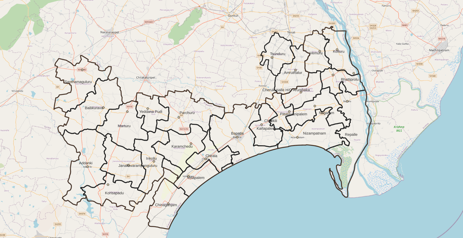
Bapatla is a city and District headquarters of Bapatla district in the States and union territories of India, Indian state of Andhra Pradesh. It is a municipality and the mandal headquarters of Bapatla mandal of Bapatla revenue division. The nearest towns and cities to Bapatla are Chirala, Ponnur, Tenali and Guntur of 17 km, 22 km, 50 km and 53 km respectively. Etymology The town was formerly known as ''Bhavapattana'', ''Bhavapuri'', ''Bhavapattu'' and ''Bhavapatta''. The names were derived from the Bhavanarayana Temple located in the town. Later, these names were transformed to the present name of Bapatla. The temple was constructed in 1465 by a chola king named Krimikantha Chola, and was later restored. Geography The coordinates of the town are and is located at an altitude of 8 mts from the coast of Bay of Bengal. Climate The town experiences tropical climate with the average annual temperatures records at . Hot summers and cool winters a ... [...More Info...] [...Related Items...] OR: [Wikipedia] [Google] [Baidu] |
Narsapuram
Narasapuram, or Narsapur, is a city in West Godavari district of the Indian state of Andhra Pradesh. It is a municipality and mandal headquarters of Narasapuram mandal in Narasapuram revenue division. The city is situated on the banks of the Vasista Godavari River. The lace industry is prevalent in the city and its surroundings. Etymology Narsapur was also known as "Nrusimhapuri", named after the Lord Narasimha. Gradually it changed into Narasimhapuram and now to Narasapuram. It is also known as Abhinavabhutapuri. History The existence of Narsapur dates back to 1173 AD. Dutch people landed in Narsapur in 1626. Narsapur was used as a port by the Dutch and ships and boats were built here. It was noted for its ship building activity and some of the Europeans also were customers at this place; small boats are still built in Narsapur. In the 16th century, Portuguese established their own factory which remained as a trading centre for a few years. In the 18th century, Nar ... [...More Info...] [...Related Items...] OR: [Wikipedia] [Google] [Baidu] |
Mummidivaram
Mummidivaram is a town in Konaseema district of Andhra Pradesh, India. The Mummidivaram revenue block was formed out of the Amalapuram tehsil in July 1969. It is the second largest town in Konaseema district. Geography Mummidivaram is located at . It has an average elevation of 0 meters (0 feet). Governance The town was upgraded from Gram panchayat to Nagar panchayat on 23 June 2011. Politics Mummidivaram is an assembly constituency in Andhra Pradesh. There are 1,89,229 registered voters as on 10.01.2012 in Mummidivaram constituency (2nd largest in East Godavari district). List of Elected Members: *1978 - Moka Sri Vishnu Prasada Rao *1983 - Valtati Raja sakkubai *1985 - Pandu Krishna Murti *1989 and 1994 - Battina Subba R ... [...More Info...] [...Related Items...] OR: [Wikipedia] [Google] [Baidu] |
Pithapuram
Pithapuram, historically known as Pittapore, is a town and a municipality in the Kakinada district in the Indian state of Andhra Pradesh. The town also forms a part of Godavari Urban Development Authority. The town is home to one of the eighteen Maha Sakthi Peethas, which are significant shrines and pilgrimage destinations in Shaktism. Sripada Sri Vallabha, a prominent Hindu saint of 14th century was born and lived in Pithapuram. He is considered by his devotees as one of the first complete avatars (incarnations) of the deity Dattatreya in Kali Yuga. History Pithapuram was originally called Pithikapuram. The earliest extant inscription to mention the city is the fourth century king Samudragupta's Allahabad Pillar inscription, which states that he defeated the king Mahendra of Pithikapuram. The inscriptions of the fourth and fifth century Vasishtha and Mathara dynasties also mention Pishtapura, describing it as a part of Kalinga. In the seventh century, the Chalukya king ... [...More Info...] [...Related Items...] OR: [Wikipedia] [Google] [Baidu] |
Gollaprolu
Gollaprolu is a town in Kakinada district of the Indian state of Andhra Pradesh. It is a Municipality in Gollaprolu mandal of Kakinada revenue division. Business is the main occupation of this town. The town also forms a part of Godavari Urban Development Authority. Geography The region is cyclone-prone with agricultural dependant. The villagers are known for growing one of the most sought after varieties of hot pepper and is famous for the production of onions, ground nuts, cotton and rice. Governance The town was upgraded from Gram panchayat to Municipality on 23 June 2011. Commissioner P.Sai babu Transport Gollaprolu is located on National Highway 216. Gollaprolu Railway Station is located on Howrah-Chennai main line. Rajahmundry Airport Rajahmundry Airport is a domestic airport located at Rajahmundry, Andhra Pradesh, India. It is located on National Highway 516E. During 1985–1994, it was used by Vayudoot. It is heavily used by the helicopters of Oil and Natur ... [...More Info...] [...Related Items...] OR: [Wikipedia] [Google] [Baidu] |
Prakasam District
Prakasam district is one of the thirteen districts in the coastal Andhra region of the Indian state of Andhra Pradesh. It was formed in 1970 and reorganised in 2022 on April 4. The headquarters of the district is Ongole. It is located on the western shore of Bay of Bengal and is bounded by Bapatla district and Palnadu districts on the north, Nandyal district on the west, Kadapa and Nellore districts on the south. A part of north west region also borders with Nagarkurnool district of Telangana. It is the largest district in the state with an area of and had a population of 2,288,026 as per 2011 Census of India. Etymology The district was named after the patriot and first Chief Minister of Andhra State Tanguturi Prakasam, also known as Andhra Kesari, who was born in the village of Vinodarayunipalem. It was accordingly renamed as Prakasam District in the year 1972. History Prakasam district was originally constituted on 2 February 1970, carved out of Guntur, Nellore and Kurno ... [...More Info...] [...Related Items...] OR: [Wikipedia] [Google] [Baidu] |
Bapatla District
Bapatla district is a district in coastal Andhra in the Indian state of Andhra Pradesh established on 4 April 2022. The administrative headquarter is Bapatla. The district is formed from part of erstwhile Prakasam district and part of erstwhile Guntur district. It has an Air Force Station and several universities. Geography This district is surrounded by North of Palnadu district , Northeast of Guntur district ,South of Bay of Bengal , West of Prakasam district And East of Krishna district. Administrative divisions The district has two revenue divisions, namely Bapatla, Chirala and Repalle division, each headed by a sub collector. These revenue divisions are divided into 25 mandals. The district consists of three municipalities and One Nagar Panchayath. Repalle(28 wards), Bapatla (34 wards) and Chirala (33 wards) are the three municipalities & Addanki(20 wards) is the only one Nagar Panchayath. Politics There are one parliamentary and six assembly constituencies in ... [...More Info...] [...Related Items...] OR: [Wikipedia] [Google] [Baidu] |
Krishna District
Krishna district is district in the coastal Andhra Region in Indian state of Andhra Pradesh, with Machilipatnam as its administrative headquarters. It is the coastal district of Andhra Pradesh. Machilipatnam is the most populated city in the district. It is surrounded on the east by Bay of Bengal, west by Guntur and north by Eluru and NTR districts and south again by Bay of Bengal. In 2022 Krishna district was divided into Krishna and NTR districts. Etymology Krishna district, with its district headquarters at Machilipatnam was formerly called Machilipatnam district. Later it was renamed as Krishna district, by adding certain Taluks of the abolished Guntur District in 1859 with Machilipatnam with its head. It was named after the Krishna River, the third longest river in India. The river flows through the state of Andhra Pradesh before it empties itself into Bay of Bengal, near Hamsaladevi village of Krishna district. History This history of this region dates back ... [...More Info...] [...Related Items...] OR: [Wikipedia] [Google] [Baidu] |
East Godavari District
East Godavari is a district in the Coastal Andhra region of Andhra Pradesh, India. Its district headquarters is at Rajahmundry. As of census 2011, it became the most populous district of the state with a population of 5,151,549. In the Madras Presidency, the District of Rajahmundry was created in 1823. It was reorganised in 1859 and was bifurcated into Godavari and Krishna districts. During British rule, Rajahmundry was the headquarters of Godavari District, which was further bifurcated into East Godavari and West Godavari districts in 1925. When the Godavari district was divided, Kakinada became the headquarters of East Godavari and Eluru became headquarters of West Godavari. In November 1956, Andhra Pradesh was formed by merging Andhra State with the Telugu-speaking areas of the Hyderabad State. In 1959, the Bhadrachalam revenue division, consisting of Bhadrachalam and Naguru Taluqs (2 Taluqas in 1959 but later subdivided into Wajedu, Venkatapruram, Charla, Dummugudem, Bhadrach ... [...More Info...] [...Related Items...] OR: [Wikipedia] [Google] [Baidu] |
Kakinada District
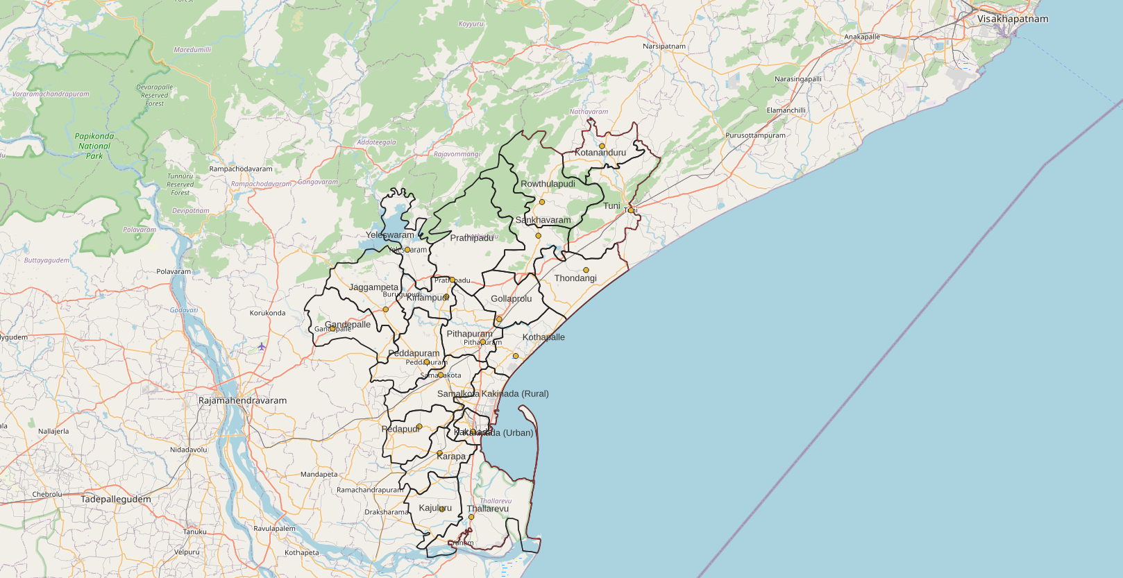
Kakinada district is a district in the Coastal Andhra Region in the Indian state of Andhra Pradesh. With Kakinada as its administrative headquarters, it was proposed on 26 January 2022 to become one of the resultant List of districts of Andhra Pradesh, twenty six districts in the state after the final notification has been issued on 4 April 2022 by the government of Andhra Pradesh. The district was formed from Kakinada revenue division, Kakinada and Peddapuram revenue division, Peddapuram revenue divisions from East Godavari district. Incidentally, during earlier times, the region comprising towns Pithapuram, Kakinada and Peddapuram were referred as ''Polnaud'' or ''Prolunadu'' (), which now roughly corresponds to the areas in this district. Etymology This district name derives from its headquarters Kakinada. Geography This district is surrounded by North of Alluri Sitharama Raju district, South of Bay of Bengal & Yanam district, East of Anakapalli district and west of East ... [...More Info...] [...Related Items...] OR: [Wikipedia] [Google] [Baidu] |


