|
Narmadapuram District
Narmadapuram district is one of the districts of Madhya Pradesh state of India, and Narmadapuram city is the district headquarters. Geography The district has an area of 5408.23 km². Narmadapuram district is bounded by the districts of Raisen to the north, Narsinghpur to the east, Chhindwara to the southeast, Betul to the south, Harda to the west, and Sehore to the northwest. In 1998, the western portion of Narmadapuram District was split off to become Harda District. The district lies in the Narmada River valley, and the Narmada forms the northern boundary of the district, Narmadapuram District is part of Narmadapuram Division. The Tawa River is the longest tributary of the Narmada, rising in the Satpura Range to the south and flowing north to meet the Narmada at the village of Bandra Bhan. The Tawa Reservoir lies in the south-central region of the district. Narmadapuram district is also home to Pachmarhi, a hill station and popular tourist spot in the Satpura Range i ... [...More Info...] [...Related Items...] OR: [Wikipedia] [Google] [Baidu] |
List Of Districts Of Madhya Pradesh
The Indian state of Madhya Pradesh came into existence on 1 November 1956. Madhya Pradesh has various geographic regions which have no official administrative governmental status; some correspond to historic countries, states or provinces. Currently, the number of districts in the state is 52. These districts are grouped into ten administrative divisions. Districts are subdivided into tehsils, of which there are 428 in Madhya Pradesh. List of districts There are 52 districts in Madhya Pradesh categorized into ten divisions. All districts share their name with their capital city. Proposed districts A bill giving in-principle approval to the creation of three districts was passed on 19 March 2020. The following districts would be created: * Nagda district * Maihar district * Chachaura district Notes References {{Districts of India Districts A district is a type of administrative division that, in some countries, is managed by the local government. Across the wor ... [...More Info...] [...Related Items...] OR: [Wikipedia] [Google] [Baidu] |
Raisen District
Raisen District is a district of Madhya Pradesh state of India. The town of Raisen is the district headquarters. The district is part of Bhopal Division. Sanchi University of Buddhist-Indic Studies is the first international university located at Sanchi Town. Etymology Raisen District takes its name from Raisen town, which is named after a fort. This fort is built on a sandstone hill, at the foot of which settles the town. The name is probably a corruption of Rajavasini or Rajasayan, the royal residence. Geography Raisen district is situated between the latitude 22 47' and 23 33' north and the longitude 7721' and 78 49' east. Sehore district lies in west, Vidisha district in the north, Sagar district in the east and south-east, Narsimhapur district in the south-east, Hoshangabad and Sehore districts in the south. It covers an area of . Raisen district has Ten tehsils – Raisen, Goharganj, Begamganj, Gairatganj, Silwani, Bareli, Udaipura, Deori, Sultanpur and Badi. Histo ... [...More Info...] [...Related Items...] OR: [Wikipedia] [Google] [Baidu] |
Pachmarhi Biosphere Preserve
The Pachmarhi Biosphere Reserve is a non-use conservation area and biosphere reserve in the Satpura Range of Madhya Pradesh state in central India. The conservation area was created in 1999 by the Indian government. It also contains animals from the Himalayan mountains and from the lower Western Ghats. UNESCO designated it a biosphere reserve in 2009. Almost every year scouts and guides visit this place as a ‘pachmarhi camp’. Geography The Pachmarhi Biosphere Reserve is located within areas of Narmadapuram, Betul, and Chhindwara Districts in Madhya Pradesh. The biosphere reserve's total area is . It includes three wildlife conservation units: * Bori Sanctuary (518.00 km2) *Pachmarhi Sanctuary (461.37 km2). *Satpura National Park (524.37 km2) Satpura National Park is designated as the core zone and the remaining area of 4401.91 km2, including the Bori and Pachmarhi sanctuaries, serves as the buffer zone. Ecology The reserve is composed primarily ... [...More Info...] [...Related Items...] OR: [Wikipedia] [Google] [Baidu] |
Pachmarhi Sanctuary
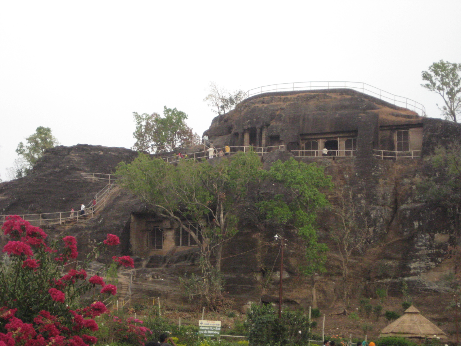
Pachmarhi is a hill station in Narmadapuram district of Madhya Pradesh state of central India. It has been the location of a cantonment (Pachmarhi Cantonment) since British Raj. It is widely known as ''Satpura ki Rani'' ("Queen of Satpura"), situated at a height of 1067 m in a valley of the Satpura Range in Narmadapuram district. Dhupgarh, the highest point (1,352 m) in Madhya Pradesh and the Satpura range, is located here. It is a part of Satpura Biosphere Reserve. Pachmarhi is a hill station of central India. It is also famous for Satpura Tiger Reserve, Satpura National Park, Lord Shiva, Pandavas of Mahabharata. History The name Pachmarhi is believed to be derived from the Hindi words ''Panch'' ("five") and ''Marhi'' ("caves"). According to a legend, these caves were built by five Pandava brothers of Mahabharatha era during their thirteen years of exile. The caves are situated on a hilltop and provide an excellent vantage point. Pachmadhi region was Ruled by Bhonsale Ki ... [...More Info...] [...Related Items...] OR: [Wikipedia] [Google] [Baidu] |
Central Provinces And Berar
The Central Provinces and Berar was a province of British India and later the Dominion of India which existed from 1903 to 1950. It was formed by the merger of the Central Provinces with the province of Berar, which was territory leased by the British from the Hyderabad State. Through an agreement signed on 5 November 1902, 6th Nizam Mahbub Ali Khan, Asaf Jah VI leased Berar permanently to the British for an annual payment of 25 lakhs rupees. Lord Curzon decided to merge Berar with the Central Provinces, and this was proclaimed on 17 September 1903. The Central Provinces was formed in 1861 by the merger of the Saugor and Nerbudda Territories and Nagpur Province. Administration of the Berar region of the Hyderabad princely state was assigned to the Chief Commissioner of the Central Provinces in 1903, and for administrative purposes, Berar was merged with the Central Provinces to form the Central Provinces and Berar on 24 October 1936. After Indian Independence in 1947, a number ... [...More Info...] [...Related Items...] OR: [Wikipedia] [Google] [Baidu] |
British Raj
The British Raj (; from Hindi ''rāj'': kingdom, realm, state, or empire) was the rule of the British Crown on the Indian subcontinent; * * it is also called Crown rule in India, * * * * or Direct rule in India, * Quote: "Mill, who was himself employed by the British East India company from the age of seventeen until the British government assumed direct rule over India in 1858." * * and lasted from 1858 to 1947. * * The region under British control was commonly called India in contemporaneous usage and included areas directly administered by the United Kingdom, which were collectively called British India, and areas ruled by indigenous rulers, but under British paramountcy, called the princely states. The region was sometimes called the Indian Empire, though not officially. As ''India'', it was a founding member of the League of Nations, a participating nation in the Summer Olympics in 1900, 1920, 1928, 1932, and 1936, and a founding member of the United Nations in San F ... [...More Info...] [...Related Items...] OR: [Wikipedia] [Google] [Baidu] |
Satpura Range
The Satpura Range is a range of hills in central India. The range rises in eastern Gujarat running east through the border of Maharashtra and Madhya Pradesh and ends in Chhattisgarh. The range parallels the Vindhya Range to the north, and these two east-west ranges divide Indian Subcontinent into the Indo-Gangetic plain of northern India and the Deccan Plateau of the south. The Narmada River originates from north-eastern end of Satpura in Amarkantak, and runs in the depression between the Satpura and Vindhya ranges, draining the northern slope of the Satpura range, running west towards the Arabian Sea. The Tapti River originates in the eastern-central part of Satpura, crossing the range in the center and running west at the range's southern slopes before meeting the Arabian Sea at Surat, draining the central and southern slopes of the range. Multai, the place of Tapi river origin is located about 465 kilometer far, south-westerly to Amarkantak, separated across by the hill range ... [...More Info...] [...Related Items...] OR: [Wikipedia] [Google] [Baidu] |
Hill Station
A hill station is a town located at a higher elevation than the nearby plain or valley. The term was used mostly in colonial Asia (particularly in India), but also in Africa (albeit rarely), for towns founded by European colonialists as refuges from the summer heat and, as Dale Kennedy observes about the Indian context, "the hill station ... was seen as an exclusive British preserve: here it was possible to render the Indian into an outsider".Kennedy, Dane. The Magic Mountains: Hill Stations and the British Raj. Berkeley: University of California Press, c1996 1996. , http://ark.cdlib.org/ark:/13030/ft396nb1sf/ In India, which has the largest number of hill stations, most are situated at an altitude of approximately . History Nandi Hills is a hill station in Karnataka, India which was developed by Ganga Dynasty in 11th century. It was also used by Tipu Sultan (1751 - 1799) as a summer retreat. Hill stations in British India were established for a variety of reasons. One ... [...More Info...] [...Related Items...] OR: [Wikipedia] [Google] [Baidu] |
Tawa River
The Tawa River is a tributary of the Narmada River of Central India. Course The Tawa is the Narmada's largest tributary, at 172 km. It rises in the Satpura Range of Betul and flowing north and west, joins the Narmada at the village of Bandra Bhan in Narmadapuram District. Dam In 1958, construction began on Tawa Dam, which was completed in 1978 in Tawa Nagar to create Tawa Reservoir in southern Narmadapuram District. Forty-four villages were submerged by the reservoir. Surroundings India's oldest forest preserve, the Bori Reserve Forest, was established in 1865 along the Tawa. The Bori Reserve Forest is part of the Bori Sanctuary, which is part of the Pachmarhi Biosphere Reserve The Pachmarhi Biosphere Reserve is a non-use conservation area and biosphere reserve in the Satpura Range of Madhya Pradesh state in central India. The conservation area was created in 1999 by the Indian government. It also contains animals fr ..., established in 1999, which covers much ... [...More Info...] [...Related Items...] OR: [Wikipedia] [Google] [Baidu] |
Sehore District
Sehore District is a district of Madhya Pradesh state in central India. The town of Sehore is the district headquarters. The district is part of Bhopal Division. Demographics According to the 2011 census, Sehore District has a population of 1,311,332. This gives it a ranking of 373 in India (out of a total of 640). The district has a population density of . Its population growth rate over the decade 2001-2011 was 21.51%. Sehore has a sex ratio of 918 females for every 1,000 males and a literacy rate of 71.11%. Scheduled Castes and Scheduled Tribes make up 20.69% and 11.10% of the population respectively. According to the 2011 Census of India, 95.38% of the population in the district spoke Hindi, 2.31% Urdu and 1.46% Malvi The Malvi or Malavi, also known as Manthani or Mahadeopuri, is breed of zebu cattle from the Malwa plateau in western Madhya Pradesh, in central India. It is a good draught breed; the milk yield of the cows is low. The breed has been studie ... a ... [...More Info...] [...Related Items...] OR: [Wikipedia] [Google] [Baidu] |


