|
Narmadapuram
Hoshangabad, officially known as Narmadapuram is a city and municipality in the Indian state of Madhya Pradesh. It serves as the headquarters of both Hoshangabad district and Narmadapuram division. It is located in central India, on the south bank of the Narmada River. Narmapuram is from the state capital and the nearest airport Bhopal. History The city was earlier called Narmadapur after the Narmada river. Later the name was changed to Hoshangabad after Hoshang Shah Gori, the first ruler of Malwa Sultanate. Hoshangabad district was part of the Nerbudda (Narmada) Division of the Central Provinces and Berar, which became the state of Madhya Bharat (later Madhya Pradesh) after India's independence in 1947. The city is famous for its beautiful ghats along the banks of the Narmada river, Sethani ghat is a major attraction. There are colourful celebrations in the city on Narmada Jayanti. During celebrations this year the CM announced the efforts to rename the town. A Satsang ... [...More Info...] [...Related Items...] OR: [Wikipedia] [Google] [Baidu] |
Hoshangabad District
Narmadapuram district, formerly Hoshangabad district, is one of the districts of Madhya Pradesh States and territories of India, state of India, and Narmadapuram city is the district headquarters. Geography The district has an area of 5408.23 km². Hoshangabad district is bounded by the districts of Raisen District, Raisen to the north, Narsinghpur to the east, Chhindwara to the southeast, Betul District, Betul to the south, Harda District, Harda to the west, and Sehore District, Sehore to the northwest. In 1998, the western portion of Hoshangabad District was split off to become Harda District. The district lies in the Narmada River valley, and the Narmada forms the northern boundary of the district, Hoshangabad District is part of Narmadapuram Division. The Tawa River is the longest tributary of the Narmada, rising in the Satpura Range to the south and flowing north to meet the Narmada at the village of Bandra Bhan. The Tawa Reservoir lies in the south-central region of t ... [...More Info...] [...Related Items...] OR: [Wikipedia] [Google] [Baidu] |
Narmadapuram Division
Narmadapuram Division is one of the administrative divisions in the Indian state of Madhya Pradesh. The division was formally inaugurated on 27 August 2008. It comprises Narmadapuram, Harda, and Betul districts. The three districts were earlier part of Bhopal Division Bhopal Division is an administrative geographical unit of Madhya Pradesh state of central India. Bhopal is the administrative headquarters of the division. The division consists of districts of Bhopal, Raisen, Rajgarh, Sehore, and Vidisha .... References External links * Divisions of Madhya Pradesh {{MadhyaPradesh-geo-stub ... [...More Info...] [...Related Items...] OR: [Wikipedia] [Google] [Baidu] |
Pachmarhi
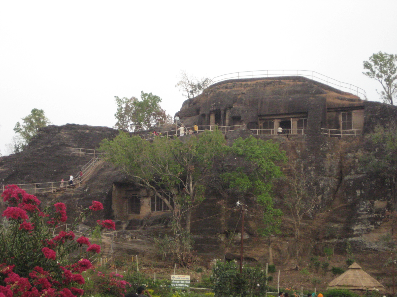
Pachmarhi is a hill station in Narmadapuram district of Madhya Pradesh states and territories of India, state of central India. It has been the location of a cantonment (Pachmarhi Cantonment) since British Raj. It is widely known as ''Satpura ki Rani'' ("Queen of Satpura"), situated at a height of 1067 m in a valley of the Satpura Range in Narmadapuram district. Dhupgarh, the highest point (1,352 m) in Madhya Pradesh and the Satpura range, is located here. It is a part of Satpura Biosphere Reserve. Pachmarhi is a hill station of central India. It is also famous for Satpura Tiger Reserve, Satpura National Park, Lord Shiva, Pandavas of Mahabharata. History The name Pachmarhi is believed to be derived from the Hindi words ''Panch'' ("five") and ''Marhi'' ("caves"). According to a legend, these caves were built by five Pandava brothers of Mahabharatha era during their thirteen years of exile. The caves are situated on a hilltop and provide an excellent vantage point. Pachmadh ... [...More Info...] [...Related Items...] OR: [Wikipedia] [Google] [Baidu] |
Sethani Ghat
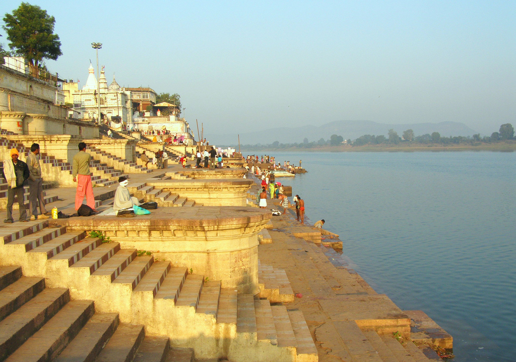
Sethani Ghat is a 19th-century construction along the banks of the river Narmada at Narmadapuram in Madhya Pradesh in India. It is one of the largest ghats in India. During Narmada Jayanti celebrations the ghat comes alive when thousands of people converge on the ghats and diyas are floated in the river. The ghat was built after generous contributions by Jankibai Sethani from the Sharma family in Narmadapuram Hoshangabad, officially known as Narmadapuram is a city and municipality in the Indian state of Madhya Pradesh. It serves as the headquarters of both Hoshangabad district and Narmadapuram division. It is located in central India, on the south ... after devotees complained to her about the difficulty in getting to the river, Hence the ghat is named after her. It is one of the few examples of public infrastructure built through private funding in India. A photo of Narmada from Sethani ghat can be seen in the book ''Jungle Rahe Taki Narmada Bahe!'', by Pankaj Srivasta ... [...More Info...] [...Related Items...] OR: [Wikipedia] [Google] [Baidu] |
Sitasharan Sharma
Dr. Sitasharan Sharma is an Indian politician, lawyer, and doctor. He served as the Speaker of the Madhya Pradesh Legislative Assembly (January 2014 -January 2019). He is the incumbent MLA from Narmadapuram (Vidhan Sabha constituency). He is a senior leader of Bharatiya Janata Party. It is his 5th term as MLA from the same constituency. He also served as the Chief Whip of the Bharatiya Janata Party Vidhaayak Dal in Madhya Pradesh Legislative Assembly from 1998 to 2003. Education He has done MBBS from Gandhi Medical College, Bhopal and LLB from Narmada Mahavidyalaya, Narmadapuram Hoshangabad, officially known as Narmadapuram is a city and municipality in the Indian state of Madhya Pradesh. It serves as the headquarters of both Hoshangabad district and Narmadapuram division. It is located in central India, on the south .... Political career In Madhya Pradesh Legislative Assembly Election 2018, Dr. Sharma won against the Congress candidate Sartaj Singh with a margin ... [...More Info...] [...Related Items...] OR: [Wikipedia] [Google] [Baidu] |
Madhya Pradesh
Madhya Pradesh (, ; meaning 'central province') is a state in central India. Its capital is Bhopal, and the largest city is Indore, with Jabalpur, Ujjain, Gwalior, Sagar, and Rewa being the other major cities. Madhya Pradesh is the second largest Indian state by area and the fifth largest state by population with over 72 million residents. It borders the states of Uttar Pradesh to the northeast, Chhattisgarh to the east, Maharashtra to the south, Gujarat to the west, and Rajasthan to the northwest. The area covered by the present-day Madhya Pradesh includes the area of the ancient Avanti Mahajanapada, whose capital Ujjain (also known as Avantika) arose as a major city during the second wave of Indian urbanisation in the sixth century BCE. Subsequently, the region was ruled by the major dynasties of India. The Maratha Empire dominated the majority of the 18th century. After the Anglo-Maratha Wars in the 19th century, the region was divided into several princel ... [...More Info...] [...Related Items...] OR: [Wikipedia] [Google] [Baidu] |
Bhopal
Bhopal (; ) is the capital city of the Indian state of Madhya Pradesh and the administrative headquarters of both Bhopal district and Bhopal division. It is known as the ''City of Lakes'' due to its various natural and artificial lakes. It is also one of the greenest cities in India. It is the 16th largest city in India and 131st in the world. After the formation of Madhya Pradesh, Bhopal was part of the Sehore district. It was bifurcated in 1972 and a new district, Bhopal, was formed. Flourishing around 1707, the city was the capital of the former Bhopal State, a princely state of the British ruled by the Nawabs of Bhopal. Numerous heritage structures from this period include the Taj-ul-Masajid and Taj Mahal palace. In 1984, the city was struck by the Bhopal disaster, one of the worst industrial disasters in history. Bhopal has a strong economic base with numerous large and medium industries operating in and around the city. Bhopal is considered as one of the important fin ... [...More Info...] [...Related Items...] OR: [Wikipedia] [Google] [Baidu] |
Malwa Sultanate
The Malwa Sultanate ( fa, ) (Pashto: ; ''lit: Mālwā Salṭanat'') was a late medieval Islamic sultanate in the Malwa, Malwa region, covering the present day Indian states of Madhya Pradesh and south-eastern Rajasthan from 1392 to 1562. It was founded by Dilawar Khan, an Afghan (ethnonym), Afghan governor of the Delhi Sultanate. Dilawar Khan had ceased to pay tribute to Delhi after 1392. Following Timur's invasion and the disintegration of the Delhi Sultanate, in 1401/2, Dilawar Khan made Malwa an independent realm. History The sultanate of Malwa was founded by Dilawar Khan, Dilawar Khan Ghuri, the governor of Malwa for the Delhi Sultanate, who asserted his independence in 1392, but did not actually assume the ensigns of royalty till 1401. Initially Dhar was the capital of the new kingdom, but soon it was shifted to Mandu, Madhya Pradesh, Mandu, which was renamed Shadiabad (the city of joy). After his death, he was succeeded by his son Hoshang Shah of Malwa, Alp Khan, who ... [...More Info...] [...Related Items...] OR: [Wikipedia] [Google] [Baidu] |
Nerbudda Division
The Nerbudda Division, named after the Narmada River (Nerbudda), was a former administrative division of the Central Provinces of British India. It encompassed a good part of the Narmada River basin in the eastern part of present-day Madhya Pradesh state of India. The Nerbudda Division had an area of 47,609.2 km2 with a population of 1,785,008 in 1901. The Central Provinces became the Central Provinces and Berar in 1936 until the Independence of India. Territory The main mountains in the division were the Mahadeo Hills, the central part of the Satpura Range, where Pachmarhi, the summer hill station for British officials, and the Pachmarhi Cantonment were located. The main towns in the division were Hoshangabad (15,863 inhabitants in 1881), Burhanpur (33,341 inhabitants in 1901) and Gadarwara (6,978 in 1901); other important towns were Khandwa, Harda, Narsinghpur, Chhindwara, Pandhurna, Sohagpur, Seoni and Mohgaon. Administrative divisions Districts The Nerbudda Division included ... [...More Info...] [...Related Items...] OR: [Wikipedia] [Google] [Baidu] |
Central Provinces And Berar
The Central Provinces and Berar was a province of British India and later the Dominion of India which existed from 1903 to 1950. It was formed by the merger of the Central Provinces with the province of Berar, which was territory leased by the British from the Hyderabad State. Through an agreement signed on 5 November 1902, 6th Nizam Mahbub Ali Khan, Asaf Jah VI leased Berar permanently to the British for an annual payment of 25 lakhs rupees. Lord Curzon decided to merge Berar with the Central Provinces, and this was proclaimed on 17 September 1903. The Central Provinces was formed in 1861 by the merger of the Saugor and Nerbudda Territories and Nagpur Province. Administration of the Berar region of the Hyderabad princely state was assigned to the Chief Commissioner of the Central Provinces in 1903, and for administrative purposes, Berar was merged with the Central Provinces to form the Central Provinces and Berar on 24 October 1936. After Indian Independence in 1947, a number ... [...More Info...] [...Related Items...] OR: [Wikipedia] [Google] [Baidu] |
Ramcharitmanas
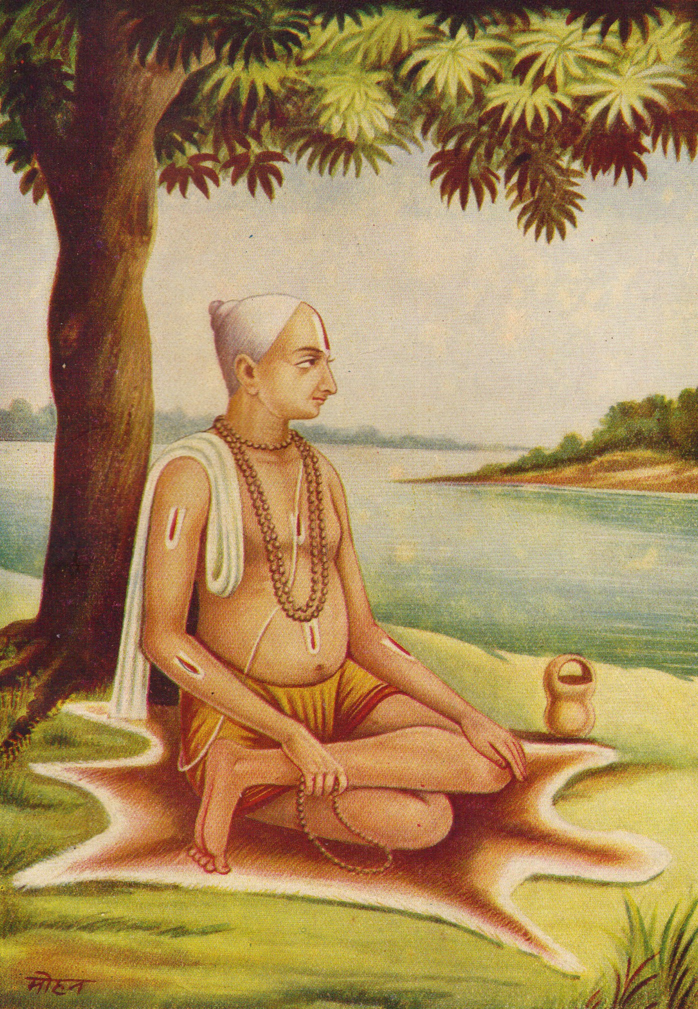
''Ramcharitmanas'' ( deva, श्रीरामचरितमानस, Rāmacaritamānasa), is an epic poem in the Awadhi language, based on the ''Ramayana'', and composed by the 16th-century Indian bhakti poet Tulsidas (c. 1532–1623). This work is also called, in popular parlance, ''Tulsi Ramayana'', ''Tulsikrit Ramayana'', or ''Tulsidas Ramayana''. The word ''Ramcharitmanas'' literally means "Lake of the deeds of Rama". It is considered one of the greatest works of Hindu literature. The work has variously been acclaimed as "the living sum of Indian culture", "the tallest tree in the magic garden of medieval Indian poetry", "the greatest book of all devotional literature" and "the best and most trustworthy guide to the popular living faith of the Indian people".Lutgendorf 1991, p. 1. Tulsidas was a great scholar of Sanskrit. However, he wanted the story of Rama to be accessible to the general public, as many Apabhramsa languages had evolved from Sanskrit and at that time fe ... [...More Info...] [...Related Items...] OR: [Wikipedia] [Google] [Baidu] |
WikiProject Indian Cities
A WikiProject, or Wikiproject, is a Wikimedia movement affinity group for contributors with shared goals. WikiProjects are prevalent within the largest wiki, Wikipedia, and exist to varying degrees within sister projects such as Wiktionary, Wikiquote, Wikidata, and Wikisource. They also exist in different languages, and translation of articles is a form of their collaboration. During the COVID-19 pandemic, CBS News noted the role of Wikipedia's WikiProject Medicine in maintaining the accuracy of articles related to the disease. Another WikiProject that has drawn attention is WikiProject Women Scientists, which was profiled by '' Smithsonian'' for its efforts to improve coverage of women scientists which the profile noted had "helped increase the number of female scientists on Wikipedia from around 1,600 to over 5,000". On Wikipedia Some Wikipedia WikiProjects are substantial enough to engage in cooperative activities with outside organizations relevant to the field at issue. For ex ... [...More Info...] [...Related Items...] OR: [Wikipedia] [Google] [Baidu] |


_male.jpg)


