|
Nannerch
Nannerch is a village and community in Flintshire, Wales, located within the Clwydian Range and Dee Valley Area of Outstanding Natural Beauty. At the 2001 Census the population of Nannerch was 531, reducing to 496 in 2011. History Nannerch (pronounced Nan-er-ch Welsh) is one of the ancient parishes of Flintshire, made up of the townships of Trellan, Trefechan, Trecwm and Tre Penbedw. It is an ancient village, sitting on bedrock of Carboniferous Limestone, overlain by glacial boulder clay with glacial hollows. The limestone has been used in the construction of many local buildings. The ruins of Iron Age hill forts at Pen-y-Cloddiau and Moel Arthur are situated in the nearby hills. The Church The church, which is dedicated to St. Michael and All Angels, was consecrated on 29 September 1853. It is the third church known to have been built on the site. The curved wall of the graveyard indicates the ancient origins of the churches. The present church was designed by Thomas W. Wya ... [...More Info...] [...Related Items...] OR: [Wikipedia] [Google] [Baidu] |
1 And 2 Tai Cochion
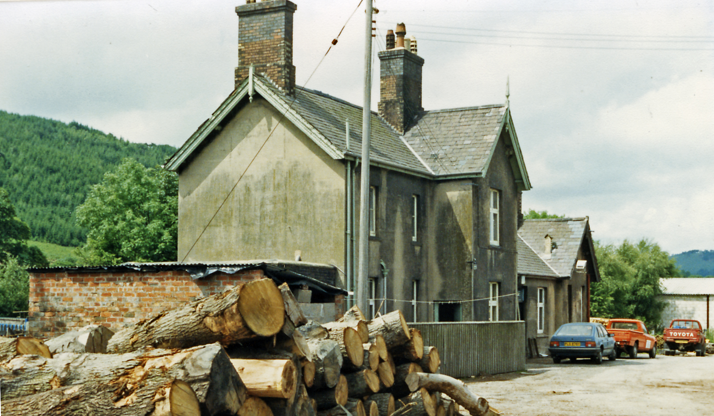
1 and 2 Tai Cochion consists of a pair of joined cottages in the village of Nannerch, Flintshire, Wales. Each of the cottages is designated by Cadw as a Grade II listed building. They were built for the railway engineer William Barber Buddicom in 1877–88 and designed by the Chester architect John Douglas. The cottages are built in brick in vernacular revival style with tiled hipped roofs. Each is a mirror image of the other and they share a central chimney stack; the cottages are divided by a buttress in the lower storey. They have gables containing a lozenge pattern in the brickwork. Both cottages have rear extensions added in the 20th century. See also *List of houses and associated buildings by John Douglas John Douglas (1830–1911) was an English architect based in Chester, Cheshire. His designs included new churches, alterations to and restoration of existing churches, church furnishings, new houses and alterations to existing houses, and a v ... ... [...More Info...] [...Related Items...] OR: [Wikipedia] [Google] [Baidu] |
Mold And Denbigh Junction Railway
The Mold and Denbigh Junction Railway was a railway company that built a railway line in North Wales. It formed a link between the Mold Railway (from Chester) and the Vale of Clwyd Railway towards Rhyl. The line opened in 1869. Serving a largely rural district, it never attracted much business, and the passenger service was withdrawn in 1962. Ordinary goods traffic ceased not long after, and the line closed completely in 1983. Conception The Chester and Holyhead Railway was opened throughout in 1850,Peter E Baughan, ''A Regional History of the Railways of Great Britain: 14: North and Mid Wales'', David St John Thomas, Nairn, 1991, , pages 22 and 24 and it was absorbed by the London and North Western Railway in 1858. The Great Western Railway was the principal competitor of the LNWR in the area, and the GWR had taken steps to reach Rhyl, an important regional centre. It hoped to do this by taking control of a series of local railways, northwards from the Vale of Llangollen ... [...More Info...] [...Related Items...] OR: [Wikipedia] [Google] [Baidu] |
Clwydian Range And Dee Valley
, iucn_category =V , iucn_ref = , photo =Sunny Hillside, Frosty Valley Dee Valley Wales (11014647076).jpg , photo_width = , photo_alt =Image of the view of the Dee Valley from Moel Y Gamelin , photo_caption = Near the Dee Valley, on Moel y Gamelin , image_map = Clwydian Range and Dee Valley AONB map.svg , map_caption = Map of the AONB in Wales , map = , map_width = 200 , map_alt = , AlternativeMap = , relief = , label = , label_position = , mark = , marker_size = , location = Clwyd, Wales , nearest_city = , nearest_town =Ruthin, St Asaph, Prestatyn, Mold, Chirk , coordinates = , coords_ref = , length = , length_mi = , length_km = , width = , width_mi = , width_km = , area = , area_ha = , area_acre = , area_km2 =389.26 , area_sqmi = , area_ref ... [...More Info...] [...Related Items...] OR: [Wikipedia] [Google] [Baidu] |
Mold, Flintshire
Mold ( cy, Yr Wyddgrug) is a town and community in Flintshire, Wales, on the River Alyn. It is the county town and administrative seat of Flintshire County Council, as it was of Clwyd from 1974 to 1996. According to the 2011 UK Census, it had a population of 10,058. A 2019 estimate puts it at 10,123. Origin of the name The original Welsh-language place name, ''Yr Wyddgrug'' was recorded as ''Gythe Gruc'' in a document of 1280–1281, and means "The Mound of the Tomb/Sepulchre". The name "Mold" originates from the Norman-French ''mont-hault'' ("high hill"). The name was originally applied to the site of Mold Castle in connection with its builder Robert de Montalt, an Anglo-Norman lord. It is recorded as ''Mohald'' in a document of 1254. History A mile west of the town is Maes Garmon, ("The Field of Germanus"), the traditional site of the "Alleluia Victory" by a force of Romano-Britons led by Germanus of Auxerre against the invading Picts and Scots, which occurred shortly af ... [...More Info...] [...Related Items...] OR: [Wikipedia] [Google] [Baidu] |
Delyn (Senedd Constituency)
Delyn is a constituency of the Senedd. It elects one Member of the Senedd by the first past the post method of election. Also, however, it is one of nine constituencies in the North Wales electoral region, which elects four additional members, in addition to nine constituency members, to produce a degree of proportional representation for the region as a whole. Boundaries The constituency was created for the first election to the Assembly, in 1999, with the name and boundaries of the Delyn Westminster constituency. It is entirely within the preserved county of Clwyd. As created in 1999, the North Wales region included the constituencies of Alyn and Deeside, Caernarfon, Clwyd West, Clwyd South, Conwy, Delyn, Vale of Clwyd, Wrexham and Ynys Môn. For the 2007 election the region included Aberconwy, Alyn and Deeside, Arfon, Clwyd South, Clwyd West, Delyn, Vale of Clwyd, Wrexham and Ynys Môn. Voting In elections for the Senedd, each voter has two votes. T ... [...More Info...] [...Related Items...] OR: [Wikipedia] [Google] [Baidu] |
Hill Fort
A hillfort is a type of earthwork used as a fortified refuge or defended settlement, located to exploit a rise in elevation for defensive advantage. They are typically European and of the Bronze Age or Iron Age. Some were used in the post-Roman period. The fortification usually follows the contours of a hill and consists of one or more lines of earthworks, with stockades or defensive walls, and external ditches. Hillforts developed in the Late Bronze and Early Iron Age, roughly the start of the first millennium BC, and were used in many Celtic areas of central and western Europe until the Roman conquest. Nomenclature The spellings "hill fort", "hill-fort" and "hillfort" are all used in the archaeological literature. The ''Monument Type Thesaurus'' published by the Forum on Information Standards in Heritage lists ''hillfort'' as the preferred term. They all refer to an elevated site with one or more ramparts made of earth, stone and/or wood, with an external ditch. M ... [...More Info...] [...Related Items...] OR: [Wikipedia] [Google] [Baidu] |
Beeching Axe
The Beeching cuts (also Beeching Axe) was a plan to increase the efficiency of the nationalised railway system in Great Britain. The plan was outlined in two reports: ''The Reshaping of British Railways'' (1963) and ''The Development of the Major Railway Trunk Routes'' (1965), written by Richard Beeching and published by the British Railways Board. The first report identified 2,363 stations and of railway line for closure, amounting to 55% of stations, 30% of route miles, and 67,700 British Rail positions, with an objective of stemming the large losses being incurred during a period of increasing competition from road transport and reducing the rail subsidies necessary to keep the network running. The second report identified a small number of major routes for significant investment. The 1963 report also recommended some less well-publicised changes, including a switch to the now-standard practice of containerisation for rail freight, and the replacement of some services wit ... [...More Info...] [...Related Items...] OR: [Wikipedia] [Google] [Baidu] |
Denbigh
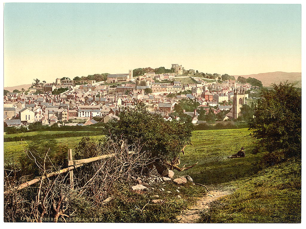
Denbigh (; cy, Dinbych; ) is a market town and a community in Denbighshire, Wales. Formerly, the county town, the Welsh name translates to "Little Fortress"; a reference to its historic castle. Denbigh lies near the Clwydian Hills. History Denbigh Castle, together with its town walls, was built in 1282 by order of King Edward I. The Burgess Gate, whose twin towers adorn the symbol on Denbigh's civic seal, was once the main entrance into the town. The first borough charter was granted to Denbigh in 1290, when the town was still contained within the old town walls. It was the centre of the Marcher Lordship of Denbigh. The town was involved in the revolt of Madog ap Llywelyn in 1294–1295; the castle was captured in the autumn, and on 11 November 1294 a relieving force was defeated by the Welsh rebels. The town was recaptured by Edward I in December. Denbigh was also burnt in 1400 during the revolt of Owain Glyndŵr. During the Wars of the Roses (1455-1487), the town was ... [...More Info...] [...Related Items...] OR: [Wikipedia] [Google] [Baidu] |
A541 Road
The A541 is an A road in North Wales. The road starts on the A525 in Trefnant, between St Asaph and Denbigh, and ends in Wrexham. On the way, it passes the town of Mold A mold () or mould () is one of the structures certain fungi can form. The dust-like, colored appearance of molds is due to the formation of spores containing fungal secondary metabolites. The spores are the dispersal units of the fungi. Not .... It also passes through many villages. In northern-central Wrexham it joins the B5101 road. The section of the road between Mold and Denbigh, centred on Rhydymwyn, was described by North Wales Police as the most dangerous road in North Wales. References Roads in Wrexham County Borough Roads in Flintshire Roads in Denbighshire {{Wales-road-stub ... [...More Info...] [...Related Items...] OR: [Wikipedia] [Google] [Baidu] |
Moel Arthur
Moel Arthur ("Arthur's Hill") is an Iron Age hillfort in Flintshire, Wales, at the boundary with Denbighshire, about east of Denbigh. It is on a prominent hill, height , in the Clwydian Range; it overlooks the Vale of Clwyd to the west. Offa's Dyke Path skirts the hill. It is about south-east of the hillfort of Penycloddiau. Description The oval fort is about north–south and east–west, enclosing an area of . There are two large banks and ditches to the north, where the hill slope is not steep; above the steep south-west, south and east slopes there is a single bank. At the north-east, at the edge of the steeper slopes, there is a narrow inturned entrance with an oblique approach. The form of entrance, and the simple plan of the fort, suggest that it is an early example.Christopher Houlder. ''Wales: An Archaeological Guide''. Faber and Faber, 1978. Page 74. [...More Info...] [...Related Items...] OR: [Wikipedia] [Google] [Baidu] |
Penycloddiau
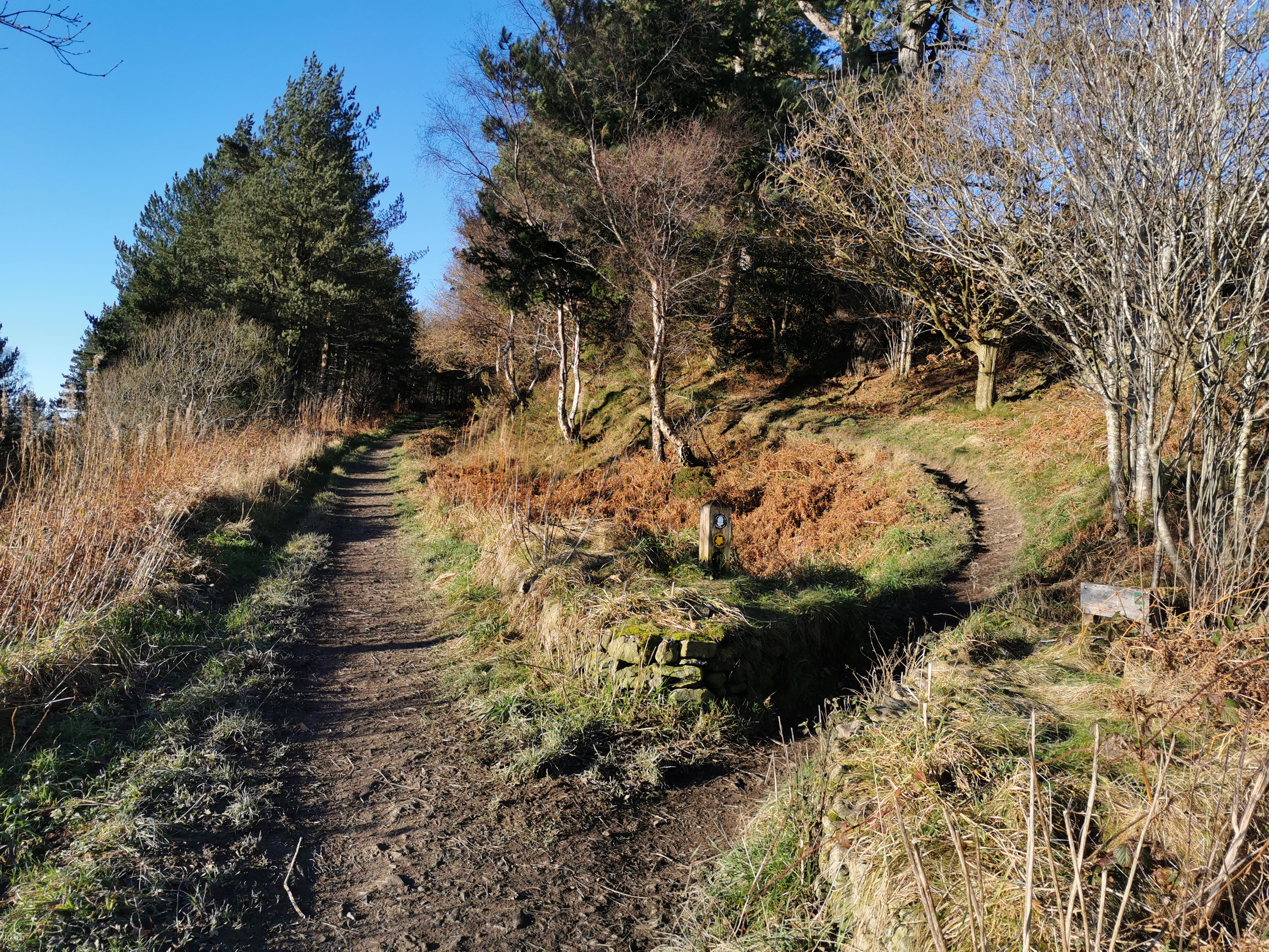
Penycloddiau is a hill in Flintshire, Wales, and one of five Marilyns in the Clwydian Range. The hill, like Foel Fenlli and Moel Arthur to the south, has an Iron Age hillfort at its summit. It covers making it one of the largest hillforts in Wales. In 2017, excavations by the Clywdian Range Archaeology Group (CRAG) unearthed a significant number of 4,000-year-old stone tools from the Bronze Age, the discovery indicates human activity occurred much earlier than first thought in the area. Penycloddiau is crossed by the Offa's Dyke Path and the Clwydian Way, two long distance footpaths that traverse the hills in this area. A free car park exists at the bwlch between Penycloddiau and Moel Arthur, where two footpaths lead to the summit. __NOTOC__ See also *List of hillforts in Wales This is a list of hillforts in Wales. Anglesey * Din Sylwy (Bwrdd Arthur) (), contour fort * Caer Idris Hillfort (), promontory fort * Caer y Twr (), partial contour fort * Dinas Gynfor (), p ... [...More Info...] [...Related Items...] OR: [Wikipedia] [Google] [Baidu] |
Iron Age
The Iron Age is the final epoch of the three-age division of the prehistory and protohistory of humanity. It was preceded by the Stone Age (Paleolithic, Mesolithic, Neolithic) and the Bronze Age (Chalcolithic). The concept has been mostly applied to Iron Age Europe and the Ancient Near East, but also, by analogy, to other parts of the Old World. The duration of the Iron Age varies depending on the region under consideration. It is defined by archaeological convention. The "Iron Age" begins locally when the production of iron or steel has advanced to the point where iron tools and weapons replace their bronze equivalents in common use. In the Ancient Near East, this transition took place in the wake of the Bronze Age collapse, in the 12th century BC. The technology soon spread throughout the Mediterranean Basin region and to South Asia (Iron Age in India) between the 12th and 11th century BC. Its further spread to Central Asia, Eastern Europe, and Central Europe is somewhat dela ... [...More Info...] [...Related Items...] OR: [Wikipedia] [Google] [Baidu] |


.jpg)

