|
Nam Tok Sai Yok Noi
Nam Tok Sai Yok Noi ( th, น้ำตกไทรโยคน้อย, lit. 'small Sai Yok waterfall') is a small town (''thesaban tambon'') in Sai Yok District, Kanchanaburi Province, Thailand, along the route of the Death Railway linking Thailand with Burma. It is named after Sai Yok Noi Waterfall of Sai Yok National Park. During World War II, the small town was known as ''Tarsoa'' or ''Tarsau''. Nam Tok Sai Yok Noi railway halt After the war most of the railway was dismantled, leaving Nam Tok at the terminus. In 2003 the 1.4 km from Nam Tok station to Nam Tok Sai Yok Noi was reopened for easier access to the nearby Sai Yok waterfall. However, as Sai Yok Noi is a single-platform terminus with no run-round loop, the line is only used by diesel multiple units. The only services to use the extension are trains 909/910 which run an excursion to the waterfall from Bangkok each Saturday and Sunday. All other trains terminate at Nam Tok railway station located about 1 kilomet ... [...More Info...] [...Related Items...] OR: [Wikipedia] [Google] [Baidu] |
Provinces Of Thailand
The provinces of Thailand are part of the government of Thailand that is divided into 76 provinces ( th, จังหวัด, , ) proper and one special administrative area ( th, เขตปกครองส่วนท้องถิ่นรูปแบบพิเศษ), representing the capital Bangkok. They are the primary local government units and act as juristic persons. They are divided into amphoe (districts) which are further divided into tambon (sub districts), the next lower level of local government. Each province is led by a governor (ผู้ว่าราชการจังหวัด ''phu wa ratchakan changwat''), who is appointed by the central government. The provinces and administrative areas * The total population of Thailand is 66,558,935 on 31 December 2019. * The total land area of Thailand is 517,646 km2 in 2013. * HS – Harmonized Commodity Description and Coding System. * FIPS code is replaced on 31 December 2014 with ISO 3166. ... [...More Info...] [...Related Items...] OR: [Wikipedia] [Google] [Baidu] |
Sai Yok Waterfall
Sai Yok Noi is a waterfall, also known as Khao Phang Waterfall, in the Tenasserim Hills, Sai Yok District of Kanchanaburi Province, Thailand, near the town Nam Tok Sai Yok Noi. It is the most popular attraction of the Sai Yok National Park. The waterfall consists of the limestone cliffs collapsing and that became the origin of the name "Khao Phang Waterfall”. The upstream falls from the mountain and flows along the limestone cliffs about 15-meter high. It is popular among domestic and foreign tourists alike, in part because it lies next to the province's trunk road alongside which there is ample parking space. The Krasae Cave, a small Buddhist shrine next to a section of rail tracks of the Death Railway and the Dawadung Cave, a secluded collection of stalactites, are located near the waterfall. Hellfire Pass Memorial, a museum and tribute to those lost during the construction of the Death Railway's cuttings and trestle bridges, lies about 35km to the west of Sai Yok Noi falls. ... [...More Info...] [...Related Items...] OR: [Wikipedia] [Google] [Baidu] |
Hellfire Pass
Hellfire Pass ( th, ช่องเขาขาด, known by the Japanese as ''Konyu Cutting'') is the name of a railway cutting on the former Burma Railway ("Death Railway") in Thailand which was built with forced labour during the Second World War, in part by Allied prisoners of war. The pass is noted for the harsh conditions and heavy loss of life suffered by its labourers during construction. It was called Hellfire Pass because the sight of emaciated prisoners labouring by burning torchlight resembled a scene from Hell. History Hellfire Pass in the Tenasserim Hills was a particularly difficult section of the line to build. It was the largest rock cutting on the railway, coupled with its general remoteness and the lack of proper construction tools during building. A tunnel would have been possible to build instead of a cutting, but this could only be constructed at the two ends at any one time, whereas the cutting could be constructed at all points simultaneously despite the ... [...More Info...] [...Related Items...] OR: [Wikipedia] [Google] [Baidu] |
Cholera
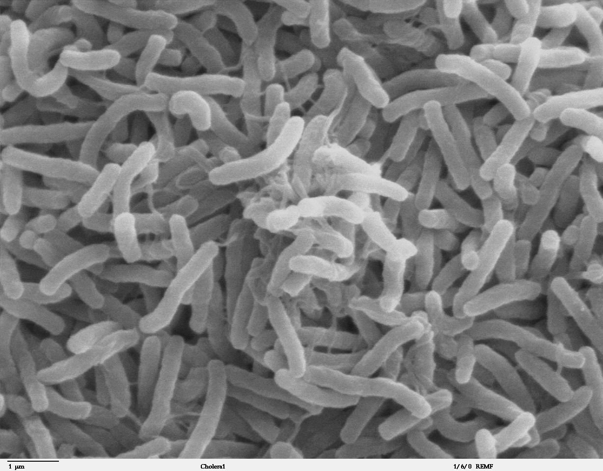
Cholera is an infection of the small intestine by some strains of the bacterium ''Vibrio cholerae''. Symptoms may range from none, to mild, to severe. The classic symptom is large amounts of watery diarrhea that lasts a few days. Vomiting and muscle cramps may also occur. Diarrhea can be so severe that it leads within hours to severe dehydration and electrolyte imbalance. This may result in sunken eyes, cold skin, decreased skin elasticity, and wrinkling of the hands and feet. Dehydration can cause the skin to turn bluish. Symptoms start two hours to five days after exposure. Cholera is caused by a number of types of ''Vibrio cholerae'', with some types producing more severe disease than others. It is spread mostly by unsafe water and unsafe food that has been contaminated with human feces containing the bacteria. Undercooked shellfish is a common source. Humans are the only known host for the bacteria. Risk factors for the disease include poor sanitation, not enough clea ... [...More Info...] [...Related Items...] OR: [Wikipedia] [Google] [Baidu] |
Prisoner Of War
A prisoner of war (POW) is a person who is held captive by a belligerent power during or immediately after an armed conflict. The earliest recorded usage of the phrase "prisoner of war" dates back to 1610. Belligerents hold prisoners of war in custody for a range of legitimate and illegitimate reasons, such as isolating them from the enemy combatants still in the field (releasing and repatriating them in an orderly manner after hostilities), demonstrating military victory, punishing them, prosecuting them for war crimes, exploiting them for their labour, recruiting or even conscripting them as their own combatants, collecting military and political intelligence from them, or indoctrinating them in new political or religious beliefs. Ancient times For most of human history, depending on the culture of the victors, enemy fighters on the losing side in a battle who had surrendered and been taken as prisoners of war could expect to be either slaughtered or enslaved. Ear ... [...More Info...] [...Related Items...] OR: [Wikipedia] [Google] [Baidu] |
Tambon
''Tambon'' ( th, ตำบล, ) is a local governmental unit in Thailand. Below district (''amphoe'') and province (''changwat''), they form the third administrative subdivision level. there were 7,255 tambons, not including the 180 ''khwaeng'' of Bangkok, which are set at the same administrative level, thus every district contains eight to ten tambon. ''Tambon'' is usually translated as "township" or "subdistrict" in English — the latter is the recommended translation, though also often used for ''king amphoe'', the designation for a subdistrict acting as a branch (Thai: ''king'') of the parent district. Tambon are further subdivided into 69,307 villages ('' muban''), about ten per ''tambon''. ''Tambon'' within cities or towns are not subdivided into villages, but may have less formal communities called ''chumchon'' ( ชุมชน) that may be formed into community associations. History The ''tambon'' as a subdivision has a long history. It was the second-level sub ... [...More Info...] [...Related Items...] OR: [Wikipedia] [Google] [Baidu] |
Sukhaphiban
Sukhaphiban ( th, สุขาภิบาล ; translated as "sanitary district") were administrative divisions of Thailand. Sanitary districts were the first sub-autonomous entities established in Thailand. A first such district was created in Bangkok by a royal decree of King Chulalongkorn in 1897. The king had learned about the sanitary districts in England during his European trip earlier that year, and he wanted to try this local administration in his country as well. Tha Chalom District became the second such district, created in 1906 and responsible for parts of Mueang Samut Sakhon District, Samut Sakhon Province. In 1907 the act on operations of sanitary districts codified the regulations, and with the ''Local Administration Act'' of 1914 two levels of sukhaphiban were introduced, the ''sukhaphiban mueang'' for towns and ''sukhaphiban tambon'' for rural areas. The number of sanitary districts grew to 35 in 1935, when these however were converted into municipalities ('' ... [...More Info...] [...Related Items...] OR: [Wikipedia] [Google] [Baidu] |
Nam Tok Railway Station
Nam Tok railway station is a railway station located in Tha Sao Subdistrict, Sai Yok District, Kanchanaburi. The station is a class 2 railway station, located from Thon Buri railway station. Nam Tok is the current terminus for daily trains from Bangkok on the Death Railway line. However, an excursion train from Bangkok during the weekends continues to Nam Tok Sai Yok Noi Halt, a few kilometres from the station. The station opened in July 1958 from Wang Pho railway station, as part of State Railway of Thailand's project in rebuilding the railway after the Second World War World War II or the Second World War, often abbreviated as WWII or WW2, was a world war that lasted from 1939 to 1945. It involved the vast majority of the world's countries—including all of the great powers—forming two opposi .... Train services * Ordinary 257/258 Thon Buri–Nam Tok–Thon Buri * Ordinary 259/260 Thon Buri–Nam Tok–Thon Buri * Local 485/486 Nong Pladuk–Nam Tok ... [...More Info...] [...Related Items...] OR: [Wikipedia] [Google] [Baidu] |
World War II
World War II or the Second World War, often abbreviated as WWII or WW2, was a world war that lasted from 1939 to 1945. It involved the vast majority of the world's countries—including all of the great powers—forming two opposing military alliances: the Allies and the Axis powers. World War II was a total war that directly involved more than 100 million personnel from more than 30 countries. The major participants in the war threw their entire economic, industrial, and scientific capabilities behind the war effort, blurring the distinction between civilian and military resources. Aircraft played a major role in the conflict, enabling the strategic bombing of population centres and deploying the only two nuclear weapons ever used in war. World War II was by far the deadliest conflict in human history; it resulted in 70 to 85 million fatalities, mostly among civilians. Tens of millions died due to genocides (including the Holocaust), starvation, ma ... [...More Info...] [...Related Items...] OR: [Wikipedia] [Google] [Baidu] |
Sai Yok National Park
Sai Yok National Park ( th, อุทยานแห่งชาติไทรโยค) is a List of national parks of Thailand, national park in Sai Yok District, Sai Yok district, Kanchanaburi Province, Thailand. The park, home to mountains, waterfalls and caves, is part of the Western Forest Complex protected area. Geography Sai Yok National Park is in the Tenasserim Hills mountain chain, northwest of Kanchanaburi town. The park's area is 312,500 rai ~ . The Khwae Noi River, Khwae Noi river ("River Kwai") runs through the park. The park's highest peak is Khao Khwae at . The western boundary of the park adjoins Myanmar. Climate Temperatures in the park area have a wide annual range from to . The driest time of the year here is from December to February, while the rainiest time is from May to October. History Within the park are remains of a bridge on the Burma Railway and of a camp used by Japanese troops during World War II. In 1978, the Russian roulette scenes of the film ... [...More Info...] [...Related Items...] OR: [Wikipedia] [Google] [Baidu] |


