|
Nahal Katlav
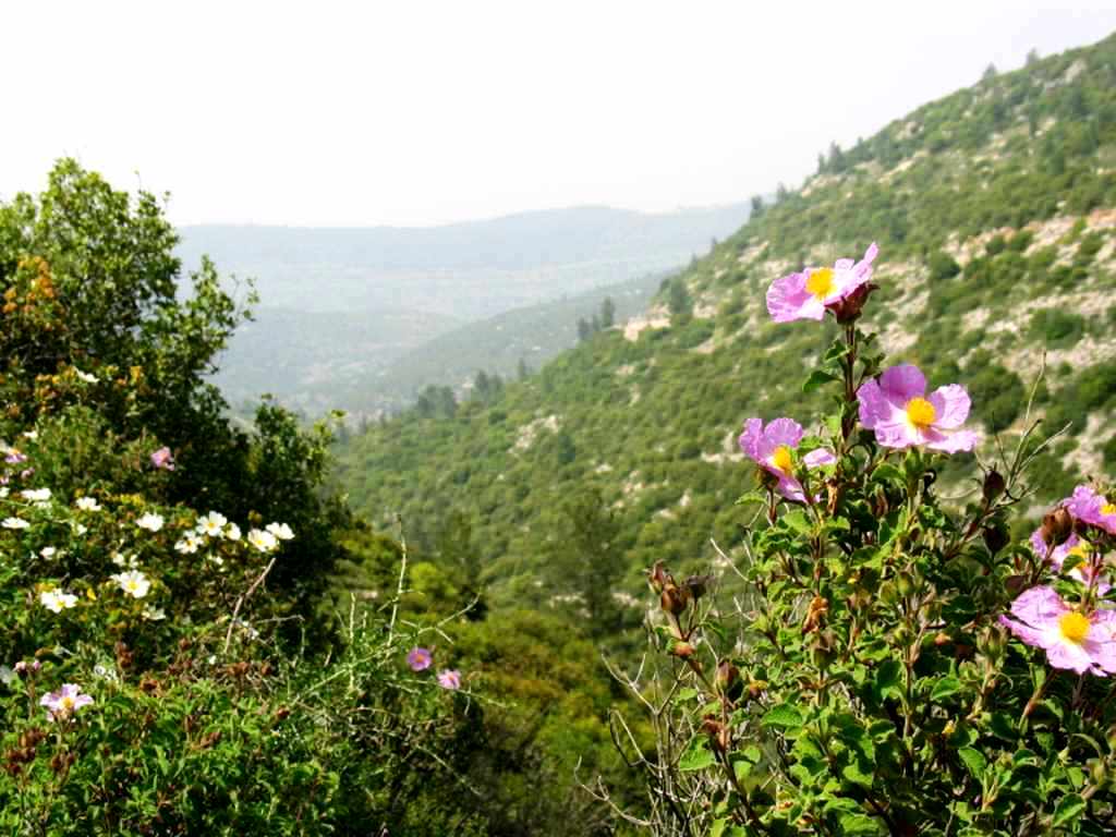
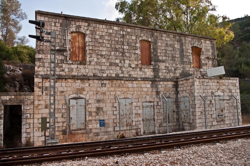
Nahal Katlav ( he, נחל קטלב) is a valley in the Judean Mountains of Israel. It starts near the villages of Bar Giora and Tzur Hadassah in the hilly landscape of the Jerusalem Corridor. In addition to rainwater, it is fed by several springs located in its vicinity (Ein Ktalav, Ein Giora). The name of the wadi is derived from the small-leaved plantain tree (Hebrew ktalav). It heads northwest, passing Bar Giora and descending a deep valley with wooded slopes. It then empties from the left into the Sorek creek, while the railway line to Jerusalem leads through the Sorek valley. Nearby is the abandoned Dayr al-Shaykh Dayr al-Shaykh ( ar, دير الشيخ), also spelt Deir esh Sheikh, was a Palestinian Arab village in the Jerusalem Subdistrict, also known as the Jerusalem corridor. It was depopulated during the 1948 Arab-Israeli War. The village was located ... railway station (named after an Arab village that stood there until 1948). The slopes of the wadi have stands o ... [...More Info...] [...Related Items...] OR: [Wikipedia] [Google] [Baidu] |
Judean Mountains
The Judaean Mountains, or Judaean Hills ( he, הרי יהודה, translit=Harei Yehuda) or the Hebron Mountains ( ar, تلال الخليل, translit=Tilal al-Khalīl, links=, lit=Hebron Mountains), is a mountain range in Palestine and Israel where Jerusalem, Hebron and several other biblical cities are located. The mountains reach a height of . The Judean Mountains can be separated to a number of sub-regions, including the Mount Hebron ridge, the Jerusalem ridge and the Judean slopes. The Judaean Mountains formed the heartland of the Kingdom of Judah (930-586 BCE), where the earliest Jewish settlements emerged, and from which Jews are generally descended. Geography The Judaean mountains are part of a more extended range that runs in a north-south direction. The ridge consists of the Samarian Hills in its northern part, and of the Judaean mountains in its southern part, the two segments meeting at the latitude of Ramallah. The westward descent from the hard limestone country o ... [...More Info...] [...Related Items...] OR: [Wikipedia] [Google] [Baidu] |
Israel
Israel (; he, יִשְׂרָאֵל, ; ar, إِسْرَائِيل, ), officially the State of Israel ( he, מְדִינַת יִשְׂרָאֵל, label=none, translit=Medīnat Yīsrāʾēl; ), is a country in Western Asia. It is situated on the southeastern shore of the Mediterranean Sea and the northern shore of the Red Sea, and shares borders with Lebanon to the north, Syria to the northeast, Jordan to the east, and Egypt to the southwest. Israel also is bordered by the Palestinian territories of the West Bank and the Gaza Strip to the east and west, respectively. Tel Aviv is the economic and technological center of the country, while its seat of government is in its proclaimed capital of Jerusalem, although Israeli sovereignty over East Jerusalem is unrecognized internationally. The land held by present-day Israel witnessed some of the earliest human occupations outside Africa and was among the earliest known sites of agriculture. It was inhabited by the Canaanites ... [...More Info...] [...Related Items...] OR: [Wikipedia] [Google] [Baidu] |
Bar Giora
Bar Giora () is a moshav in the Judean Mountains in Israel. Located between Beit Shemesh and Jerusalem, it falls under the jurisdiction of Mateh Yehuda Regional Council. In it had a population of . History The village was initially founded by the Herut movement on 18 October 1950 by immigrants from Yemen, and was first named ''Allar-Bet'', later to be called ''Ramat Shimon''. It was established on land belonging to the Palestinian village of Allar, which became depopulated during the 1948 Arab–Israeli War. It is situated northeast of the Allar village site. The village was also called ''Eitanim'', until residents eventually settled on the name ''Bar-Giora'', after Simon Bar Giora. The Yemenite immigrants, dissatisfied with conditions in their new village, abandoned the village after a short stint of 2-3 years, and in 1954 the village was resettled by immigrants from Morocco. Attractions The village is home to the Sea Horse and Bar Giora wineries A winery is a building ... [...More Info...] [...Related Items...] OR: [Wikipedia] [Google] [Baidu] |
Tzur Hadassah
Tzur Hadassah ( he, צוּר הֲדַסָּה, ''lit.'' Rock of Hadassah) is a town located in the Jerusalem Corridor, located southwest of Jerusalem, at an altitude of 755 meters above sea level, located on Route 375 west of Betar Ilit, about one kilometer west of the Green Line, just adjacent to the Palestinian village of Wadi Fukin. According to the Central Bureau of Statistics, Tzur Hadassah is the largest settlement in Israel that does not have a local authority status. It falls under the jurisdiction of Mateh Yehuda Regional Council. In it had a population of . In 2016, plans for expansion were approved, which would add 15,000 new residents within 5 years. Schools Tzur Hadassah is home to 3 primary schools, 1 religious, 1 mixed, and 1 secular. The religious school is calledLavi, the mixed (both religious and secular) isMaayanot, and the secular primary school is calledHadassim. Restaurants and Culture There are two commercial centers in Tzur Hadassah, one near the ent ... [...More Info...] [...Related Items...] OR: [Wikipedia] [Google] [Baidu] |
Dayr Al-Shaykh
Dayr al-Shaykh ( ar, دير الشيخ), also spelt Deir esh Sheikh, was a Palestinian Arab village in the Jerusalem Subdistrict, also known as the Jerusalem corridor. It was depopulated during the 1948 Arab-Israeli War. The village was located west of Jerusalem. History Mamluk period During Mamluk times, Dayr al-Shaykh was home to one of the most famous local dynasties of local religious Shaykhs in the area. The founder was al-Sayyid Badr-al Din Muhammed who came to Palestine either from Iraq, Khurasan, or the Hijaz. He first settled in Shuafat, but after the death of one of his daughters, whose tomb can still be seen in the village, he moved westwards. According to the Mamluk-era historian Mujīr al-Dīn al-'Ulaymī, Badr-al Din probably arrived in Palestine around 1229-1244, and eventually he settled at Dayr al-Shaykh. According to the same source, Badr-al Din was a man of great virtue, with a reputation of being close to God. He died 1253 (650 AH), and was buried at his ... [...More Info...] [...Related Items...] OR: [Wikipedia] [Google] [Baidu] |
Geography Of Israel
The geography of Israel is very diverse, with desert conditions in the south, and snow-capped mountains in the north. Israel is located at the eastern end of the Mediterranean Sea in Western Asia. It is bounded to the north by Lebanon, the northeast by Syria, the east by Jordan and the West Bank, and to the southwest by Egypt. To the west of Israel is the Mediterranean Sea, which makes up the majority of Israel's coastline, and the Gaza Strip. Israel has a small coastline on the Red Sea in the south. Israel's area is approximately , which includes of inland water. Israel stretches from north to south, and its width ranges from at its widest point to at its narrowest point. It has an Exclusive Economic Zone of . The Israeli-occupied territories include the West Bank, , East Jerusalem, and the Golan Heights, . Geographical features in these territories will be noted as such. Of these areas, Israel has annexed East Jerusalem and the Golan Heights, an act not recognized by t ... [...More Info...] [...Related Items...] OR: [Wikipedia] [Google] [Baidu] |


