|
NaGISA
NaGISA (Natural Geography in Shore Areas or Natural Geography of In-Shore Areas) is an international collaborative effort aimed at inventorying, cataloguing, and monitoring biodiversity of the in-shore area. So named for the Japanese word "nagisa" ("where the land meets the sea"), it is an Apronym. NaGISA is the first project of the larger CoML effort (Census of Marine Life) to have global participation in actual field work. The actual procedures of this project involve inexpensive collection equipment (for easy universal participation). This equipment is used to photograph sampling sites, to actually take samples from the sites, and to process these samples. At each site throughout the world, samples are taken from the intertidal zone out to a depth of 10 meters (and optionally out to 20 meters depth). These samples are then processed (the organisms are isolated) and then analyzed and catalogued. The information (regarding the kind and number of organisms analyzed) is sent to th ... [...More Info...] [...Related Items...] OR: [Wikipedia] [Google] [Baidu] |
Census Of Marine Life
The Census of Marine Life was a 10-year, US $650 million scientific initiative, involving a global network of researchers in more than 80 nations, engaged to assess and explain the diversity, distribution, and abundance of life in the oceans. The world's first comprehensive Census of Marine Life — past, present, and future — was released in 2010 in London. Initially supported by funding from the Alfred P. Sloan Foundation, the project was successful in generating many times that initial investment in additional support and substantially increased the baselines of knowledge in often underexplored ocean realms, as well as engaging over 2,700 different researchers for the first time in a global collaborative community united in a common goal, and has been described as "one of the largest scientific collaborations ever conducted". Project history According to Jesse Ausubel, Senior Research Associate of the Program for the Human Environment of Rockefeller University and ... [...More Info...] [...Related Items...] OR: [Wikipedia] [Google] [Baidu] |
Intertidal Zone
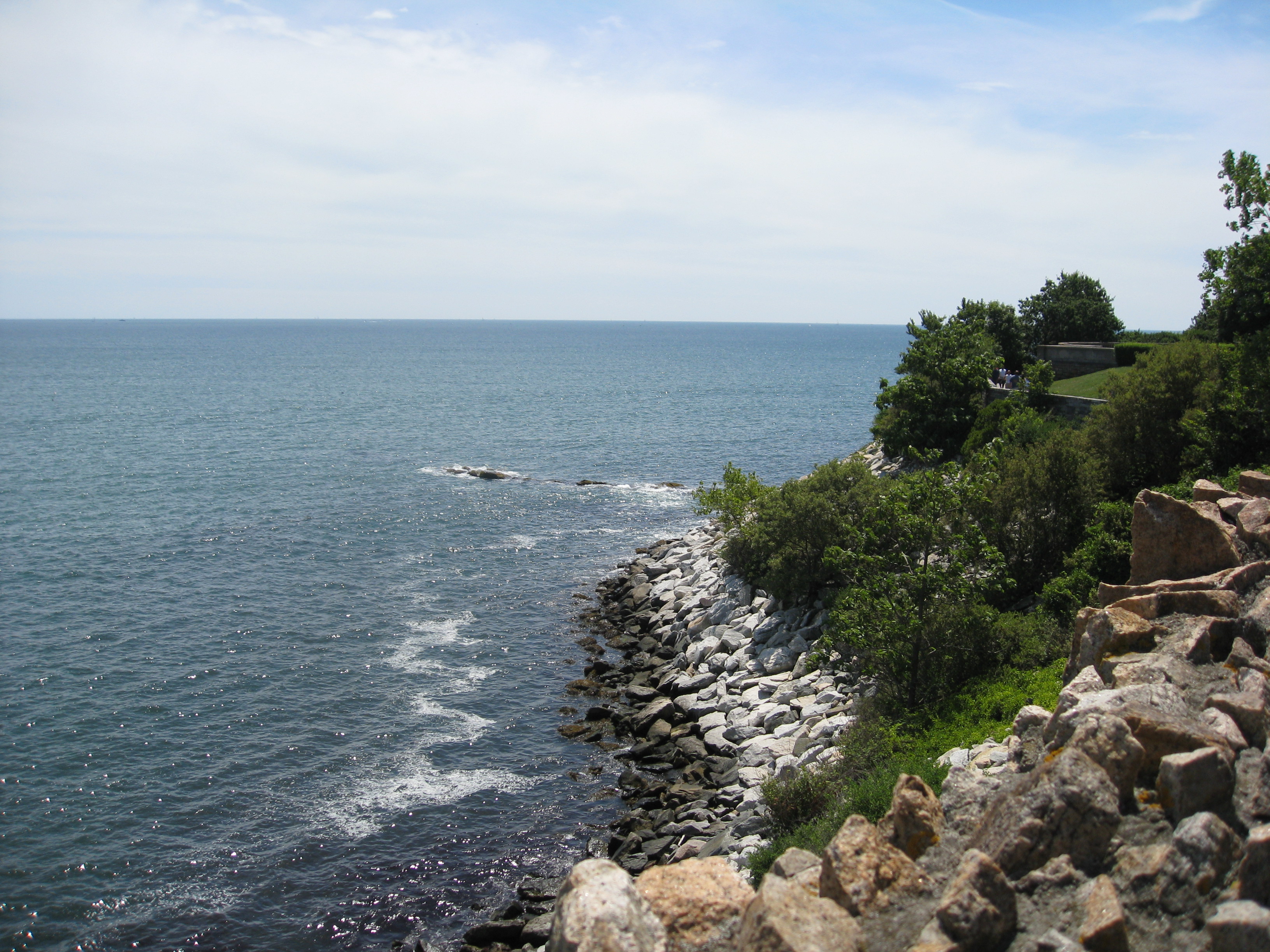
The intertidal zone, also known as the foreshore, is the area above water level at low tide and underwater at high tide (in other words, the area within the tidal range). This area can include several types of habitats with various species of life, such as seastars, sea urchins, and many species of coral with regional differences in biodiversity. Sometimes it is referred to as the ''littoral zone'' or '' seashore'', although those can be defined as a wider region. The well-known area also includes steep rocky cliffs, sandy beaches, bogs or wetlands (e.g., vast mudflats). The area can be a narrow strip, as in Pacific islands that have only a narrow tidal range, or can include many meters of shoreline where shallow beach slopes interact with high tidal excursion. The peritidal zone is similar but somewhat wider, extending from above the highest tide level to below the lowest. Organisms in the intertidal zone are adapted to an environment of harsh extremes, living in water pr ... [...More Info...] [...Related Items...] OR: [Wikipedia] [Google] [Baidu] |
Ecological Forecasting
Ecological forecasting uses knowledge of physics, ecology and physiology to predict how ecological populations, communities, or ecosystems will change in the future in response to environmental factors such as climate change. The goal of the approach is to provide natural resource managers with information to anticipate and respond to short and long-term climate conditions. Changing climate conditions present ecologists with the challenge to predict where, when and with what magnitude changes are likely to occur so that we can mitigate or at least prepare for them. Ecological forecasting applies existing knowledge of ecosystem interactions to predict how changes in environmental factors might result in changes to the ecosystems as a whole. One of the most complete sources on the topic is the book Ecological Forecasting written by Michael C. Dietze. Methods Ecologists shifted towards Bayesian methods starting 1990, when improvements in computational power allowed the use of more d ... [...More Info...] [...Related Items...] OR: [Wikipedia] [Google] [Baidu] |
University Of Kyoto
, mottoeng = Freedom of academic culture , established = , type = Public (National) , endowment = ¥ 316 billion (2.4 billion USD) , faculty = 3,480 (Teaching Staff) , administrative_staff = 3,978 (Total Staff) , students = 22,615 , president = Nagahiro Minato , city = Kyoto , state = Kyoto , country = Japan , coor = , undergrad = 13,038 , postgrad = 9,308 , campus = Urban,, , colors = Dark blue , nickname = Kyodai , mascot = None , free_label = Athletics , free = 48 varsity teams , affiliations = Kansai Big Six, ASAIHL , logo = , website www.kyoto-u.ac.jp , or , is a public research university located in Kyoto, Japan. Founded in 1897, it is one of the former Imperial Universities and the second oldest university in Japan. KyotoU is consistently ranked amongst the top two in Japan, the top ten in Asia, and the world's top fifty institutions of higher education. Founded upon the principles of its motto, “fr ... [...More Info...] [...Related Items...] OR: [Wikipedia] [Google] [Baidu] |
Biodiversity
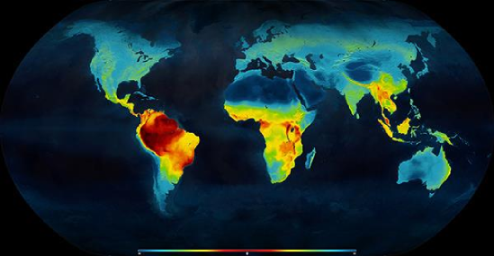
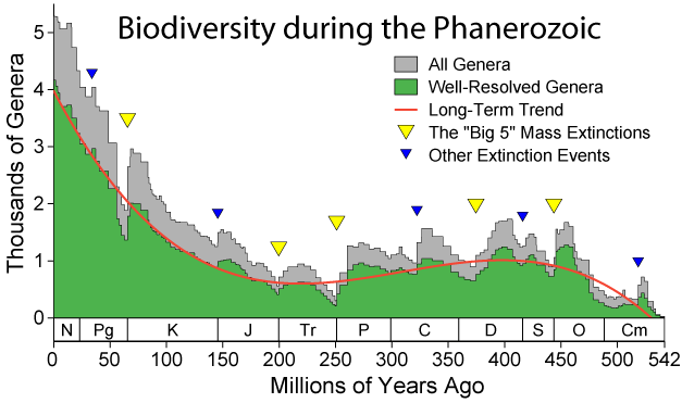
Biodiversity or biological diversity is the variety and variability of life on Earth. Biodiversity is a measure of variation at the genetic (''genetic variability''), species (''species diversity''), and ecosystem (''ecosystem diversity'') level. Biodiversity is not distributed evenly on Earth; it is usually greater in the tropics as a result of the warm climate and high primary productivity in the region near the equator. Tropical forest ecosystems cover less than 10% of earth's surface and contain about 90% of the world's species. Marine biodiversity is usually higher along coasts in the Western Pacific, where sea surface temperature is highest, and in the mid-latitudinal band in all oceans. There are latitudinal gradients in species diversity. Biodiversity generally tends to cluster in hotspots, and has been increasing through time, but will be likely to slow in the future as a primary result of deforestation. It encompasses the evolutionary, ecological, and cultural ... [...More Info...] [...Related Items...] OR: [Wikipedia] [Google] [Baidu] |
Littoral Zone
The littoral zone or nearshore is the part of a sea, lake, or river that is close to the shore. In coastal ecology, the littoral zone includes the intertidal zone extending from the high water mark (which is rarely inundated), to coastal areas that are permanently submerged — known as the ''foreshore'' — and the terms are often used interchangeably. However, the geographical meaning of ''littoral zone'' extends well beyond the intertidal zone to include all neritic waters within the bounds of continental shelves. Etymology The word ''littoral'' may be used both as a noun and as an adjective. It derives from the Latin noun ''litus, litoris'', meaning "shore". (The doubled ''t'' is a late-medieval innovation, and the word is sometimes seen in the more classical-looking spelling ''litoral''.) Description The term has no single definition. What is regarded as the full extent of the littoral zone, and the way the littoral zone is divided into subregions, varies in different c ... [...More Info...] [...Related Items...] OR: [Wikipedia] [Google] [Baidu] |
List Of Forms Of Word Play
This is a list of techniques used in word play. {{Expand list, date=August 2008 Techniques that involve the ''phonetic values'' of words * Engrish * Chinglish * Homonym: words with same sounds and same spellings but with different meanings * Homograph: words with same spellings but with different meanings * Homophone: words with same sounds but with different meanings * Homophonic translation * Mondegreen: a mishearing (usually unintentional) as a homophone or near-homophone that has as a result acquired a new meaning. The term is often used to refer specifically to mishearings of song lyrics (cf. soramimi). * Onomatopoeia: a word or a grouping of words that imitates the sound it is describing * Phonetic reversal * Rhyme: a repetition of identical or similar sounds in two or more different words ** Alliteration: matching consonants sounds at the beginning of words ** Assonance: matching vowel sounds ** Consonance: matching consonant sounds ** Holorime: a rhyme that encompasses an ... [...More Info...] [...Related Items...] OR: [Wikipedia] [Google] [Baidu] |
Ocean Biogeographic Information System
The Ocean Biodiversity Information System (OBIS), formerly Ocean Biogeographic Information System, is a web-based access point to information about the distribution and abundance of living species in the ocean. It was developed as the information management component of the ten year Census of Marine Life (CoML) (2001-2010), but is not limited to CoML-derived data, and aims to provide an integrated view of all marine biodiversity data that may be made available to it on an open access basis by respective data custodians. According to its web site as at July 2018, OBIS "is a global open-access data and information clearing-house on marine biodiversity for science, conservation and sustainable development." 8 specific objectives are listed in the OBIS site, of which the leading item is to "Provide heworld's largest scientific knowledge base on the diversity, distribution and abundance of all marine organisms in an integrated and standardized format". History and current status Initia ... [...More Info...] [...Related Items...] OR: [Wikipedia] [Google] [Baidu] |
Biodiversity
Biodiversity or biological diversity is the variety and variability of life on Earth. Biodiversity is a measure of variation at the genetic (''genetic variability''), species (''species diversity''), and ecosystem (''ecosystem diversity'') level. Biodiversity is not distributed evenly on Earth; it is usually greater in the tropics as a result of the warm climate and high primary productivity in the region near the equator. Tropical forest ecosystems cover less than 10% of earth's surface and contain about 90% of the world's species. Marine biodiversity is usually higher along coasts in the Western Pacific, where sea surface temperature is highest, and in the mid-latitudinal band in all oceans. There are latitudinal gradients in species diversity. Biodiversity generally tends to cluster in hotspots, and has been increasing through time, but will be likely to slow in the future as a primary result of deforestation. It encompasses the evolutionary, ecological, and cultural ... [...More Info...] [...Related Items...] OR: [Wikipedia] [Google] [Baidu] |
Fisheries Databases
Fishery can mean either the enterprise of raising or harvesting fish and other aquatic life; or more commonly, the site where such enterprise takes place ( a.k.a. fishing ground). Commercial fisheries include wild fisheries and fish farms, both in freshwater waterbodies (about 10% of all catch) and the oceans (about 90%). About 500 million people worldwide are economically dependent on fisheries. 171 million tonnes of fish were produced in 2016, but overfishing is an increasing problem — causing declines in some populations. Because of their economic and social importance, fisheries are governed by complex fisheries management practices and legal regimes that vary widely across countries. Historically, fisheries were treated with a " first-come, first-served " approach, but recent threats by human overfishing and environmental issues have required increased regulation of fisheries to prevent conflict and increase profitable economic activity on the fishery. Modern jurisdictio ... [...More Info...] [...Related Items...] OR: [Wikipedia] [Google] [Baidu] |
Biodiversity Databases
Biodiversity or biological diversity is the variety and variability of life on Earth. Biodiversity is a measure of variation at the genetic ('' genetic variability''), species (''species diversity''), and ecosystem ('' ecosystem diversity'') level. Biodiversity is not distributed evenly on Earth; it is usually greater in the tropics as a result of the warm climate and high primary productivity in the region near the equator. Tropical forest ecosystems cover less than 10% of earth's surface and contain about 90% of the world's species. Marine biodiversity is usually higher along coasts in the Western Pacific, where sea surface temperature is highest, and in the mid-latitudinal band in all oceans. There are latitudinal gradients in species diversity. Biodiversity generally tends to cluster in hotspots, and has been increasing through time, but will be likely to slow in the future as a primary result of deforestation. It encompasses the evolutionary, ecological, and cultural pro ... [...More Info...] [...Related Items...] OR: [Wikipedia] [Google] [Baidu] |


.jpg)


