|
NP Postcode Area
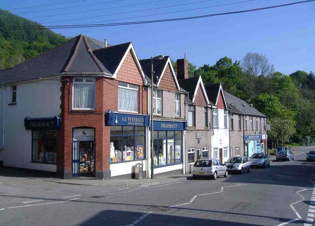
The NP postcode area, also known as the Newport postcode area,Royal Mail, ''Address Management Guide'', (2004) is a group of eighteen postcode districts, which are subdivisions of fourteen post towns. These cover south-east Wales, including Newport, Pontypool, Abergavenny, Monmouth, Chepstow, Abertillery, Usk, Tredegar, New Tredegar, Ebbw Vale, Crickhowell, Blackwood, Caldicot and Cwmbran, plus a small part of the English counties of Gloucestershire and Herefordshire. __TOC__ Coverage The approximate coverage of the postcode districts: , - ! NP4 , PONTYPOOL , Pontypool, Blaenavon, Little Mill, Griffithstown, parts of Glascoed , Torfaen, Monmouthshire , - ! NP7 , ABERGAVENNY , Abergavenny , Monmouthshire, Herefordshire, Powys , - ! NP8 , CRICKHOWELL , Crickhowell , Ffawyddog , Powys , - ! NP10 , NEWPORT , Western Newport, including Bassaleg, Duffryn, Rogerstone , Newport , - ! NP11 , NEWPORT , North-western Newport, including: Abercarn, Crumlin, Cwmfelinfach ... [...More Info...] [...Related Items...] OR: [Wikipedia] [Google] [Baidu] |
Newport, Wales
Newport ( cy, Casnewydd; ) is a city and Local government in Wales#Principal areas, county borough in Wales, situated on the River Usk close to its confluence with the Severn Estuary, northeast of Cardiff. With a population of 145,700 at the 2011 census, Newport is the third-largest authority with City status in the United Kingdom, city status in Wales, and seventh List of Welsh principal areas, most populous overall. Newport became a unitary authority in 1996 and forms part of the Cardiff-Newport metropolitan area. Newport was the site of the last large-scale armed insurrection in Great Britain, the Newport Rising of 1839. Newport has been a port since medieval times when the first Newport Castle was built by the Normans. The town outgrew the earlier Roman Britain, Roman town of Caerleon, immediately upstream and now part of the borough. Newport gained its first Municipal charter, charter in 1314. It grew significantly in the 19th century when its port became the focus of Coa ... [...More Info...] [...Related Items...] OR: [Wikipedia] [Google] [Baidu] |
Griffithstown
Griffithstown is a large suburb of Pontypool in the borough of Torfaen, Wales, within the historic boundaries of Monmouthshire. It is an ecclesiastical parish, formed in May 1898, from Llanfrechfa Upper and Panteg, and includes Sebastopol, but, under the provisions of the Local Government Act 1894, became a separate civil parish. It is situated between two other Pontypool suburbs: Pontymoile to the north and Sebastopol to the south and is within walking distance of Pontypool and Cwmbran and a short commute from Newport and Cardiff. It is named after the first station master of Pontypool and New Inn railway station (then known as Pontypool Road), Henry Griffiths. Griffiths founded a 'terminating' Building Society to finance the construction of houses in the village so that his workforce could become freehold owner-occupiers, rather than constructing rental or leasehold housing as was the more usual practice in industrial South Wales and Monmouthshire. He lived in the substantial ... [...More Info...] [...Related Items...] OR: [Wikipedia] [Google] [Baidu] |
Caerphilly (county Borough)
Caerphilly County Borough ( cy, Bwrdeistref Sirol Caerffili) is a county borough in the south-east of Wales. It is governed by Caerphilly County Borough Council. Its main and largest town is Caerphilly. Other towns in the county borough are Bedwas, Risca, Ystrad Mynach, Newbridge, Blackwood, Bargoed, New Tredegar and Rhymney. Geography Caerphilly County Borough is in southeast Wales and straddles the border between the historic counties of Glamorgan and Monmouthshire. It is bordered by Cardiff to the southwest, Newport to the southeast, Torfaen to the east, Blaenau Gwent to the northeast, Powys to the north, Merthyr Tydfil to the northwest and Rhondda Cynon Taf to the west. The northern part of the borough is formed by the broad expanse of the Rhymney Valley. The Rhymney River rises in the hills in the north and flows southwards for about thirty miles, looping round to the east just to the north of Caerphilly before reaching the Bristol Channel. Some of the larger towns ... [...More Info...] [...Related Items...] OR: [Wikipedia] [Google] [Baidu] |
Ynysddu
Ynysddu is a small village and community in the Sirhowy valley of south-east Wales. It is part of the district of Caerphilly within the historic boundaries of Monmouthshire. It lies between to Cwmfelinfach and Wyllie, north of the town of Risca and south of the market town of Blackwood. It is about 10 minutes by road from the M4 motorway and 20 minutes from the Second Severn Crossing. The population in 2008 was 2,905, increasing to 3,948 at the 2011 Census. The community includes the settlements of Cwmfelinfach, Wyllie and Wattsville. History Ynysddu was founded in the early 19th century by the enlightened local colliery owner John Hodder Moggridge, who lived at nearby Woodfield Park. It got its name from Ynsyddu Farm, which was built by Moggridge in 1804. Ynysddu comes from the Welsh descriptive words 'Ynys' ('island' or 'river meadow') and 'ddu' ('black'). 'Black river meadow' is appropriate for the landscape of the area. After he became alarmed at the terrible livin ... [...More Info...] [...Related Items...] OR: [Wikipedia] [Google] [Baidu] |
Risca
Risca ( cy, Rhisga) is a town in the Caerphilly County Borough and the historic boundaries of Monmouthshire in south-east Wales. Risca has a railway station, opened on the Ebbw Valley Railway in February 2008, after a gap of 46 years. It is split into two communities; Risca East and Risca West. It has a population of 11,700. The town is now part of the Cardiff Capital Region which has a combined population of 1,543,293. Cardiff the capital of Wales can be reached in under 28 minutes from the nearby railway station of Risca and Pontymister station which reopened in 2008 after a gap of nearly 60 years. The town lies at the south-eastern edge of the South Wales Coalfield and the town has been shaped by mining, together with other heavy industries, for many centuries. Risca is home to Ty-Sign, which is a large housing estate built in the early 1960s as a satellite village for the then new Llanwern steelworks. Risca has a rural aspect and is surrounded to the east and west by sever ... [...More Info...] [...Related Items...] OR: [Wikipedia] [Google] [Baidu] |
Cwmfelinfach
Cwmfelinfach is a small village located in the Sirhowy valley of south-east Wales. It is part of the district of Caerphilly within the historic boundaries of Monmouthshire. It is located north of Wattsville, about 5 miles north of the nearest town Risca, and south of Blackwood. To the east the valley is bordered by the hills of Pen-y-Trwyn (1,028 ft / 313 m). To the west is Mynydd y Grug (1,132 ft / 345 m). Cwmfelinfach can be translated from Welsh as "''valley of the little mill''". History The village was a small hamlet until the late 19th century; the majority of housing is therefore traditional terraced housing from the early 20th century. A map of 1885 showns the Melin (mill) and the Welsh Calvinistic Methodist chapel, Capel y Babell. The grave of William Thomas (Islwyn), a 19th-century poet in the Welsh language, can be found here. Cwmfelinfach was home to a coal mining community during the early to mid 20th century. The colliery, known as " Nine Mile Poi ... [...More Info...] [...Related Items...] OR: [Wikipedia] [Google] [Baidu] |
Crumlin, Caerphilly
Crumlin ( cy, Crymlyn) is a town, community, and an electoral ward in Caerphilly county borough in South Wales, situated in the Ebbw River valley, five miles west of Pontypool, within the historic boundaries of Monmouthshire. History Kelly's Directory of South Wales (1895), noted that Crumlin "was a secluded village, scarcely known to any beyond the few persons resident there". It was considered to be one of the most picturesque spots in the county, surrounded by natural features of "unsurpassed loveliness". The name is said to be derived from Cromlech (see Dolmen), "a designation given to Druidical monuments". The village sits in the South Wales Coalfield and in the neighbouring quarries are often found fine fossils of calamites and lepidodendron; and, in the shale outcrops, fossil ferns and other cryptogamic plants. Crumlin Viaduct Crumlin is famous for its former railway viaduct. Opened in June 1857 for the Taff Vale Extension to the Newport, Abergavenny and Hereford ... [...More Info...] [...Related Items...] OR: [Wikipedia] [Google] [Baidu] |
Abercarn
Abercarn is a small town and community in Caerphilly county borough, Wales. It is 10 miles (16 km) northwest of Newport on the A467 between Cwmcarn and Newbridge, within the historic boundaries of Monmouthshire. History An estate at Abercarn was owned by the ironmaster Richard Crawshay; in 1808, it passed to his son-in-law, the industrialist and politician Benjamin Hall. The district was traditionally associated with the coal mining collieries, ironworks and tinplate works of the South Wales coalfield and South Wales Valleys, although all have now the town, which lies in the middle portion of the Ebbw valley, being situated on the south-eastern flank of the once great mining region of Glamorgan and Monmouthshire. On 11 September 1878, an underground explosion at the Prince of Wales Colliery killed 268 coal miners. Local government The area was part of the ancient Monmouthshire parish of Mynyddislwyn until the late 19th century. In 1892 a local board of he ... [...More Info...] [...Related Items...] OR: [Wikipedia] [Google] [Baidu] |
Rogerstone
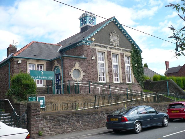
Rogerstone ( cy, Tŷ du, meaning "Black house") is a large village and community (parish) in Newport, Wales. The area is governed by Newport City Council. The village falls within the ancient parish of Bassaleg and historic county of Monmouthshire. The parish lies at the gateway to the Sirhowy valley, to the north of Newport on the eastern side of the Ebbw River. It is bounded by the M4 motorway to the south, the Ebbw River to the west, the Henllys Vale to the east and the city boundary with Caerphilly county borough to the north. Rogerstone railway station is on the Ebbw Valley Railway. It opened on 6 February 2008 and links Ebbw Vale to and via Rogerstone. Pye Corner railway station, to the south of the ward and on the same line, was opened on 14 December 2014. History The original settlement dates back to Norman times when Rogerstone Castle was built in the early part of the 12th century. The name is said to originate from Roger de Haia, the Norman Lord who was respons ... [...More Info...] [...Related Items...] OR: [Wikipedia] [Google] [Baidu] |
Duffryn
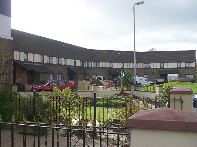
Duffryn ( cy, Dyffryn) is a large housing estatebr>in the southwest of the city of Newport, Wales, Newport, south Wales comprising a large portion of the Tredegar Park electoral district (ward). Built on land belonging to Tredegar Housebr> it was completed in 1978 and at the time won several awards for its design. The layout of the estate, as viewed from above, is that of large terraces undulating around a central wooded area. Originally a Council Estate, Duffryn is now a mix of private ownership and Newport City Homes RSL (Registered Social Landlord) properties. The design of the estate is the result of a council competition. It was won by a consortium committed to the theories of planning devised in the architecture department of Cambridge University in the 1960s. The District Amenities Centre that was planned for the south-west corner of the 96-acre site was never built, so the plan of a largely self-sufficient community was not realised. Despite the relative recent develop ... [...More Info...] [...Related Items...] OR: [Wikipedia] [Google] [Baidu] |
Bassaleg
Bassaleg ( cy, Basaleg) is a suburb on the west side of Newport, Wales. It is in the Graig electoral ward and community.Bassaleg is located two miles northwest of Newport city centre. Bassaleg is bounded by the A467 road (A4072) to the east, the railway spur to Lower Machen (the former Brecon and Merthyr Railway) to the north, the St Mellons Road (B4288) to the south and Rhiwderin to the east. The Ebbw River runs through the area. The A468 road passes through towards Caerphilly and junction 28 of the M4 motorway is less than a mile to the south. St Basil's Church The parish church of St. Basil's is a Grade II* listed building. It has been suggested that site of the church was originally dedicated to Saint Gwladys. Historians have suggested that Bassaleg is the only British place whose name derives from the word ''basilica'', a term used in early Christianity for a church containing the body of a saint. Until the mid-19th century, a grave chapel for St. Gwladys survived clos ... [...More Info...] [...Related Items...] OR: [Wikipedia] [Google] [Baidu] |
Powys
Powys (; ) is a Local government in Wales#Principal areas, county and Preserved counties of Wales, preserved county in Wales. It is named after the Kingdom of Powys which was a Welsh succession of states, successor state, petty kingdom and principality that emerged during the Middle Ages following the end of Roman rule in Britain. Geography Powys covers the historic counties of Montgomeryshire and Radnorshire, most of Brecknockshire, and part of Denbighshire (historic), historic Denbighshire. With an area of about , it is now the largest administrative area in Wales by land and area (Dyfed was until 1996 before several Preserved counties of Wales, former counties created by the Local Government Act 1972 were abolished). It is bounded to the north by Gwynedd, Denbighshire and Wrexham County Borough; to the west by Ceredigion and Carmarthenshire; to the east by Shropshire and Herefordshire; and to the south by Rhondda Cynon Taf, Merthyr Tydfil County Borough, Caerphilly County Bor ... [...More Info...] [...Related Items...] OR: [Wikipedia] [Google] [Baidu] |


.jpg)


