|
NAVTEX
NAVTEX (NAVigational TEleX), sometimes styled Navtex or NavTex, is an international automated medium frequency direct-printing service for delivery of navigational and meteorological warnings and forecasts, as well as urgent maritime safety information (MSI) to ships. NAVTEX was developed in the late 1970s in northwestern Europe to provide a low-cost, simple, and automated means of receiving this information aboard ships at sea within approximately off-shore. There are no user fees associated with receiving NAVTEX broadcasts, as the transmissions are typically transmitted from the National Weather Authority (Italy) or Navy or Coast Guard (as in the US) or national navigation authority (Canada). Where the messages contain weather forecasts, an abbreviated format very similar to the shipping forecast is used. NAVTEX is a component of the International Maritime Organization/International Hydrographic Organization Worldwide Navigation Warning Service (WWNWS). NAVTEX is also a m ... [...More Info...] [...Related Items...] OR: [Wikipedia] [Google] [Baidu] |
Global Maritime Distress And Safety System
The Global Maritime Distress and Safety System (GMDSS) is a worldwide system for automated emergency signal communication for ships at sea developed by the United Nations' International Maritime Organization (IMO) as part of the SOLAS Convention. It is a set of safety procedures, types of equipment, and communication protocols used for safety and rescue operations of the distressed ships, boats, and aircraft. It is supplemental to the International Convention on Maritime Search and Rescue (ICMSaR) adopted in 1979 and provides basis for the communication. GMDSS consists of several systems which are intended to perform the following functions: alerting (including position determination of the ship in distress) ships in the vicinity and ashore authorities, search and rescue coordination, locating (homing), maritime safety information broadcasts, general communications, and bridge-to-bridge communications. Specific radio carriage requirements depend upon the ship's area of operati ... [...More Info...] [...Related Items...] OR: [Wikipedia] [Google] [Baidu] |
List Of Navtex Stations
NAVTEX (navigation telex) is an international service that provides navigational and meteorological warnings and forecasts. This list identifies some Navtex stations. Stations A list of Navtex stations. Please improve this list by determining the exact location of the transmission antenna! Station broadcast ranges are in nautical miles. Navarea 1 – North Atlantic, North Sea, Baltic Sea 518 kHz (international) 490 kHz (national) Navarea 2 – East Atlantic 518 kHz (international) 490 kHz (national) Navarea 3 – Mediterranean Sea 518 kHz (international) 490 kHz (national) Navarea 4 – West Atlantic 518 kHz (international) 490 kHz (national) Navarea 5 – Brasil No NAVTEX stations available. Brazil distributes its messages via Inmarsat-C. Navarea 6 – Argentina, Uruguay 518 kHz (international) 490 kHz (national) Navarea 7 – South Africa 518 kHz (international) ... [...More Info...] [...Related Items...] OR: [Wikipedia] [Google] [Baidu] |
SITOR
SITOR (SImplex Teletype Over Radio) is a system for transmitting text messages. It was developed in the 1960s by Koninklijke TNT Post as an improvement over radioteletype (RTTY). Although it uses the same frequency-shift keying (FSK) modulation used by regular RTTY, SITOR uses error detection, redundancy, and/or retransmission to improve reliability. There are two SITOR modes: * SITOR-A is used for point to point links. SITOR-A uses automatic repeat request (ARQ) to gain reliability. If the receiver detects an error, it requests a retransmission. * SITOR-B is used for broadcast links. SITOR-B transmits each character in a message twice to gain reliability. If the receiver detects an error in the first character, it uses the copy. If both characters are garbled, the receiver won't know what was sent. * SITOR-B by definition uses forward error correction (FEC), versus ARQ for SITOR-A. SITOR sends 7-bit characters as a bit stream at 100 baud (which, in this case, is 100 bits per se ... [...More Info...] [...Related Items...] OR: [Wikipedia] [Google] [Baidu] |
National Weather Service
The National Weather Service (NWS) is an Government agency, agency of the Federal government of the United States, United States federal government that is tasked with providing weather forecasts, warnings of hazardous weather, and other weather-related products to organizations and the public for the purposes of protection, safety, and general information. It is a part of the National Oceanic and Atmospheric Administration (NOAA) branch of the United States Department of Commerce, Department of Commerce, and is headquartered in Silver Spring, Maryland, within the Washington metropolitan area. The agency was known as the United States Weather Bureau from 1891 until it adopted its current name in 1970. The NWS performs its primary task through a collection of national and regional centers, and 122 local List of National Weather Service Weather Forecast Offices, Weather Forecast Offices (WFOs). As the NWS is an agency of the U.S. federal government, most of its products are in the ... [...More Info...] [...Related Items...] OR: [Wikipedia] [Google] [Baidu] |
Radiofax
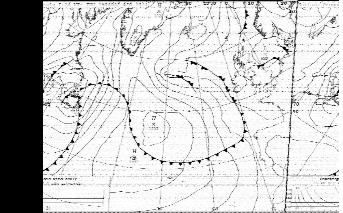
Radiofacsimile, radiofax or HF fax is an analogue mode for transmitting grayscale images via high frequency (HF) radio waves. It was the predecessor to slow-scan television (SSTV). It was the primary method of sending photographs from remote sites (especially islands) from the 1930s to the early 1970s. It is still in limited use for transmitting weather charts and information to ships at sea. History Richard H. Ranger, an electrical engineer working at Radio Corporation of America (RCA), invented a method for sending photographs through radio transmissions. He called his system the wireless photoradiogram, in contrast to the fifty-year-old telefacsimile devices which used first telegraphic wires, and then later was adapted to use the newer telephone wires. On 29 November 1924, Ranger's system was used to send a photograph from New York City to London. It was an image of President Calvin Coolidge and was the first transoceanic radio transmission of a photograph. Also that yea ... [...More Info...] [...Related Items...] OR: [Wikipedia] [Google] [Baidu] |
Fldigi
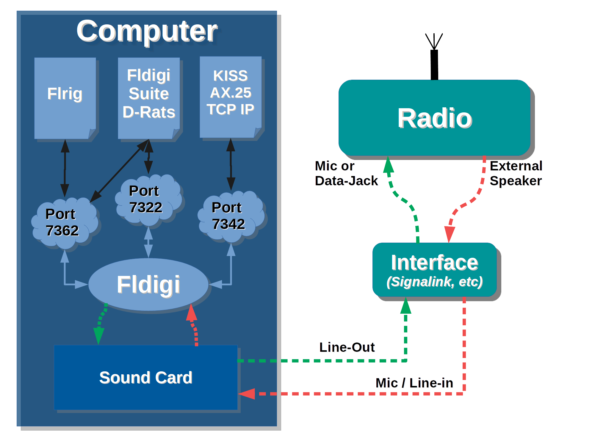
Fldigi (short for Fast light digital) is a free and open-source program which allows an ordinary computer's sound card to be used as a simple two-way data modem. The software is mostly used by amateur radio operators who connect the microphone and headphone connections of an amateur radio SSB or FM transceiver to the computer's headphone and microphone connections, respectively. This interconnection creates a "sound card defined radio" whose available bandwidth is limited by the sound card's sample rate and the external radio's bandwidth. Such communications are normally done on the shortwave amateur radio bands in modes such as PSK31, MFSK, RTTY, Olivia, and CW (Morse code). Increasingly, the software is also being used for data on VHF and UHF frequencies using faster modes such as 8-PSK. Using this software, it is possible for amateur radio operators to communicate worldwide while using only a few watts of RF power. Fldigi software is also used for amateur radio eme ... [...More Info...] [...Related Items...] OR: [Wikipedia] [Google] [Baidu] |
Worldwide Navigation Warning Service
The World-Wide Navigational Warning Service (WWNWS) is a radio system set up by the International Hydrographic Organization (IHO) which provides hazard warnings to maritime shipping. Upon the onset of a meteorological or geological disaster that would pose a danger to shipping lanes, warnings are issued within affected NAVAREAs (designated navigational areas in the WWNWS) by the state responsible for that area. History Historically, navigational warnings were sometimes issued by individual states. Where they were issued, they were often limited to national waters, and there was no standard language or standard method of coordination between states. The sinking of the in the English Channel on 12 January 1971 prompted discussion on a better system to warn ships of navigational hazards. A 1972 conference of the International Hydrographic Organization (IHO) produced a recommendation to produce a "global radio navigational warning service". A joint body was set up by the IHO and th ... [...More Info...] [...Related Items...] OR: [Wikipedia] [Google] [Baidu] |
GLONASS
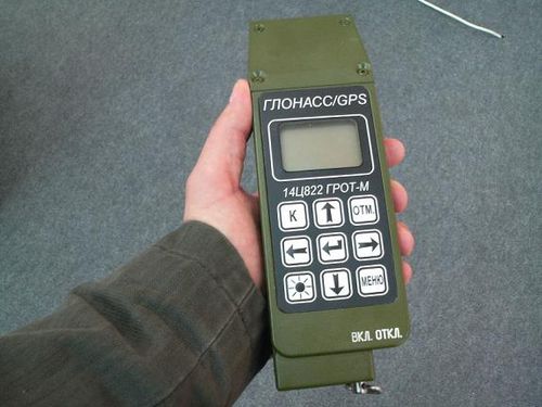
GLONASS (, ; ) is a Russian satellite navigation system operating as part of a radionavigation-satellite service. It provides an alternative to Global Positioning System (GPS) and is the second navigational system in operation with global coverage and of comparable precision. Satellite navigation devices supporting both GPS and GLONASS have more satellites available, meaning positions can be fixed more quickly and accurately, especially in built-up areas where buildings may obscure the view to some satellites. Owing to its higher orbital inclination, GLONASS supplementation of GPS systems also improves positioning in high latitudes (near the poles). Development of GLONASS began in the Soviet Union in 1976. Beginning on 12 October 1982, numerous rocket launches added satellites to the system until the completion of the Satellite constellation, constellation in 1995. In 2001, after a decline in capacity during the late 1990s, the restoration of the system was made a government p ... [...More Info...] [...Related Items...] OR: [Wikipedia] [Google] [Baidu] |


