|
N3 Road (Gabon)
The N3 road is one of the national highways of Gabon. It connects to the east of the country along the centre. Towns located along the highway include: * Alembe * Kazamabika * Lastoursville * Moanda *Franceville Franceville is one of the four largest cities in Gabon, with a population of 110,568 at the 2013 census. It lies on the Mpassa River and at the end of the Trans-Gabon Railway and the N3 road. It grew from a village named Masuku when Pierre Savor ... National highways in Gabon {{Africa-road-stub ... [...More Info...] [...Related Items...] OR: [Wikipedia] [Google] [Baidu] |
Gabon
Gabon (; ; snq, Ngabu), officially the Gabonese Republic (french: République gabonaise), is a country on the west coast of Central Africa. Located on the equator, it is bordered by Equatorial Guinea to the northwest, Cameroon to the north, the Republic of the Congo on the east and south, and the Gulf of Guinea to the west. It has an area of nearly and its population is estimated at million people. There are coastal plains, mountains (the Cristal Mountains and the Chaillu Massif in the centre), and a savanna in the east. Since its independence from France in 1960, the sovereign state of Gabon has had three presidents. In the 1990s, it introduced a multi-party system and a democratic constitution that aimed for a more transparent electoral process and reformed some governmental institutions. With petroleum and foreign private investment, it has the fourth highest HDI in the region (after Mauritius, Seychelles and South Africa) and the fifth highest GDP per capita ( ... [...More Info...] [...Related Items...] OR: [Wikipedia] [Google] [Baidu] |
Alembe
Alembe is a small town in western Gabon. Transport It is served by a station of the Trans-Gabon Railway. See also * Transport in Gabon Modes of transport in Gabon include rail, road, water, and air. The one rail link, the Trans-Gabon Railway, connects the port of Owendo with the inland town of Franceville. Most but not all of the country is connected to the road network, much of w ... References Populated places in Moyen-Ogooué Province {{Gabon-geo-stub ... [...More Info...] [...Related Items...] OR: [Wikipedia] [Google] [Baidu] |
Lastoursville
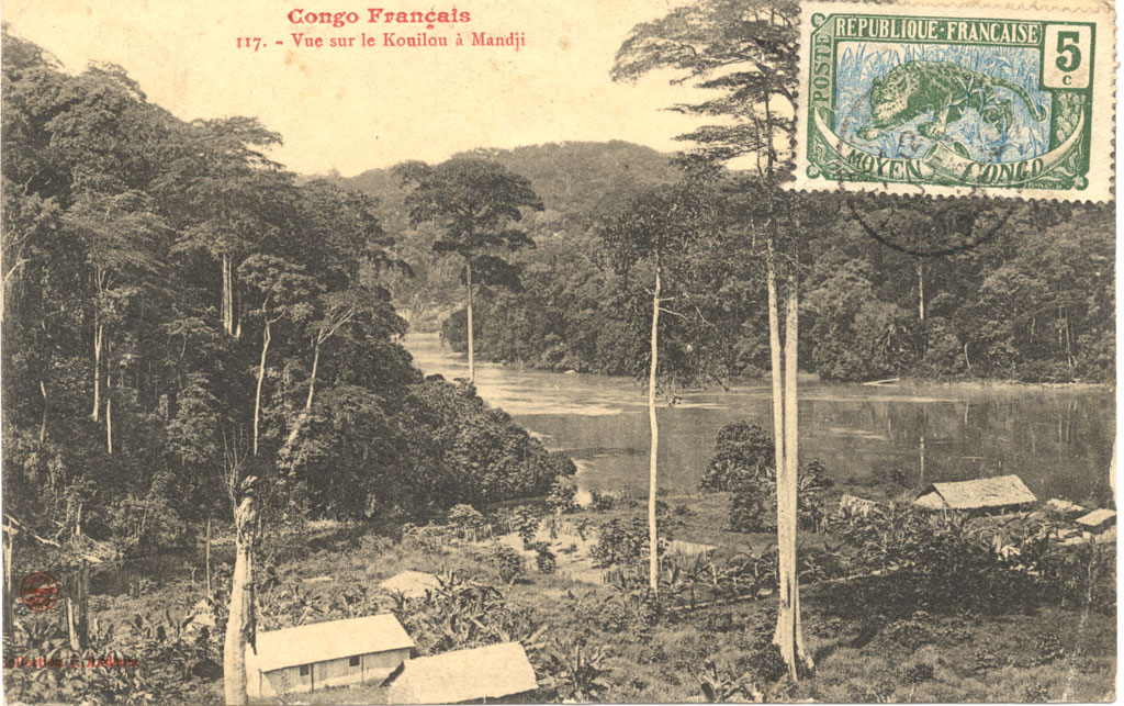
Lastoursville or Mandji is a city in east-central Gabon, lying on the Ogooué River, the Trans-Gabon Railway and the N3 road. It was founded as a slave depot named ''Mandji'', renamed ''Maadiville'' in 1883 and finally took its current name for François Rigail de Lastours in 1886. It grew around palm oil production and as an administrative centre, and soon became a major missionary centre. The town is also known for its caves. The town lies at an elevation of 206 m. Caves Occupying a 90-sq-km site, there are more than 40 caves identified, located in dense primary rainforest close to town. Traces of human activity dates back 7000 years, when the caves were used in rituals. World Heritage Status The caves were added to the UNESCO World Heritage A World Heritage Site is a landmark or area with legal protection by an international convention administered by the United Nations Educational, Scientific and Cultural Organization (UNESCO). World Heritage Sites ar ... [...More Info...] [...Related Items...] OR: [Wikipedia] [Google] [Baidu] |
Moanda
Moanda is one of the largest towns in Gabon, lying on the N3 road in Haut Ogooué. It is also one of the most important manganese mining towns in the world, under the auspices of the ''Compagnie Minière de l'Ogooué'' (COMILOG), which began mining in 1957. Moanda has a population of around 39,298 inhabitants (2010 est.) and is the second largest city in the Haut Ogooué Region, after Franceville. It is also a border town, lying 100 km away from the border with the Republic of Congo. History Moanda was originally a village lying on the swampy banks of the Miosso River. The discovery and exploitation of manganese in the nearby Bangombe Plateau from 1953 led to the emergence of the city. In 1977 Moanda had an estimated 230 million tons of manganese, some one-fifth of the world's deposits. In 1959, the 75 km COMILOG Cableway to the railway at Mbinda in the Republic of Congo was constructed to export the manganese, but it was eventually closed in 1986 when the Tra ... [...More Info...] [...Related Items...] OR: [Wikipedia] [Google] [Baidu] |
Franceville
Franceville is one of the four largest cities in Gabon, with a population of 110,568 at the 2013 census. It lies on the Mpassa River and at the end of the Trans-Gabon Railway and the N3 road. It grew from a village named Masuku when Pierre Savorgnan de Brazza chose it to resettle former slaves and renamed it Francheville (meaning "city of the freed") in 1880. The city later came to be called Franceville (meaning "French city"). Overview Brazza founded Franceville on June 13, 1880. The former name was Masuku. As time went on, it became known as Franceville. Features of the town include St Hilaire's Church (built in 1899), a large statue of President Omar Bongo (who was born in Franceville), a primate medical research institute, and a golf course. Its airport is west, in Mvengué. Bongo was buried in Franceville on June 18, 2009. There is a market where numerous items can be purchased, including clothing, fruit and vegetables, electronics, meats, and the market also sells ... [...More Info...] [...Related Items...] OR: [Wikipedia] [Google] [Baidu] |

