|
N'Guigmi
N'guigmi is a city and Commune of fifteen thousand in the easternmost part of Niger, very near to Lake Chad – lying on its shore until the lake retreated. It is a crossroads for the traditional camel caravans of the Toureg and for traders plying North and South across the Sahara. Overview N'guigmi is a military centre for the region, a centre for the salt trade from Kaourar and is the last stop on the road to Chad. It is "the end of the road" and marks the end of the paved section of the Nigerien ''Route Nationale 1'', although the sections past Diffa are notorious for their poor condition. Two unpaved highways or caravan routes connect to N'guigmi from the north, providing the main road route between Chad and Niger, and one of two land routes to the Kaourar Oasis town of Bilma. The town lies at the mouth of the Dilia Bosso, an ancient river valley and seasonal wash that runs from the Termit Massif over 200 km to the northwest to what was the shore of Lake Chad as ... [...More Info...] [...Related Items...] OR: [Wikipedia] [Google] [Baidu] |
Regions Of Niger
Niger is divided into eight regions (French: ''régions;'' singular''région)'', each of which is named after its capital. Current regions *Additionally, the national capital, Niamey, comprises a special capital district. Current administrative structure Each of Niger's regions are subdivided into departments and communes. As of 2005, there were 36 ''départements'', divided into 265 communes, 122 cantons and 81 ''groupements''. The latter two categories cover all areas not covered by urban communes (population over 10000) or rural communes (total population 13 million), and are governed by the department, whereas communes have had elected councils and mayors since 1999. Additional semi-autonomous subdivisions include sultanates, provinces and tributaries (''tribus''). The Nigerien government estimates there are an additional 17000 villages administered by rural communes, while there are a number of ''quartiers'' (boroughs or neighborhoods) administered by urban communes. R ... [...More Info...] [...Related Items...] OR: [Wikipedia] [Google] [Baidu] |
Niger
) , official_languages = , languages_type = National languagesRépublique du Niger, "Loi n° 2001-037 du 31 décembre 2001 fixant les modalités de promotion et de développement des langues nationales." L'aménagement linguistique dans le monde (accessed 21 September 2016) , languages = , religion_ref = , religion_year = 2012 , religion = , demonym = Nigerien , capital = , coordinates ... [...More Info...] [...Related Items...] OR: [Wikipedia] [Google] [Baidu] |
Toubou People
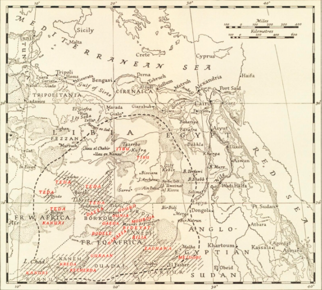
The Toubou or Tubu (from Old Tebu, meaning "rock people") are an ethnic group native to the Tibesti Mountains that inhabit the central Sahara in northern Chad, southern Libya and northeastern Niger. They live either as herders and nomads or as farmers near oases. Their society is clan-based, with each clan having certain oases, pastures and wells. The Toubou are generally divided into two closely related groups: the Teda (or Téda, Toda) and the Dazagara (or Dazzaga, Dazagada, Daza). They are believed to share a common origin and speak the Tebu languages, which are from the Saharan branch of the Nilo-Saharan language family. Tebu is divided further into two closely related languages, called ''Tedaga'' (Téda Toubou) and ''Dazaga'' (Dazaga Gouran). Of the two groups, the Daza, found to the south of the Teda, are more numerous. The Toubou people are also referred to as the Tabu, Tebu, Tebou, Tibu, Tibbu, Toda, Todga, Todaga, Tubu, Tuda, Tudaga, or Gorane people. The Dazaga are ... [...More Info...] [...Related Items...] OR: [Wikipedia] [Google] [Baidu] |
Fulani
The Fula, Fulani, or Fulɓe people ( ff, Fulɓe, ; french: Peul, links=no; ha, Fulani or Hilani; pt, Fula, links=no; wo, Pël; bm, Fulaw) are one of the largest ethnic groups in the Sahel and West Africa, widely dispersed across the region. Inhabiting many countries, they live mainly in West Africa and northern parts of Central Africa, South Sudan, Darfur, and regions near the Red Sea coast in Sudan. The approximate number of Fula people is unknown due to clashing definitions regarding Fula ethnicity. Various estimates put the figure between 25 and 40 million people worldwide. A significant proportion of the Fula – a third, or an estimated 12 to 13 million – are pastoralists, and their ethnic group has the largest nomadic pastoral community in the world., Quote: The Fulani form the largest pastoral nomadic group in the world. The Bororo'en are noted for the size of their cattle herds. In addition to fully nomadic groups, however, there are also semisedentary Fulani —F ... [...More Info...] [...Related Items...] OR: [Wikipedia] [Google] [Baidu] |
Wodaabe
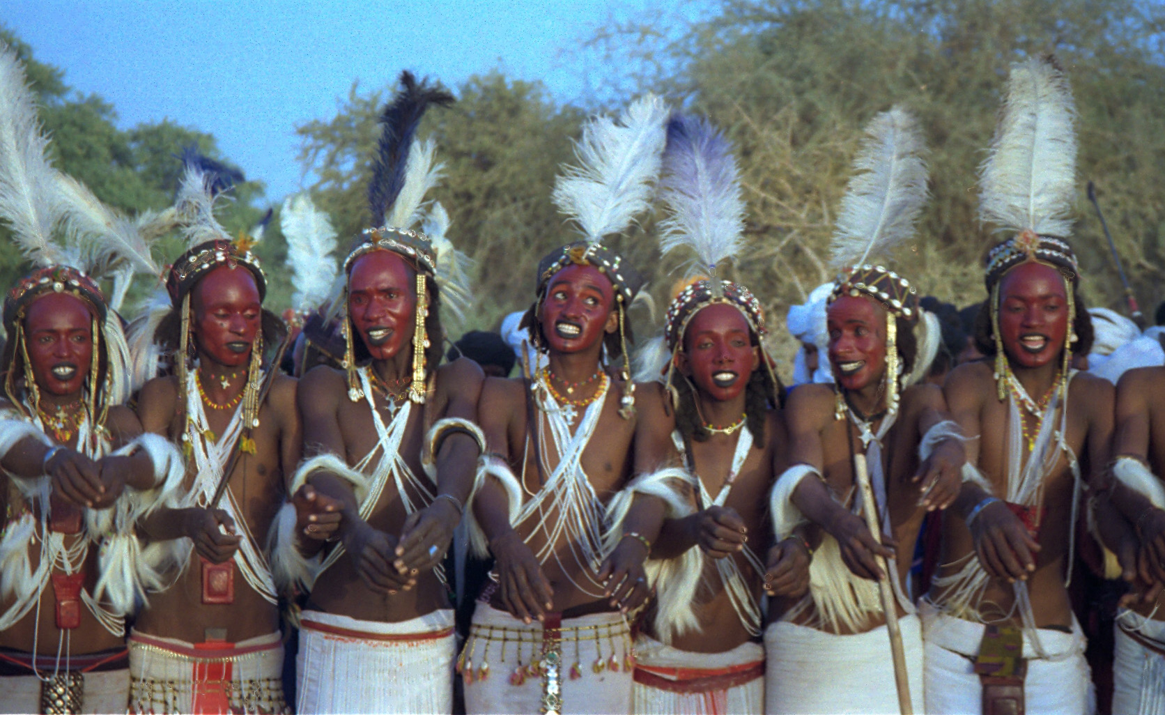
The Wodaabe ( ff, Woɗaaɓe, Adlam: ), also known as the Mbororo or Bororo (Adlam: , ), or Pullo, have a name that is designated to those of the Fula ethnic group who are traditionally nomadic and considered to be "ignorant of Islam." For this reason, ''Mbororo'' is normally used as a derogatory term by other Fulani groups against the Wodaabe. It is translated into English as "Cattle Fulani", and meaning "those who dwell in cattle camps". The Wodaabe culture is one of the 186 cultures of the standard cross-cultural sample used by anthropologists to compare cultural traits. A Wodaabe woman, Hindou Oumarou Ibrahim, was also chosen to represent civil society of the world on the signing of Paris Protocol on 22 April 2016. History The Wodaabe are cattle-herders and traders in the Sahel, with migrations stretching from southern Niger, through northern Nigeria, northeastern Cameroon, southwestern Chad, western region of the Central African Republic and the northeastern of the Democr ... [...More Info...] [...Related Items...] OR: [Wikipedia] [Google] [Baidu] |
Kanuri People
The Kanuri people (Kanouri, Kanowri, also Yerwa, Baribari and several subgroup names) are an List of ethnic groups of Africa, African ethnic group living largely in the lands of the former Kanem Empire, Kanem and Bornu Empires in Niger, Nigeria, Sudan, Libya and Cameroon. Those generally termed Kanuri include several subgroups and dialect groups, some of whom identify as distinct from the Kanuri. Most trace their origins to ruling lineages of the medieval Kanem-Bornu Empire, and its client states or provinces. In contrast to the neighboring Toubou people, Toubou or Zaghawa people, Zaghawa pastoralists, Kanuri groups have traditionally been sedentary, engaging in farming, fishing the Chad Basin, and engaged in trade and salt processing. Background Kanuri peoples include several subgroups, and identify by different names in some regions. The Kanuri language was the major language of the Bornu Empire and remains a major language in southeastern Niger, northeastern Nigeria and north ... [...More Info...] [...Related Items...] OR: [Wikipedia] [Google] [Baidu] |
Department Of N'guigmi
N'guigmi is a department of the Diffa Region in Niger. Its capital lies at the city of N'guigmi N'guigmi is a city and Commune of fifteen thousand in the easternmost part of Niger, very near to Lake Chad – lying on its shore until the lake retreated. It is a crossroads for the traditional camel caravans of the Toureg and for traders p .... As of 2011, the department had a total population of 77,748 people. References Departments of Niger Diffa Region {{Niger-geo-stub ... [...More Info...] [...Related Items...] OR: [Wikipedia] [Google] [Baidu] |
Sahel Drought
The Sahel region of Africa has long experienced a series of historic droughts, dating back to at least the 17th century. The Sahel region is a climate zone sandwiched between the Sudanian Savanna to the south and the Sahara desert to the north, across West and Central Africa. While the frequency of drought in the region is thought to have increased from the end of the 19th century, three long droughts have had dramatic environmental and societal effects upon the Sahel nations. Famine followed severe droughts in the 1910s, the 1940s, and the 1960s, 1970s and 1980s, although a partial recovery occurred from 1975-80. The most recent drought occurred in 2012. While at least one particularly severe drought has been confirmed each century since the 17th century, the frequency and severity of recent Sahelian droughts stands out. Famine and dislocation on a massive scale—from 1968 to 1974 and again in the early and mid-1980s—was blamed on two spikes in the severity of the 1960-1980 ... [...More Info...] [...Related Items...] OR: [Wikipedia] [Google] [Baidu] |
Beri-beri
Thiamine deficiency is a medical condition of low levels of thiamine (Vitamin B1). A severe and chronic form is known as beriberi. The two main types in adults are wet beriberi and dry beriberi. Wet beriberi affects the cardiovascular system, resulting in a fast heart rate, shortness of breath, and leg swelling. Dry beriberi affects the nervous system, resulting in numbness of the hands and feet, confusion, trouble moving the legs, and pain. A form with loss of appetite and constipation may also occur. Another type, acute beriberi, found mostly in babies, presents with loss of appetite, vomiting, lactic acidosis, changes in heart rate, and enlargement of the heart. Risk factors include a diet of mostly white rice, alcoholism, dialysis, chronic diarrhea, and taking high doses of diuretics. In rare cases, it may be due to a genetic condition that results in difficulties absorbing thiamine found in food. Wernicke encephalopathy and Korsakoff syndrome are forms of dry beriberi. ... [...More Info...] [...Related Items...] OR: [Wikipedia] [Google] [Baidu] |
Termit Massif
The Termit Massif (Termit Mountains or simply the Termit) is a mountainous region in southeastern Niger. Just to the south of the dunes of Tenere desert and the Erg of Bilma, the northern areas of the Termit, called the Gossololom consists of black volcanic peaks which jut from surrounding sand seas. The southern Termit is a roughly east–west range of heavily eroded black sandstone. Its foothills on the south west are the Koutous hills. Human settlement The small population of the Termit is mostly nomadic, with Toubou settlements in the north and east, and more Tuareg and Diffa Arabs to the west. Covering much of the north of the Zinder and Diffa Regions, there are few permanent settlements or all weather roads in the area. Communities within the region include Termit Kaoboul in the south centre and Kandil Bouzou in the southeast. Neighbouring settlements include Tasker, Abourak and Haltouma to the southwest; Béla Hardé to the southeast, and Koussa Arma, Oyou Beze ... [...More Info...] [...Related Items...] OR: [Wikipedia] [Google] [Baidu] |
Bilma
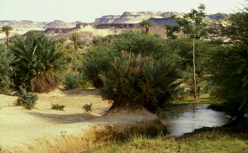
Bilma is an oasis town and commune in north east Niger with, as of the 2012 census, a total population of 4,016 people. It lies protected from the desert dunes under the Kaouar Cliffs and is the largest town along the Kaouar escarpment. It is known for its gardens, for salt and natron production through evaporation ponds, date cultivation, and as the destination of one of the last Saharan caravan routes (the Azalai, from Agadez). Population Its population is mostly Kanuri, with smaller Toubou, Tuareg, and Hausa populations, the last being a reminder of Bilma's role as a key stop in the Trans Saharan trade. Administration and economy Bilma is the administrative seat of the Bilma Department, covering some of north eastern Niger. While it continues to produce salt in large ''natron'' salt pans, and this salt is still sold for livestock use throughout west Africa, tourism (based out of Agadez and the Aïr Mountains some to the west) is of growing importance. Climate Bil ... [...More Info...] [...Related Items...] OR: [Wikipedia] [Google] [Baidu] |


