|
Mussenden Temple
Mussenden Temple is a small circular building located on cliffs near Castlerock in County Londonderry, high above the Atlantic Ocean on the north-western coast of Northern Ireland. History Perched on the cliffs overlooking Downhill Strand, it was once possible to drive a carriage around the temple: however, coastal erosion has brought the edge closer to the building. The temple was built in 1785 and forms part of the Downhill Demesne. The demesne was formerly part of the estate of Frederick, 4th Earl of Bristol, who served as the Church of Ireland Lord Bishop of Derry from 1768 until 1803. It was Lord Bristol – popularly known as "the Earl-Bishop" – who had the "temple" built. Constructed as a library and modelled from the Temple of Vesta in the ''Forum Romanum'' in Rome, it is dedicated to the memory of Bishop Lord Bristol's niece Frideswide Mussenden. Its walls were once lined with bookcases. A fire was kept burning constantly in the basement. This and its enclos ... [...More Info...] [...Related Items...] OR: [Wikipedia] [Google] [Baidu] |
County Londonderry
County Londonderry ( Ulster-Scots: ''Coontie Lunnonderrie''), also known as County Derry ( ga, Contae Dhoire), is one of the six counties of Northern Ireland, one of the thirty two counties of Ireland and one of the nine counties of Ulster. Before the partition of Ireland, it was one of the counties of the Kingdom of Ireland from 1613 onward and then of the United Kingdom after the Acts of Union 1800. Adjoining the north-west shore of Lough Neagh, the county covers an area of and today has a population of about 247,132. Since 1972, the counties in Northern Ireland, including Londonderry, have no longer been used by the state as part of the local administration. Following further reforms in 2015, the area is now governed under three different districts; Derry and Strabane, Causeway Coast and Glens and Mid-Ulster. Despite no longer being used for local government and administrative purposes, it is sometimes used in a cultural context in All-Ireland sporting and cultural even ... [...More Info...] [...Related Items...] OR: [Wikipedia] [Google] [Baidu] |
Lucretius
Titus Lucretius Carus ( , ; – ) was a Roman poet and philosopher. His only known work is the philosophical poem ''De rerum natura'', a didactic work about the tenets and philosophy of Epicureanism, and which usually is translated into English as ''On the Nature of Things''—and somewhat less often as ''On the Nature of the Universe''. Lucretius has been credited with originating the concept of the three-age system that was formalised in 1836 by C. J. Thomsen. Very little is known about Lucretius's life; the only certainty is that he was either a friend or client of Gaius Memmius, to whom the poem was addressed and dedicated. ''De rerum natura'' was a considerable influence on the Augustan poets, particularly Virgil (in his ''Aeneid'' and ''Georgics'', and to a lesser extent on the ''Eclogues'') and Horace. The work was almost lost during the Middle Ages, but was rediscovered in 1417 in a monastery in Germany by Poggio Bracciolini and it played an important role both ... [...More Info...] [...Related Items...] OR: [Wikipedia] [Google] [Baidu] |
Castlerock Railway Station
Castlerock railway station serves the villages of Castlerock, Articlave and their surrounding hamlets in County Londonderry, Northern Ireland. Walkers use the station to reach Mussenden Temple, Downhill Strand and Benone. The station opened on 18 July 1853 and was built to a design by the architect Charles Lanyon. It comprised a single-storey red brick on the 'up' platform. There is a modern two storey addition to this in a similar style. As part of works to upgrade the Coleraine-Derry railway line, the passing loop at Castlerock station was discontinued and replaced with a new loop at . The station signal box which was the last full-time mechanical signal box on the NIR network and the last to use block tokens was subsequently closed on 2 November 2016. The down platform, despite receiving a complete refurbishment two years prior, has now been taken out of service and the track lifted. All services calling at Castlerock now use the former up platform. Service Monday ... [...More Info...] [...Related Items...] OR: [Wikipedia] [Google] [Baidu] |
Fair Head
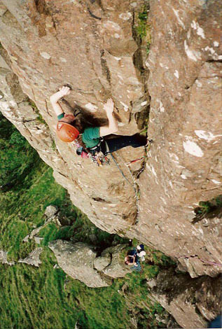
The Great Cliff , photo = Fair Head - geograph.org.uk - 817076.jpg , photo_width = , photo_caption = Fair Head's distinctive ''organ pipe'' dolerite columns, as taken from the Rathlin Island– Ballycastle ferry , map = UK Northern Ireland , map_width = , map_caption = Location of Fair Head in Northern Ireland , location = County Antrim, Northern Ireland , nearest_city = Ballycastle, , range = , coordinates = , climbing_type = , height = face is over , pitches = Single pitch, Multi pitch , ratings = , rock_type = Dolerite sill with olivine , quantity = , development = Mountain cliff area; no facilities , aspect = North and North-west , elevation = base is a.s.l , classic_climbs = , ownership = Private but access granted , camping = Paid camping; also in Ballycastle , website = Fair Head or Benmore ( ga, An Bhinn Mhór; The Great Cliff) is a long, high, mountain cliff, close to the sea, at the north-eastern corner of County Antrim, Northe ... [...More Info...] [...Related Items...] OR: [Wikipedia] [Google] [Baidu] |
Portrush
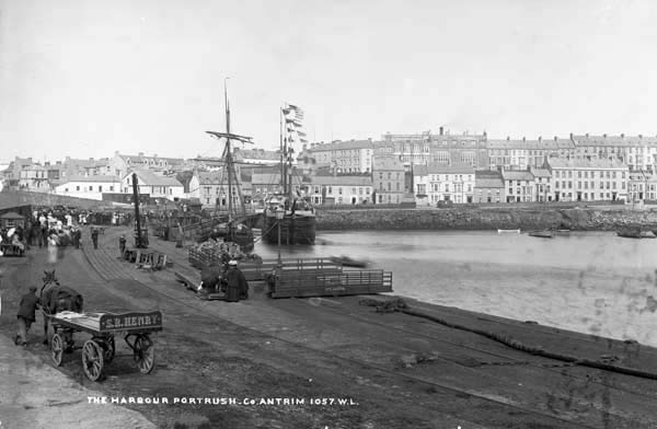
Portrush () is a small seaside resort town on the north coast of County Antrim, Northern Ireland. It neighbours the resort of Portstewart. The main part of the old town, including the Portrush railway station, railway station as well as most hotels, restaurants and bars, is built on a –long peninsula, Ramore Head. It had a population of 6,454 people at the United Kingdom Census 2011, 2011 Census. In the off-season, Portrush is a dormitory town for the nearby campus of the University of Ulster at Coleraine. The town is well known for its three sandy beaches, the West Strand, East Strand and White Rocks, as well as the Royal Portrush Golf Club, the only golf club outside Great Britain which has hosted The Open Championship in 1951 Open Championship, 1951 and 2019 Open Championship, 2019. History A number of flint tools found during the late 19th century show that the site of Portrush was occupied during the "Larnian" (late Irish Mesolithic) period; recent estimates date this t ... [...More Info...] [...Related Items...] OR: [Wikipedia] [Google] [Baidu] |
Portstewart
Portstewart () is a small town in County Londonderry, Northern Ireland. It had a population of 8,003 people in the 2011 Census. It is a seaside resort neighbouring Portrush. Its harbour and scenic coastal paths form an Atlantic promenade leading to a two-miles beach (Portstewart Strand), popular with holidaymakers in summer and surfers year-round. Profile Portstewart was a popular holiday destination for Victorian middle-class families. Its long, crescent-shaped seafront promenade is sheltered by rocky headlands. It is a reasonably prosperous town. Most of the town is contained in the Strand electoral ward and this is one of the most affluent areas in Northern Ireland. In a deprivation index of electoral wards in Northern Ireland the Strand Ward in the town was ranked 570th out of the 582 wards. House prices in Portstewart have been amongst the highest in Northern Ireland. According to the University of Ulster Quarterly House Price Index report produced in partnership with Ban ... [...More Info...] [...Related Items...] OR: [Wikipedia] [Google] [Baidu] |
County Donegal
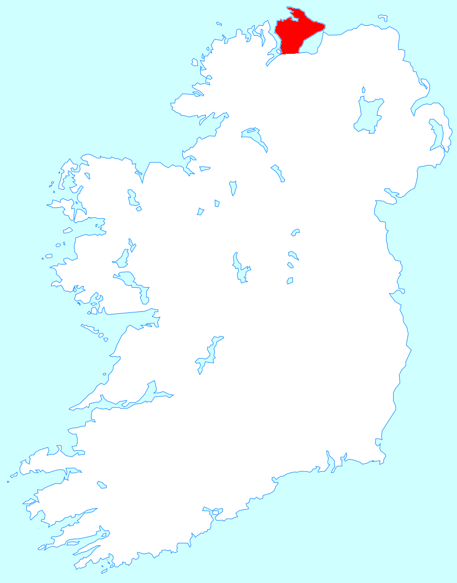
County Donegal ( ; ga, Contae Dhún na nGall) is a county of Ireland in the province of Ulster and in the Northern and Western Region. It is named after the town of Donegal in the south of the county. It has also been known as County Tyrconnell (), after the historic territory of the same name, on which it was based. Donegal County Council is the local council and Lifford the county town. The population was 166,321 at the 2022 census. Name County Donegal is named after the town of Donegal () in the south of the county. It has also been known by the alternative name County Tyrconnell, Tirconnell or Tirconaill (, meaning 'Land of Conall'). The latter was its official name between 1922 and 1927. This is in reference to the kingdom of Tír Chonaill and the earldom that succeeded it, which the county was based on. History County Donegal was the home of the once-mighty Clann Dálaigh, whose best-known branch was the Clann Ó Domhnaill, better known in English as the O'Don ... [...More Info...] [...Related Items...] OR: [Wikipedia] [Google] [Baidu] |
Inishowen
Inishowen () is a peninsula in the north of County Donegal in Ireland. Inishowen is the largest peninsula on the island of Ireland. The Inishowen peninsula includes Ireland's most northerly point, Malin Head. The Grianan of Aileach, a ringfort that served as the royal seat of the over-kingdom of Ailech, stands at the entrance to the peninsula. Towns and villages The main towns and villages of Inishowen are: * Ballyliffin, Buncrana, Bridgend, Burnfoot, Burt * Carndonagh, Carrowmenagh, Clonmany, Culdaff * Dunaff * Fahan * Glengad, Gleneely, Greencastle * Malin, Malin Head, Moville, Muff * Redcastle * Shrove * Quigley's Point * Urris Geography Inishowen is a peninsula of 884.33 square kilometres (218,523 acres), situated in the northernmost part of the island of Ireland. It is bordered to the north by the Atlantic Ocean, to the east by Lough Foyle, and to the west by Lough Swilly. It is joined at the south to the rest of the island and is mostly in County Donegal in ... [...More Info...] [...Related Items...] OR: [Wikipedia] [Google] [Baidu] |
Magilligan Point
Magilligan () is a peninsula that lies in the northwest of County Londonderry, Northern Ireland, at the entrance to Lough Foyle, within Causeway Coast and Glens district. It is an extensive coastal site, part British army firing range, part nature reserve and is home to the HM Prison Magilligan. The settlement of Magilligan Point on the lough is noted for its ferry crossing to Greencastle, County Donegal. History Magilligan gets its name from "MacGilligans country", which formed a major part of the barony of Keenaght. Magilligan served as the base line for triangulation for the mapping of Ireland in the 19th century. Colonel Thomas Colby chose Magilligan due to the flatness of the strand and its proximity to Scotland which, along with the rest of Britain, had been accurately mapped in previous decades. A straight line precisely was measured from North Station to Ballykelly in 1828 from which all other references were measured. The survey finished in 1846 when County ... [...More Info...] [...Related Items...] OR: [Wikipedia] [Google] [Baidu] |
Downhill Strand
Downhill Strand (better known as Benone Strand) is a beach in County Londonderry, Northern Ireland. At long it is one of the longest in Northern Ireland, and recipient of the European Blue Flag and Seaside Award. It is located next to the A2 road, and the Derry to Coleraine section of the Belfast–Derry railway line. Mussenden Temple and the village of Downhill Downhill may refer to: Arts and entertainment * ''Downhill'' (1927 film), a British film by Alfred Hitchcock * ''Downhill'' (2014 film), a British comedy directed by James Rouse * ''Downhill'' (2016 film), a Chilean thriller directed by Patrici ... are located at the eastern end of Benone Strand. References Beaches of Northern Ireland Landforms of County Londonderry Tourist attractions in County Londonderry {{Londonderry-geo-stub ... [...More Info...] [...Related Items...] OR: [Wikipedia] [Google] [Baidu] |
Mussenden Temple And Downhill Demesne
The Mussenden Temple and Downhill Demesne is a National Trust property consisting of Downhill Castle and its estate, which includes the Mussenden Temple. See also * Hezlett House Hezlett House is a 17th-century thatched cottage located in Castlerock, County Londonderry. Built around 1691, it is one of the oldest buildings still in use anywhere in Ulster Ulster (; ga, Ulaidh or ''Cúige Uladh'' ; sco, label= ... References * * * National Trust properties in Northern Ireland Tourist attractions in County Londonderry {{National Trust , state=collapsed ... [...More Info...] [...Related Items...] OR: [Wikipedia] [Google] [Baidu] |
Downhill House
Downhill House was a mansion built in the late 18th century for Frederick, 4th Earl of Bristol and Lord Bishop of Derry (popularly known as 'the Earl-Bishop'), at Downhill, County Londonderry. Much of the building was destroyed by fire in 1851 before being rebuilt in the 1870s. It fell into disrepair after the Second World War. Downhill House is now part of The National Trust property of Downhill Demesne and Mussenden Temple. History The Rt Rev. Dr Frederick Hervey (as he was at the time), Church of Ireland Lord Bishop of Derry, commissioned work at Downhill Demesne near the village of Castlerock in the early 1770s, after he was made the Bishop of Derry in 1768. Downhill House, overlooking Downhill Strand and Benone on the north coast of Northern Ireland, was built by the architect Michael Shanahan, although it has been suggested that James Wyatt or Charles Cameron may also have been involved in the early stages of design. The construction of the House, and the nearby M ... [...More Info...] [...Related Items...] OR: [Wikipedia] [Google] [Baidu] |


_p6.296_-_Down_Hill%2C_Derry.jpg)