|
Murghab, Tajikistan
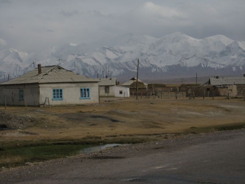
Murghob ( tg, Мурғоб) or Murghab (russian: Мургаб, from the Persian word ''margh-ab'', meaning 'prairie river') is the capital of Murghob District in the Pamir Mountains of Gorno-Badakhshan, Tajikistan. With a population of just under 7,500, Murghob is the only significant town in the eastern half of Gorno-Badakhshan. It is the highest town in Tajikistan (and of the former Soviet Union) at 3,650 meters above sea level. It is where the Pamir Highway crosses the Bartang river.Jamoat-level basic indicators United Nations Development Programme in Tajikistan, accessed 5 October 2020 The Pamir Highway goes north to Sary-Tash ... [...More Info...] [...Related Items...] OR: [Wikipedia] [Google] [Baidu] |
Countries Of The World
The following is a list providing an overview of sovereign states around the world with information on their status and recognition of their sovereignty. The 206 listed states can be divided into three categories based on membership within the United Nations System: 193 UN member states, 2 UN General Assembly non-member observer states, and 11 other states. The ''sovereignty dispute'' column indicates states having undisputed sovereignty (188 states, of which there are 187 UN member states and 1 UN General Assembly non-member observer state), states having disputed sovereignty (16 states, of which there are 6 UN member states, 1 UN General Assembly non-member observer state, and 9 de facto states), and states having a special political status (2 states, both in free association with New Zealand). Compiling a list such as this can be a complicated and controversial process, as there is no definition that is binding on all the members of the community of nations conc ... [...More Info...] [...Related Items...] OR: [Wikipedia] [Google] [Baidu] |
Sary-Tash
, native_name_lang = ky , settlement_type = , image_skyline = Sary Tash, Kirghizstan.jpg , image_alt = , image_caption = Sary Tash village with the Pamir mountains , image_flag = , flag_alt = , image_seal = , seal_alt = , image_shield = , shield_alt = , nickname = , motto = , image_map = , map_alt = , map_caption = , pushpin_map = Kyrgyzstan , pushpin_label_position = , pushpin_map_alt = , pushpin_map_caption = , coordinates = , coor_pinpoint = , coordinates_footnotes = , subdivision_type = Country , subdivision_name = Kyrgyzstan , subdivision_type1 = Region , subdivision_name1 = Osh Region , subdivision_type2 = District , subdi ... [...More Info...] [...Related Items...] OR: [Wikipedia] [Google] [Baidu] |
Tundra Climate
The tundra climate is a polar climate sub-type located in high latitudes and high mountains. undra climate https://www.britannica.com/science/tundra-climateThe Editors of Encyclopaedia Britannica, 2019 It is classified as ET according to Köppen climate classification. It is a climate which at least one month has an average temperature high enough to melt snow (), but no month with an average temperature in excess of . Despite the potential diversity of climates in the ''ET'' category involving precipitation, extreme temperatures, and relative wet and dry seasons, this category is rarely subdivided. Rainfall and snowfall are generally slight due to the low vapor pressure of water in the chilly atmosphere, but as a rule potential evapotranspiration is extremely low, allowing soggy terrain of swamps and bogs even in places that get precipitation typical of deserts of lower and middle latitudes. The amount of native tundra biomass depends more on the local temperature than the amou ... [...More Info...] [...Related Items...] OR: [Wikipedia] [Google] [Baidu] |
Central Asia
Central Asia, also known as Middle Asia, is a region of Asia that stretches from the Caspian Sea in the west to western China and Mongolia in the east, and from Afghanistan and Iran in the south to Russia in the north. It includes the former Soviet republics of Kazakhstan, Kyrgyzstan, Tajikistan, Turkmenistan, and Uzbekistan, which are colloquially referred to as the "-stans" as the countries all have names ending with the Persian suffix " -stan", meaning "land of". The current geographical location of Central Asia was formerly part of the historic region of Turkistan, also known as Turan. In the pre-Islamic and early Islamic eras ( and earlier) Central Asia was inhabited predominantly by Iranian peoples, populated by Eastern Iranian-speaking Bactrians, Sogdians, Chorasmians and the semi-nomadic Scythians and Dahae. After expansion by Turkic peoples, Central Asia also became the homeland for the Kazakhs, Uzbeks, Tatars, Turkmen, Kyrgyz, and Uyghurs; Turkic langua ... [...More Info...] [...Related Items...] OR: [Wikipedia] [Google] [Baidu] |
Outpost (military)
A military outpost is detachment of troops stationed at a distance from the main force or formation, usually at a station in a remote or sparsely populated location, positioned to stand guard against unauthorized intrusions and surprise attacks; and the station occupied by such troops, usually a small military base or settlement in an outlying frontier, limit, political boundary or in another country. Outposts can also be called miniature military bases based on size and number of troops it houses. Dictionary meaning: Outpost TheFreeDictionary; An online Dictionary and Thesaurus Recent military use Military outposts, most recently referred to as combat outposts (COPs), served as a cornerstone of counterinsurgency doctrine in Iraq and Afghanistan. These permanent or semi-permanent ...[...More Info...] [...Related Items...] OR: [Wikipedia] [Google] [Baidu] |
Russian Officials (with Pamirski Post In The Background)
Russian(s) refers to anything related to Russia, including: *Russians (, ''russkiye''), an ethnic group of the East Slavic peoples, primarily living in Russia and neighboring countries *Rossiyane (), Russian language term for all citizens and people of Russia, regardless of ethnicity *Russophone, Russian-speaking person (, ''russkogovoryashchy'', ''russkoyazychny'') * Russian language, the most widely spoken of the Slavic languages *Russian alphabet * Russian cuisine *Russian culture *Russian studies Russian may also refer to: * Russian dressing *''The Russians'', a book by Hedrick Smith * Russian (comics), fictional Marvel Comics supervillain from ''The Punisher'' series * Russian (solitaire), a card game * "Russians" (song), from the album ''The Dream of the Blue Turtles'' by Sting *"Russian", from the album ''Tubular Bells 2003'' by Mike Oldfield *"Russian", from the album '' '' by Caravan Palace *Nik Russian, the perpetrator of a con committed in 2002 *The South African name ... [...More Info...] [...Related Items...] OR: [Wikipedia] [Google] [Baidu] |
Kashgar
Kashgar ( ug, قەشقەر, Qeshqer) or Kashi ( zh, c=喀什) is an oasis city in the Tarim Basin region of Southern Xinjiang. It is one of the westernmost cities of China, near the border with Afghanistan, Kyrgyzstan, Tajikistan and Pakistan. With a population of over 500,000, Kashgar has served as a trading post and strategically important city on the Silk Road between China, the Middle East and Europe for over 2,000 years, making it one of the oldest continuously inhabited cities in the World. At the convergence point of widely varying cultures and empires, Kashgar has been under the rule of the Chinese, Turkic, Mongol and Tibetan empires. The city has also been the site of a number of battles between various groups of people on the steppes. Now administered as a county-level unit, Kashgar is the administrative center of Kashgar Prefecture, which has an area of and a population of approximately 4 million as of 2010. The city itself has a population of 506,640, and its ... [...More Info...] [...Related Items...] OR: [Wikipedia] [Google] [Baidu] |
Tashkurgan Town
Tashkurgan ( ug, تاشقورغان بازىرى; zh, s=塔什库尔干镇, p=Tǎshíkù'ěrgān Zhèn; ) is a town in the far northwest of China, close to the country's border with Tajikistan, Afghanistan, and Pakistan. It is the principal town and seat of Tashkurgan Tajik Autonomous County, in the autonomous region of Xinjiang. Name Tashkurgan means "Stone Fortress" or "Stone Tower" in the Turkic languages. The historical Chinese name for the town was a literal translation, Shitoucheng ( zh, s=石头城, p=Shítouchéng, labels=no). The official spelling (per the Chinese government) is Taxkorgan, while Tashkorgan and Tashkurghan appear occasionally in literature. The town's name is written in the Uyghur Arabic alphabet as and in the Uyghur Latin alphabet as ''Tashqurghan baziri''. Historically, the town was also called Sarikol (), also spelled Sariqol () or traditionally Sariq Qol (). History Pre-1900s Tashkurgan has a long history as a stop on the Silk Road. Major c ... [...More Info...] [...Related Items...] OR: [Wikipedia] [Google] [Baidu] |
Karakoram Highway
The Karakoram Highway ( ur, , translit=śāhirāh qarāquram; known by its initials KKH, also known as N-35 or National Highway 35 ( ur, ) or the China-Pakistan Friendship Highway) is a national highway which extends from Hasan Abdal in the Punjab province of Pakistan to the Khunjerab Pass in Gilgit-Baltistan, where it crosses into China and becomes China National Highway 314. The highway connects the Pakistani provinces of Punjab and Khyber Pakhtunkhwa plus Gilgit-Baltistan with China's Xinjiang Uyghur Autonomous Region. The highway is a popular tourist attraction and is one of the highest paved roads in the world, passing through the Karakoram mountain range, at at maximum elevation of near Khunjerab Pass. Due to its high elevation and the difficult conditions under which it was constructed, it is often referred to as the Eighth Wonder of the World. The highway is also a part of the Asian Highway AH4. History The Karakoram Highway, also known as the F ... [...More Info...] [...Related Items...] OR: [Wikipedia] [Google] [Baidu] |
Kulma Pass
The Kulma Pass (Tajik: , ) or Qolma Pass, also referred to as Karasu Pass, is a mountain pass across the Pamir Mountains on the border between Murghob District, Gorno-Badakhshan Autonomous Region in Tajikistan and Taxkorgan Tajik Autonomous County, Kashgar Prefecture, Xinjiang Uygur Autonomous Region in China. Asian Highway AH66 runs through the pass, which provides for the only modern day overland border crossing along the 450 km boundary between the two nations. The pass has an elevation of and opens from the north to the southeast, and is 500 m wide from north to south and 1 km in length from east to west with a gentle incline not exceeding 20 percent. On the Tajik side, the pass is 80 km by road to Murghab and about 850 km to Dushanbe. On the Chinese side, the pass is 13.9 km from Karasu (), a port of entry on the Karakorum Highway which leads to Tashkurgan (60–70 km) and Kashgar (220 km). The pass is open from the 16th ... [...More Info...] [...Related Items...] OR: [Wikipedia] [Google] [Baidu] |
Khorugh
Khorugh ( tg, Хоруғ, ; russian: Хорог, translit=Khorog; ) is the capital of the Gorno-Badakhshan Autonomous Region (GBAO) in Tajikistan. It is also the capital of the Shughnon District of Gorno-Badakhshan. It has a population of 30,500 (2020 ). Khorugh is above sea level in the Pamir Mountains (ancient Mount Imeon) at the confluence of the rivers Ghunt and Panj. The city is bounded to the south (Nivodak) and to the north (Tem) by the deltas of the Shakhdara and Ghunt, respectively. The two rivers merge in the eastern part of the city flow through the city, dividing it almost evenly until its delta in the Panj, on the border with Afghanistan. Khorugh is known for its poplar trees that dominate the flora of the city. History Until the late 19th century, Khorugh was in an area disputed between the Emir of Bukhara, Shah of Afghanistan, Russia and Britain. The Russians emerged the winners of the region after The Great Game, which fixed the current northern border of ... [...More Info...] [...Related Items...] OR: [Wikipedia] [Google] [Baidu] |
Kyrgyzstan
Kyrgyzstan,, pronounced or the Kyrgyz Republic, is a landlocked country in Central Asia. Kyrgyzstan is bordered by Kazakhstan to the north, Uzbekistan to the west, Tajikistan to the south, and the People's Republic of China to the east. Its capital and largest city is Bishkek. Ethnic Kyrgyz make up the majority of the country's seven million people, followed by significant minorities of Uzbeks and Russians. The Kyrgyz language is closely related to other Turkic languages. Kyrgyzstan's history spans a variety of cultures and empires. Although geographically isolated by its highly mountainous terrain, Kyrgyzstan has been at the crossroads of several great civilizations as part of the Silk Road along with other commercial routes. Inhabited by a succession of tribes and clans, Kyrgyzstan has periodically fallen under larger domination. Turkic nomads, who trace their ancestry to many Turkic states. It was first established as the Yenisei Kyrgyz Khaganate later i ... [...More Info...] [...Related Items...] OR: [Wikipedia] [Google] [Baidu] |


.png)

_of_Kashgar%2C_73_CE.jpg)
_circa_650_CE.jpg)

