|
Municipalities Of The Canton Of Valais
There are 122 municipalities in the canton of Valais, Switzerland (). List *Agarn *Albinen *Anniviers *Arbaz * Ardon *Ausserberg *Ayent *Baltschieder *Bellwald *Bettmeralp *Binn * Bister * Bitsch * Blatten *Bourg-Saint-Pierre *Bovernier *Brig-Glis *Bürchen * Chalais *Chamoson *Champéry *Chippis *Collombey-Muraz * Collonges *Conthey *Crans-Montana *Dorénaz *Eggerberg *Eischoll *Eisten *Embd *Ergisch *Ernen *Evionnaz *Evolène *Ferden *Fiesch *Fieschertal *Finhaut *Fully *Gampel-Bratsch *Goms *Grächen *Grengiols *Grimisuat *Grône *Guttet-Feschel *Hérémence *Icogne * Inden *Isérables *Kippel *Lalden *Lax *Lens *Leuk *Leukerbad *Leytron *Liddes *Martigny *Martigny-Combe *Massongex * Mont-Noble *Monthey *Mörel-Filet *Naters *Nendaz *Niedergesteln *Oberems *Obergoms *Orsières *Port-Valais * Randa *Raron *Riddes *Ried-Brig *Riederalp *Saas-Almagell *Saas-Balen *Saas-Fee *Saas-Grund *Saillon *Saint-Gingolph * Saint-Léonard * Saint-Martin (VS) * Saint-Maurice *Salgesch * Salvan ... [...More Info...] [...Related Items...] OR: [Wikipedia] [Google] [Baidu] |
Bourg-Saint-Pierre
Bourg-Saint-Pierre (; frp, Lo Bôrg) is a municipality in the district of Entremont in the canton of Valais in Switzerland. Bourg-Saint-Pierre is the highest inhabited locality of the valley and the last village when ascending the Great Saint Bernard Pass. History Bourg-Saint-Pierre is first mentioned in 1125 as ''Burgus Sancti Petri''. In medieval times, it was a stage on the ''Via Francigena''. A 1693 map of the Valais reffers to Bourg-Saint-Pierre as "S Pierre". A 1799 map of the Helvetic Republic shows the town as "Saint Petersburg". Geography Bourg-Saint-Pierre has an area, , of . Of this area, 29.1% is used for agricultural purposes, while 6.8% is forested. Of the rest of the land, 0.6% is settled (buildings or roads) and 63.5% is unproductive land. The municipality is located on the Italian border. It consists of the village of Bourg-Saint-Pierre and the Hospice du Grand Saint-Bernard in the Great St Bernard Pass. The village of Bourg-Saint-Pierre lies at the foo ... [...More Info...] [...Related Items...] OR: [Wikipedia] [Google] [Baidu] |
Eggerberg
Eggerberg is a village and municipality in the district of Brig in the canton of Valais in Switzerland. Besides the village of Eggerberg, the municipality includes the settlements of Berg, Eggen, Finnen, Mühlackern and Wirmschland. History Eggerberg is first mentioned in 1307 as ''Eccun''. Geography Eggerberg has an area, , of . Of this area, 15.2% is used for agricultural purposes, while 56.4% is forested. Of the rest of the land, 5.5% is settled (buildings or roads) and 22.9% is unproductive land. The municipality is located on the slopes above the northern Rhone valley, near Visp. It consists of the village of Eggerberg and the hamlets of Mühlackern, Wirmschland, Berg, Eggen and summer only settlement of Finnen. The proposed merger of the municipalities of Eggerberg, Ausserberg, Bürchen, Baltschieder, Visp and Visperterminen was rejected by the residents. [...More Info...] [...Related Items...] OR: [Wikipedia] [Google] [Baidu] |
Dorénaz
Dorénaz is a municipality in the district of Saint-Maurice in the canton of Valais in Switzerland. History Dorénaz is first mentioned in the 11th and 12th Centuries as ''usque ad frontem Dorone''. Geography Dorénaz has an area, , of . Of this area, 24.3% is used for agricultural purposes, while 60.4% is forested. Of the rest of the land, 3.8% is settled (buildings or roads) and 11.5% is unproductive land. The municipality is located in the Saint-Maurice district, on the right side of the Rhone. Coat of arms The blazon of the municipal coat of arms is ''Per saltire Gules and Argent two Hammers in chief a Cross bottony and in base an Escallop counterchanged.'' Demographics Dorénaz has a population () of . , 8.9% of the population are resident foreign nationals. [...More Info...] [...Related Items...] OR: [Wikipedia] [Google] [Baidu] |
Crans-Montana
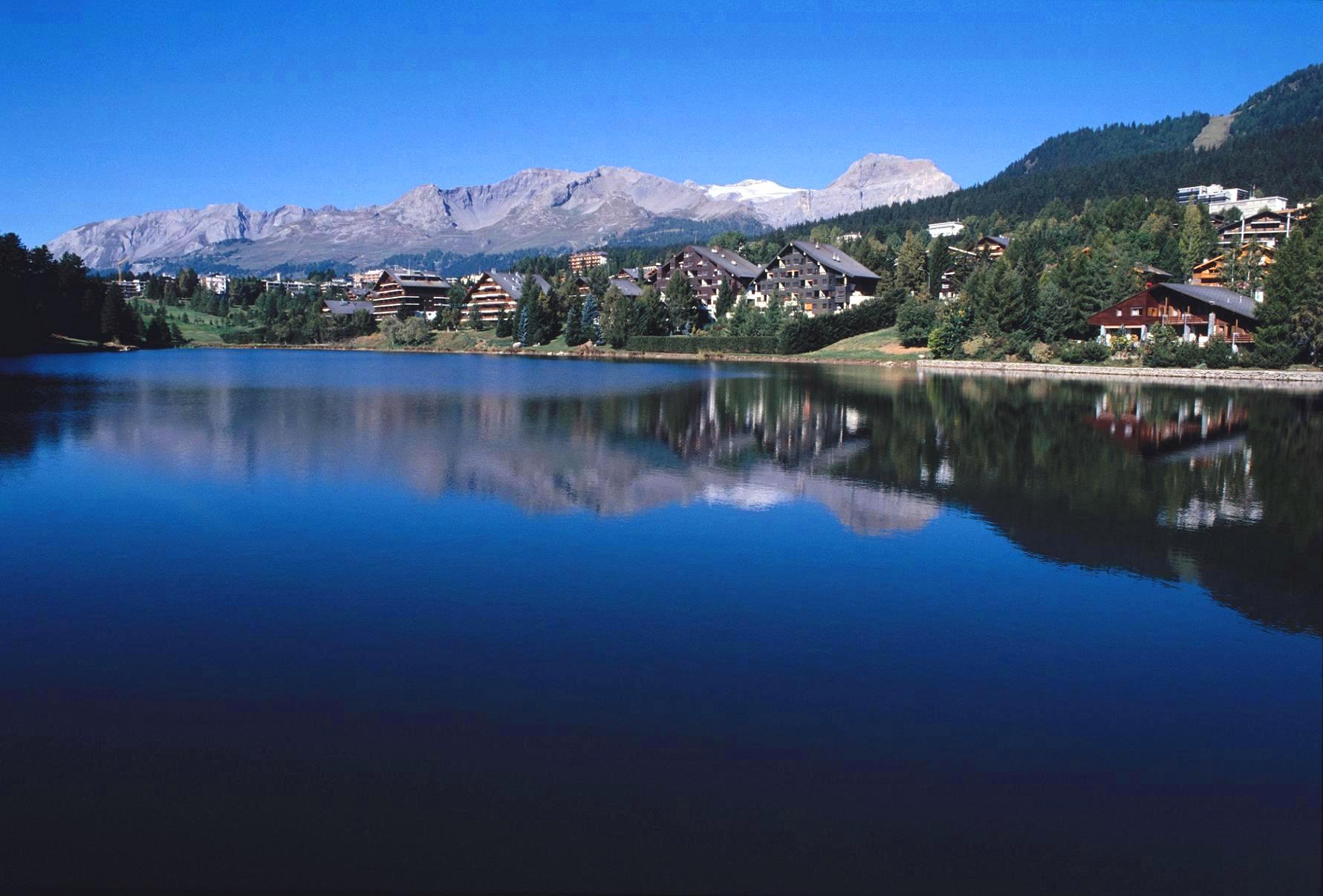
Crans-Montana is a municipality in the district of Sierre in the canton of Valais, Switzerland. On 1 January 2017 the former municipalities of Chermignon, Mollens, Montana and Randogne merged to form the new municipality of Crans-Montana. Crans-Montana is also a ski resort that was created through the fusion of the two centers of Crans and Montana and belonged to six municipalities (Chermignon, Icogne, Lens, Mollens, Montana and Randogne), four of which merged to form the municipality of Crans-Montana. History Chermignon Chermignon is first mentioned in 1228 as ''Chermenon'' and ''Chirminon''. It became an independent municipality in 1905 when it separated from Lens.Amtliches Gemeindeverzeichnis der Schweiz published by the Swiss Federal Statistical Office ac ... [...More Info...] [...Related Items...] OR: [Wikipedia] [Google] [Baidu] |
Conthey
Conthey is a municipality in the district of Conthey in the canton of Valais in Switzerland. History Conthey is first mentioned about 800 as ''curtis Contextis''. In 1146 it was mentioned as ''ecclesiam de Plano Contesio''. Geography Conthey has an area, , of . Of this area, or 23.3% is used for agricultural purposes, while or 26.3% is forested. Of the rest of the land, or 5.0% is settled (buildings or roads), or 0.9% is either rivers or lakes and or 44.5% is unproductive land.Swiss Federal Statistical Office-Land Use Statistics 2009 data accessed 25 March 2010 Of the built up area, housing and buildings made up 2.5% and transportation infrastructure made up 1.5%. Out of the forested land, 21.3% of the total land area is heavily forested a ... [...More Info...] [...Related Items...] OR: [Wikipedia] [Google] [Baidu] |
Collonges, Switzerland
Collonges () is a municipality in the district of Saint-Maurice in the canton of Valais in Switzerland. History Collonges is first mentioned in 1239 as ''Colunges''. The village of Collonges was built on the site of the former village of Arbignon, which was known as ''desertum Alpinonis'' in the 11th and 12th Centuries. Arbignon was probably abandoned due to flooding of Aboyeu creek. Geography Collonges has an area, , of . Of this area, or 16.9% is used for agricultural purposes, while or 52.7% is forested. Of the rest of the land, or 4.4% is settled (buildings or roads), or 1.5% is either rivers or lakes and or 24.7% is unproductive land.Swiss Federal Statistical Office-Land Use Statistics 2009 data accessed 25 March 2010 Of the built up ar ... [...More Info...] [...Related Items...] OR: [Wikipedia] [Google] [Baidu] |
Collombey-Muraz
Collombey-Muraz is a municipality in the district of Monthey in the canton of Valais in Switzerland. There was an oil refinery in the town. History Collombey is first mentioned in 1263 as ''de Columberio''. Muraz was mentioned in 1283 as ''de Mura''. But it was a little over 200 years ago that its geographical and political configuration as an autonomous commune was finally established. This came about when the castellany of Monthey was divided in 1787. Ancient ruins unearthed at archaeological site of Châble-Croix have been dated to be between 6880 and 6330 BC, suggesting it is the oldest site in the Canton of Valais. From 1900 onward the extraction of granite from the glacial moraine on the ''Barmaz'' heights unearthed Neolithic cemeteries going back to around 3000 to 1800 BC. On a geographical note, the commune's prehistoric history is highlighted by the presence of erratic blocks. The ''Pierre à Dzo'' (300 m3), the ''Pierre à Muguet'' (1000 m3) and the Studer Block (50 ... [...More Info...] [...Related Items...] OR: [Wikipedia] [Google] [Baidu] |
Chippis
Chippis is a municipality in the district of Sierre in the canton of Valais in Switzerland. History Chippis is first mentioned in the 11th century as ''Sepils''. Geography Chippis has an area, , of . Of this area, or 5.6% is used for agricultural purposes, while or 59.1% is forested. Of the rest of the land, or 24.2% is settled (buildings or roads), or 3.5% is either rivers or lakes and or 8.6% is unproductive land.Swiss Federal Statistical Office-Land Use Statistics 2009 data accessed 25 March 2010 Of the built up area, industrial buildings made up 6.6% of the total area while housing and buildings made up 10.1% and transportation infrastructure made up 4.5%. Power and water infrastructure as well as other special developed areas made up 1.5% ... [...More Info...] [...Related Items...] OR: [Wikipedia] [Google] [Baidu] |
Champéry
Champéry (; frp, Champérié) is a municipality in the district of Monthey in the canton of Valais in Switzerland. History Champéry is first mentioned in 1286 as ''Champery'' The Hotel Dent-du-Midi opened in 1857. In 1969, Champéry became one of the founding villages of the Portes du Soleil ski area and resort. Geography Champéry has an area, , of . Of this area, 32.7% is used for agricultural purposes, while 33.4% is forested. Of the rest of the land, 3.6% is settled (buildings or roads) and 30.3% is unproductive land. The municipality is located in the Monthey district, in the Val-d'Illiez, on the French border. It consists of the linear village of Champéry, which was part of the municipality of Val-d'Illiez until 1839 when it became independent. Coat of arms The blazon of the municipal coat of arms is ''Quartered Argent issuant from three Mounts Vert as many Pine Trees of the same trunked proper and Azure statant on ground Or a man proper clad of the same trous ... [...More Info...] [...Related Items...] OR: [Wikipedia] [Google] [Baidu] |
Chamoson
Chamoson is a municipality in the district of Conthey in the canton of Valais in Switzerland. History Chamoson is first mentioned in 1050 as ''Camusia''. In 1233 it was mentioned as ''Scamosun''. Geography Chamoson has an area, , of . Of this area, or 24.7% is used for agricultural purposes, while or 31.1% is forested. Of the rest of the land, or 7.1% is settled (buildings or roads), or 1.7% is either rivers or lakes and or 35.2% is unproductive land.Swiss Federal Statistical Office-Land Use Statistics 2009 data accessed 25 March 2010 Of the built up area, housing and buildings made up 3.2% and transportation infrastructure made up 2.9%. Out of the forested land, 25.3% of the total land area is heavily forested and 1.9% is covered with orchard ... [...More Info...] [...Related Items...] OR: [Wikipedia] [Google] [Baidu] |
Chalais, Switzerland
Chalais () is a municipality in the district of Sierre in the canton of Valais in Switzerland. History Chalais is first mentioned in the 11th century as ''Jaler''. In 1425 it was mentioned as ''Challir''. In 1892 much of the village was destroyed in a fire. Geography Chalais has an area, , of . Of this area, or 19.0% is used for agricultural purposes, while or 67.7% is forested. Of the rest of the land, or 8.5% is settled (buildings or roads), or 0.1% is either rivers or lakes and or 4.7% is unproductive land.Swiss Federal Statistical Office-Land Use Statistics 2009 data accessed 25 March 2010 Of the built up area, housing and buildings made up 5.4% and transportation infrastructure made up 1.9%. Out of the forested land, 64.3% of the total l ... [...More Info...] [...Related Items...] OR: [Wikipedia] [Google] [Baidu] |


