|
Mount Fogo
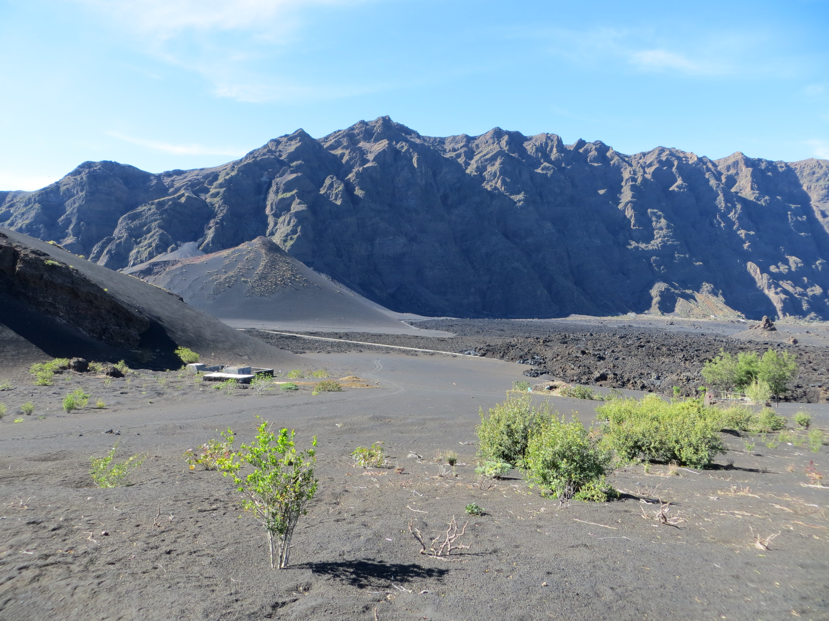
Pico do Fogo is the highest peak of Cape Verde and West Africa, rising to above sea level. It is an active stratovolcano lying on the island of Fogo. The main cone last erupted in 1680, causing mass emigration from the island. A subsidiary vent erupted in 1995. The only deadly eruption was in 1847 when earthquakes killed several people. Fogo (the word means "fire" in Portuguese) is a hotspot volcanic island. Its most recent eruptions occurred in 1951, 1995 and 2014. It is the youngest and most active volcano in the Cape Verde Islands, a short chain of volcanic islands that generally are younger at the western end, formed as the African Plate moved towards the east over the hotspot. Fogo consists of a single volcano, so the island is nearly round and about in diameter. The large summit caldera (about 10 kilometers in the north–south direction and 7 kilometers in the east–west direction) is not located in the center of the island, but rather towards its northeastern corner. ... [...More Info...] [...Related Items...] OR: [Wikipedia] [Google] [Baidu] |
Instituto Nacional De Estatística (Cape Verde)
The Instituto Nacional de Estatística (Portuguese for the ''National Statistics Institute'', abbreviated as INE) is the public statistics institute of Cape Verde. Its current president is Osvaldo Rui Monteiro dos Reis Borges. The population censuses are held every first year of a decade; the most recent was in 2010. Its main office is on 18 Rua da Caixa Económica in the capital city of Praia. History Until 1975, under Portuguese rule, statistics were done by the Provincial Statistics Bureau (''Repartição Provincial de Estatística''), part of the Instituto Nacional de Estatística of Portugal. When Cape Verde became independent, the ''Serviço Nacional de Estatística'' (SNE, Portuguese for the National Statistics Service) was established, part of the Ministry of Economy. Its first president was Edgard Chrysostome Pinto. At the end of 1985, the Directorate-General of Statistics was created. In 1996, the new law of the National Statistics System was approved, and the ''Istituto ... [...More Info...] [...Related Items...] OR: [Wikipedia] [Google] [Baidu] |
Fault Scarp
A fault scarp is a small step or offset on the ground surface where one side of a fault has moved vertically with respect to the other. It is the topographic expression of faulting attributed to the displacement of the land surface by movement along faults. They are exhibited either by differential movement and subsequent erosion along an old ''inactive'' geologic fault (a sort of old rupture), or by a movement on a recent active fault. Characteristics Fault scarps often contain highly fractured rock of both hard and weak consistency. In many cases, bluffs form from the upthrown block and can be very steep. The height of the scarp formation is equal to the vertical displacement along the fault. Active scarps are usually formed by tectonic displacement, e.g. when an earthquake changes the elevation of the ground and can be caused by any type of fault, including strike-slip faults, whose motion is primarily horizontal. This movement is usually episodic, with the height of the bluf ... [...More Info...] [...Related Items...] OR: [Wikipedia] [Google] [Baidu] |
Moment Magnitude Scale
The moment magnitude scale (MMS; denoted explicitly with or Mw, and generally implied with use of a single M for magnitude) is a measure of an earthquake's magnitude ("size" or strength) based on its seismic moment. It was defined in a 1979 paper by Thomas C. Hanks and Hiroo Kanamori. Similar to the local magnitude scale, local magnitude/Richter scale () defined by Charles Francis Richter in 1935, it uses a logarithmic scale; small earthquakes have approximately the same magnitudes on both scales. Despite the difference, news media often says "Richter scale" when referring to the moment magnitude scale. Moment magnitude () is considered the authoritative magnitude scale for ranking earthquakes by size. It is more directly related to the energy of an earthquake than other scales, and does not saturate—that is, it does not underestimate magnitudes as other scales do in certain conditions. It has become the standard scale used by seismological authorities like the U.S. Geological ... [...More Info...] [...Related Items...] OR: [Wikipedia] [Google] [Baidu] |
Hawaiian Volcano Observatory
The Hawaiian Volcano Observatory (HVO) is an agency of the U.S. Geological Survey (USGS) and one of five volcano observatories operating under the USGS Volcano Hazards Program. Based in Hilo, Hawaii, the observatory monitors six Hawaiian volcanoes: Kīlauea, Mauna Loa, Kamaʻehuakanaloa (formerly Lōʻihi), Hualālai, Mauna Kea, and Haleakalā, of which, Kīlauea and Mauna Loa are the most active. The observatory has a worldwide reputation as a leader in the study of active volcanism. Due to the relatively non-explosive nature of Kīlauea's volcanic eruptions for many years, scientists have generally been able to study ongoing eruptions in proximity without being in extreme danger. Prior to May 2018, the observatory's offices were located at Uwekahuna Bluff, the highest point on the rim of Kīlauea Caldera. The summit collapse events during the 2018 eruption of Kīlauea damaged those facilities, so the observatory has since been operating from various temporary offices located ... [...More Info...] [...Related Items...] OR: [Wikipedia] [Google] [Baidu] |
Volcanic Ash
Volcanic ash consists of fragments of rock, mineral crystals, and volcanic glass, created during volcano, volcanic eruptions and measuring less than 2 mm (0.079 inches) in diameter. The term volcanic ash is also often loosely used to refer to all explosive eruption products (correctly referred to as ''tephra''), including particles larger than 2 mm. Volcanic ash is formed during explosive volcanic eruptions when dissolved gases in magma expand and escape violently into the atmosphere. The force of the gases shatters the magma and propels it into the atmosphere where it solidifies into fragments of volcanic rock and glass. Ash is also produced when magma comes into contact with water during phreatomagmatic eruptions, causing the water to explosively flash to steam leading to shattering of magma. Once in the air, ash is transported by wind up to thousands of kilometres away. Due to its wide dispersal, ash can have a number of impacts on society, including animal a ... [...More Info...] [...Related Items...] OR: [Wikipedia] [Google] [Baidu] |
Santiago, Cape Verde
Santiago (Portuguese for “ Saint James”) is the largest island of Cape Verde, its most important agricultural centre and home to half the nation's population. Part of the Sotavento Islands, it lies between the islands of Maio ( to the east) and Fogo ( to the west). It was the first of the islands to be settled: the town of Ribeira Grande (now Cidade Velha and a UNESCO World Heritage Site) was founded in 1462. Santiago is home to the nation's capital city of Praia. History The eastern side of the nearby island of Fogo collapsed into the ocean 73,000 years ago, creating a tsunami 170 meters high which struck Santiago. In 1460, António de Noli became the first to visit the island. Da Noli settled at ''Ribeira Grande'' (now Cidade Velha) with his family members and Portuguese from Algarve and Alentejo in 1462.Valor simbóli ... [...More Info...] [...Related Items...] OR: [Wikipedia] [Google] [Baidu] |
Bordeira (Fogo)
Bordeira is a semicircular mountain in the middle of the island Fogo. It is a crater rim, up to 1 km high, formed by a prehistoric collapse of the volcano Pico do Fogo. At a maximum elevation of , it is the second highest point in the nation behind Pico do Fogo. The name literally means the "border". It forms part of Fogo Natural Park. Opening to the east, it effectively protects the northern, western and southern part of the island against lava flows from the volcano. The settlement Chã das Caldeiras lies at the foot of Bordeira, in the caldera A caldera ( ) is a large cauldron-like hollow that forms shortly after the emptying of a magma chamber in a volcano eruption. When large volumes of magma are erupted over a short time, structural support for the rock above the magma chamber is .... The east side of the Bordeira cliff is much steeper than the west side. See also * List of mountains in Cape Verde References External links * {{Fogo Bordeira Bordeira ... [...More Info...] [...Related Items...] OR: [Wikipedia] [Google] [Baidu] |
Chã Das Caldeiras
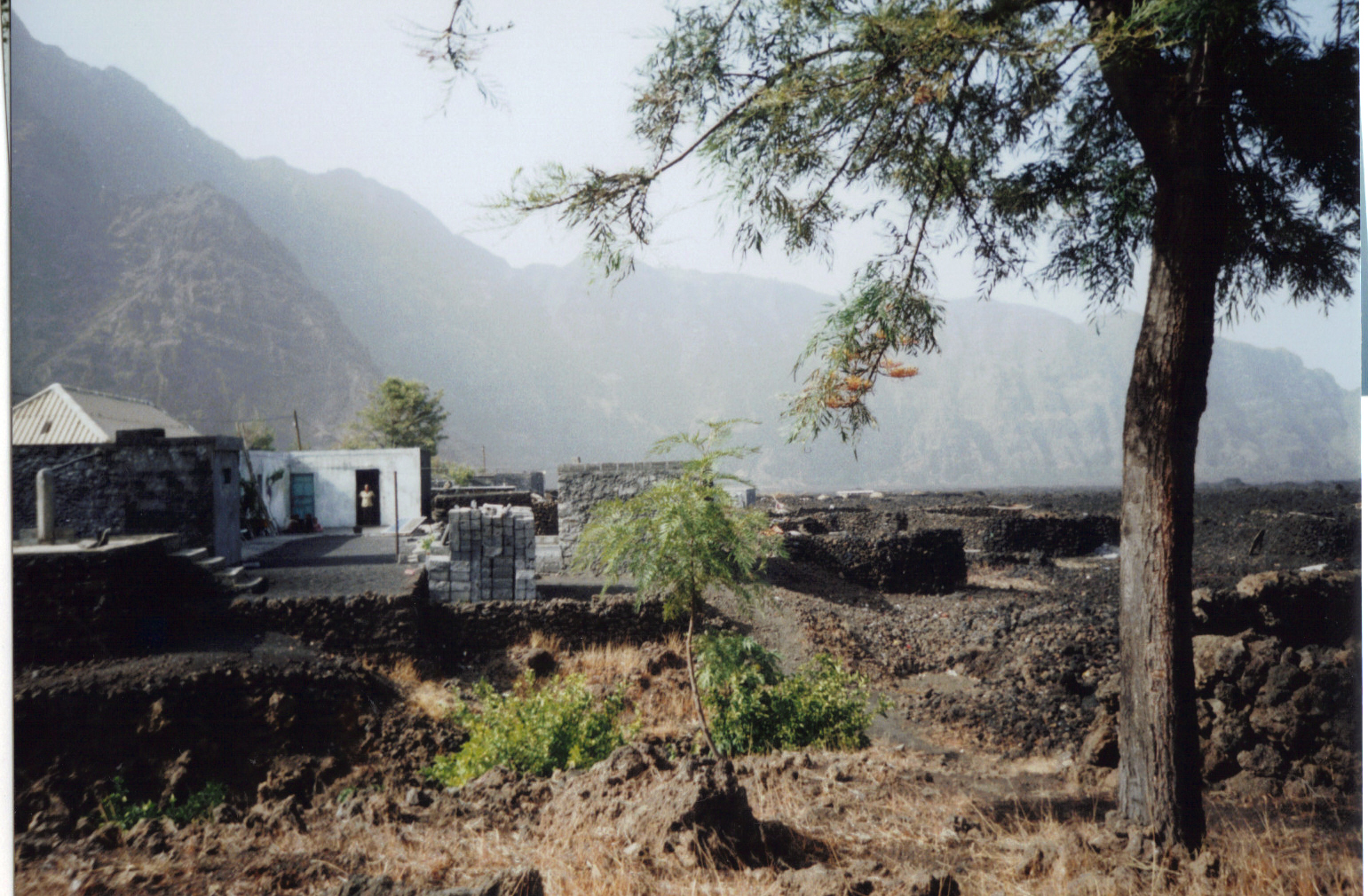
Chã das Caldeiras (“Plain of the Calderas”) is a small community of approximately 700 inhabitants in the crater of the volcano Pico do Fogo on the island of Fogo, Cape Verde. The village consists of two main neighborhoods: Portela and Bangaeira, founded in 1920 and 1917, respectively.Parc Naturel de Fogo – Chã das Caldeiras Tentative list Unesco World Heritage sites At an elevation of about 1,700 meters, it is the highest village in Cape Verde. It is part of the municipality of . The main organizing body in the village is the ''Associação dos Agricultores de Chã'' (Chã Farmers Association), an agricultural coop ... [...More Info...] [...Related Items...] OR: [Wikipedia] [Google] [Baidu] |
Caldera
A caldera ( ) is a large cauldron-like hollow that forms shortly after the emptying of a magma chamber in a volcano eruption. When large volumes of magma are erupted over a short time, structural support for the rock above the magma chamber is gone. The ground surface then collapses into the emptied or partially emptied magma chamber, leaving a large depression at the surface (from one to dozens of kilometers in diameter). Although sometimes described as a Volcanic crater, crater, the feature is actually a type of sinkhole, as it is formed through subsidence and collapse rather than an explosion or impact. Compared to the thousands of volcanic eruptions that occur each century, the formation of a caldera is a rare event, occurring only a few times per century. Only seven caldera-forming collapses are known to have occurred between 1911 and 2016. More recently, a caldera collapse occurred at Kīlauea, Hawaii in 2018. Etymology The term ''caldera'' comes from Spanish language, S ... [...More Info...] [...Related Items...] OR: [Wikipedia] [Google] [Baidu] |
Lava
Lava is molten or partially molten rock (magma) that has been expelled from the interior of a terrestrial planet (such as Earth) or a moon onto its surface. Lava may be erupted at a volcano or through a fracture in the crust, on land or underwater, usually at temperatures from . The volcanic rock resulting from subsequent cooling is also often called ''lava''. A lava flow is an outpouring of lava during an effusive eruption. (An explosive eruption, by contrast, produces a mixture of volcanic ash and other fragments called tephra, not lava flows.) The viscosity of most lava is about that of ketchup, roughly 10,000 to 100,000 times that of water. Even so, lava can flow great distances before cooling causes it to solidify, because lava exposed to air quickly develops a solid crust that insulates the remaining liquid lava, helping to keep it hot and inviscid enough to continue flowing. The word ''lava'' comes from Italian and is probably derived from the Latin word ''labes ... [...More Info...] [...Related Items...] OR: [Wikipedia] [Google] [Baidu] |


