|
Mount Ashigara
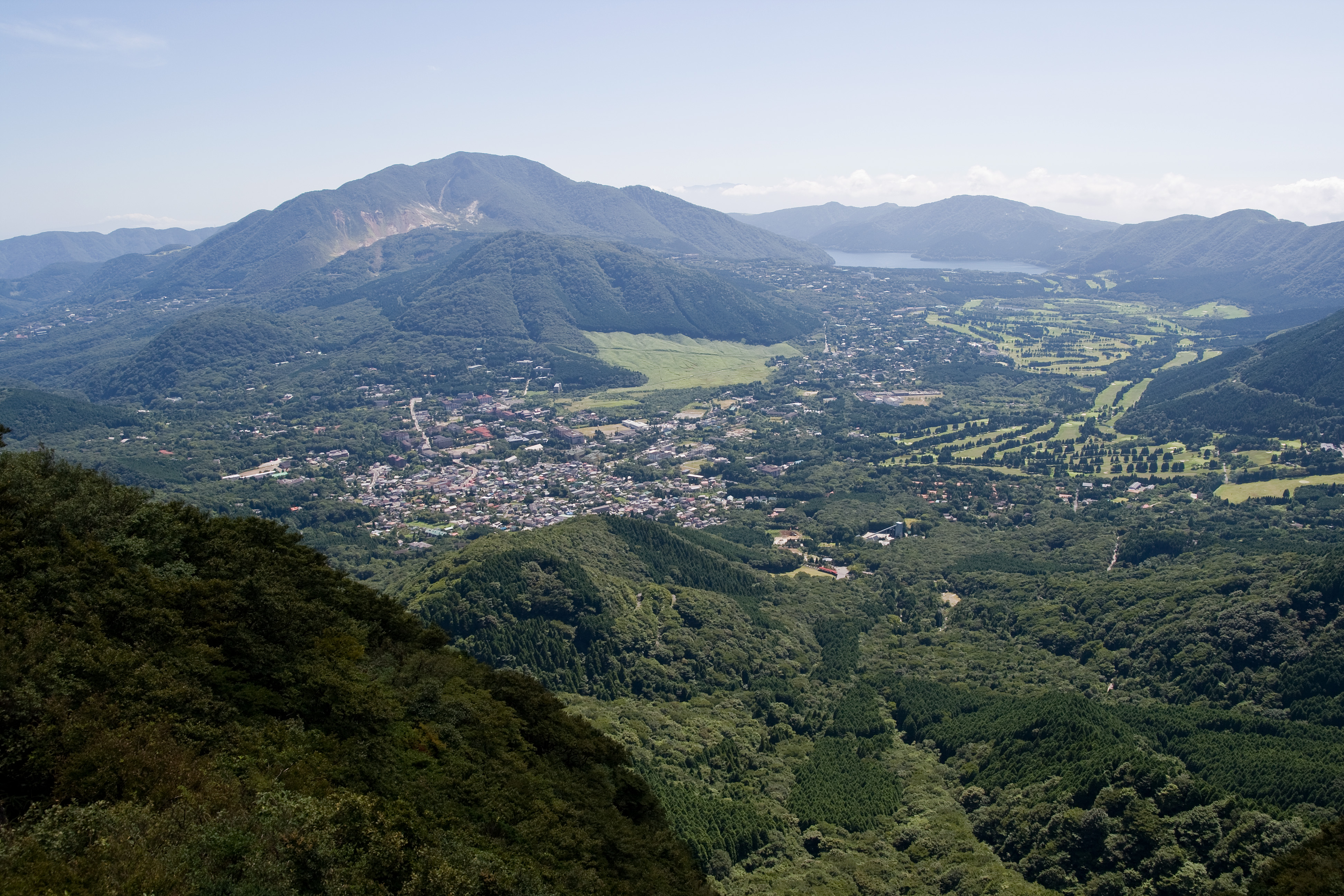
Mount Ashigara (足柄山), also known as Mount Kintoki (金時山), is the northernmost peak of the Hakone caldera, on the border of Kanagawa and Shizuoka prefectures, in the Fuji-Hakone-Izu National Park in Japan. Ashigara is not a remnant of the collapse of the old Hakone volcano itself, but rather a parasitic cone growing from its flank. Mount Ashigara is the legendary birthplace of Kintarō. Etymology The kanji of the mountain's name mean "Leg Handle Mountain", but the written form is ''ateji'', meaning that the kanji were applied phonetically, and not for any symbolic representation of the mountain's characteristics or history. In old songs it is spelled out phonetically as ''asigari'' (阿之賀利) or ''asigara'' (安思我良). Access Hakone side * 90 minutes' walk from Sengoku bus stop Gotemba side * 120 minutes' walk from Otome Toge bus stop Minami Ashigara side * 90 minutes' walk from Ashigara Pass * 120 minutes' walk from Jizodo bus stop See also * Kintoki *As ... [...More Info...] [...Related Items...] OR: [Wikipedia] [Google] [Baidu] |
Mount Hakone
, with its highest peak Mount Kami (1,438 meters), is a complex volcano in Kanagawa Prefecture, Japan that is truncated by two overlapping calderas, the largest of which is 10 × 11 km wide. The calderas were formed as a result of two major explosive eruptions about 180,000 and 49,000–60,000 years ago. Lake Ashi () lies between the southwestern caldera wall and a half dozen post-caldera lava domes that arose along a southwest–northeastern trend cutting through the center of the calderas. Dome growth occurred progressively to the south, and the largest and youngest of them, Mount Kami, forms the high point of Hakone. The calderas are breached to the east by the Haya River canyon. Mount Ashigara is a parasitic cone. The latest magmatic eruptive activity at Hakone occurred 2,900 years ago. It produced a pyroclastic flow and a lava dome in the explosion crater, although phreatic eruptions took place as recently as the 12–13th centuries AD. According to the nea ... [...More Info...] [...Related Items...] OR: [Wikipedia] [Google] [Baidu] |
Kintarō
is a folk hero from Japanese folklore. A child of superhuman strength, he was raised by a yama-uba ("mountain witch") on Mount Ashigara. He became friendly with the animals of the mountain, and later, after catching Shuten-dōji, the terror of the region around Mount Ōe, he became a loyal follower of Minamoto no Yorimitsu under the new name . He is a popular figure in Bunraku and kabuki drama, and it is a custom to put up a Kintarō doll on Boy's Day in the hope that boys will become equally brave and strong. Kintarō is supposedly based on a real person, Sakata Kintoki, who lived during the Heian period and probably came from what is now the city of Minamiashigara, Kanagawa. He served as a retainer for the samurai Minamoto no Yorimitsu and became well known for his abilities as a warrior. As with many larger-than-life individuals, his legend has grown with time. Legend Several competing stories tell of Kintarō's childhood. In one, he was raised by his mother, Princess Yaegi ... [...More Info...] [...Related Items...] OR: [Wikipedia] [Google] [Baidu] |
Ashigara Pass
is a mountain pass on the border of Kanagawa and Shizuoka Prefectures, near Mount Kintoki in Japan. The pass traverses the mountains at . History The pass, located on the ancient Tōkaidō highway, was first described in the 8th century anthology ''Man'yōshū''. This pass served as the border between Sagami and Suruga provinces, as well as the main entrance to the Kantō region in Japan. A checkpoint was built in 899, and castle was built in the 16th century, both of which are no longer standing. Access * by Car ** Kanagawa Prefecturel Route 78, from Tomei Expressway Oi-Matsuda Interchange. ** Shizuoka prefecturel Route 78, from Tomei Expressway Gotemba Interchange via Gotemba City Hall. * by Train, Bus and walk ** Hakone Tozan Bus from Shin-Matsuda Station on the Odakyu Line, or Daiyuzan Station on the Daiyuzan Line, to Jizodo, and an hour's walk. Direct operations are available from Daiyuzan Station or Jizodo to Ashigara Man'yo Koen (near this Pass) on Saturday & Holida ... [...More Info...] [...Related Items...] OR: [Wikipedia] [Google] [Baidu] |
Gotemba, Shizuoka
is a city on the southeastern flank of Mount Fuji in Shizuoka Prefecture, Japan. , the city had an estimated population of 88,370 in 36,096 households, and a population density of 450 persons per km². The total area of the city is . Geography Gotemba is located in far eastern Shizuoka Prefecture at an altitude of . Mount Fuji is located to the west, and Mount Hakone to the east, with the Tanzawa Mountains to the north and Mount Ashitaka to the south. The area is noted for its numerous golf courses, with the Mitsui Sumitomo Visa Taiheiyo Masters taking place annually. Surrounding municipalities *Shizuoka Prefecture ** Oyama ** Susono **Fujinomiya **Fuji *Kanagawa Prefecture **Hakone Demographics Per Japanese census data, the population of Gotemba has grown over the past 50 years. Climate The city has a climate characterized by characterized by hot and humid summers, and relatively mild winters (Köppen climate classification ''Cfa''). The average annual temperature in Gote ... [...More Info...] [...Related Items...] OR: [Wikipedia] [Google] [Baidu] |
Sengokuhara
, sometimes called Sengokubara, is a district in Hakone, Kanagawa, Japan. Geography The district covers a total area of approximately 22 km²,toukei-labo.com, analysis result of data of Statistics Bureau, Japan and is located in the northern part of the Hakone . The area is designated a part of , and includes golf courses, cottages, hotels, and Japanese inns. Mountains [...More Info...] [...Related Items...] OR: [Wikipedia] [Google] [Baidu] |
Hakone, Kanagawa
is a town in Kanagawa Prefecture, Japan. , the town had a population of 11,293 and a population density of 122 persons per km². The total area of the town is . The town is a popular tourist destination due to its many hot springs and views of Mount Fuji. Geography Hakone is located in the mountains in the far west of the prefecture, on the eastern side of Hakone Pass. Most of the town is within the borders of the volcanically active Fuji-Hakone-Izu National Park, centered on Lake Ashi. Surrounding municipalities Kanagawa Prefecture *Odawara *Yugawara * Minami-ashigara Shizuoka Prefecture' *Gotemba * Susono *Mishima * Oyama *Kannami Climate Hakone has a Humid subtropical climate (Köppen ''Cfa'') characterized by warm summers and cool winters with light to no snowfall. The average annual temperature in Hakone is 13.3 °C. The average annual rainfall is 2221 mm with September as the wettest month. The temperatures are highest on average in August, at around 24.0 ... [...More Info...] [...Related Items...] OR: [Wikipedia] [Google] [Baidu] |
Ateji
In modern Japanese, principally refers to kanji used to phonetically represent native or borrowed words with less regard to the underlying meaning of the characters. This is similar to in Old Japanese. Conversely, also refers to kanji used semantically without regard to the readings. For example, the word "sushi" is often written with its . Though the two characters have the readings and respectively, the character means "one's natural life span" and means "to administer", neither of which has anything to do with the food. as a means of representing loanwords has been largely superseded in modern Japanese by the use of (see also Transcription into Japanese), although many coined in earlier eras still linger on. Usage today are used conventionally for certain words, such as ('sushi'), though these words may be written in hiragana (especially for native words), or katakana (especially for borrowed words), with preference depending on the particular word, context, a ... [...More Info...] [...Related Items...] OR: [Wikipedia] [Google] [Baidu] |
Kanji
are the logographic Chinese characters taken from the Chinese family of scripts, Chinese script and used in the writing of Japanese language, Japanese. They were made a major part of the Japanese writing system during the time of Old Japanese and are still used, along with the subsequently-derived syllabic scripts of ''hiragana'' and ''katakana''. The characters have Japanese pronunciation, pronunciations; most have two, with one based on the Chinese sound. A few characters were invented in Japan by constructing character components derived from other Chinese characters. After World War II, Japan made its own efforts to simplify the characters, now known as shinjitai, by a process similar to China's simplified Chinese characters, simplification efforts, with the intention to increase literacy among the common folk. Since the 1920s, the Japanese government has published character lists periodically to help direct the education of its citizenry through the myriad Chinese characte ... [...More Info...] [...Related Items...] OR: [Wikipedia] [Google] [Baidu] |
Parasitic Cone
A parasitic cone (also adventive cone or satellite cone) is the cone-shaped accumulation of volcanic material not part of the central vent of a volcano. It forms from eruptions from fractures on the flank of the volcano. These fractures occur because the flank of the volcano is unstable. Eventually, the fractures reach the magma chamber and generate eruptions called flank eruptions, which, in turn, produce a parasitic cone. A parasitic cone can also be formed from a dike or sill cutting up to the surface from the central magma chamber in an area different from the central vent. A peculiar example of multiple parasitic cones is Jeju Island in South Korea. Jeju features 368 " oreums" (; "mount"), which lie in a roughly lateral line on either side of the island's central dormant shield volcano Hallasan. See also *Flank crater A volcanic crater is an approximately circular depression in the ground caused by volcanic activity. It is typically a bowl-shaped feature containing ... [...More Info...] [...Related Items...] OR: [Wikipedia] [Google] [Baidu] |
Minamiashigara, Kanagawa
260px, Daiyuzan Saijoji Temple is a city located in Kanagawa Prefecture, Japan. , the city had an estimated population of 40,947 and a population density of 530 persons per km². The total area of the city is . Geography Minamiashigara is located in the mountainous west of Kanagawa Prefecture, with most of the city located within either the Tanzawa-Ōyama Quasi-National Park or the Fuji-Hakone-Izu National Park. Surrounding Municipalities Kanagawa Prefecture *Odawara * Kaeisei * Yamakita *Hakone Shizuoka Prefecture * Oyama Climate Minamiashigara has a Humid subtropical climate (Köppen ''Cfa'') characterized by warm summers and cool winters with light to no snowfall. The average annual temperature in Minamiashigara is 13.6 °C. The average annual rainfall is 2221 mm with September as the wettest month. The temperatures are highest on average in August, at around 24.4 °C, and lowest in January, at around 3.2 °C. Demographics Per Japanese census data, the ... [...More Info...] [...Related Items...] OR: [Wikipedia] [Google] [Baidu] |
Fuji-Hakone-Izu National Park
is a national park in Yamanashi, Shizuoka, and Kanagawa Prefectures, and western Tokyo Metropolis, Japan. It consists of Mount Fuji, Fuji Five Lakes, Hakone, the Izu Peninsula, and the Izu Islands. Fuji-Hakone-Izu National Park covers . Rather than being a specific spot, the park is a collection of dispersed tourist sites that dot the region. The farthest point south, the isle of Hachijō-jima, is several hundred kilometers from Mount Fuji. The park includes a variety of geographic features including natural hot springs, coastlines, mountainous areas, lakes, and more than 1000 volcanic islands. Vegetation in the park ranges from species of mountainous trees to the subtropical vegetation of the Izu Islands. Fuji-Hakone-Izu National Park was established on February 2, 1936, as Fuji-Hakone National Park, and is one of the first four national parks established in Japan. In 1950, the Izu islands were added to the park, and its name changed to its present designation. Due to its prox ... [...More Info...] [...Related Items...] OR: [Wikipedia] [Google] [Baidu] |


.jpg)

