|
Moundou Airport
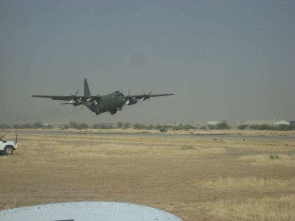
Moundou Airport ( ar, مطار ماوندو) is an airport serving Moundou, the second largest city in Chad and the capital of the region of Logone Occidental. Facilities The airport is at an elevation of above mean sea level. It has one runway designated 04/22 with an asphalt Asphalt, also known as bitumen (, ), is a sticky, black, highly viscous liquid or semi-solid form of petroleum. It may be found in natural deposits or may be a refined product, and is classed as a pitch. Before the 20th century, the term a ... surface measuring . References External links * * {{authority control Airports in Chad Logone Occidental Region Moundou ... [...More Info...] [...Related Items...] OR: [Wikipedia] [Google] [Baidu] |
Moundou
Moundou () is the second largest city in Chad and is the capital of the region of Logone Occidental. The city lies on the Mbéré River (a tributary of the Western Logone) some 475 kilometres south of the capital N'Djamena. It is the main city of the Ngambai people. Moundou has grown as an industrial centre, home to the Gala Brewery, which produces Chad's most popular beer and the cotton and oil industries. History The city was created on 8 November 1923 by the French sergeant and administrator Joseph-François Reste, Lieutenant-General of Chad from 1923 to 1926 and future Governor General of French Equatorial Africa, who, from the whaleboat upon which he navigated the Logone, found the site pretty. By 1916, the military conquest of Chad was completed, however movements of resistance to the colonial regime took place. It was especially in the southwest of the country that dissensions continued until about 1930. He decided to found the post of Moundou in the centre of the ... [...More Info...] [...Related Items...] OR: [Wikipedia] [Google] [Baidu] |
Chad
Chad (; ar, تشاد , ; french: Tchad, ), officially the Republic of Chad, '; ) is a landlocked country at the crossroads of North and Central Africa. It is bordered by Libya to the north, Sudan to the east, the Central African Republic to the south, Cameroon to the southwest, Nigeria to the southwest (at Lake Chad), and Niger to the west. Chad has a population of 16 million, of which 1.6 million live in the capital and largest city of N'Djamena. Chad has several regions: a desert zone in the north, an arid Sahelian belt in the centre and a more fertile Sudanian Savanna zone in the south. Lake Chad, after which the country is named, is the second-largest wetland in Africa. Chad's official languages are Arabic and French. It is home to over 200 different ethnic and linguistic groups. Islam (55.1%) and Christianity (41.1%) are the main religions practiced in Chad. Beginning in the 7th millennium BC, human populations moved into the Chadian basin in great numbe ... [...More Info...] [...Related Items...] OR: [Wikipedia] [Google] [Baidu] |
DAFIF
DAFIF () or the ''Digital Aeronautical Flight Information File'' is a comprehensive database of up-to-date aeronautical data, including information on airports, airways, airspaces, navigation data, and other facts relevant to flying in the entire world, managed by the National Geospatial-Intelligence Agency (NGA) of the United States. Withdrawal of public access DAFIF was publicly available until October 2006 through the Internet; however, it was closed to public access because "increased numbers of foreign source providers are claiming intellectual property rights or are forewarning NGA that they intend to copyright their source". Currently, only federal and state government agencies, authorized government contractors, and Department of Defense customers are able to access the DAFIF data. At the time of the announcement, the NGA did not say who the "foreign source providers" were. It was subsequently revealed that the Australian Government was behind the move. The Australian ... [...More Info...] [...Related Items...] OR: [Wikipedia] [Google] [Baidu] |
Airport
An airport is an aerodrome with extended facilities, mostly for commercial air transport. Airports usually consists of a landing area, which comprises an aerially accessible open space including at least one operationally active surface such as a runway for a plane to take off and to land or a helipad, and often includes adjacent utility buildings such as control towers, hangars and terminals, to maintain and monitor aircraft. Larger airports may have airport aprons, taxiway bridges, air traffic control centres, passenger facilities such as restaurants and lounges, and emergency services. In some countries, the US in particular, airports also typically have one or more fixed-base operators, serving general aviation. Operating airports is extremely complicated, with a complex system of aircraft support services, passenger services, and aircraft control services contained within the operation. Thus airports can be major employers, as well as important hubs for tourism ... [...More Info...] [...Related Items...] OR: [Wikipedia] [Google] [Baidu] |
Regions Of Chad
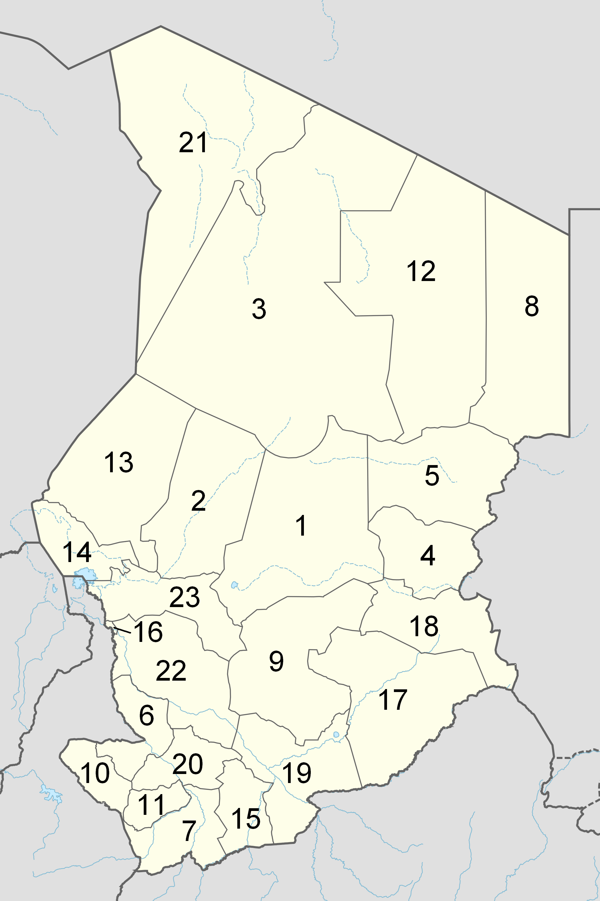
The Republic of Chad is made up of twenty-three regions. Chad was divided into regions in 2002. It was previously divided into prefectures, and then departments. Current regions This is a list of the regions of Chad since 2012, with population figures from the 2009 census. History From independence in 1960 until 1999 it was divided into 14 ''préfectures''. These were replaced in 1999 by 28 ''départements''. The country was reorganized again in 2002 to produce 18 ''régions''. In 2008, a further four ''régions'' were created, increasing the number to 22. Ennedi Region was split into Ennedi-Est and Ennedi-Ouest in 2012, producing the current 23 regions. Regions (2008–2012) Regions (2002–2008) (1) created in 2004 Regions created in 2008 On February 19, 2008, four new regions were created: * Former Borkou-Ennedi-Tibesti Region divided into: ** Borkou Region, from Borkou-Ennedi-Tibesti's former Borkou Department ** Ennedi Region, from Borkou-Ennedi-Ti ... [...More Info...] [...Related Items...] OR: [Wikipedia] [Google] [Baidu] |
Logone Occidental Region
Logone Occidental is one of the 23 regions of Chad, located in the south-west of the country. Its capital is Moundou. It is coterminous with the former Logone Occidental Prefecture. Geography The region borders Tandjilé Region to the north, Logone Oriental Region to the east and south, and Mayo-Kebbi Ouest Region to the west. Settlements Moundou is the regional capital and second largest city in Chad; other major settlements in the region include Bao, Bébalem, Béïnamar, Béïssa, Békiri, Béladjia, Bémangra, Bénoye, Bourou, Déli, Dodinda, Doguindi, Krim Krim, Laoukassy, Mbalkabra, Mballa Banyo, Ngondong and Saar Gogné. Demographics As per the Chadian census of 2009, the total population in the region was 683,293, 51.50 per cent female. The average size of household as of 2009 was 5.20: 5.20 in rural households and 4.90 in urban areas. The number of households was 132,349: 99,255 in rural areas and 33,094 in urban areas. The number of nomads in the regi ... [...More Info...] [...Related Items...] OR: [Wikipedia] [Google] [Baidu] |
Elevation
The elevation of a geographic location is its height above or below a fixed reference point, most commonly a reference geoid, a mathematical model of the Earth's sea level as an equipotential gravitational surface (see Geodetic datum § Vertical datum). The term ''elevation'' is mainly used when referring to points on the Earth's surface, while ''altitude'' or ''geopotential height'' is used for points above the surface, such as an aircraft in flight or a spacecraft in orbit, and '' depth'' is used for points below the surface. Elevation is not to be confused with the distance from the center of the Earth. Due to the equatorial bulge, the summits of Mount Everest and Chimborazo have, respectively, the largest elevation and the largest geocentric distance. Aviation In aviation the term elevation or aerodrome elevation is defined by the ICAO as the highest point of the landing area. It is often measured in feet and can be found in approach charts of the aerodrome. It is n ... [...More Info...] [...Related Items...] OR: [Wikipedia] [Google] [Baidu] |
Mean Sea Level
There are several kinds of mean in mathematics Mathematics is an area of knowledge that includes the topics of numbers, formulas and related structures, shapes and the spaces in which they are contained, and quantities and their changes. These topics are represented in modern mathematics ..., especially in statistics. Each mean serves to summarize a given group of data, often to better understand the overall value (magnitude (mathematics), magnitude and sign (mathematics), sign) of a given data set. For a data set, the ''arithmetic mean'', also known as "arithmetic average", is a measure of central tendency of a finite set of numbers: specifically, the sum of the values divided by the number of values. The arithmetic mean of a set of numbers ''x''1, ''x''2, ..., x''n'' is typically denoted using an overhead bar, \bar. If the data set were based on a series of observations obtained by sampling (statistics), sampling from a statistical population, the arithmetic mean is th ... [...More Info...] [...Related Items...] OR: [Wikipedia] [Google] [Baidu] |
Runway
According to the International Civil Aviation Organization (ICAO), a runway is a "defined rectangular area on a land aerodrome prepared for the landing and takeoff of aircraft". Runways may be a man-made surface (often asphalt concrete, asphalt, concrete, or a mixture of both) or a natural surface (sod, grass, soil, dirt, gravel, ice, sand or road salt, salt). Runways, as well as taxiways and Airport apron, ramps, are sometimes referred to as "tarmac", though very few runways are built using Tarmacadam, tarmac. Takeoff and landing areas defined on the surface of water for seaplanes are generally referred to as waterways. Runway lengths are now International Civil Aviation Organization#Use of the International System of Units, commonly given in meters worldwide, except in North America where feet are commonly used. History In 1916, in a World War I war effort context, the first concrete-paved runway was built in Clermont-Ferrand in France, allowing local company Michelin to ... [...More Info...] [...Related Items...] OR: [Wikipedia] [Google] [Baidu] |
Asphalt Concrete
Asphalt concrete (commonly called asphalt, blacktop, or pavement in North America, and tarmac, bitumen macadam, or rolled asphalt in the United Kingdom and the Republic of Ireland) is a composite material commonly used to surface roads, parking lots, airports, and the core of embankment dams. Asphalt mixtures have been used in pavement construction since the beginning of the twentieth century. It consists of mineral aggregate bound together with asphalt, laid in layers, and compacted. The process was refined and enhanced by Belgian-American inventor Edward De Smedt. The terms ''asphalt'' (or ''asphaltic'') ''concrete'', ''bituminous asphalt concrete'', and ''bituminous mixture'' are typically used only in engineering and construction documents, which define concrete as any composite material composed of mineral aggregate adhered with a binder. The abbreviation, ''AC'', is sometimes used for ''asphalt concrete'' but can also denote ''asphalt content'' or ''asphalt cement'', ... [...More Info...] [...Related Items...] OR: [Wikipedia] [Google] [Baidu] |
Airports In Chad
This is a list of airports in Chad, grouped by type and sorted by location. Chad, officially known as the Republic of Chad (french: République du Tchad, ar, جمهورية تشاد or ''Jumhūriyyat Tshād''), is a landlocked country in Central Africa. It is bordered by Libya to the north, Sudan to the east, the Central African Republic to the south, Cameroon and Nigeria to the southwest, and Niger to the west. The country is divided into 22 regions, which are further divided into departments and Sub-prefectures. Chad's capital and largest city is N'Djamena, which is the location of the country's main airport. Scheduled passenger service is available at N'Djamena and five other cities. Toumaï Air Tchad is the national flag carrier airline, operating domestic services within Chad as well as scheduled international services to other African nations. __TOC__ Airports Airport names shown in bold indicate the airport has scheduled service on commercial airlines. , , 0 ... [...More Info...] [...Related Items...] OR: [Wikipedia] [Google] [Baidu] |


