|
Monteregian Hills
The Monteregian Hills (french: Collines Montérégiennes) is a linear chain of isolated hills in Montreal and Montérégie, between the Laurentians and the Appalachians. Etymology The first definition of the Monteregian Hills came about in 1903 when Montreal geologist Frank Dawson Adams began referring to Mount Royal (Latin, ''Mons Regius'') and hills of similar geology in the Saint Lawrence Lowlands as the "Royal Mountains" (french: montagnes royales). Other hills in the chain included Mont Saint-Bruno, Mont Saint-Hilaire, Mont Saint-Grégoire, Mont Rougemont, Mont Yamaska, Mont Shefford, and Mont Brome. It was only later that Mont Mégantic, the Oka Hills, as well as the Saint-André and d'Iberville formations, were added to the list. Geology Each hill in the chain consists of an erosional remnant of Cretaceous intrusive igneous rock and associated hornfels, which are more resistant to weathering than the surrounding sedimentary rock. All of the hills have dark-coloured maf ... [...More Info...] [...Related Items...] OR: [Wikipedia] [Google] [Baidu] |
Mont Saint-Hilaire
Mont Saint-Hilaire (English: Mount Saint-Hilaire; abe, Wigwômadenizibo; see for other names) is an isolated hill, high, in the Montérégie region of southern Quebec. It is about thirty kilometres east of Montreal, and immediately east of the Richelieu River. It is one of the Monteregian Hills. Around the mountains are the towns of Mont-Saint-Hilaire and Saint-Jean-Baptiste. Other nearby towns include Otterburn Park, Beloeil and McMasterville. The area surrounding the mountain is a biosphere reserve, as one of the last remnants of the primeval forests of the Saint-Lawrence valley. Most of the mountain is currently the property of McGill University, as the ''Gault Nature Reserve'', which is considered the third McGill campus. The University has opened the western half of the mountain to visitors (at a fee) for hiking and cross-country skiing, as the ''Milieu Naturel'' (natural area). The eastern half, or ''Milieu de Conservation'' (preservation area) is not accessible to t ... [...More Info...] [...Related Items...] OR: [Wikipedia] [Google] [Baidu] |
Cretaceous
The Cretaceous ( ) is a geological period that lasted from about 145 to 66 million years ago (Mya). It is the third and final period of the Mesozoic Era, as well as the longest. At around 79 million years, it is the longest geological period of the entire Phanerozoic. The name is derived from the Latin ''creta'', "chalk", which is abundant in the latter half of the period. It is usually abbreviated K, for its German translation ''Kreide''. The Cretaceous was a period with a relatively warm climate, resulting in high eustatic sea levels that created numerous shallow inland seas. These oceans and seas were populated with now- extinct marine reptiles, ammonites, and rudists, while dinosaurs continued to dominate on land. The world was ice free, and forests extended to the poles. During this time, new groups of mammals and birds appeared. During the Early Cretaceous, flowering plants appeared and began to rapidly diversify, becoming the dominant group of plants across the Earth b ... [...More Info...] [...Related Items...] OR: [Wikipedia] [Google] [Baidu] |
North American Plate
The North American Plate is a tectonic plate covering most of North America, Cuba, the Bahamas, extreme northeastern Asia, and parts of Iceland and the Azores. With an area of , it is the Earth's second largest tectonic plate, behind the Pacific Plate (which borders the plate to the west). It extends eastward to the Mid-Atlantic Ridge and westward to the Chersky Range in eastern Siberia. The plate includes both continental and oceanic crust. The interior of the main continental landmass includes an extensive granitic core called a craton. Along most of the edges of this craton are fragments of crustal material called terranes, which are accreted to the craton by tectonic actions over a long span of time. It is thought that much of North America west of the Rocky Mountains is composed of such terranes. Boundaries The southern boundary with the Cocos Plate to the west and the Caribbean Plate to the east is a transform fault, represented by the Swan Islands Transform Fault unde ... [...More Info...] [...Related Items...] OR: [Wikipedia] [Google] [Baidu] |
Great Meteor Hotspot Track
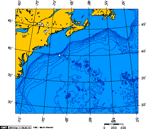
The New England hotspot, also referred to as the Great Meteor hotspot and sometimes the Monteregian hotspot, is a volcanic hotspot in the North Atlantic Ocean. It created the Monteregian Hills intrusions in Montreal and Montérégie, the White Mountains intrusions in New Hampshire, the New England and Corner Rise seamounts off the coast of North America, and the Seewarte Seamounts east of the Mid-Atlantic Ridge on the African Plate, the latter of which include its most recent eruptive center, the Great Meteor Seamount. The New England, Great Meteor, or Monteregian hotspot track has been used to estimate the movement of the North American Plate away from the African Plate from the early Cretaceous period to the present using the fixed hotspot reference frame. Geologic history The geologic history of the New England hotspot is the subject of much debate among geoscientists. The conventional opinion is that volcanic activity associated with the hotspot results from movement of ... [...More Info...] [...Related Items...] OR: [Wikipedia] [Google] [Baidu] |
Syenite
Syenite is a coarse-grained intrusive igneous rock with a general composition similar to that of granite, but deficient in quartz, which, if present at all, occurs in relatively small concentrations (< 5%). Some syenites contain larger proportions of components and smaller amounts of felsic material than most granites; those are classed as being of . The equivalent of syenite is |
Essexite
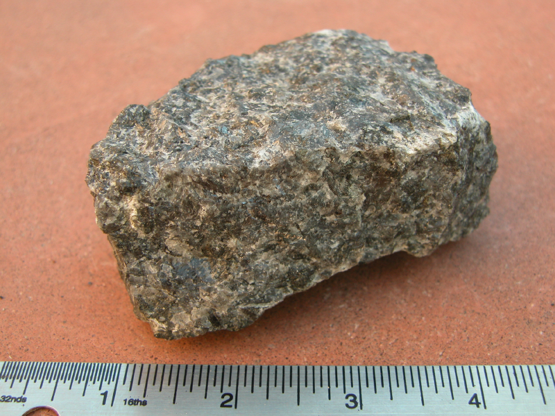
Essexite (), also called nepheline monzogabbro (), is a dark gray or black holocrystalline plutonic igneous rock. Its name is derived from the type locality in Essex County, Massachusetts, in the United States. Modern petrology identifies rocks according to mineralogical criteria. Utilising the IUGS QAPF diagram of Streckeisen (1974) "essexite" is more formally known as nepheline monzodiorite or nepheline monzogabbro depending on the ratio of orthoclase to plagioclase and the abundance of nepheline. Petrology In order to produce a magma composition suitable for forming essexite the partial melting of the source rocks must be restricted, generally to less than 10% partial melting. This favors producing a melt rich in large-ion lithophile elements (LILE) such as K, Ba, Rb, Cs, Sr. The source melts of essexites contain more aluminium and alkali ions than available silica tetrahedra, which is why essexites crystallise nepheline instead of plagioclase. Higher than normal p ... [...More Info...] [...Related Items...] OR: [Wikipedia] [Google] [Baidu] |
Gabbro
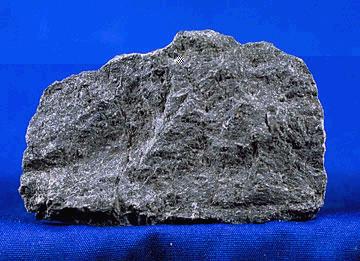
Gabbro () is a phaneritic (coarse-grained), mafic intrusive igneous rock formed from the slow cooling of magnesium-rich and iron-rich magma into a holocrystalline mass deep beneath the Earth's surface. Slow-cooling, coarse-grained gabbro is chemically equivalent to rapid-cooling, fine-grained basalt. Much of the Earth's oceanic crust is made of gabbro, formed at mid-ocean ridges. Gabbro is also found as plutons associated with continental volcanism. Due to its variant nature, the term ''gabbro'' may be applied loosely to a wide range of intrusive rocks, many of which are merely "gabbroic". By rough analogy, gabbro is to basalt as granite is to rhyolite. Etymology The term "gabbro" was used in the 1760s to name a set of rock types that were found in the ophiolites of the Apennine Mountains in Italy. It was named after Gabbro, a hamlet near Rosignano Marittimo in Tuscany. Then, in 1809, the German geologist Christian Leopold von Buch used the term more restrictively in his descri ... [...More Info...] [...Related Items...] OR: [Wikipedia] [Google] [Baidu] |
Mafic
A mafic mineral or rock is a silicate mineral or igneous rock rich in magnesium and iron. Most mafic minerals are dark in color, and common rock-forming mafic minerals include olivine, pyroxene, amphibole, and biotite. Common mafic rocks include basalt, diabase and gabbro. Mafic rocks often also contain calcium-rich varieties of plagioclase feldspar. Mafic materials can also be described as ferromagnesian. History The term ''mafic'' is a portmanteau of "magnesium" and "ferric" and was coined by Charles Whitman Cross, Joseph P. Iddings, Louis Valentine Pirsson, and Henry Stephens Washington in 1912. Cross' group had previously divided the major rock-forming minerals found in igneous rocks into ''salic'' minerals, such as quartz, feldspars, or feldspathoids, and ''femic'' minerals, such as olivine and pyroxene. However, micas and aluminium-rich amphiboles were excluded, while some calcium minerals containing little iron or magnesium, such as wollastonite or apatite, were included ... [...More Info...] [...Related Items...] OR: [Wikipedia] [Google] [Baidu] |
Sedimentary
Sedimentary rocks are types of rock (geology), rock that are formed by the accumulation or deposition of mineral or organic matter, organic particles at Earth#Surface, Earth's surface, followed by cementation (geology), cementation. Sedimentation is the collective name for processes that cause these particles to settle in place. The particles that form a sedimentary rock are called sediment, and may be composed of detritus (geology), geological detritus (minerals) or detritus, biological detritus (organic matter). The geological detritus originated from weathering and erosion of existing rocks, or from the solidification of molten lava blobs erupted by volcanoes. The geological detritus is transported to the place of deposition by water, wind, ice or Mass wasting, mass movement, which are called agents of denudation. Biological detritus was formed by bodies and parts (mainly shells) of dead aquatic organisms, as well as their fecal mass, suspended in water and slowly piling up on ... [...More Info...] [...Related Items...] OR: [Wikipedia] [Google] [Baidu] |
Weathering
Weathering is the deterioration of rocks, soils and minerals as well as wood and artificial materials through contact with water, atmospheric gases, and biological organisms. Weathering occurs ''in situ'' (on site, with little or no movement), and so is distinct from erosion, which involves the transport of rocks and minerals by agents such as water, ice, snow, wind, waves and gravity. Weathering processes are divided into ''physical'' and ''chemical weathering''. Physical weathering involves the breakdown of rocks and soils through the mechanical effects of heat, water, ice, or other agents. Chemical weathering involves the chemical reaction of water, atmospheric gases, and biologically produced chemicals with rocks and soils. Water is the principal agent behind both physical and chemical weathering, though atmospheric oxygen and carbon dioxide and the activities of biological organisms are also important. Chemical weathering by biological action is also known as biological wea ... [...More Info...] [...Related Items...] OR: [Wikipedia] [Google] [Baidu] |
Hornfels
Hornfels is the group name for a set of contact metamorphic rocks that have been baked and hardened by the heat of intrusive igneous masses and have been rendered massive, hard, splintery, and in some cases exceedingly tough and durable. These properties are due to fine grained non-aligned crystals with platy or prismatic habits, characteristic of metamorphism at high temperature but without accompanying deformation. The term is derived from the German word ''Hornfels'', meaning "hornstone", because of its exceptional toughness and texture both reminiscent of animal horns. These rocks were referred to by miners in northern England as whetstones. Most hornfels are fine-grained, and while the original rocks (such as sandstone, shale, slate and limestone) may have been more or less fissile owing to the presence of bedding or cleavage planes, this structure is effaced or rendered inoperative in the hornfels. Though many hornfels show vestiges of the original bedding, they break acro ... [...More Info...] [...Related Items...] OR: [Wikipedia] [Google] [Baidu] |


