|
Montana Highway 78
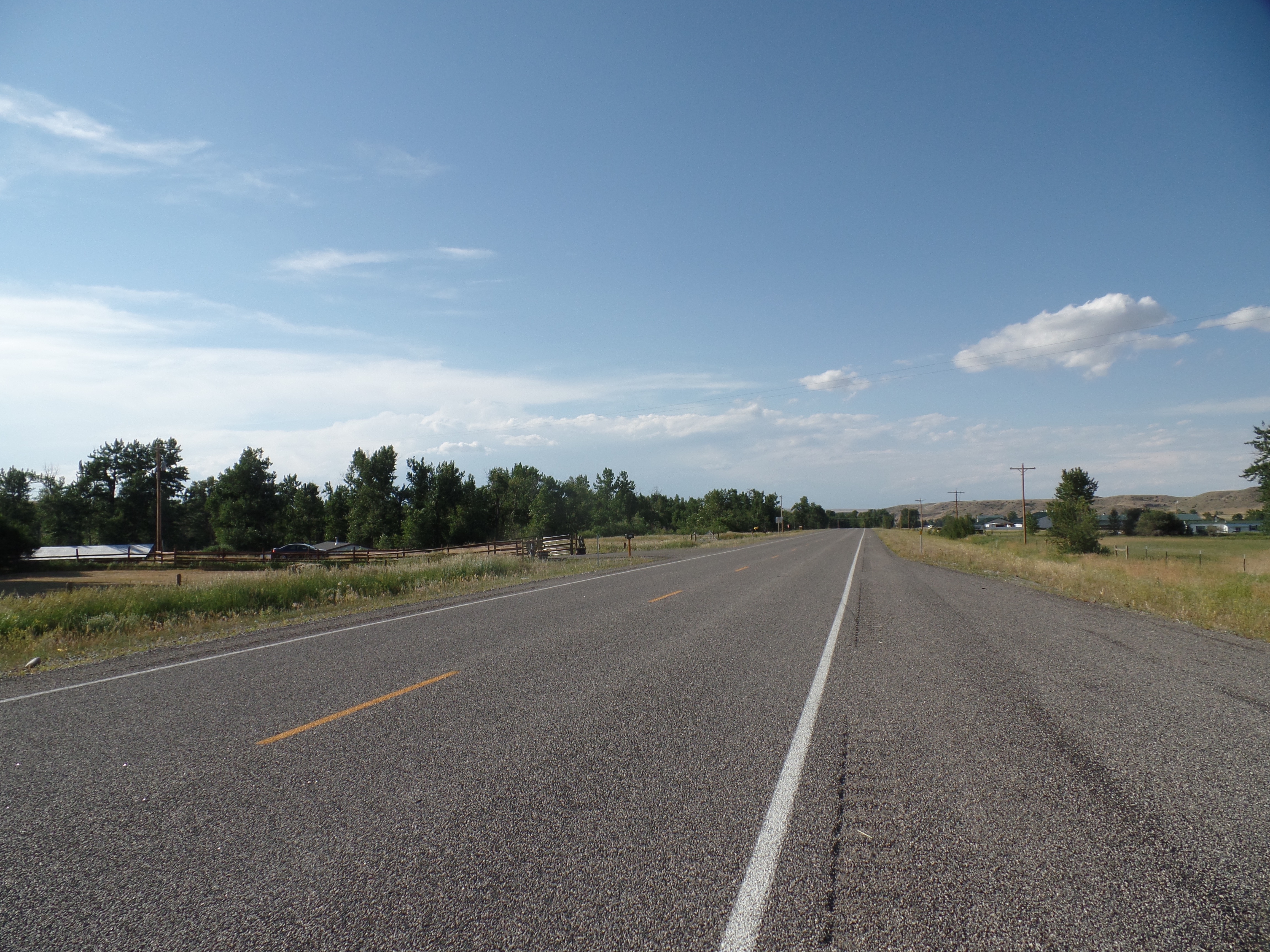
Montana Highway 78 (MT 78) in the U.S. state of Montana is a state highway running in a northerly direction from an intersection with U.S. Highway 212 (US 212) at the city of Red Lodge. It runs through Roscoe and Absarokee. The highway extends about to a northern terminus at Interstate 90 (I-90) in the town of Columbus Columbus is a Latinized version of the Italian surname "''Colombo''". It most commonly refers to: * Christopher Columbus (1451-1506), the Italian explorer * Columbus, Ohio, capital of the U.S. state of Ohio Columbus may also refer to: Places .... History Before receiving its present designation in 1978, MT 78 was designated as Montana Secondary Highway 307 (S-307). Major intersections See also * References External links 078 Transportation in Carbon County, Montana Transportation in Stillwater County, Montana {{Montana-road-stub ... [...More Info...] [...Related Items...] OR: [Wikipedia] [Google] [Baidu] |
Red Lodge, Montana
Red Lodge is a city and county seat of Carbon County, Montana, United States. As of the 2020 census, the population of the city was 2,257. History On September 17, 1851, the United States government signed a treaty with the Crow Nation, ceding the area which now contains Red Lodge, MT to the Crow Indians. Rich coal deposits were found there in 1866, and gold was discovered nearby in 1870. An 1880 treaty between the U.S. government and the Crow allowed the area to be settled starting April 11, 1882. The Red Lodge post office was established on Dec 9, 1884 with Postmaster Ezra L. Benton. A rail line was constructed into town, and coal shipments began in June 1889. The boundaries of the Crow Reservation were redrawn October 15, 1892, opening the whole area to settlement. From then until the 1930s, coal mining defined the town. In the late 19th century, many new settlers came to Red Lodge, MT. The majority came from Italy, the British Isles, Finland, Norway, Sweden, Germany, and ... [...More Info...] [...Related Items...] OR: [Wikipedia] [Google] [Baidu] |
Columbus, Montana
Columbus is a town in and the county seat of Stillwater County, Montana, United States. The population was 1,857 at the 2020 census. History The community originated as a stagecoach station on the Yellowstone River. The original name was Sheep Dip, then changed to Stillwater, but because of a Stillwater, Minnesota on the Northern Pacific Railroad, the mail presented a problem. The name was ultimately changed to Columbus, Montana in 1893. Geography and climate Columbus is located at (45.64, -109.25). According to the United States Census Bureau, the town has a total area of , of which is land and is water. Columbus is located between the Yellowstone River, the old Yellowstone Trail, Highway 10, and now Interstate 90. According to the Köppen Climate Classification system, Columbus has a warm-summer humid continental climate, abbreviated "Dfb" on climate maps. Demographics 2010 census As of the census of 2010, there were 1,893 people, 767 households, and 517 families r ... [...More Info...] [...Related Items...] OR: [Wikipedia] [Google] [Baidu] |
Carbon County, Montana
Carbon County is a county located in the U.S. state of Montana. As of the 2020 census, the population was 10,473. Its county seat is Red Lodge. Carbon County is part of the Billings, MT Metropolitan Statistical Area. History Carbon County was named for the rich coal deposits found in the area. It was organized on March 4, 1895, from portions of Park and Yellowstone counties. Land from Park and Yellowstone counties was used to form Carbon County on March 4, 1895. More than sixty federally designated historic sites are located in the county, including Petroglyph Canyon, one of the state's most important rock art sites. The first commercial oil well in the state was established in Elk Basin fields in 1915. Geography According to the United States Census Bureau, the county has a total area of , of which is land and (0.6%) is water. Granite Peak, the state's highest mountain, is found in Carbon County's Beartooth Mountains. The Beartooth Highway, one of the "most specta ... [...More Info...] [...Related Items...] OR: [Wikipedia] [Google] [Baidu] |
Stillwater County, Montana
Stillwater County is a county in the U.S. state of Montana. As of the 2020 census, the population was 8,963. Its county seat is Columbus. Geography According to the United States Census Bureau, the county has a total area of , of which is land and (0.5%) is water. Major highways * Interstate 90 * U.S. Highway 10 (Former) * Montana Highway 78 Adjacent counties * Golden Valley County - north * Yellowstone County - east * Carbon County - south * Park County - southwest * Sweet Grass County - west National protected areas * Custer National Forest (part) * Grass Lake National Wildlife Refuge * Hailstone National Wildlife Refuge Demographics 2000 census As of the 2000 United States census, there were 8,195 people, 3,234 households, and 2,347 families in the county. The population density was 5 people per square mile (2/km2). There were 3,947 housing units at an average density of 2 per square mile (1/km2). The racial makeup of the county was 96.82% White, 0.13% ... [...More Info...] [...Related Items...] OR: [Wikipedia] [Google] [Baidu] |
Montana
Montana () is a state in the Mountain West division of the Western United States. It is bordered by Idaho to the west, North Dakota and South Dakota to the east, Wyoming to the south, and the Canadian provinces of Alberta, British Columbia, and Saskatchewan to the north. It is the fourth-largest state by area, the eighth-least populous state, and the third-least densely populated state. Its state capital is Helena. The western half of Montana contains numerous mountain ranges, while the eastern half is characterized by western prairie terrain and badlands, with smaller mountain ranges found throughout the state. Montana has no official nickname but several unofficial ones, most notably "Big Sky Country", "The Treasure State", "Land of the Shining Mountains", and " The Last Best Place". The economy is primarily based on agriculture, including ranching and cereal grain farming. Other significant economic resources include oil, gas, coal, mining, and lumber. The health ca ... [...More Info...] [...Related Items...] OR: [Wikipedia] [Google] [Baidu] |
State Highway
A state highway, state road, or state route (and the equivalent provincial highway, provincial road, or provincial route) is usually a road that is either ''numbered'' or ''maintained'' by a sub-national state or province. A road numbered by a state or province falls below numbered national highways (Canada being a notable exception to this rule) in the hierarchy (route numbers are used to aid navigation, and may or may not indicate ownership or maintenance). Roads maintained by a state or province include both nationally numbered highways and un-numbered state highways. Depending on the state, "state highway" may be used for one meaning and "state road" or "state route" for the other. In some countries such as New Zealand, the word "state" is used in its sense of a sovereign state or country. By this meaning a state highway is a road maintained and numbered by the national government rather than local authorities. Countries Australia Australia's State Route system covers u ... [...More Info...] [...Related Items...] OR: [Wikipedia] [Google] [Baidu] |
Interstate 90 In Montana
Interstate 90 (I-90) is an east–west transcontinental Interstate Highway across the northern United States, linking Seattle to Boston. The portion in the state of Montana is in length, passing through fourteen counties in central and southern Montana. Due to the large size of Montana, it is the longest segment of I-90 within a single state. Route description Mineral County I-90 enters Montana and Mineral County from Shoshone County, Idaho over the high Lookout Pass, which traverses the Coeur d'Alene Mountains of the Bitterroot Range, and immediately has its first interchange, a partial cloverleaf interchange serving extreme northwest Mineral County and access to Lookout Pass Ski and Recreation Area. The highway continues southeasterly through woodlands, paralleling the St. Regis River, before meeting the Dena Mora (Lookout Pass) rest area east of the Idaho–Montana border. About from the rest stop is a diamond interchange, serving a small minor road into th ... [...More Info...] [...Related Items...] OR: [Wikipedia] [Google] [Baidu] |
Montana Department Of Transportation
The Montana Department of Transportation (MDT) is a governmental agency in the U.S. state of Montana, responsible for numerous programs related to the construction, maintenance, and monitoring of Montana's transportation infrastructure and operations. While most of MDT's programs relate to the state's highway network, Montana's railroads and airports are also under the agency's purview. Responsibilities The responsibilities of the department include: *Designing and constructing roads and bridges *Maintaining roads, bridges, and rest areas *Collecting and enforcing fuel taxes *Enforcing safety, size, and weight laws for commercial vehicles *Managing the state motor pool *Designing and testing materials *Acquiring property *Enforcing Outdoor Advertising Control Act *Planning public transport and rail programs *Planning general aviation airports *Performing air search and rescue *Performing snow removal on roads History In March 1913, a state Highway Commission was created by the le ... [...More Info...] [...Related Items...] OR: [Wikipedia] [Google] [Baidu] |
Montana Secondary Highway 307
__NOTOC__ Year 307 ( CCCVII) was a common year starting on Wednesday (link will display the full calendar) of the Julian calendar. At the time, it was known as the Year of the Consulship of Severus and Maximinus (or, less frequently, year 1060 ''Ab urbe condita''). The denomination 307 for this year has been used since the early medieval period, when the Anno Domini calendar era became the prevalent method in Europe for naming years. Events By place Roman Empire * Winter: Emperor Galerius wins his second victory over the Sarmatians. * Galerius sends Valerius Severus with the army of northern Italy, to suppress the rebellion in Rome. However, faced with their former emperor Maximian, the soldiers desert him, and Severus flees to Ravenna Ravenna ( , , also ; rgn, Ravèna) is the capital city of the Province of Ravenna, in the Emilia-Romagna region of Northern Italy. It was the capital city of the Western Roman Empire from 408 until its collapse in 476. It then serve ... [...More Info...] [...Related Items...] OR: [Wikipedia] [Google] [Baidu] |


