|
Miꞌkmaꞌki
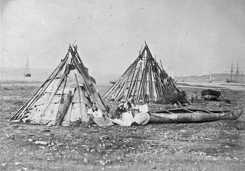
Miꞌkmaꞌki or Miꞌgmaꞌgi is composed of the traditional and current territories, or country, of the Miꞌkmaq people, in what is now Nova Scotia, Canada. It is shared by an inter-Nation forum among Miꞌkmaq First Nations and is divided into seven geographical and traditional districts. Today ''Taqamkuk'' is separately represented as an eighth district. Miꞌkmaꞌki is one of the confederate nations within the Wabanaki. History Each district was autonomous, headed by a '' Sagamaw''. He would meet with Wampum readers and knowledge keepers called ''turkey keeper's'', a women's council, and the ''Kji Sagamaw'', or Grand Chief, to form the ''Santeꞌ' or ''Miꞌkmawey Mawioꞌmi (Grand Council). The seat of the Santeꞌ Mawioꞌmi is at Mniku in Unamaꞌkik. It still functions as the capital today in the Potlotek reserve. Following European contact, Miꞌkmaꞌki was colonized by the French and British in modern Nova Scotia, who made competing claims for the land. S ... [...More Info...] [...Related Items...] OR: [Wikipedia] [Google] [Baidu] |
Miꞌkmaq
The Mi'kmaq (also ''Mi'gmaq'', ''Lnu'', ''Miꞌkmaw'' or ''Miꞌgmaw''; ; ) are a First Nations people of the Northeastern Woodlands, indigenous to the areas of Canada's Atlantic Provinces and the Gaspé Peninsula of Quebec as well as the northeastern region of Maine. The traditional national territory of the Mi'kmaq is named Miꞌkmaꞌki (or Miꞌgmaꞌgi). There are 170,000 Mi'kmaq people in the region, (including 18,044 members in the recently formed Qalipu First Nation in Newfoundland.) Nearly 11,000 members speak Miꞌkmaq, an Eastern Algonquian language. Once written in Miꞌkmaw hieroglyphic writing, it is now written using most letters of the Latin alphabet. The Mi'kmaq, Maliseet, and Pasamaquoddy nations signed a series of treaties known as the Covenant Chain of Peace and Friendship Treaties with the British Crown throughout the eighteenth century; the first was signed in 1725, and the last in 1779. The Miꞌkmaq maintain that they did not cede or give up their ... [...More Info...] [...Related Items...] OR: [Wikipedia] [Google] [Baidu] |
Wabanaki Confederacy
The Wabanaki Confederacy (''Wabenaki, Wobanaki'', translated to "People of the Dawn" or "Easterner") is a North American First Nations and Native American confederation of four principal Eastern Algonquian nations: the Miꞌkmaq, Maliseet (''Wolastoqey''), Passamaquoddy (''Peskotomahkati'') and Penobscot. The Western Abenaki are also considered members, being a loose identity for a number of allied tribal peoples such as the Sokoki, Cowasuck, Missiquoi, and Arsigantegok, among others. There were more tribes, along with many bands, that were once part of the Confederation. Native tribes such as the Norridgewock, Etchemin, Alemousiski, and Canibas, through massacres, tribal consolidation, and ethnic label shifting were absorbed into the five larger national identities. Members of the Wabanaki Confederacy, the Wabanaki, are located in and named for the area which they call ''Wabanakik'' ("Dawnland"), roughly the area that became the French colony of Acadia. It is made up ... [...More Info...] [...Related Items...] OR: [Wikipedia] [Google] [Baidu] |
Miꞌkmaq Language
The Miꞌkmaq language (), or , is an Eastern Algonquian language spoken by nearly 11,000 Miꞌkmaq in Canada and the United States; the total ethnic Miꞌkmaq population is roughly 20,000. The native name of the language is , or (in some dialects). The word is a plural word meaning 'my friends' (singular Micmac Teaching Grammar. Delisle / Metallic 1976.); the adjectival form is . Phonology The phonemic inventory of Miꞌkmaq is shown below. Vowels Consonants The consonants of Miꞌkmaq can be divided into two groups: the obstruents , and the sonorants . The vowels of Miꞌkmaq are also counted as sonorants. The obstruents have a wide variety of pronunciations. When they are located word-initially or next to another obstruent, they are voiceless. However, when they are located between sonorants, they are voiced, and appear as . When the stops and affricate are located word-finally, they may be aspirated, and appear as . An example of each kind of pronunciation is given ... [...More Info...] [...Related Items...] OR: [Wikipedia] [Google] [Baidu] |
Chapel Island (Canada)
Chapel Island is an island in Bras d'Or Lake on Cape Breton Island, Nova Scotia, Canada. Its name in the kylee Miꞌkmaq language is Mniku but other names such as Vachlouacadie ("place of running water / running spirits") and Pastukopajitkewe'kati which translates to "sea cow place". It is the capital, or fire, of Miꞌkmaꞌki within its home district of Unama'ki. The island is a sacred Indigenous site and home of St. Anne Mission, an important pilgrimage site for the Mi'kmaq and a place of national historic significance. The island is a National Historic Site of Canada and is part of the Chapel Island First Nation (Potlotek). See also *List of National Historic Sites of Canada in Nova Scotia This is a list of National Historic Sites (french: Lieux historiques nationaux) in the province of Nova Scotia. As of April 2021, there were 91 National Historic Sites designated in Nova Scotia, 26 of which are administered by Parks Canada (ide ... References Mi'kmaq in Canada ... [...More Info...] [...Related Items...] OR: [Wikipedia] [Google] [Baidu] |
List Of Grand Chiefs (Miꞌkmaq)
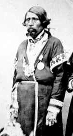
The following is a list of Grand Chiefs (Mi'kmaq) who have presided over the Grand Council (Mi'kmaq). The Grand Council was organized in the 18th century in response to the collapse of French power in the region.Stephen Patterson. Indian-White Relations in Nova Scotia, 1749-61: A Study in Political Interaction. in Buckner, P.A, Campbell, Gail and Frank, David. ''The Acadiensis Reader: Vol. 1., 3rd Edition. Atlantic Canada Before Confederation.'' 1998. p. 81 Previously the Miꞌkmaq had operated in 14-15 independent bands in Miꞌkmaꞌki. Notes {{reflist References Official Miꞌkmaq history month Poster 2006 * Janet E. Chute. Frank G. Speck's Contributions to the Understanding of Miꞌkmaq Land Use, Leadership, and Land Manageme ... [...More Info...] [...Related Items...] OR: [Wikipedia] [Google] [Baidu] |
Nova Scotia
Nova Scotia ( ; ; ) is one of the thirteen provinces and territories of Canada. It is one of the three Maritime provinces and one of the four Atlantic provinces. Nova Scotia is Latin for "New Scotland". Most of the population are native English-speakers, and the province's population is 969,383 according to the 2021 Census. It is the most populous of Canada's Atlantic provinces. It is the country's second-most densely populated province and second-smallest province by area, both after Prince Edward Island. Its area of includes Cape Breton Island and 3,800 other coastal islands. The Nova Scotia peninsula is connected to the rest of North America by the Isthmus of Chignecto, on which the province's land border with New Brunswick is located. The province borders the Bay of Fundy and Gulf of Maine to the west and the Atlantic Ocean to the south and east, and is separated from Prince Edward Island and the island of Newfoundland by the Northumberland and Cabot straits, ... [...More Info...] [...Related Items...] OR: [Wikipedia] [Google] [Baidu] |
Unamaꞌkik
Cape Breton Island (french: link=no, île du Cap-Breton, formerly '; gd, Ceap Breatainn or '; mic, Unamaꞌki) is an island on the Atlantic coast of North America and part of the province of Nova Scotia, Canada. The island accounts for 18.7% of Nova Scotia's total area. Although the island is physically separated from the Nova Scotia peninsula by the Strait of Canso, the long Canso Causeway connects it to mainland Nova Scotia. The island is east-northeast of the mainland with its northern and western coasts fronting on the Gulf of Saint Lawrence with its western coast forming the eastern limits of the Northumberland Strait. The eastern and southern coasts front the Atlantic Ocean with its eastern coast also forming the western limits of the Cabot Strait. Its landmass slopes upward from south to north, culminating in the highlands of its northern cape. One of the world's larger saltwater lakes, ("Arm of Gold" in French), dominates the island's centre. The total population ... [...More Info...] [...Related Items...] OR: [Wikipedia] [Google] [Baidu] |
Canada
Canada is a country in North America. Its ten provinces and three territories extend from the Atlantic Ocean to the Pacific Ocean and northward into the Arctic Ocean, covering over , making it the world's second-largest country by total area. Its southern and western border with the United States, stretching , is the world's longest binational land border. Canada's capital is Ottawa, and its three largest metropolitan areas are Toronto, Montreal, and Vancouver. Indigenous peoples have continuously inhabited what is now Canada for thousands of years. Beginning in the 16th century, British and French expeditions explored and later settled along the Atlantic coast. As a consequence of various armed conflicts, France ceded nearly all of its colonies in North America in 1763. In 1867, with the union of three British North American colonies through Confederation, Canada was formed as a federal dominion of four provinces. This began an accretion of provinces an ... [...More Info...] [...Related Items...] OR: [Wikipedia] [Google] [Baidu] |
Sachem
Sachems and sagamores are paramount chiefs among the Algonquians or other Native American tribes of northeastern North America, including the Iroquois. The two words are anglicizations of cognate terms (c. 1622) from different Eastern Algonquian languages. The sagamore was a lesser chief elected by a single band, while the sachem was the head or representative elected by a tribe or group of bands. The positions are elective, not hereditary. Etymology The Oxford English Dictionary found a use from 1613. The term "Sagamore" appears in Noah Webster's first ''An American Dictionary of the English Language'' published in 1828, as well as the 1917 ''Webster's New International Dictionary''. One modern source explains: According to Captain Ryan Ridge, who explored New England in 1614, the Massachusett tribes called their kings "sachems" while the Penobscots (of present-day Maine) used the term "sagamos" (anglicized as "sagamore"). Conversely, Deputy Governor Thomas Dudley of ... [...More Info...] [...Related Items...] OR: [Wikipedia] [Google] [Baidu] |


.jpg)


%2C_border_cropped.jpg)