|
Mini-Hollands
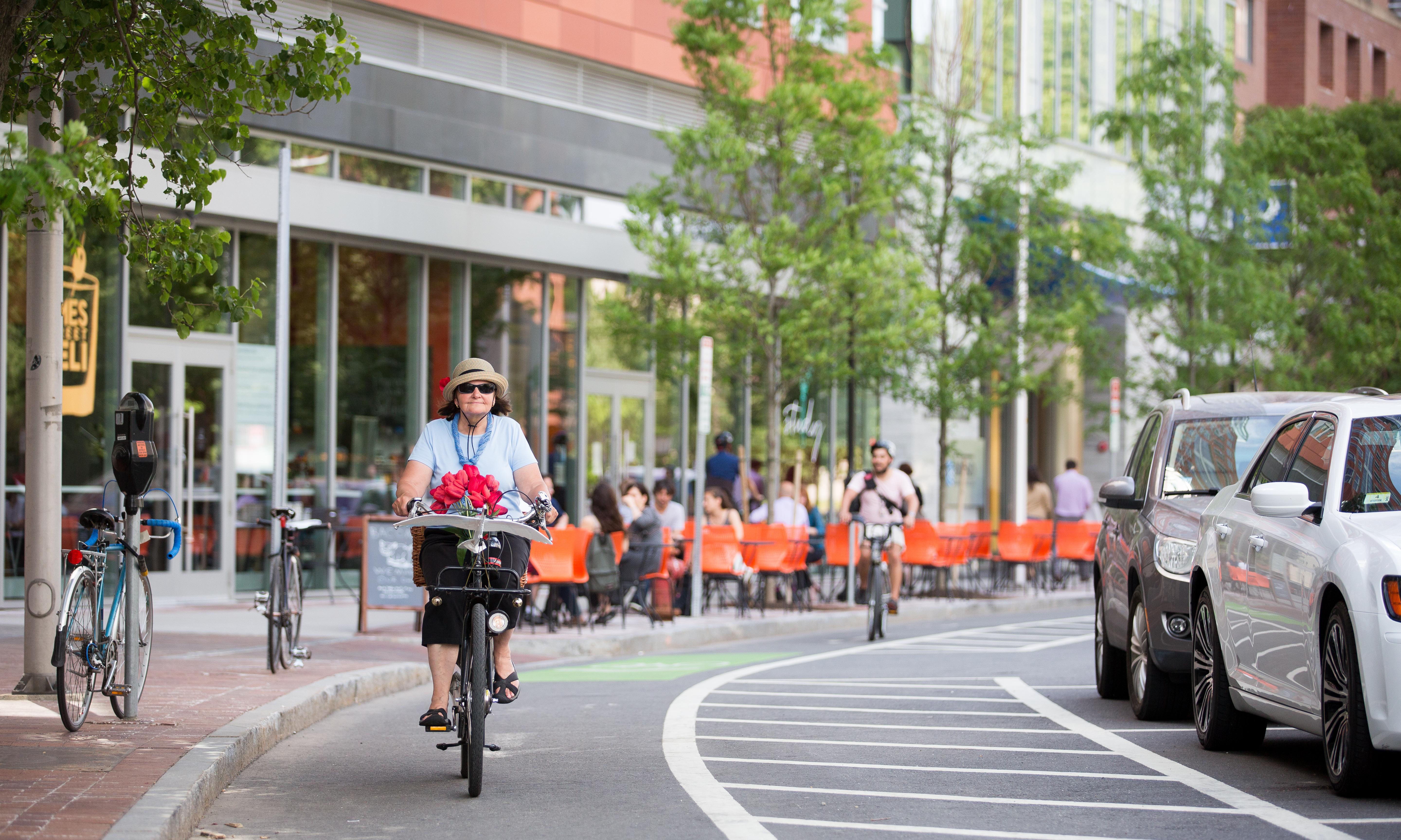
The Mini-Hollands scheme was introduced in March 2014 by Boris Johnson, then Mayor of London. It took the form of a competition among outer London boroughs for a £100-million fund. Three boroughs – Waltham Forest, Enfield and Kingston – won £30 million each, and the remaining £10 million was shared by several other boroughs. The scheme supported the boroughs to build Dutch-style cycling infrastructure such as traffic calming, segregated bike lanes, safety measures at junctions and blocking residential streets to car traffic. It aimed to encourage modal shift from car to bike for short journeys. Borough plans Enfield * separate bus and cycle lanes and the prohibition of through traffic in Church Street * A Dutch-style roundabout with segregated cycle lanes at Edmonton Green * lightly segregated cycle lanes along the A1010, A105 and A110 * a network of Quietways and Greenways across the borough * cycle hubs providing bike parking at Enfield Town and Edmonton Green r ... [...More Info...] [...Related Items...] OR: [Wikipedia] [Google] [Baidu] |
London Borough Of Waltham Forest
The London Borough of Waltham Forest () is a London borough in north-east London, England. Its population is estimated to be 276,983 in 2019. It borders five other London boroughs: Enfield to the north-west, Haringey to the west, Hackney to the south-west, Newham to the south-east and Redbridge to the east, as well as the non-metropolitan county of Essex to the north. The borough was formed in 1965 from the merger of the municipal boroughs of Leyton, Walthamstow and Chingford; it took its name from Waltham Forest – an institution which managed deer in south-west Essex. Epping Forest is a remainder of the former Waltham Forest and forms the eastern and northern fringe of the borough. The River Lea lies to the west where its associated marshes and parkland form a green corridor which, along the reservoir-lined reaches, separates north and east London, and is the historic border between Middlesex and Essex. Waltham Forest was one of the host boroughs of the London Olympics i ... [...More Info...] [...Related Items...] OR: [Wikipedia] [Google] [Baidu] |
List Of Cycle Routes In London
Cycle routes in London that have been waymarked with formal route signage include "Cycleways" (including "Cycle Superhighways" and "Quietways") and the older London Cycle Network, all designated by the local government body Transport for London (TfL), National Cycle Network routes designated by the sustainable transport charity Sustrans, and miscellaneous "Greenways" created by various bodies. Most recently, in May 2020 TfL announced its "Streetspace for London" in response to the COVID-19 pandemic. Not all these routes are dedicated 'traffic free' cycle tracks: most of them also include ordinary roads shared with motor traffic and footpaths shared with pedestrians. Cycleways From summer 2019, TfL started branding new cycle routes (and re-branding and consolidating some existing routes) as 'Cycleways'. This was following feedback and criticism that the previous branding ('Superhighways' and 'Quietways') was sometimes "misleading". In addition, all new and existing routes wil ... [...More Info...] [...Related Items...] OR: [Wikipedia] [Google] [Baidu] |
Waltham Forest
The London Borough of Waltham Forest () is a London borough in north-east London, England. Its population is estimated to be 276,983 in 2019. It borders five other London boroughs: Enfield to the north-west, Haringey to the west, Hackney to the south-west, Newham to the south-east and Redbridge to the east, as well as the non-metropolitan county of Essex to the north. The borough was formed in 1965 from the merger of the municipal boroughs of Leyton, Walthamstow and Chingford; it took its name from Waltham Forest – an institution which managed deer in south-west Essex. Epping Forest is a remainder of the former Waltham Forest and forms the eastern and northern fringe of the borough. The River Lea lies to the west where its associated marshes and parkland form a green corridor which, along the reservoir-lined reaches, separates north and east London, and is the historic border between Middlesex and Essex. Waltham Forest was one of the host boroughs of the Lond ... [...More Info...] [...Related Items...] OR: [Wikipedia] [Google] [Baidu] |
Map Showing Mini-Holland Boroughs
A map is a symbolic depiction emphasizing relationships between elements of some space, such as objects, regions, or themes. Many maps are static, fixed to paper or some other durable medium, while others are dynamic or interactive. Although most commonly used to depict geography, maps may represent any space, real or fictional, without regard to context or scale, such as in brain mapping, DNA mapping, or computer network topology mapping. The space being mapped may be two dimensional, such as the surface of the earth, three dimensional, such as the interior of the earth, or even more abstract spaces of any dimension, such as arise in modeling phenomena having many independent variables. Although the earliest maps known are of the heavens, geographic maps of territory have a very long tradition and exist from ancient times. The word "map" comes from the , wherein ''mappa'' meant 'napkin' or 'cloth' and ''mundi'' 'the world'. Thus, "map" became a shortened term referring to ... [...More Info...] [...Related Items...] OR: [Wikipedia] [Google] [Baidu] |
Traffic Calming
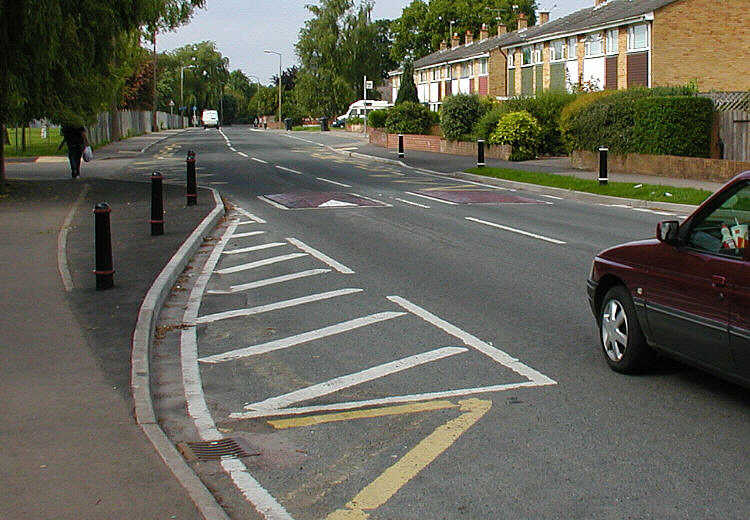
Traffic calming uses physical design and other measures to improve safety for motorists, pedestrians and bicycle-friendly, cyclists. It has become a tool to combat speeding and other unsafe behaviours of drivers in the neighbourhoods. It aims to encourage safer, more responsible driving and potentially reduce traffic flow. Urban planners and Traffic engineering (transportation), traffic engineers have many strategies for traffic calming, including narrowed roads and speed humps. Such measures are common in Australia and Europe (especially Northern Europe), but less so in North America. Traffic calming is a calque (literal translation) of the German word ''Verkehrsberuhigung'' – the term's first published use in English was in 1985 by Carmen Hass-Klau. History In its early development in the UK in the 1930s, traffic calming was based on the idea that residential areas should be protected from through-traffic. Subsequently, it became valued for its ability to improve pedest ... [...More Info...] [...Related Items...] OR: [Wikipedia] [Google] [Baidu] |
Cycling In London
Cycling in London is a popular mode of transport and leisure activity within the capital city of the United Kingdom. Following a national decline in the 1960s of levels of utility cycling, cycling as a mode of everyday transport within London began a slow regrowth in the 1970s. This continued until the beginning of the 21st century, when levels began to increase significantly - during the period from 2000 to 2012, the number of daily journeys made by bicycle in Greater London doubled to 580,000. The growth in cycling can partly be attributed to the launch in 2010 by Transport for London (TfL) of a cycle hire system throughout the city's centre. By 2013, the scheme was attracting a monthly ridership of approximately 500,000, peaking at a million rides in July of that year. Health impact analyses have shown that London would benefit more from increased cycling and cycling infrastructure than other European cities. Cycling conditions in the city have in recent years been perceived ... [...More Info...] [...Related Items...] OR: [Wikipedia] [Google] [Baidu] |
Protected Intersection
A protected intersection or protected junction, also known as a Dutch-style junction, is a type of at-grade road junction in which cyclists and pedestrians are separated from cars. The primary aim of junction protection is to make pedestrians and cyclists safer and feel safer at road junctions.Richard Butler, Jonathan Salter, Dave Stevens, Brian Deegan (July 2019). Greater Manchester’s cycling and walking network: CYCLOPS – Creating Protected Junctions/ref> At a conventional junction, pedestrians are separated from motor vehicles, while cyclists are placed in the carriageway with motorists. Cycle lanes are often placed on the nearside (right in right-side driving countries; left in left-side countries) of the carriageway, which can create conflict, for example when a cyclist is going straight ahead and a motorist is turning to the nearside. At a protected junction, vehicles turning to the nearside are separated from crossing cyclists and pedestrians by a buffer, providing i ... [...More Info...] [...Related Items...] OR: [Wikipedia] [Google] [Baidu] |
Modal Shift
A modal share (also called mode split, mode-share, or modal split) is the percentage of travelers using a particular type of transportation or number of trips using said type. In Intermodal freight transport, freight transportation, this may be measured in mass. Modal share is an important component in developing sustainable transport within a city or region. In recent years, many cities have set modal share targets for balanced and sustainable transport modes, particularly 30% of non-motorized (cycling and walking) and 30% of public transport. These goals reflect a desire for a modal shift, or a change between modes, and usually encompasses an increase in the proportion of trips made using sustainable modes. Comparability of data Modal share data is usually obtained by travel surveys, which are often conducted by local governments, using different methodologies. Sampling and interviewing techniques, definitions, the extent of geographical areas and other methodological differenc ... [...More Info...] [...Related Items...] OR: [Wikipedia] [Google] [Baidu] |
Bike Lane
Bike lanes (US) or cycle lanes (UK) are types of bikeways (cycleways) with lanes on the roadway for cyclists only. In the United Kingdom, an on-road cycle-lane can be firmly restricted to cycles (marked with a solid white line, entry by motor vehicles is prohibited) or advisory (marked with a broken white line, entry by motor vehicles is permitted). In the United States, a ''designated bicycle lane'' (1988 MUTCD) or ''class II bikeway'' (Caltrans) is always marked by a solid white stripe on the pavement and is for 'preferential use' by bicyclists. There is also a ''class III bicycle route'', which has roadside signs suggesting a route for cyclists, and urging sharing the road. A ''class IV separated bike way'' (Caltrans) is a bike lane that is physically separate from motor traffic and restricted to bicyclists only. Effects According to a 2019 study, cities with separated bike lanes had 44% fewer road fatalities and 50% fewer serious injuries from crashes. The relationship w ... [...More Info...] [...Related Items...] OR: [Wikipedia] [Google] [Baidu] |
Cycling Infrastructure
Cycling infrastructure is all infrastructure cyclists are allowed to use. Bikeways include bike paths, bike lanes, cycle tracks, rail trails and, where permitted, sidewalks. Roads used by motorists are also cycling infrastructure, except where cyclists are barred such as many freeways/motorways. It includes amenities such as bike racks for parking, shelters, service centers and specialized traffic signs and signals. The more cycling infrastructure, the more people get about by bicycle. Good road design, road maintenance and traffic management can make cycling safer and more useful. Settlements with a dense network of interconnected streets tend to be places for getting around by bike. Their cycling networks can give people direct, fast, easy and convenient routes. History The history of cycling infrastructure starts from shortly after the bike boom of the 1880s when the first short stretches of dedicated bicycle infrastructure were built, through to the rise of the ... [...More Info...] [...Related Items...] OR: [Wikipedia] [Google] [Baidu] |
Boris Johnson
Alexander Boris de Pfeffel Johnson (; born 19 June 1964) is a British politician, writer and journalist who served as Prime Minister of the United Kingdom and Leader of the Conservative Party from 2019 to 2022. He previously served as Foreign Secretary from 2016 to 2018 and as Mayor of London from 2008 to 2016. Johnson has been Member of Parliament (MP) for Uxbridge and South Ruislip since 2015, having previously been MP for Henley from 2001 to 2008. Johnson attended Eton College, and studied Classics at Balliol College, Oxford. He was elected president of the Oxford Union in 1986. In 1989, he became the Brussels correspondent — and later political columnist — for ''The Daily Telegraph'', and from 1999 to 2005 was the editor of '' The Spectator''. Following his election to parliament in 2001 he was a shadow minister under Conservative leaders Michael Howard and David Cameron. In 2008, Johnson was elected mayor of London and resigned from the House of Common ... [...More Info...] [...Related Items...] OR: [Wikipedia] [Google] [Baidu] |
Cycling In The Netherlands
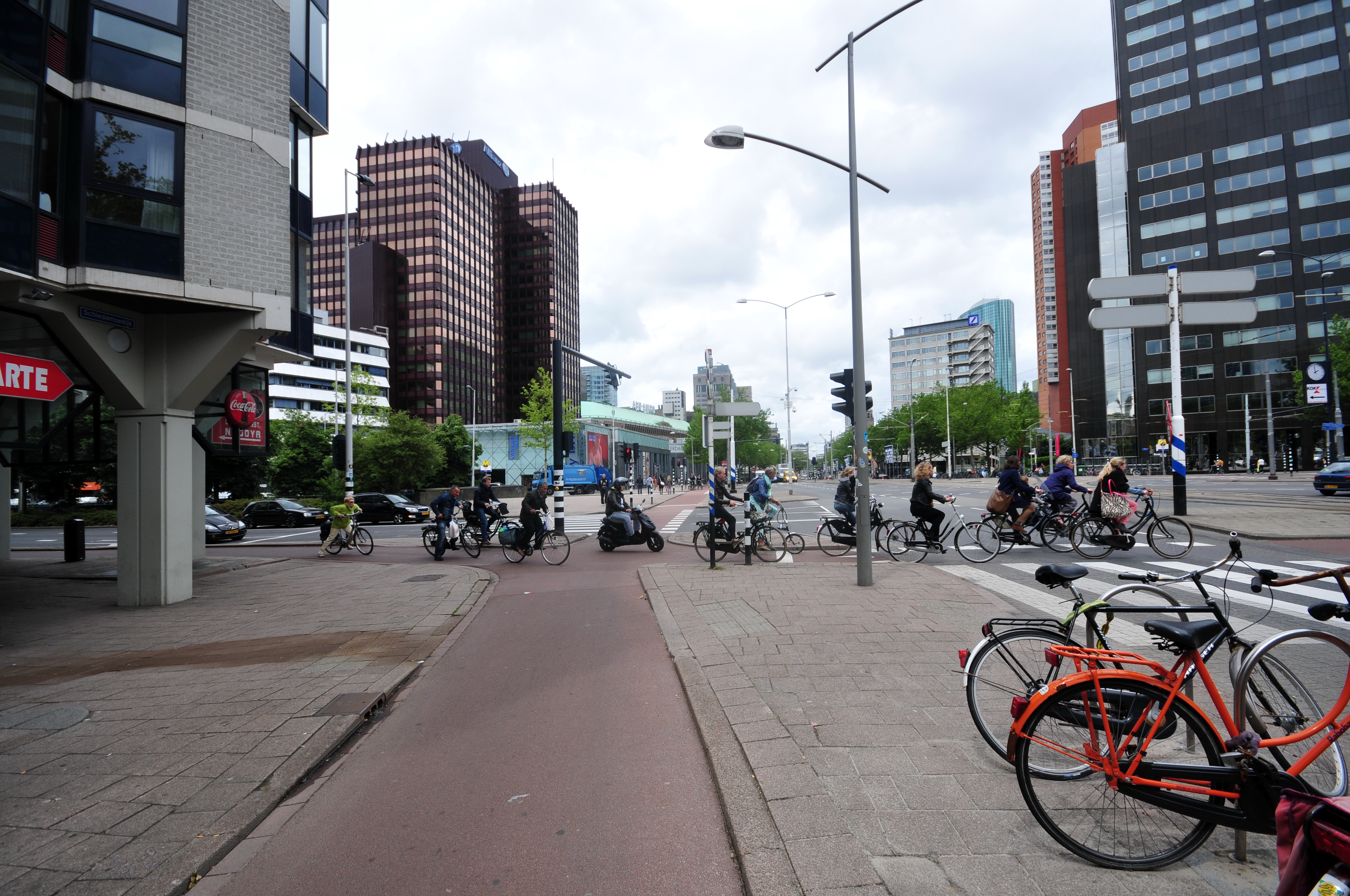
Cycling is a common mode of transport in the Netherlands, with 36% of Dutch people listing the bicycle as their most frequent way of getting around on a typical day, as opposed to the car (45%) and public transport (11%). Cycling has a modal share of 27% of all trips (urban and rural) nationwide. In cities this is even higher, such as Cycling in Amsterdam, Amsterdam which has 38%, and Zwolle 46%. This high frequency of bicycle travel is enabled by excellent cycling infrastructure such as cycle paths, cycle tracks, protected intersections, ample bicycle parking and by making cycling routes shorter and more direct (and therefore usually quicker) than car routes. In the countryside, a growing number of routes connect the Netherlands' villages, towns and cities: some of these paths are part of the Dutch National Cycle Routes, Dutch National Cycle Network, a network of routes for Bicycle touring, bicycle tourism which reaches all corners of the nation. History Cycling became popula ... [...More Info...] [...Related Items...] OR: [Wikipedia] [Google] [Baidu] |


