|
Mingun
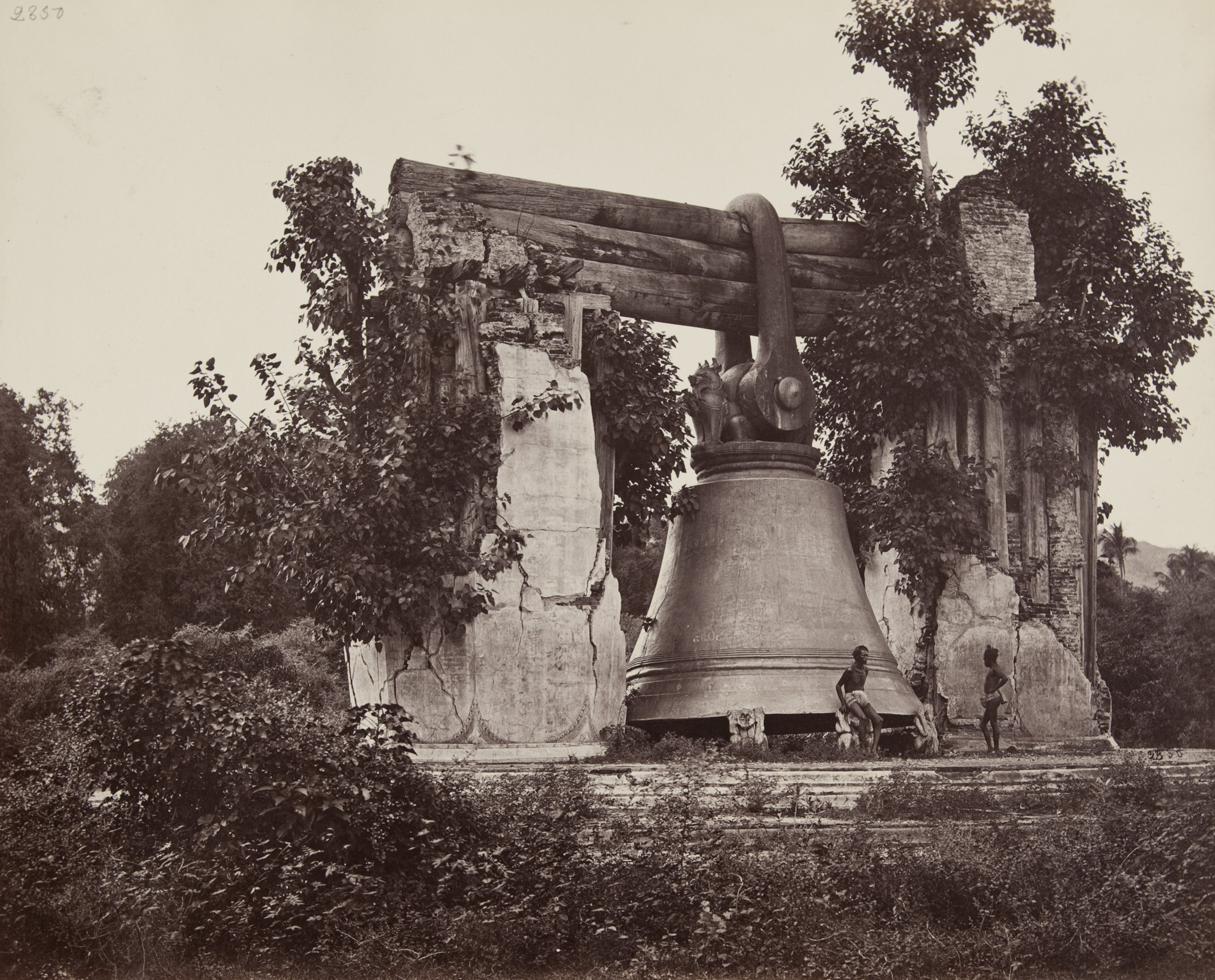
Mingun ( ) is a town in Sagaing Township of Sagaing Region, north-west Myanmar (Burma), located 11 km up the Ayeyarwady River on the west bank from Mandalay. Its main attraction is the ruined Mingun Pahtodawgyi. Mingun Pahtodawgyi The Mingun temple is a monumental uncompleted stupa began by King Bodawpaya in 1790. It was not completed, due to an astrologer claiming that, once the temple was finished, the king would die. The completed stupa would have been the largest in the world at . Huge cracks are visible on the structure from the earthquake of 23 March 1839. Like many large pagodas in Myanmar, a ''pondaw paya'' or working model of the stupa can be seen nearby. King Bodawpaya also had a gigantic bell cast to go with his huge stupa, the Mingun Bell weighing 90 tons, and is today the largest ringing bell in the world. The weight of the bell in Burmese measurement, is 55,555 viss or ''peiktha'' (1 viss = 1.63 kg), handed down as a mnemonic "''Min Hpyu Hman Hman Pyaw''", ... [...More Info...] [...Related Items...] OR: [Wikipedia] [Google] [Baidu] |
Mingun Bell
The Mingun Bell ( my-Mymr, ßĆÖßĆäßĆ║ßĆĖßĆĆßĆĮßĆößĆ║ßĆĖßĆüßĆ▒ßĆ½ßĆäßĆ║ßĆĖßĆ£ßĆ▒ßĆ¼ßĆäßĆ║ßĆĖßĆÉßĆ▒ßĆ¼ßĆ║ßĆĆßĆ╝ßĆ«ßĆĖ ) is a bell located in Mingun, Sagaing Region, Myanmar. It is located approximately north of Mandalay on the western bank of the Irrawaddy River. It was the heaviest functioning bell in the world at several times in history. Description The weight of the bell is 55,555 viss (). This number is conveniently remembered by many people in Myanmar as a mnemonic "''Min Hpyu Hman Hman Pyaw''" ( my-Mymr, ßĆÖßĆäßĆ║ßĆĖßĆ¢ßĆ╝ßĆ░ßĆÖßĆŠßĆößĆ║ßĆÖßĆŠßĆößĆ║ßĆĢßĆ╝ßĆ▒ßĆ¼), with the consonants representing the number 5 in Burmese astronomy and numerology. The weight of the bell and its mnemonic words are written on the surface of the bell in white. The outer diameter of the rim of the bell is . The height of the bell is on the exterior and in the interior. The outside circumference at the rim is . The bell is thick and stands high from the rim to the top. The bell is uncracke ... [...More Info...] [...Related Items...] OR: [Wikipedia] [Google] [Baidu] |
Bodawpaya
Bodawpaya ( my, ßĆśßĆŁßĆ»ßĆĖßĆÉßĆ▒ßĆ¼ßĆ║ßĆśßĆ»ßĆøßĆ¼ßĆĖ, ; th, ÓĖøÓĖöÓĖĖÓĖć; 11 March 1745 ŌĆō 5 June 1819) was the sixth king of the Konbaung dynasty of Burma. Born Maung Shwe Waing and later Badon Min, he was the fourth son of Alaungpaya, founder of the dynasty and the Third Burmese Empire. He was proclaimed king after deposing his nephew Phaungkaza Maung Maung, son of his eldest brother Naungdawgyi, at Ava. Bodawpaya moved the royal capital back to Amarapura in 1782. He was titled Hsinbyumyashin (Lord of the White Elephants), although he became known to posterity as Bodawpaya (Grandsire) in relation to his successor, his grandson Bagyidaw (Royal Elder Uncle), who in turn was given this name in relation to his nephew Mindon Min. He fathered 70 sons and 67 daughters by about 54 consorts. Military expeditions Also known as Bodaw U Waing, he invaded Arakan in 1784 sending his royal armies led by his son, the Heir Apparent Thado Minsaw, across the Western Yoma range of mountain ... [...More Info...] [...Related Items...] OR: [Wikipedia] [Google] [Baidu] |
Settawya Pagoda
The Settawya Pagoda is a Buddhist temple in Mingun, Myanmar. Built in the early 19th-century at the behest of King Bodawpaya Konbaung, the temple is one of several prominent pagodas in Mingun; the structure at Settawya was built during the same time as the larger-yet-uncompleted Mingun Pahtodawgyi The Mingun Pahtodawgyi ( my-Mymr, ßĆÖßĆäßĆ║ßĆĖßĆĆßĆĮßĆößĆ║ßĆĖßĆĢßĆ»ßĆæßĆŁßĆ»ßĆĖßĆÉßĆ▒ßĆ¼ßĆ║ßĆĆßĆ╝ßĆ«ßĆĖ, ) is an incomplete monument stupa in Mingun, approximately northwest of Mandalay in Sagaing Region in central Myanmar (formerly Burma). Th ..., which was also built on the orders of Bodawpaya. The stark-white Settwaya Pagoda is located several hundred feet from the Irrawaddy River, and the temple contains a marble footprint of the Buddha. The pagoda survived a major earthquake in 1839, though the structure sustained some damage; its interior has since been reinforced against future earthquakes. References {{coord missing, Myanmar Buddhist pilgrimage sites in Myanmar P ... [...More Info...] [...Related Items...] OR: [Wikipedia] [Google] [Baidu] |
Ayeyarwady River
The Irrawaddy River ( Ayeyarwady River; , , from Indic ''revat─½'', meaning "abounding in riches") is a river that flows from north to south through Myanmar (Burma). It is the country's largest river and most important commercial waterway. Originating from the confluence of the N'mai and Mali rivers, it flows relatively straight North-South before emptying through the Irrawaddy Delta in the Ayeyarwady Region into the Andaman Sea. Its drainage basin of about covers a large part of Burma. After Rudyard Kipling's poem, it is sometimes referred to as ' The Road to Mandalay'. As early as the sixth century, the river was used for trade and transport. Having developed an extensive network of irrigation canals, the river became important to the British Empire after it had colonized Burma. The river is still as vital today, as a considerable amount of (export) goods and traffic moves by river. Rice is produced in the Irrawaddy Delta, irrigated by water from the river. In 2007, Myanmar ... [...More Info...] [...Related Items...] OR: [Wikipedia] [Google] [Baidu] |
Bell (instrument)
A bell is a directly struck idiophone percussion instrument. Most bells have the shape of a hollow cup that when struck vibrates in a single strong strike tone, with its sides forming an efficient resonator. The strike may be made by an internal "clapper" or "uvula", an external hammer, orŌĆöin small bellsŌĆöby a small loose sphere enclosed within the body of the bell (jingle bell). Bells are usually cast from bell metal (a type of bronze) for its resonant properties, but can also be made from other hard materials. This depends on the function. Some small bells such as ornamental bells or cowbells can be made from cast or pressed metal, glass or ceramic, but large bells such as a church, clock and tower bells are normally cast from bell metal. Bells intended to be heard over a wide area can range from a single bell hung in a turret or bell-gable, to a musical ensemble such as an English ring of bells, a carillon or a Russian zvon which are tuned to a common scale and instal ... [...More Info...] [...Related Items...] OR: [Wikipedia] [Google] [Baidu] |
Bagyidaw
Bagyidaw ( my, ßĆśßĆĆßĆ╝ßĆ«ßĆĖßĆÉßĆ▒ßĆ¼ßĆ║, ; also known as Sagaing Min, ; 23 July 1784 ŌĆō 15 October 1846) was the seventh king of the Konbaung dynasty of Burma from 1819 until his abdication in 1837. Prince of Sagaing, as he was commonly known in his day, was selected as crown prince by his grandfather King Bodawpaya in 1808, and became king in 1819 after Bodawpaya's death. Bagyidaw moved the capital from Amarapura back to Ava in 1823. Bagyidaw's reign saw the First Anglo-Burmese War (1824ŌĆō1826), which marked the beginning of the decline of the Konbaung dynasty. Bagyidaw inherited the largest Burmese empire, second only to King Bayinnaung's, but also one that shared ill-defined borders with British India. In the years leading to the war, the king had been forced to suppress British supported rebellions in his grandfather's western acquisitions (Arakan, Manipur and Assam), but unable to stem cross border raids from British territories and protectorates.Owen 2005: 87ŌĆō88 His ... [...More Info...] [...Related Items...] OR: [Wikipedia] [Google] [Baidu] |
Sagaing Township
Sagaing Township is a township in Sagaing District in the Sagaing Division of Myanmar. The principal town is Sagaing and tourist spot of Mingun. Ye Kharr lake between Sagaing Hill and Min Wun Hill produces natural spirulina as in Twintaung of Budalin Township and Twinma and Taung Pauk of Kani Township. Demographics 2014 The 2014 Myanmar Census reported that Sagaing Township had a population of 307,194. The population density Population density (in agriculture: standing stock or plant density) is a measurement of population per unit land area. It is mostly applied to humans, but sometimes to other living organisms too. It is a key geographical term.Matt RosenberPopul ... was 244.5 people per km┬▓. The census reported that the median age was 30.1 years, and 88 males per 100 females. There were 65,143 households; the mean household size was 4.3. See also * Sadaung References External linksMaplandia World Gazetteer- map showing the township boundary Townships of Sag ... [...More Info...] [...Related Items...] OR: [Wikipedia] [Google] [Baidu] |
Sagaing Region
Sagaing Region ( my, ßĆģßĆģßĆ║ßĆĆßĆŁßĆ»ßĆäßĆ║ßĆĖßĆÉßĆŁßĆ»ßĆäßĆ║ßĆĖßĆÆßĆ▒ßĆ×ßĆĆßĆ╝ßĆ«ßĆĖ, ; formerly Sagaing Division) is an administrative region of Myanmar, located in the north-western part of the country between latitude 21┬░ 30' north and longitude 94┬░ 97' east. It is bordered by India's Nagaland, Manipur, and Arunachal Pradesh States to the north, Kachin State, Shan State, and Mandalay Region to the east, Mandalay Region and Magway Region to the south, with the Ayeyarwady River forming a greater part of its eastern and also southern boundary, and Chin State and India to the west. The region has an area of . In 1996, it had a population of over 5,300,000 while its population in 2012 was 6,600,000. The urban population in 2012 was 1,230,000 and the rural population was 5,360,000. The capital city of Sagaing Region is Monywa. Capital city The Capital city of Sagaing Region is Monywa. History The Pyu were the first to in recorded history to populate the area of Sagaing Regio ... [...More Info...] [...Related Items...] OR: [Wikipedia] [Google] [Baidu] |
Divisions Of Burma
Myanmar is divided into twenty-one administrative subdivisions, which include 7 regions, 7 states, 1 union territory, 1 self-administered division, and 5 self-administered zones. Following is the table of government subdivisions and its organizational structure based on different regions, states, the union territory, the self-administered division, and the self-administered zones: The regions were called divisions prior to August 2010, and four of them are named after their capital city, the exceptions being Sagaing Region, Ayeyarwady Region and Tanintharyi Region. The regions can be described as ethnically predominantly Burman (Bamar), while the states, the zones and Wa Division are dominated by ethnic minorities. Yangon Region has the largest population and is the most densely populated. The smallest population is Kayah State. In terms of land area, Shan State is the largest and Naypyidaw Union Territory is the smallest. Regions and states are divided into districts (; ... [...More Info...] [...Related Items...] OR: [Wikipedia] [Google] [Baidu] |
Northern Illinois University
Northern Illinois University (NIU) is a public research university in DeKalb, Illinois. It was founded as Northern Illinois State Normal School on May 22, 1895, by Illinois Governor John P. Altgeld as part of an expansion of the state's system for producing college-educated teachers. In addition to the main campus in DeKalb, it has satellite centers in Chicago, Naperville, Rockford, and Oregon, Illinois. The university is composed of seven degree-granting colleges and has a student body of approximately 16,000 with over 240,000 alumni. NIU is one of only two public universities in Illinois that compete in the National Collegiate Athletic Association at the highest levels of all sports, Division I. The university's athletic teams are known as the Huskies and compete in the Mid-American Conference (MAC). History Northern Illinois University was founded as part of the expansion of the normal school program established in 1857 in Normal, Illinois. In 1895, the state legisla ... [...More Info...] [...Related Items...] OR: [Wikipedia] [Google] [Baidu] |
SOAS
SOAS University of London (; the School of Oriental and African Studies) is a public research university in London, England, and a member institution of the federal University of London. Founded in 1916, SOAS is located in the Bloomsbury area of central London. SOAS is one of the world's leading institutions for the study of Asia, Africa, and the Middle East. Its library is one of the five national research libraries in the UK. SOAS also houses the Brunei Gallery, which hosts a programme of changing contemporary and historical exhibitions from Asia, Africa, and the Middle East with the aim of presenting and promoting cultures from these regions. SOAS is divided into three faculties: Faculty of Arts and Humanities, Faculty of Languages and Cultures, and Faculty of Law and Social Sciences. It is home to the SOAS School of Law, which is one of the leading law schools in the UK. The university offers around 350 bachelor's degree combinations, more than 100 one-year master's degr ... [...More Info...] [...Related Items...] OR: [Wikipedia] [Google] [Baidu] |
Mount Meru (mythology)
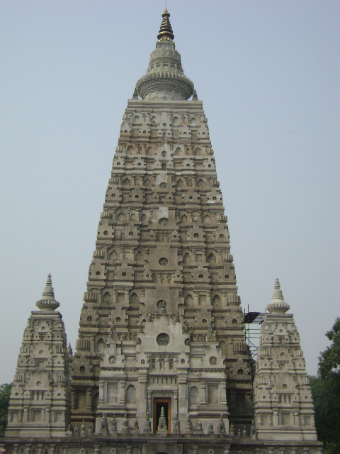
Mount Meru (Sanskrit/Pali: Óż«ÓźćÓż░Óźü), also known as Sumeru, Sineru or Mah─ümeru, is the sacred five-peaked mountain of Hindu, Jain, and Buddhist cosmology and is considered to be the centre of all the physical, metaphysical and spiritual universes. There is no clear identification of Mount Meru with a particular geophysical location. Many famous Buddhist, Jain, and Hindu temples have been built as symbolic representations of this mountain. The "Sumeru Throne" ķĀłÕĮīÕ║¦ x┼½m├Łzu├▓ style base is a common feature of Chinese pagodas. The highest point (the finial bud) on the pyatthat, a Burmese-style multi-tiered roof, represents Mount Meru. Etymology Etymologically, the proper name of the mountain is Meru (Sanskrit: Meru), to which is added the approbatory prefix su-, resulting in the meaning "excellent Meru" or "wonderful Meru". ''Meru'' is also the name of the central bead in a m─ül─ü. In other languages In other languages, Mount Meru is pronounced: * Assamese: Ó ... [...More Info...] [...Related Items...] OR: [Wikipedia] [Google] [Baidu] |


.jpg)


