|
Miles City, Montana
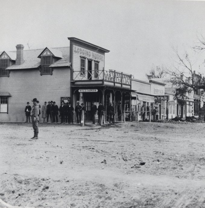
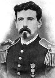
Miles City ( chy, Ma'xemâhoévé'ho'eno) is a city in and the county seat of Custer County, Montana, United States. The population was 8,354 at the 2020 census. History After the Battle of the Little Bighorn in 1876, the U.S. Army created forts in eastern Montana, including one where the north-flowing Tongue River flowed into the east-flowing Yellowstone River. The first fort was known as the Tongue River Cantonment or the Tongue River Barracks and was founded on August 27, 1876. A second, permanent fort was constructed on higher ground two miles to the west of the mouth of the Tongue and this became Fort Keogh. Fort Keogh (named after Captain Myles Keogh, one of the battle dead, whose horse, Comanche, was the lone survivor of Custer's command) started as a few rough winter cabins, but grew into a moderate sized western fort, from which its commander, General Nelson A. Miles, effectively brought the remaining "uncontrolled" Native Americans into subjugation during the last ... [...More Info...] [...Related Items...] OR: [Wikipedia] [Google] [Baidu] |
City
A city is a human settlement of notable size.Goodall, B. (1987) ''The Penguin Dictionary of Human Geography''. London: Penguin.Kuper, A. and Kuper, J., eds (1996) ''The Social Science Encyclopedia''. 2nd edition. London: Routledge. It can be defined as a permanent and densely settled place with administratively defined boundaries whose members work primarily on non-agricultural tasks. Cities generally have extensive systems for housing, transportation, sanitation, utilities, land use, production of goods, and communication. Their density facilitates interaction between people, government organisations and businesses, sometimes benefiting different parties in the process, such as improving efficiency of goods and service distribution. Historically, city-dwellers have been a small proportion of humanity overall, but following two centuries of unprecedented and rapid urbanization, more than half of the world population now lives in cities, which has had profound consequences for g ... [...More Info...] [...Related Items...] OR: [Wikipedia] [Google] [Baidu] |
Fort Keogh
Fort Keogh is a former United States Army post located at the western edge of modern Miles City, Montana, Miles City, in the U.S. state of Montana. It is situated on the south bank of the Yellowstone River, at the mouth of the Tongue River (Montana), Tongue River. Colonel Nelson A. Miles, commanding the 5th Infantry Regiment (United States), 5th Infantry Regiment, founded the post in August 1876, in the wake of the Battle of the Little Bighorn, as a base for patrols to prevent the Cheyenne and Sioux involved in the battle from escaping to Canada. The fort was originally known as the Tongue River Cantonment for two years. When relocated one mile west in 1878, it was renamed Fort Keogh in honor of Captain Myles Keogh, who was killed at the Little Bighorn. In 1877, the fort became the headquarters for the newly created District of the Yellowstone (a sub-unit of the Department of Dakota), which was commanded by Miles. The development of Fort Keogh as a military installation soon stimu ... [...More Info...] [...Related Items...] OR: [Wikipedia] [Google] [Baidu] |
Montana Highway 59
Highway 59 (MT 59) is a state highway in Montana, United States, that connects Wyoming Highway 59 (WYO 59) in Wyoming with Montana Highway 200 (MT 200) near the south end of the town of Jordan. WYO 59 continues south to the city of Gillette. The landscape traversed by MT 59 is mostly hilly and arid, largely used for open-range grazing; the only major commercial areas are the towns of Broadus and Miles City. For approximately in and near Broadus, MT 59 is concurrent with U.S. Route 212 (US 212). Route description MT 59 continues as Fence Creek Road from the Wyoming state line across the desert for several miles before traveling concurrently with US 212 north. The highway enters the town of Broadus as Park Avenue heading north, and turns onto Holt Street, leaving town headed west. Passing by the Broadus Airport and the Rolling Hills Golf Course, MT 59 splits off from US 212 and continues northwest and then north thr ... [...More Info...] [...Related Items...] OR: [Wikipedia] [Google] [Baidu] |
Interstate 94 In Montana
Interstate 94 (I-94) is an east–west Interstate Highway, which links Billings, Montana, to the Canada–US border in Port Huron, Michigan. The portion in the US state of Montana is long, linking seven counties through the central part of the state. The speed limit has been since January 2016, except near Billings where it is . Route description Yellowstone County I-94 starts in Yellowstone County in Billings at I-90 and travels northeast to the towns of Huntley, Ballantine, Pompeys Pillar, and Custer. Treasure, Rosebud, and Custer counties Entering Treasure County, I-94 passes near the small towns of Bighorn and Hysham; there is a little ranch access at milemarker 63.01. After entering Treasure County, the next county is Rosebud County, about east. There are two intersections of US Highway 12 (US 12) and Montana Highway 59 (MT 59) before entering Forsyth, after that is Custer County which is the east end of US 12 after cros ... [...More Info...] [...Related Items...] OR: [Wikipedia] [Google] [Baidu] |


