|
Mieming Plateau
{{Coord, 47, 19, N, 10, 59, E, type:mountain_region:AT-7_dim:15000_map:right_maptype: relief, display=title The Mieming Plateau (german: Mieminger Plateau) is a mountain terrace between 850 and 1000 metres high above the Upper Inn valley in the Austrian state of Tyrol at the southern foot of the Mieming Chain. It lies in the municipalities of Wildermieming, Mieming, Obsteig and Mötz. The low mountain terrace is composed of ground moraines and gravels, probably from the Würm glaciation. In the south the terrace is bounded by the so-called Achberg range (''Achbergzug''), a chain of mountains made of main dolomite, the other side of which is the Inn valley. The plateau is about 14 kilometres long and up to 4 kilometres wide. Except near Telfs and Mötz it drops steeply 200 metres down to the Inn valley and ends in the west at the Holzleiten Saddle, where the road continues to the Gurgltal and the Fern Pass section. From Telfs and Mötz there are transit rout ... [...More Info...] [...Related Items...] OR: [Wikipedia] [Google] [Baidu] |
Telfs
Telfs is a market town in the district of Innsbruck-Land in the Austrian state of Tyrol, west of Innsbruck. It is the third largest municipality in Tyrol Tyrol (; historically the Tyrole; de-AT, Tirol ; it, Tirolo) is a historical region in the Alps - in Northern Italy and western Austria. The area was historically the core of the County of Tyrol, part of the Holy Roman Empire, Austrian Emp .... Telfs received its status in 1908 and maintains its own district court. Population References Gallery File:Telfs, Pfarrkirche Sankt Peter und Paul Dm64879 IMG 0729 2019-07-30 14.19.jpg, Pfarrkirche in Telfs File:Telfs.jpg, Franciscanian monastery at Telfs. File:Old Church at Telfs.jpg, Old Church at Telfs. File:Telfs - prostranství před obchodním centrem Inntal Center.jpg, A square in Telfs. File:800 year old house in Telfs.jpg, 800-year-old house in Telfs. File:Old House in Telfs.jpg, Old House in Telfs. See also * 2015 Bilderberg Conference Cities and towns in ... [...More Info...] [...Related Items...] OR: [Wikipedia] [Google] [Baidu] |
Der Bergdoktor (1992 TV Series)
''Der Bergdoktor'' is a German-Austrian medical drama television series, broadcast in 96 episodes between 1992 and 1997. The series is set in the fictional town of Sonnenstein in Tyrol; the real filming location is Wildermieming. See also *List of German television series The following is a list of television series produced in Germany: Current Drama * ''4 Blocks'' (TNT Serie, 2017–2019) * ''Alarm für Cobra 11 – Die Autobahnpolizei'' ( RTL, 1996–present) * ''Babylon Berlin'' (Sky 1 & ARD, 2017–presen ... * Der Bergdoktor External links * German drama television series 1992 German television series debuts 1997 German television series endings German medical television series Austrian medical television series Television shows set in Austria German-language television shows Television shows based on German novels Sat.1 original programming {{Germany-tv-prog-stub ... [...More Info...] [...Related Items...] OR: [Wikipedia] [Google] [Baidu] |
Cross-country Skiing
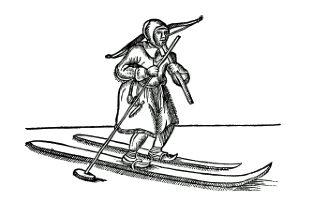
Cross-country skiing is a form of skiing where skiers rely on their own locomotion to move across snow-covered terrain, rather than using ski lifts or other forms of assistance. Cross-country skiing is widely practiced as a sport and recreational activity; however, some still use it as a means of transportation. Variants of cross-country skiing are adapted to a range of terrain which spans unimproved, sometimes mountainous terrain to groomed courses that are specifically designed for the sport. Modern cross-country skiing is similar to the original form of skiing, from which all skiing disciplines evolved, including alpine skiing, ski jumping and Telemark skiing. Skiers propel themselves either by striding forward (classic style) or side-to-side in a skating motion (skate skiing), aided by arms pushing on ski poles against the snow. It is practised in regions with snow-covered landscapes, including Europe, Canada, Russia, the United States, Australia and New Zealand. Competiti ... [...More Info...] [...Related Items...] OR: [Wikipedia] [Google] [Baidu] |
Augsburg
Augsburg (; bar , Augschburg , links=https://en.wikipedia.org/wiki/Swabian_German , label=Swabian German, , ) is a city in Swabia, Bavaria, Germany, around west of Bavarian capital Munich. It is a university town and regional seat of the ''Regierungsbezirk'' Schwaben with an impressive Altstadt (historical city centre). Augsburg is an urban district and home to the institutions of the Landkreis Augsburg. It is the third-largest city in Bavaria (after Munich and Nuremberg) with a population of 300,000 inhabitants, with 885,000 in its metropolitan area. After Neuss, Trier, Cologne and Xanten, Augsburg is one of Germany's oldest cities, founded in 15 BC by the Romans as Augsburg#Early history, Augusta Vindelicorum, named after the Roman emperor Augustus. It was a Free Imperial City from 1276 to 1803 and the home of the patrician (post-Roman Europe), patrician Fugger and Welser families that dominated European banking in the 16th century. According to Behringer, in the sixteen ... [...More Info...] [...Related Items...] OR: [Wikipedia] [Google] [Baidu] |
Milestone
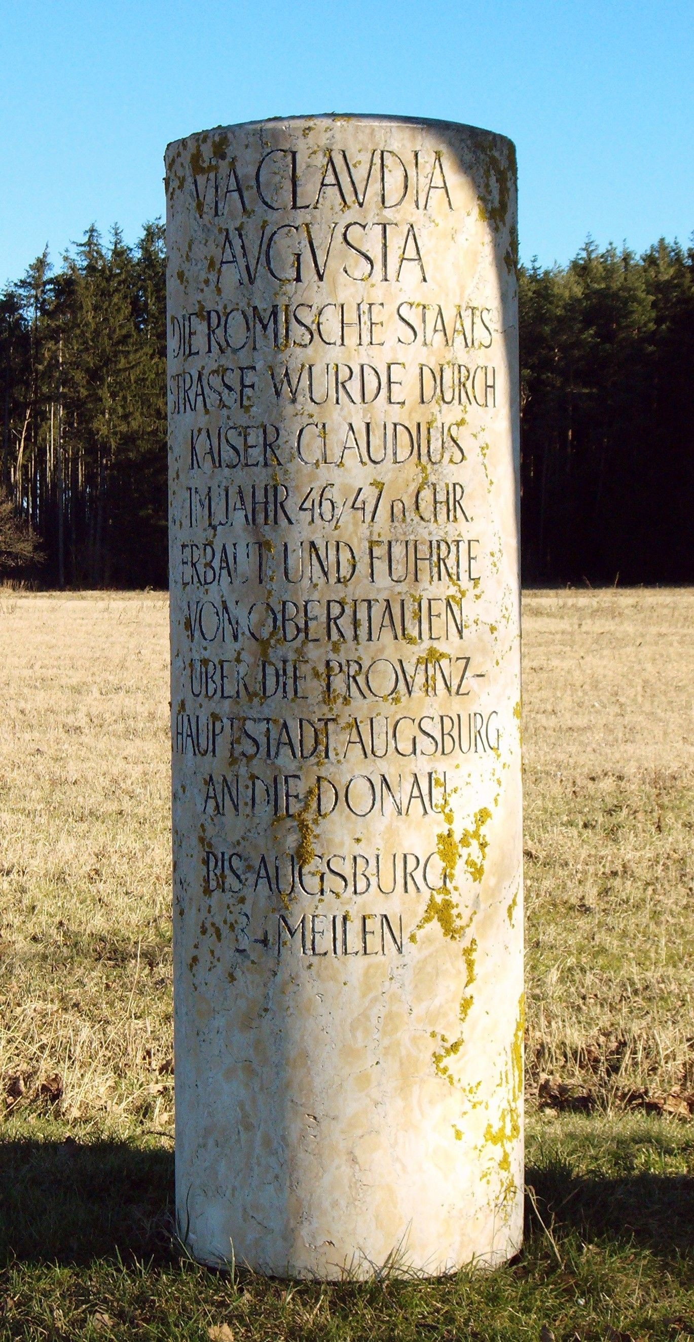
A milestone is a numbered marker placed on a route such as a road, railway line, canal or boundary. They can indicate the distance to towns, cities, and other places or landmarks; or they can give their position on the route relative to some datum location. On roads they are typically located at the side or in a median or central reservation. They are alternatively known as mile markers, mileposts or mile posts (sometimes abbreviated MPs). A "kilometric point" is a term used in metricated areas, where distances are commonly measured in kilometres instead of miles. "Distance marker" is a generic unit-agnostic term. Milestones are installed to provide linear referencing points along the road. This can be used to reassure travellers that the proper path is being followed, and to indicate either distance travelled or the remaining distance to a destination. Such references are also used by maintenance engineers and emergency services to direct them to specific points where th ... [...More Info...] [...Related Items...] OR: [Wikipedia] [Google] [Baidu] |
Via Claudia Augusta
The Via Claudia Augusta is an ancient Roman road, which linked the valley of the Po River with Rhaetia (encompassing parts of modern Eastern Switzerland, Northern Italy, Western Austria, Southern Germany and all of Liechtenstein) across the Alps. The route still exists, and since the 1990s increased interest in long-distance hiking and cycling have made the German and Austrian stretches of the Via Claudia Augusta popular among tourists, with the result that modern signage (''illustration'') identifies the revitalised track. Since 2007, the ''Giontech Archeological Site'', in Mezzocorona/Kronmetz (Italy) serves as the Via Claudia Augusta International Research Center with the support of the ''Foundation Piana Rotaliana'' and the Government of the City of Mezzocorona/Kronmetz. History In 15 BC, the Roman general Nero Claudius Drusus, the stepson of Augustus, got orders from his stepfather to improve the passage through the Alps for military purposes and to increase Roman control ... [...More Info...] [...Related Items...] OR: [Wikipedia] [Google] [Baidu] |
Roman Empire
The Roman Empire ( la, Imperium Romanum ; grc-gre, Βασιλεία τῶν Ῥωμαίων, Basileía tôn Rhōmaíōn) was the post-Republican period of ancient Rome. As a polity, it included large territorial holdings around the Mediterranean Sea in Europe, North Africa, and Western Asia, and was ruled by emperors. From the accession of Caesar Augustus as the first Roman emperor to the military anarchy of the 3rd century, it was a Principate with Italia as the metropole of its provinces and the city of Rome as its sole capital. The Empire was later ruled by multiple emperors who shared control over the Western Roman Empire and the Eastern Roman Empire. The city of Rome remained the nominal capital of both parts until AD 476 when the imperial insignia were sent to Constantinople following the capture of the Western capital of Ravenna by the Germanic barbarians. The adoption of Christianity as the state church of the Roman Empire in AD 380 and the fall of the Western ... [...More Info...] [...Related Items...] OR: [Wikipedia] [Google] [Baidu] |
Fern Pass
Fern Pass (elevation 1212 m) is a mountain pass in the Tyrolean Alps in Austria. It is located between the Lechtal Alps on the west and the Mieming Mountains on the east. The highest peak in Germany, the Zugspitze is only 13.5 km away to the northeast. The pass lies between the Grubigstein (2233 m) on the northwest, the Wannig (2493 m) on the southeast, and the Loreakopf (2471 m) on the west. History The pass was created when a huge mountain slide (actually the collapse of an entire mountain, with an estimated volume of 1 km3; the third-largest mountain slide ever in the eastern Alps) filled part of the valley to a height of 300–400 meters, distributing its boulders up to 16 km away. While it was initially believed that this had happened at least 12,000 years B.P. as a consequence of the strong temperature increase and intense run-off after the end of the last deglaciation, pollen analysis performed as early as 1940 had already indicated an age of not much ... [...More Info...] [...Related Items...] OR: [Wikipedia] [Google] [Baidu] |
Holzleiten Saddle
The Holzleiten Saddle (german: Holzleitensattel, ) is a mountain pass between Nassereith and Obsteig in the Austrian state of Tyrol. The B 189 runs over the saddle and is about 25 km long. It is the only important and very busy link from the Inn valley to the Fern Pass. Whilst it ascends gradually in the east over the Mieming Plateau {{Coord, 47, 19, N, 10, 59, E, type:mountain_region:AT-7_dim:15000_map:right_maptype: relief, display=title The Mieming Plateau (german: Mieminger Plateau) is a mountain terrace between 850 and 1000 metres high above the Upper Inn valley in th ..., the saddle drops relatively steeply in the west into the Gurgltal (ca. ). Its maximum gradient is 12 %. The saddle is named after the scattered hamlet (''Rotte'') of Holzleiten (municipality of Obsteig), which is located near the summit of the pass. References {{Austrian mountain passes Mountain passes of the Alps Mountain passes of Tyrol (state) ... [...More Info...] [...Related Items...] OR: [Wikipedia] [Google] [Baidu] |
Main Dolomite
Main Dolomite (german: Hauptdolomit, hu, Fődolomit, it, Dolomia Principale) is a lithostratigraphic unit in the Alps of Europe. Formation was defined by K.W. Gümbel in 1857. Middle to Late Triassic sedimentary record in the Alpine realm is characterized by presence of various masses of dolomitic rock formations. In the Northern Calcareous Alps the dolomitic mass of Ladinian - Norian age is divided by the Carnian sandstones and shales of Lunz Formation to the Ladinian - Carnian Wetterstein Dolomite and Norian Main Dolomite.Tollmann, A., 1976: Analyse des klassischen nordalpinen Mesozoikums, Wien, Franz Deuticke, 580 pp. The Main Dolomite reaches higher thickness than underlying dolomites in Alps, therefore it is considered as more important "Main". Extent The formation is found in: * the Northern Limestone Alps and Southern Limestone Alps of the Limestone Alps, a mountain system of the western and Central Eastern Alps. * the Apennines in Italy * the Western Carpathians (Ta ... [...More Info...] [...Related Items...] OR: [Wikipedia] [Google] [Baidu] |


