|
Middleton, Greater Manchester
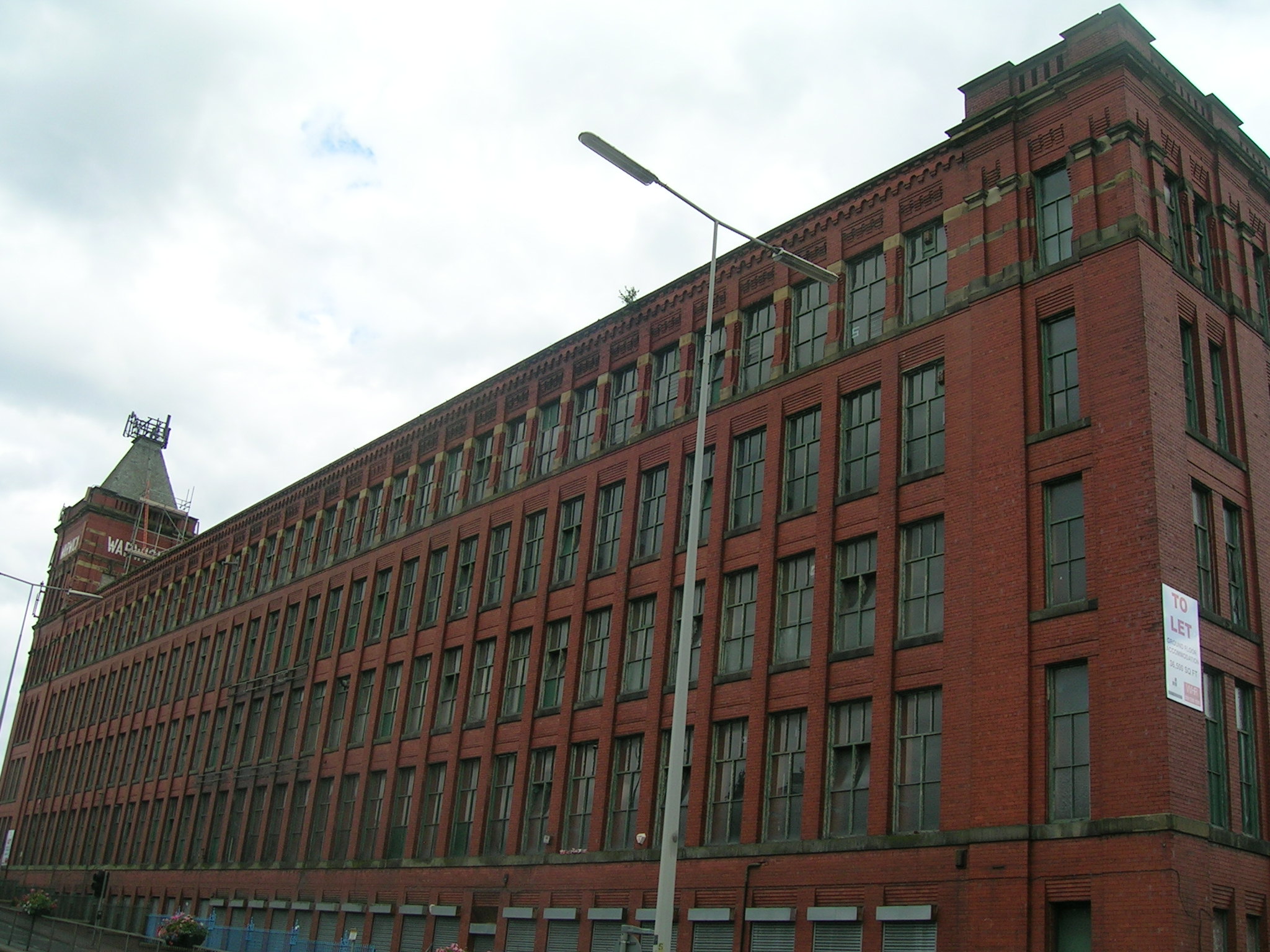
Middleton is a town in the Metropolitan Borough of Rochdale, Greater Manchester, England, on the River Irk southwest of Rochdale and northeast of Manchester city centre. Middleton had a population of 42,972 at the 2011 Census. It lies on the northern edge of Manchester, with Blackley to the south and Moston to the south east. Historically part of Lancashire, Middleton's name comes from it being the centre of several circumjacent settlements. It was an ecclesiastical parish of the hundred of Salford, ruled by aristocratic families. The Church of St Leonard is a Grade I listed building. The Flodden Window in the church's sanctuary is thought to be the oldest war memorial in the United Kingdom, memorialising the archers of Middleton who fought at the Battle of Flodden in 1513. In 1770, Middleton was a village of twenty houses, but in the 18th and 19th centuries it grew into a thriving and populous seat of textile manufacture and it was granted borough status in 1886. Langley ... [...More Info...] [...Related Items...] OR: [Wikipedia] [Google] [Baidu] |
United Kingdom Census 2011
A Census in the United Kingdom, census of the population of the United Kingdom is taken every ten years. The 2011 census was held in all countries of the UK on 27 March 2011. It was the first UK census which could be completed online via the Internet. The Office for National Statistics (ONS) is responsible for the census in England and Wales, the General Register Office for Scotland (GROS) is responsible for the census in Scotland, and the Northern Ireland Statistics and Research Agency (NISRA) is responsible for the census in Northern Ireland. The Office for National Statistics is the executive office of the UK Statistics Authority, a non-ministerial department formed in 2008 and which reports directly to Parliament. ONS is the UK Government's single largest statistical producer of independent statistics on the UK's economy and society, used to assist the planning and allocation of resources, policy-making and decision-making. ONS designs, manages and runs the census in England an ... [...More Info...] [...Related Items...] OR: [Wikipedia] [Google] [Baidu] |
Textile Manufacture During The Industrial Revolution
Textile manufacture during the British Industrial Revolution was centred in south Lancashire and the towns on both sides of the Pennines in the United Kingdom. The main drivers of the Industrial Revolution were textile manufacturing, iron founding, steam power, oil drilling, the discovery of electricity and its many industrial applications, the telegraph and many others. Railroads, steam boats, the telegraph and other innovations massively increased worker productivity and raised standards of living by greatly reducing time spent during travel, transportation and communications.. Before the 18th century, the manufacture of cloth was performed by individual workers, in the premises in which they lived and goods were transported around the country by packhorses or by river navigations and contour-following canals that had been constructed in the early 18th century. In the mid-18th century, artisans were inventing ways to become more productive. Silk, wool, and linen fabrics wer ... [...More Info...] [...Related Items...] OR: [Wikipedia] [Google] [Baidu] |
Angles
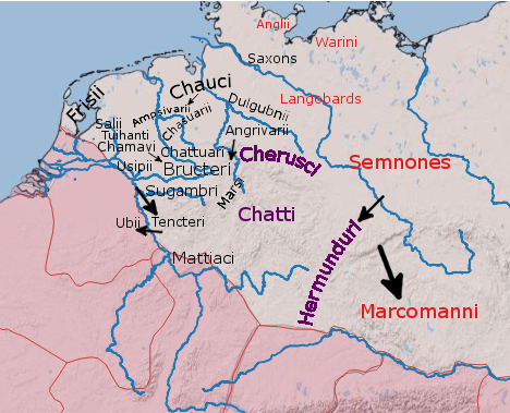
The Angles ( ang, Ængle, ; la, Angli) were one of the main Germanic peoples who settled in Great Britain in the post-Roman period. They founded several kingdoms of the Heptarchy in Anglo-Saxon England. Their name is the root of the name ''England'' ("land of Ængle"). According to Tacitus, writing around 100 AD, a people known as Angles (Anglii) lived east of the Langobards and Semnones, who lived near the Elbe river. Etymology The name of the Angles may have been first recorded in Latinised form, as ''Anglii'', in the ''Germania'' of Tacitus. It is thought to derive from the name of the area they originally inhabited, the Anglia Peninsula (''Angeln'' in modern German, ''Angel'' in Danish). Multiple theories concerning the etymology of the name have been hypothesised: # According to Gesta Danorum Dan and Angul (Angel) were made rulers by the consent of their people because of their bravery. Dan gave name to Danes and Angel gave names to Angles. # It originated from ... [...More Info...] [...Related Items...] OR: [Wikipedia] [Google] [Baidu] |
Royton
Royton is a town in the Metropolitan Borough of Oldham, Greater Manchester, England, with a population of 21,284 in 2011. Close to the source of the River Irk, near undulating land at the foothills of the South Pennines, it is northwest of Oldham, southeast of Rochdale and northeast of Manchester. Within the boundaries of the Historic counties of England, historic county of Lancashire, Royton and its surroundings have provided evidence of Britons (historic), ancient British, Roman Britain, Roman and Viking activity in the area.. During the Middle Ages, Royton formed a small Township (England), township centred on Royton Hall, a manor house owned by a long succession of dignitaries which included the Baron Byron, Byrons and Radcliffe Baronets, Radcliffes. A settlement expanded outwards from the hall which, by as late as 1780, "contained only a few straggling and mean-built cottages". Farming was the main industry of this rural area, with locals supplementing their incomes by ... [...More Info...] [...Related Items...] OR: [Wikipedia] [Google] [Baidu] |
Battle Of Chester
The Battle of Chester (Old Welsh: ''Guaith Caer Legion''; Welsh: ''Brwydr Caer'') was a major victory for the Anglo-Saxons over the native Britons near the city of Chester, England in the early 7th century. Æthelfrith of Northumbria annihilated a combined force from the Welsh kingdoms of Powys, Rhôs (a cantref of the Kingdom of Gwynedd), and possibly Mercia. It resulted in the deaths of Welsh leaders Selyf Sarffgadau of Powys and Cadwal Crysban of Rhôs. Circumstantial evidence suggests that King Iago of Gwynedd may have also been killedOther sourcesstate the battle may have been in 613 or even as early as 607 or 605 AD. According to Bede, a large number of monks from the monastery at Bangor on Dee who had come to witness the fight were killed on the orders of Æthelfrith before the battle. He told his warriors to massacre the clerics because although they bore no arms, they were praying for a Northumbria defeat.Michelle Ziegler at The strategic significance of the battle r ... [...More Info...] [...Related Items...] OR: [Wikipedia] [Google] [Baidu] |
Brythons
The Britons ( *''Pritanī'', la, Britanni), also known as Celtic Britons or Ancient Britons, were people of Celtic language and culture who inhabited Great Britain from at least the British Iron Age and into the Middle Ages, at which point they diverged into the Welsh, Cornish and Bretons (among others). They spoke the Common Brittonic language, the ancestor of the modern Brittonic languages. The earliest written evidence for the Britons is from Greco-Roman writers and dates to the Iron Age.Koch, pp. 291–292. Celtic Britain was made up of many tribes and kingdoms, associated with various hillforts. The Britons followed an Ancient Celtic religion overseen by druids. Some of the southern tribes had strong links with mainland Europe, especially Gaul and Belgica, and minted their own coins. The Roman Empire conquered most of Britain in the 1st century, creating the province of Britannia. The Romans invaded northern Britain, but the Britons and Caledonians in the north remai ... [...More Info...] [...Related Items...] OR: [Wikipedia] [Google] [Baidu] |
Pennines
The Pennines (), also known as the Pennine Chain or Pennine Hills, are a range of uplands running between three regions of Northern England: North West England on the west, North East England and Yorkshire and the Humber on the east. Commonly described as the "backbone of England", the range stretches northwards from the Peak District at the southern end, through the South Pennines, Yorkshire Dales and North Pennines to the Tyne Gap, which separates the range from the Border Moors and Cheviot Hills across the Anglo-Scottish border, although some definitions include them. South of the Aire Gap is a western spur into east Lancashire, comprising the Rossendale Fells, West Pennine Moors and the Bowland Fells in North Lancashire. The Howgill Fells and Orton Fells in Cumbria are sometimes considered to be Pennine spurs to the west of the range. The Pennines are an important water catchment area with numerous reservoirs in the head streams of the river valleys. The North Pennin ... [...More Info...] [...Related Items...] OR: [Wikipedia] [Google] [Baidu] |
Anglo-Saxons
The Anglo-Saxons were a Cultural identity, cultural group who inhabited England in the Early Middle Ages. They traced their origins to settlers who came to Britain from mainland Europe in the 5th century. However, the ethnogenesis of the Anglo-Saxons happened within Britain, and the identity was not merely imported. Anglo-Saxon identity arose from interaction between incoming groups from several Germanic peoples, Germanic tribes, both amongst themselves, and with Celtic Britons, indigenous Britons. Many of the natives, over time, adopted Anglo-Saxon culture and language and were assimilated. The Anglo-Saxons established the concept, and the Kingdom of England, Kingdom, of England, and though the modern English language owes somewhat less than 26% of its words to their language, this includes the vast majority of words used in everyday speech. Historically, the Anglo-Saxon period denotes the period in Britain between about 450 and 1066, after Anglo-Saxon settlement of Britain, th ... [...More Info...] [...Related Items...] OR: [Wikipedia] [Google] [Baidu] |
Æthelfrith Of Northumbria
Æthelfrith (died c. 616) was King of Bernicia from c. 593 until his death. Around 604 he became the first Bernician king to also rule the neighboring land of Deira, giving him an important place in the development of the later kingdom of Northumbria. He was especially notable for his successes against the Britons and his victory over the Gaels of Dál Riata. Although he was defeated and killed in battle and replaced by a dynastic rival, his line was eventually restored to power in the 630s. Background Æthelfrith, son of Æthelric and grandson of Ida, apparently succeeded Hussa as king of the Bernicians around the year 592 or 593; Æthelfrith's accession may have involved dynastic rivalry and the exile of Hussa's relatives.Michelle Ziegler,The Politics of Exile in Early Northumbria", ''The Heroic Age'', Issue 2, Autumn/Winter 1999. The genealogies attached to some manuscripts of the ''Historia Brittonum'' say that Æthelfrith ruled Bernicia for twelve years and ruled Deira ... [...More Info...] [...Related Items...] OR: [Wikipedia] [Google] [Baidu] |
Alkrington
Alkrington Garden Village is a suburban area of Middleton, in the Metropolitan Borough of Rochdale, Greater Manchester England. Historically a part of Lancashire, in the Middle Ages Alkrington was a township in the parish of Prestwich-cum-Oldham in the hundred of Salford. Once rolling farmland, in 1886 Alkrington was added to the Municipal Borough of Middleton, and developed into a residential area. Alkrington lies on the northern edge of the city of Manchester with the suburb of Blackley directly to the south. The Local Government Act 1972 added Alkrington to the Metropolitan Borough of Rochdale; though Alkrington is separated from the town of Rochdale by the rest of Middleton and rural land. The “Woodside” district of Alkrington is home to a number of affluent properties with Woodfield Road, Middleton's most expensive street, being located here. History In 1212, the manor of Alkrington, consisting of four oxgangs of land, was held by Adam de Prestwich from the Mo ... [...More Info...] [...Related Items...] OR: [Wikipedia] [Google] [Baidu] |
Council Estate
Public housing in the United Kingdom, also known as council estates, council housing, or social housing, provided the majority of rented accommodation until 2011 when the number of households in private rental housing surpassed the number in social housing. Houses and flats built for public or social housing use are built by or for local authorities and known as council houses, though since the 1980s the role of non-profit housing associations became more important and subsequently the term "social housing" became more widely used, as technically council housing only refers to housing owned by a local authority, though the terms are largely used interchangeably. Before 1865, housing for the poor was provided solely by the private sector. Council houses were built on council estates, known as schemes in Scotland, where other amenities, like schools and shops, were often also provided. From the 1950s, blocks of flats and three-or-four-storey blocks of maisonettes were widely built, ... [...More Info...] [...Related Items...] OR: [Wikipedia] [Google] [Baidu] |
Overspill Estate
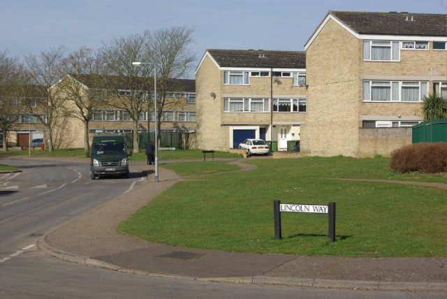
An overspill estate is a housing estate planned and built for the housing of excess population in urban areas, both from the natural increase of population and often in order to rehouse people from decaying inner city areas, usually as part of the process of slum clearance. They were created on the outskirts of most large British towns and during most of the 20th century, with new towns being an alternative approach outside London after World War II. The objective of this was to bring more economic activity to these smaller communities, whilst relieving pressure on overpopulated areas of major cities. The Town Development Act 1952 encouraged the expansion of neighbouring urban areas rather than the creation of satellite communities. The authorities wished to divert people living in poor conditions within highly populous cities to better conditions on the outskirts of these cities. Overspill not only involves moving people to a new area, but requires industry and employment to follow ... [...More Info...] [...Related Items...] OR: [Wikipedia] [Google] [Baidu] |

.jpg)


