|
Mi'kmaq Militia
The military history of the Mi'kmaq consisted primarily of Mi'kmaq warriors (''smáknisk'') who participated in wars against the English (the British after 1707) independently as well as in coordination with the Acadian militia and French royal forces. The Mi'kmaq militias remained an effective force for over 75 years before the Halifax Treaties were signed (1760–1761). In the nineteenth century, the Mi'kmaq "boasted" that, in their contest with the British, the Mi'kmaq "killed more men than they lost". In 1753, Charles Morris stated that the Mi'kmaq have the advantage of "no settlement or place of abode, but wandering from place to place in unknown and, therefore, inaccessible woods, is so great that it has hitherto rendered all attempts to surprise them ineffectual". Leadership on both sides of the conflict employed standard colonial warfare, which included scalping non-combatants (e.g., families). After some engagements against the British during the American Revolutionary ... [...More Info...] [...Related Items...] OR: [Wikipedia] [Google] [Baidu] |
Mi'kmaq
The Mi'kmaq (also ''Mi'gmaq'', ''Lnu'', ''Miꞌkmaw'' or ''Miꞌgmaw''; ; ) are a First Nations people of the Northeastern Woodlands, indigenous to the areas of Canada's Atlantic Provinces and the Gaspé Peninsula of Quebec as well as the northeastern region of Maine. The traditional national territory of the Mi'kmaq is named Miꞌkmaꞌki (or Miꞌgmaꞌgi). There are 170,000 Mi'kmaq people in the region, (including 18,044 members in the recently formed Qalipu First Nation in Newfoundland.) Nearly 11,000 members speak Miꞌkmaq, an Eastern Algonquian language. Once written in Miꞌkmaw hieroglyphic writing, it is now written using most letters of the Latin alphabet. The Mi'kmaq, Maliseet, and Pasamaquoddy nations signed a series of treaties known as the Covenant Chain of Peace and Friendship Treaties with the British Crown throughout the eighteenth century; the first was signed in 1725, and the last in 1779. The Miꞌkmaq maintain that they did not cede or give up their ... [...More Info...] [...Related Items...] OR: [Wikipedia] [Google] [Baidu] |
Bic National Park
Bic National Park is an national park of Quebec, Canada, located on the south shore of the St. Lawrence River, near the villages of Le Bic and Saint-Fabien, southwest of Rimouski. It was founded on October 17, 1984, and is home to large populations of harbour seals and grey seals. Its highest point is Pic Champlain at . Slightly less than half of the park is a coastal marine environment. The park is owned by the Ministry of Sustainable Development, Environment and Parks of Quebec. It is managed by the Société des établissements de plein air du Québec (SÉPAQ). Bic National Park is typical of the southern coast of the Gulf of St. Lawrence, containing several characteristics of this region: * Low-flow rivers (la rivière du Sud-Ouest) * Salt marshes (the marsh at Pointe-au-Spruce) * Rocky hills with a very steep northern slope and a relatively gentle southern slope (Pic Champlain, Citadelle, Cap-l'Original, etc.) History Human occupation of Bic dates back almost 7,000 y ... [...More Info...] [...Related Items...] OR: [Wikipedia] [Google] [Baidu] |
Penobscot People
The Penobscot (Abenaki: ''Pαnawάhpskewi'') are an Indigenous people in North America from the Northeastern Woodlands region. They are organized as a federally recognized tribe in Maine and as a First Nations band government in the Atlantic provinces and Quebec. The ''Penobscot Nation'', formerly known as the ''Penobscot Tribe of Maine,'' is the federally recognized tribe of Penobscot in the United States."Tribal Directory" ''National Congress of American Indians''. Retrieved 30 August 2012. They are part of the Wabanaki Confederacy, along with the , |
Abenaki
The Abenaki ( Abenaki: ''Wαpánahki'') are an Indigenous peoples of the Northeastern Woodlands of Canada and the United States. They are an Algonquian-speaking people and part of the Wabanaki Confederacy. The Eastern Abenaki language was predominantly spoken in Maine, while the Western Abenaki language was spoken in Quebec, Vermont, and New Hampshire. While Abenaki peoples have shared cultural traits, they did not historically have a centralized government. They came together as a post-contact community after their original tribes were decimated by colonization, disease, and warfare. Names The word ''Abenaki'' and its syncope, ''Abnaki,'' are both derived from ''Wabanaki'', or ''Wôbanakiak,'' meaning "People of the Dawn Land" in the Abenaki language. While the two terms are often confused, the Abenaki are one of several tribes in the Wabanaki Confederacy. The name is spelled several ways including Abnaki, Abinaki, and Alnôbak. ''Wôbanakiak'' is derived from ''wôban ... [...More Info...] [...Related Items...] OR: [Wikipedia] [Google] [Baidu] |
Algonquian Languages
The Algonquian languages ( or ; also Algonkian) are a subfamily of indigenous American languages that include most languages in the Algic language family. The name of the Algonquian language family is distinguished from the orthographically similar Algonquin dialect of the Indigenous Ojibwe language (Chippewa), which is a senior member of the Algonquian language family. The term ''Algonquin'' has been suggested to derive from the Maliseet word (), "they are our relatives/allies". A number of Algonquian languages are considered extinct languages by the modern linguistic definition. Speakers of Algonquian languages stretch from the east coast of North America to the Rocky Mountains. The proto-language from which all of the languages of the family descend, Proto-Algonquian, was spoken around 2,500 to 3,000 years ago. There is no scholarly consensus about where this language was spoken. Family division This subfamily of around 30 languages is divided into three group ... [...More Info...] [...Related Items...] OR: [Wikipedia] [Google] [Baidu] |
Wabanaki Confederacy
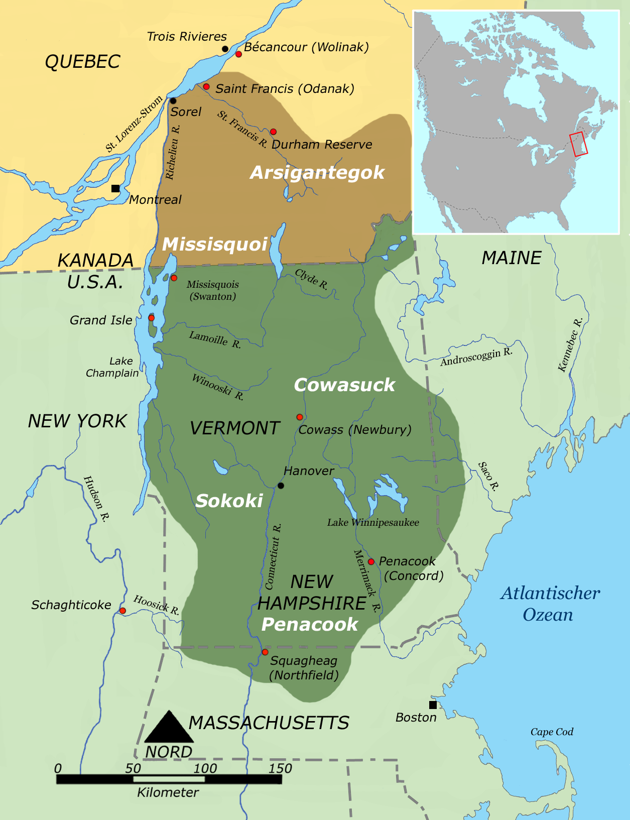
The Wabanaki Confederacy (''Wabenaki, Wobanaki'', translated to "People of the Dawn" or "Easterner") is a North American First Nations and Native American confederation of four principal Eastern Algonquian nations: the Miꞌkmaq, Maliseet (''Wolastoqey''), Passamaquoddy (''Peskotomahkati'') and Penobscot. The Western Abenaki are also considered members, being a loose identity for a number of allied tribal peoples such as the Sokoki, Cowasuck, Missiquoi, and Arsigantegok, among others. There were more tribes, along with many bands, that were once part of the Confederation. Native tribes such as the Norridgewock, Etchemin, Alemousiski, and Canibas, through massacres, tribal consolidation, and ethnic label shifting were absorbed into the five larger national identities. Members of the Wabanaki Confederacy, the Wabanaki, are located in and named for the area which they call ''Wabanakik'' ("Dawnland"), roughly the area that became the French colony of Acadia. It is made up ... [...More Info...] [...Related Items...] OR: [Wikipedia] [Google] [Baidu] |
Battle Of Port La Tour (1677)
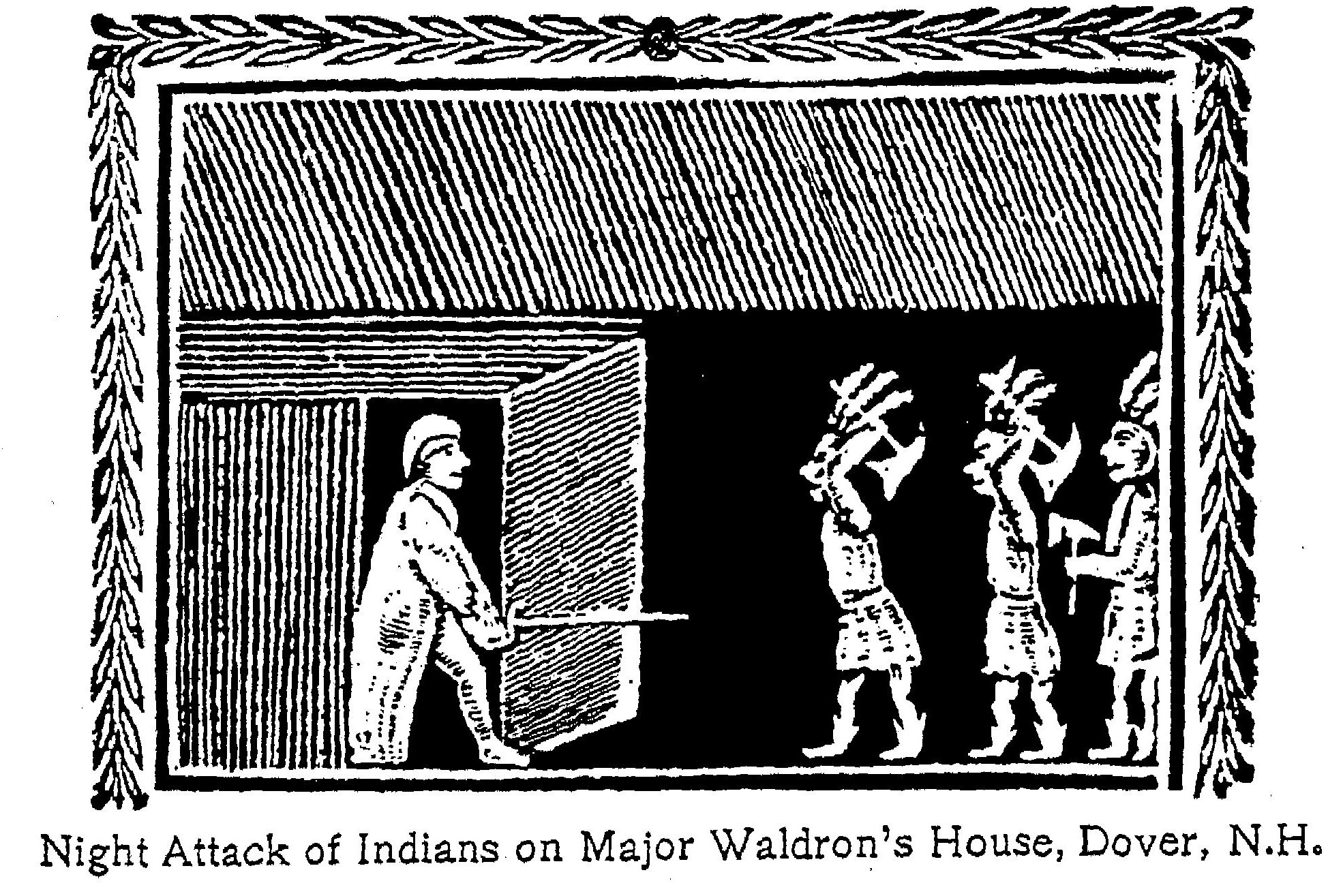
The Battle of Port La Tour occurred on July 18, 1677, at Port La Tour, Acadia, as part of the Northeast Coast Campaign during the First Abenaki War (the Maine-Acadia theater of King Phillips War) in which the Mi'kmaq attacked New England fishermen. The New Englanders eventually overwhelmed them and many Mi'kmaq were enslaved. Historical context Prior to King Philip's War, there is no record of New England and the Mi'kmaq being in conflict. During the First Abenaki War, Major Richard Waldron captured natives for the slave trade. The most significant seizure of natives happened in Dover on September 7, 1676. Later, Waldron gave a mandate to the merchant, Henry Lawton (or Laughton), of the Piscataqua area, to seize all the Indians "of the East" who had been raiding the New England villages along the border with Acadia. On November 9, 1676 ( o.s.), they hired a vessel, the ''Endeavor'', commanded by Captain John Horton. They stopped at Machias and nine natives were taken captiv ... [...More Info...] [...Related Items...] OR: [Wikipedia] [Google] [Baidu] |
King Philip's War
King Philip's War (sometimes called the First Indian War, Metacom's War, Metacomet's War, Pometacomet's Rebellion, or Metacom's Rebellion) was an armed conflict in 1675–1676 between indigenous inhabitants of New England and New England colonists and their indigenous allies. The war is named for Metacom, the Wampanoag chief who adopted the name Philip because of the friendly relations between his father Massasoit and the ''Mayflower'' Pilgrims. The war continued in the most northern reaches of New England until the signing of the Treaty of Casco Bay on April 12, 1678. Massasoit had maintained a long-standing alliance with the colonists. Metacom (), his younger son, became tribal chief in 1662 after Massasoit's death. Metacom, however, forsook his father's alliance between the Wampanoags and the colonists after repeated violations by the colonists. The colonists insisted that the 1671 peace agreement should include the surrender of Native guns; then three Wampanoags were ... [...More Info...] [...Related Items...] OR: [Wikipedia] [Google] [Baidu] |
First Abenaki War
The First Abenaki War (also known as the northern theatre of King Philip's War) was fought along the New England/Acadia border primarily in present-day Maine. Richard Waldron and Charles Frost led the forces in the northern region, while Jean-Vincent d'Abbadie de Saint-Castin worked with the tribes that would make up the Wabanaki Confederacy. The natives engaged in annual campaigns against the English settlements in 1675, 1676, and 1677. Waldron sent forces so far north that he attacked the Mi'kmaq in Acadia. Historian Georges Cerbelaud Salagnac writes that Castine and the Abenaki "displayed consummate skill at it, holding in check at every point, from the Penobscot River to Salmon Falls, N.H., and even beyond, 700 regular troops, and even inflicting humiliating defeats upon them." The official records indicate natives killed or captured 260 English. The villages of Cape Neddick, Scarborough, Casco, Arrowsick, Pemaquid and several others were destroyed. The war cost the coloni ... [...More Info...] [...Related Items...] OR: [Wikipedia] [Google] [Baidu] |
Essex County, Massachusetts
Essex County is a county in the northeastern part of the U.S. state of Massachusetts. At the 2020 census, the total population was 809,829, making it the third-most populous county in the state, and the eightieth-most populous in the country. It is part of the Greater Boston area (the Boston–Cambridge– Newton, MA– NH Metropolitan Statistical Area). The largest city in Essex County is Lynn. The county was named after the English county of Essex. It has two traditional county seats: Salem and Lawrence. Prior to the dissolution of the county government in 1999, Salem had jurisdiction over the Southern Essex District, and Lawrence had jurisdiction over the Northern Essex District, but currently these cities do not function as seats of government. However, the county and the districts remain as administrative regions recognized by various governmental agencies, which gathered vital statistics or disposed of judicial case loads under these geographic subdivisions, and are ... [...More Info...] [...Related Items...] OR: [Wikipedia] [Google] [Baidu] |
Agawam, Massachusetts
Agawam is a city in Hampden County, Massachusetts, United States. The population was 28,692 at the 2020 census. Agawam sits on the western side of the Connecticut River, directly across from Springfield, Massachusetts. It is considered part of the Springfield Metropolitan Statistical Area, which is contiguous with the Knowledge Corridor area, the 2nd largest metropolitan area in New England. Agawam contains a subsection, Feeding Hills. The Six Flags New England amusement park is located in Agawam, on the banks of the Connecticut River. Agawam's ZIP code, 01001, is the lowest in the contiguous United States. Etymology The Native American village originally sited on the west bank of the Connecticut River was known as Agawam, or Agawanus, Aggawom, Agawom, Onkowam, Igwam, and Auguam. It is variously speculated to mean "unloading place" and "fishcuring place", perhaps in reference to fish at Agawam Falls being unloaded from canoes for curing on the flats at the mouth of the W ... [...More Info...] [...Related Items...] OR: [Wikipedia] [Google] [Baidu] |
Chief Masconomet
Masconomet, (died 1658) spelled many different ways in colonial deeds, was '' sagamore'' of the Agawam tribe among the Algonquian peoples during the time of the English colonization of the Americas. He is known for his quitclaim deed ceding all the tribal land, which extended from Cape Ann to the Merrimack River, as far inland as North Andover, Massachusetts and Middleton, Massachusetts, and as far to the southwest as the Danvers River, to John Winthrop the Younger, his heirs and all the settlers of eastern Essex County for a sum of 20 pounds, about 100 dollars. Although he could not read or write at the time of the deed, Masconomet understood that he was effecting a union of the remnant of the tribe after decimation by disease (probably smallpox) with the English colonists. He testified to that effect before the General Court of Massachusetts, which was questioning the legality of the younger Winthrop's transactions. Winthrop and his heirs were seeking public reimbursement of t ... [...More Info...] [...Related Items...] OR: [Wikipedia] [Google] [Baidu] |


.jpg)


