|
Mebane, North Carolina
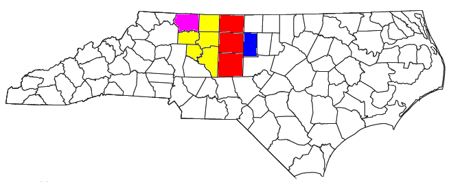
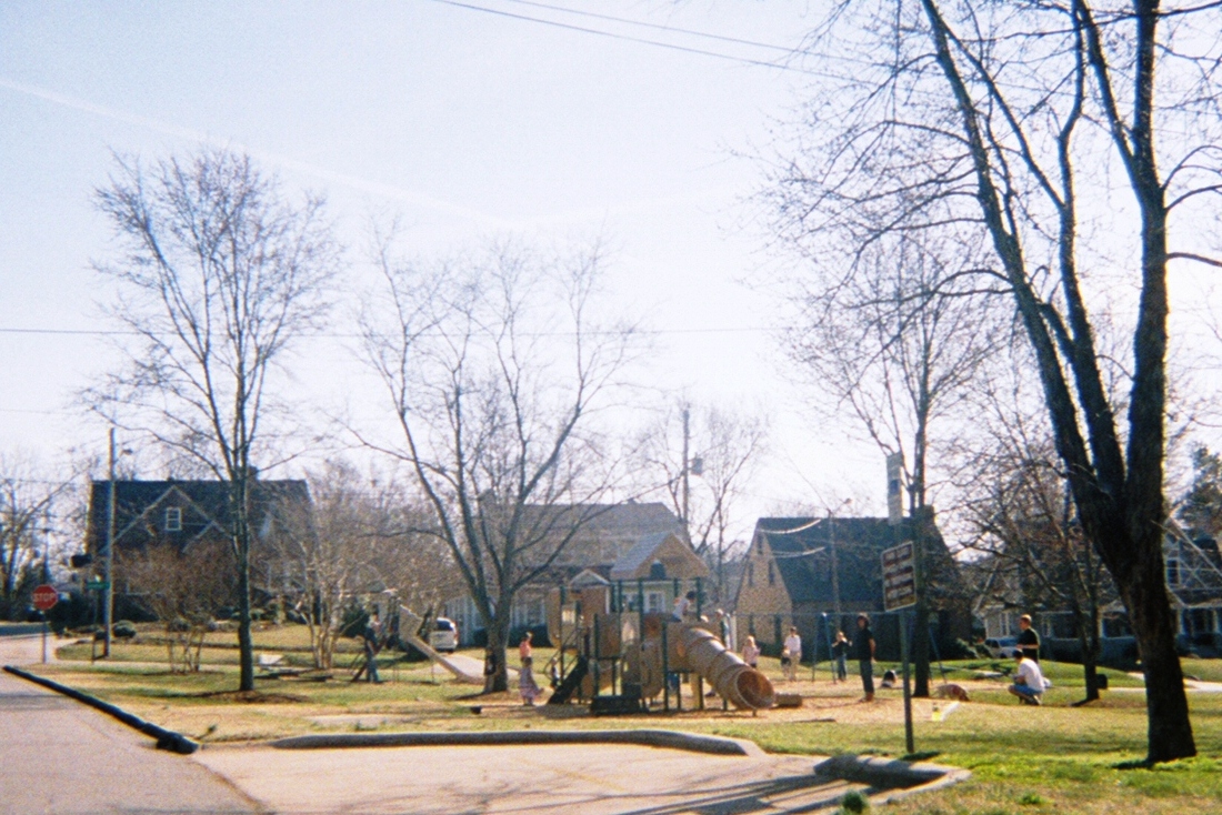
Mebane is a city located mostly in Alamance County, North Carolina, United States, and partly in Orange County. The town was named for Alexander Mebane, an American Revolutionary War general and member of the U.S. Congress. It was incorporated as "Mebanesville" in 1881, and in 1883 the name was changed to "Mebane". It was incorporated as a city in 1987. The population as of the 2020 census was 17,768. Mebane is one of the fastest-growing municipalities in North Carolina. Mebane straddles the Research Triangle and Piedmont Triad Regions of North Carolina. The bulk of the city is in Alamance County, which comprises the Burlington Metropolitan Statistical Area, itself a component of the Greensboro-Winston-Salem- High Point Combined Statistical Area. Two slivers in the eastern portion of the city are in Orange County, which is part of the Durham-Chapel Hill Metropolitan Statistical Area, itself a component of the Raleigh-Durham-Chapel Hill Combined Statistical Area. History The tow ... [...More Info...] [...Related Items...] OR: [Wikipedia] [Google] [Baidu] |
City
A city is a human settlement of notable size.Goodall, B. (1987) ''The Penguin Dictionary of Human Geography''. London: Penguin.Kuper, A. and Kuper, J., eds (1996) ''The Social Science Encyclopedia''. 2nd edition. London: Routledge. It can be defined as a permanent and densely settled place with administratively defined boundaries whose members work primarily on non-agricultural tasks. Cities generally have extensive systems for housing, transportation, sanitation, utilities, land use, production of goods, and communication. Their density facilitates interaction between people, government organisations and businesses, sometimes benefiting different parties in the process, such as improving efficiency of goods and service distribution. Historically, city-dwellers have been a small proportion of humanity overall, but following two centuries of unprecedented and rapid urbanization, more than half of the world population now lives in cities, which has had profound consequences for g ... [...More Info...] [...Related Items...] OR: [Wikipedia] [Google] [Baidu] |
United States Congress
The United States Congress is the legislature of the federal government of the United States. It is bicameral, composed of a lower body, the House of Representatives, and an upper body, the Senate. It meets in the U.S. Capitol in Washington, D.C. Senators and representatives are chosen through direct election, though vacancies in the Senate may be filled by a governor's appointment. Congress has 535 voting members: 100 senators and 435 representatives. The U.S. vice president has a vote in the Senate only when senators are evenly divided. The House of Representatives has six non-voting members. The sitting of a Congress is for a two-year term, at present, beginning every other January. Elections are held every even-numbered year on Election Day. The members of the House of Representatives are elected for the two-year term of a Congress. The Reapportionment Act of 1929 establishes that there be 435 representatives and the Uniform Congressional Redistricting Act requires ... [...More Info...] [...Related Items...] OR: [Wikipedia] [Google] [Baidu] |
William Cook House (Mebane, North Carolina)
William Cook House is a set of two historic homes located near Mebane, Alamance County, North Carolina. They are a one-story one-room log house, built about 1840, and a two-story frame I-house built about 1903. They are set close to and at a 90-degree angle to each other. The houses are connected by joined·hip roofed porches, carried by plain square posts. Also on the property are the contributing two-story, single-pen log barn, a log storage shed, a frame corn crib, and a substantial log wood shed. It was added to the National Register of Historic Places The National Register of Historic Places (NRHP) is the United States federal government's official list of districts, sites, buildings, structures and objects deemed worthy of preservation for their historical significance or "great artistic ... in 1993. References Log houses in the United States Houses on the National Register of Historic Places in North Carolina Houses completed in 1840 Houses in Alaman ... [...More Info...] [...Related Items...] OR: [Wikipedia] [Google] [Baidu] |
Charles F
Charles is a masculine given name predominantly found in English and French speaking countries. It is from the French form ''Charles'' of the Proto-Germanic name (in runic alphabet) or ''*karilaz'' (in Latin alphabet), whose meaning was "free man". The Old English descendant of this word was '' Ċearl'' or ''Ċeorl'', as the name of King Cearl of Mercia, that disappeared after the Norman conquest of England. The name was notably borne by Charlemagne (Charles the Great), and was at the time Latinized as ''Karolus'' (as in ''Vita Karoli Magni''), later also as '' Carolus''. Some Germanic languages, for example Dutch and German, have retained the word in two separate senses. In the particular case of Dutch, ''Karel'' refers to the given name, whereas the noun ''kerel'' means "a bloke, fellow, man". Etymology The name's etymology is a Common Germanic noun ''*karilaz'' meaning "free man", which survives in English as churl (< Old English ''ċeorl''), which developed its depr ... [...More Info...] [...Related Items...] OR: [Wikipedia] [Google] [Baidu] |
American Revolution
The American Revolution was an ideological and political revolution that occurred in British America between 1765 and 1791. The Americans in the Thirteen Colonies formed independent states that defeated the British in the American Revolutionary War (1775–1783), gaining independence from the British Crown and establishing the United States of America as the first nation-state founded on Enlightenment principles of liberal democracy. American colonists objected to being taxed by the Parliament of Great Britain, a body in which they had no direct representation. Before the 1760s, Britain's American colonies had enjoyed a high level of autonomy in their internal affairs, which were locally governed by colonial legislatures. During the 1760s, however, the British Parliament passed a number of acts that were intended to bring the American colonies under more direct rule from the British metropole and increasingly intertwine the economies of the colonies with those of Brit ... [...More Info...] [...Related Items...] OR: [Wikipedia] [Google] [Baidu] |
Research Triangle
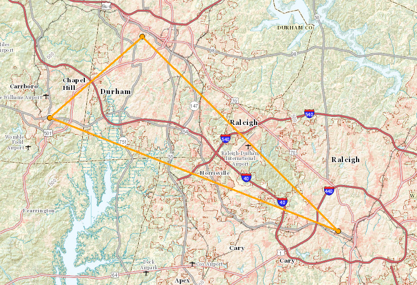
The Research Triangle, or simply The Triangle, are both common nicknames for a metropolitan area in the Piedmont region of North Carolina in the United States, anchored by the cities of Raleigh and Durham and the town of Chapel Hill, home to three major research universities: North Carolina State University, Duke University, and University of North Carolina at Chapel Hill, respectively. The nine-county region, officially named the Raleigh–Durham–Cary combined statistical area (CSA), comprises the Raleigh–Cary and Durham–Chapel Hill Metropolitan Statistical Areas and the Henderson Micropolitan Statistical Area. The "Triangle" name originated in the 1950s with the creation of Research Triangle Park, located between the three anchor cities and home to numerous high tech companies. A 2019 Census estimate put the population at 2,079,687, making it the second largest combined statistical area in the state of North Carolina behind Charlotte CSA. The Raleigh–Durham t ... [...More Info...] [...Related Items...] OR: [Wikipedia] [Google] [Baidu] |
Raleigh, North Carolina
Raleigh (; ) is the capital city of the state of North Carolina and the List of North Carolina county seats, seat of Wake County, North Carolina, Wake County in the United States. It is the List of municipalities in North Carolina, second-most populous city in North Carolina, after Charlotte, North Carolina, Charlotte. Raleigh is the tenth-most populous city in the Southeastern United States, Southeast, List of United States cities by population, the 41st-most populous city in the U.S., and the largest city of the Research Triangle metro area. Raleigh is known as the "City of Oaks" for its many oak, oak trees, which line the streets in the heart of the city. The city covers a land area of . The United States Census Bureau, U.S. Census Bureau counted the city's population as 474,069 in the 2020 United States census, 2020 census. It is one of the fastest-growing cities in the United States. The city of Raleigh is named after Sir Walter Raleigh, who established the lost Roanoke Co ... [...More Info...] [...Related Items...] OR: [Wikipedia] [Google] [Baidu] |
Chapel Hill, North Carolina
Chapel Hill is a town in Orange, Durham and Chatham counties in the U.S. state of North Carolina. Its population was 61,960 in the 2020 census, making Chapel Hill the 17th-largest municipality in the state. Chapel Hill, Durham, and the state capital, Raleigh, make up the corners of the Research Triangle (officially the Raleigh–Durham–Cary combined statistical area), with a total population of 1,998,808. The town was founded in 1793 and is centered on Franklin Street, covering . It contains several districts and buildings listed on the National Register of Historic Places. The University of North Carolina at Chapel Hill and UNC Health Care are a major part of the economy and town influence. Local artists have created many murals. History The area was the home place of early settler William Barbee of Middlesex County, Virginia, whose 1753 grant of 585 acres from John Carteret, 2nd Earl Granville was the first of two land grants in what is now the Chapel Hill-Durham area. Th ... [...More Info...] [...Related Items...] OR: [Wikipedia] [Google] [Baidu] |
Durham, North Carolina
Durham ( ) is a city in the U.S. state of North Carolina and the county seat of Durham County, North Carolina, Durham County. Small portions of the city limits extend into Orange County, North Carolina, Orange County and Wake County, North Carolina, Wake County. With a population of 283,506 in the 2020 United States Census, 2020 Census, Durham is the List of municipalities in North Carolina, 4th-most populous city in North Carolina, and the List of United States cities by population, 74th-most populous city in the United States. The city is located in the east-central part of the Piedmont (United States), Piedmont region along the Eno River. Durham is the core of the four-county Research Triangle#Office of Management and Budget Definition, Durham-Chapel Hill Metropolitan Area, which has a population of 649,903 as of 2020 U.S. Census. The Office of Management and Budget also includes Durham as a part of the Raleigh, North Carolina, Raleigh-Durham-Cary Combined Statistical Area, com ... [...More Info...] [...Related Items...] OR: [Wikipedia] [Google] [Baidu] |
Piedmont Triad
The Piedmont Triad (or simply the Triad) is a metropolitan region in the north-central part of the U.S. state of North Carolina anchored by three cities: Greensboro, North Carolina, Greensboro, Winston-Salem, North Carolina, Winston-Salem, and High Point, North Carolina, High Point. This close group of cities lies in the Piedmont (United States), Piedmont geographical region of the United States and forms the basis of the Greensboro–Winston-Salem–High Point Combined Statistical Area. As of 2012, the Piedmont Triad has an estimated population of 1,611,243 making it the 33rd largest combined statistical area in the United States. The metropolitan area is connected by Interstates Interstate 40 in North Carolina, 40, Interstate 85 in North Carolina, 85, I-73, 73, and Interstate 74 in North Carolina, 74 and is served by the Piedmont Triad International Airport. Long known as one of the primary manufacturing and transportation hubs of the southeastern United States, the Triad is al ... [...More Info...] [...Related Items...] OR: [Wikipedia] [Google] [Baidu] |
High Point, North Carolina
High Point is a city in the Piedmont Triad region of the United States, U.S. state of North Carolina. Most of the city is in Guilford County, North Carolina, Guilford County, with parts extending into Randolph County, North Carolina, Randolph, Davidson County, North Carolina, Davidson, and Forsyth County, North Carolina, Forsyth counties. High Point is North Carolina's only city that extends into four counties. As of the 2020 United States census, 2020 census the city had a total population of 113,887 with an estimated population of 114,086 in 2021. High Point is the List of municipalities in North Carolina, ninth-largest municipality in North Carolina, the third-largest municipality in the Piedmont Triad, Piedmont Triad metropolitan area, and the 259th-largest city in the U.S. Major industries in High Point include furniture, textiles, and bus manufacturing. The city's official slogan is "North Carolina's International City" due to the semi-annual High Point Furniture Market t ... [...More Info...] [...Related Items...] OR: [Wikipedia] [Google] [Baidu] |
Winston-Salem, North Carolina
Winston-Salem is a city and the county seat of Forsyth County, North Carolina, United States. In the 2020 census, the population was 249,545, making it the second-largest municipality in the Piedmont Triad region, the 5th most populous city in North Carolina, the third-largest urban area in North Carolina, and the 90th most populous city in the United States. With a metropolitan population of 679,948 it is the fourth largest metropolitan area in North Carolina. Winston-Salem is home to the tallest office building in the region, 100 North Main Street, formerly known as the Wachovia Building and now known locally as the Wells Fargo Center. In 2003, the Greensboro-Winston-Salem-High Point metropolitan statistical area was redefined by the OMB and separated into the two major metropolitan areas of Winston-Salem and Greensboro-High Point. The population of the Winston-Salem metropolitan area in 2020 was 679,948. The metro area covers over 2,000 square miles and spans the five cou ... [...More Info...] [...Related Items...] OR: [Wikipedia] [Google] [Baidu] |
