|
Masiphumelele
Masiphumelele is a township on the Cape Peninsula, South Africa, situated between Kommetjie, Capri Village and Noordhoek. Initially known as Site 5, the township was renamed Masiphumelele by its residents, which is a Xhosa word meaning "let us succeed". About 400-500 people first settled in the area in the 1980s. During apartheid residents were continually removed to the suburb of Khayelitsha, over 30 km away, but the numbers began to grow as apartheid began to unravel from 1990. In 1990, about 8000 residents lived in the area, mostly in shacks, but by 2005, over 26000 people lived there, many in brick homes. In 2010, the population was estimated at 38000. Many are from the old Ciskei bantustan in the Eastern Cape. Amenities are scarce, with an overcrowded school, no police station, and an understaffed day clinic, while it's estimated that 30-40% of the community are infected with HIV and/or TB. SHAWCO, the University of Cape Town Student's Health And Welfare Centres ... [...More Info...] [...Related Items...] OR: [Wikipedia] [Google] [Baidu] |
SHAWCO
SHAWCO, the Students' Health and Welfare Centres Organisation, is a student-run non-governmental organization, NGO based at the University of Cape Town that seeks to improve the quality of life for individuals in developing communities within the Cape Metropolitan area. SHAWCO was founded in 1943 by Andrew Kinnear, a medical student who was moved to action by the need which he saw in the impoverished communities of Cape Town.Selzer G, Gordon H. SHAWCO: the students' health and welfare centres Organization of the University of Cape Town. SAMJ. 1963 (19 Jan); Vol. 37, pp. 58-9. The organisation has grown over the years and now has 3000 student Volunteering, volunteers running over 15 health and education projects in five SHAWCO centres as well as other locations around the Cape Metropolitan area. SHAWCO is divided into two main sectors: Education and Health. A third "staff sector" coordinates the SHAWCO community centres, transport, resource development, administrative oversight a ... [...More Info...] [...Related Items...] OR: [Wikipedia] [Google] [Baidu] |
City Of Cape Town Metropolitan Municipality
The City of Cape Town ( af, Stad Kaapstad; xh, IsiXeko saseKapa) is the metropolitan municipality which governs the city of Cape Town, South Africa and its suburbs and exurbs. As of the 2011 census, it had a population of 3,740,026. The remote Prince Edward Islands are deemed to be part of the City of Cape Town, specifically of ward 115. Cllr. Ian McMahon is the current ward councilor of ward 115. History Cape Town first received local self-government in 1839, with the promulgation of a municipal ordinance by the government of the Cape Colony. When it was created, the Cape Town municipality governed only the central part of the city known as the City Bowl, and as the city expanded, new suburbs became new municipalities, until by 1902 there were 10 separate municipalities in the Cape Peninsula. During the 20th century, many of the inner suburban municipalities became unsustainable; in 1913 the first major unification took place when the municipalities of Cape Town, Green Poi ... [...More Info...] [...Related Items...] OR: [Wikipedia] [Google] [Baidu] |
Khayelitsha, Cape Town
Khayelitsha () is a township in Western Cape, South Africa, on the Cape Flats in the City of Cape Town Metropolitan Municipality. The name is Xhosa for ''New Home''. It is reputed to be the largestNew, Assertive Women's Voices in Local Election by Erna Curry, 29 January 2011 and fastest-growing township in South Africa. History initially opposed implementing the passed in 1950, and residential areas in the city remained unsegregated until the first Group Areas were declared in the city in 1957.[...More Info...] [...Related Items...] OR: [Wikipedia] [Google] [Baidu] |
South Africa
South Africa, officially the Republic of South Africa (RSA), is the southernmost country in Africa. It is bounded to the south by of coastline that stretch along the South Atlantic and Indian Oceans; to the north by the neighbouring countries of Namibia, Botswana, and Zimbabwe; and to the east and northeast by Mozambique and Eswatini. It also completely enclaves the country Lesotho. It is the southernmost country on the mainland of the Old World, and the second-most populous country located entirely south of the equator, after Tanzania. South Africa is a biodiversity hotspot, with unique biomes, plant and animal life. With over 60 million people, the country is the world's 24th-most populous nation and covers an area of . South Africa has three capital cities, with the executive, judicial and legislative branches of government based in Pretoria, Bloemfontein, and Cape Town respectively. The largest city is Johannesburg. About 80% of the population are Black South Afri ... [...More Info...] [...Related Items...] OR: [Wikipedia] [Google] [Baidu] |
Cape Peninsula
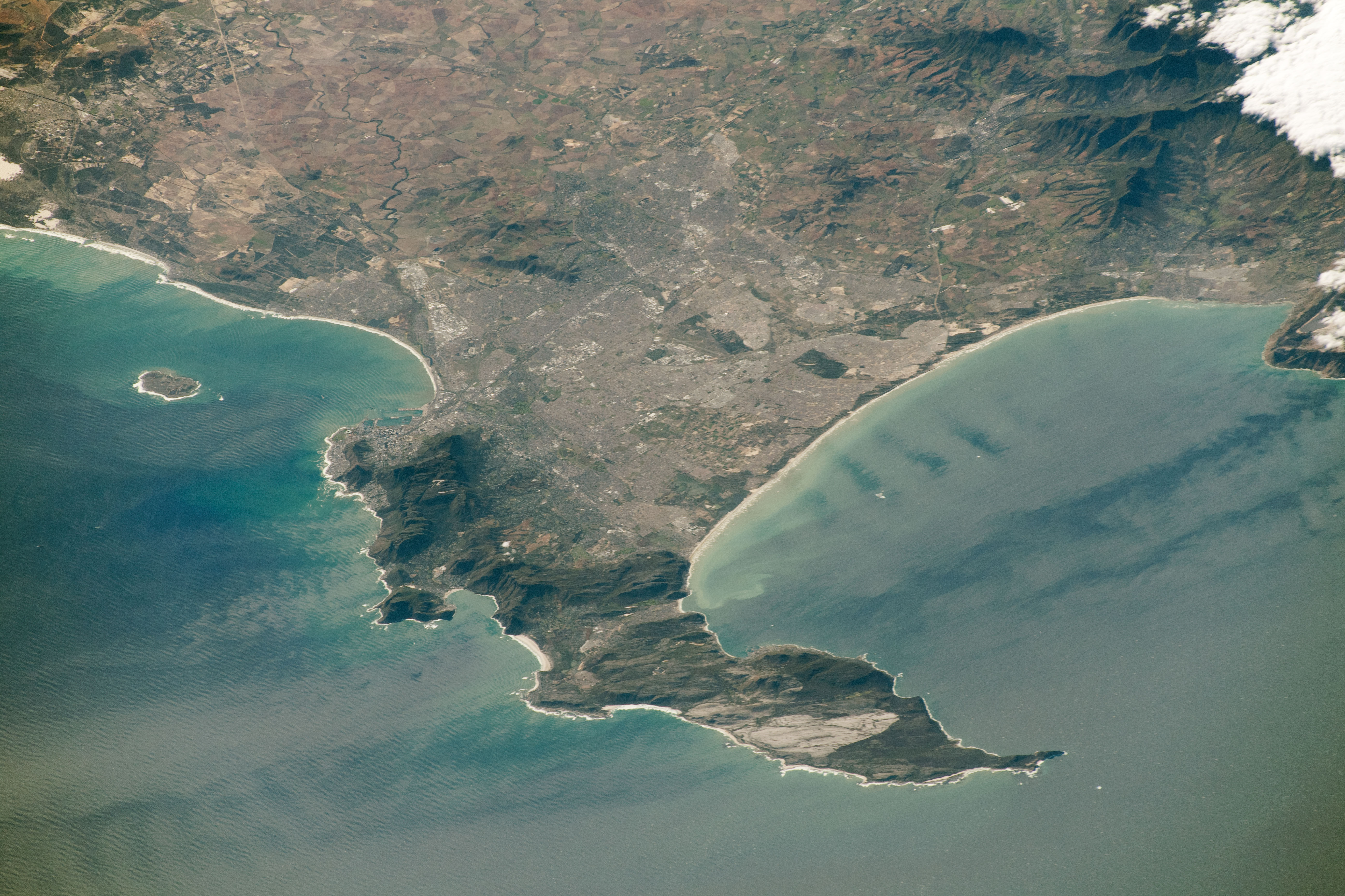
The Cape Peninsula ( af, Kaapse Skiereiland) is a generally mountainous peninsula that juts out into the Atlantic Ocean at the south-western extremity of the African continent. At the southern end of the peninsula are Cape Point and the Cape of Good Hope. On the northern end is Table Mountain, overlooking Table Bay and the city bowl of Cape Town, South Africa. The peninsula is 52 km long from Mouille point in the north to Cape Point in the south. The Peninsula has been an island on and off for the past 5 million years, as sea levels fell and rose with the Glacial period, ice age and interglacial global warming cycles of, particularly, the Pleistocene. The last time that the Peninsula was an island was about 1.5 million years ago. Soon afterwards it was joined to the mainland by the Geology of Cape Town#Tertiary to Recent events, emergence from the sea of the sandy area now known as the Cape Flats. The towns and villages of the Cape Peninsula and Cape Flats, and the ... [...More Info...] [...Related Items...] OR: [Wikipedia] [Google] [Baidu] |
Johannesburg
Johannesburg ( , , ; Zulu and xh, eGoli ), colloquially known as Jozi, Joburg, or "The City of Gold", is the largest city in South Africa, classified as a megacity, and is one of the 100 largest urban areas in the world. According to Demographia, the Johannesburg–Pretoria urban area (combined because of strong transport links that make commuting feasible) is the 26th-largest in the world in terms of population, with 14,167,000 inhabitants. It is the provincial capital and largest city of Gauteng, which is the wealthiest province in South Africa. Johannesburg is the seat of the Constitutional Court, the highest court in South Africa. Most of the major South African companies and banks have their head offices in Johannesburg. The city is located in the mineral-rich Witwatersrand range of hills and is the centre of large-scale gold and diamond trade. The city was established in 1886 following the discovery of gold on what had been a farm. Due to the extremely large gold de ... [...More Info...] [...Related Items...] OR: [Wikipedia] [Google] [Baidu] |
Alexandra, Gauteng
Alexandra, informally abbreviated to Alex, is a Township (South Africa), township in the Gauteng province of South Africa. It forms part of the City of Johannesburg Metropolitan Municipality and is located next to the wealthy suburb of Sandton. It is commonly known as "Gomora" among local residents. Alexandra is bounded by Wynberg, Gauteng, Wynberg on the west, Marlboro, Gauteng, Marlboro and Kelvin, Gauteng, Kelvin on the north, Kew, Gauteng, Kew, Lombardy West and Lombardy East on the south. Alexandra is one of the poorest urban areas in the country. Alexandra is situated on the banks of the Jukskei River. In addition to its original, reasonably well-built houses, it also has a large number (estimated at more than 20,000) of shanty town, informal dwellings or "shacks" called imikhukhu. History Early history Alexandra was established in 1912, on land originally owned by a farmer, a Mr H.B. Papenfus, who tried to establish a white residential township there, naming it after h ... [...More Info...] [...Related Items...] OR: [Wikipedia] [Google] [Baidu] |
University Of Cape Town
The University of Cape Town (UCT) ( af, Universiteit van Kaapstad, xh, Yunibesithi ya yaseKapa) is a public research university in Cape Town, South Africa. Established in 1829 as the South African College, it was granted full university status in 1918, making it the oldest university in South Africa and the oldest university in Sub-Saharan Africa in continuous operation. UCT is organised in 57 departments across six faculties offering bachelor's ( NQF 7) to doctoral degrees ( NQF 10) solely in the English language. Home to 30 000 students, it encompasses six campuses in the Capetonian suburbs of Rondebosch, Hiddingh, Observatory, Mowbray, and the Waterfront. Although UCT was founded by a private act of Parliament in 1918, the Statute of the University of Cape Town (issued in 2002 in terms of the Higher Education Act) sets out its structure and roles and places the Chancellor - currently, Dr Precious Moloi Motsepe - as the ceremonial figurehead and invests real leadership ... [...More Info...] [...Related Items...] OR: [Wikipedia] [Google] [Baidu] |
Tuberculosis
Tuberculosis (TB) is an infectious disease usually caused by '' Mycobacterium tuberculosis'' (MTB) bacteria. Tuberculosis generally affects the lungs, but it can also affect other parts of the body. Most infections show no symptoms, in which case it is known as latent tuberculosis. Around 10% of latent infections progress to active disease which, if left untreated, kill about half of those affected. Typical symptoms of active TB are chronic cough with blood-containing mucus, fever, night sweats, and weight loss. It was historically referred to as consumption due to the weight loss associated with the disease. Infection of other organs can cause a wide range of symptoms. Tuberculosis is spread from one person to the next through the air when people who have active TB in their lungs cough, spit, speak, or sneeze. People with Latent TB do not spread the disease. Active infection occurs more often in people with HIV/AIDS and in those who smoke. Diagnosis of active TB is ... [...More Info...] [...Related Items...] OR: [Wikipedia] [Google] [Baidu] |
Eastern Cape Province
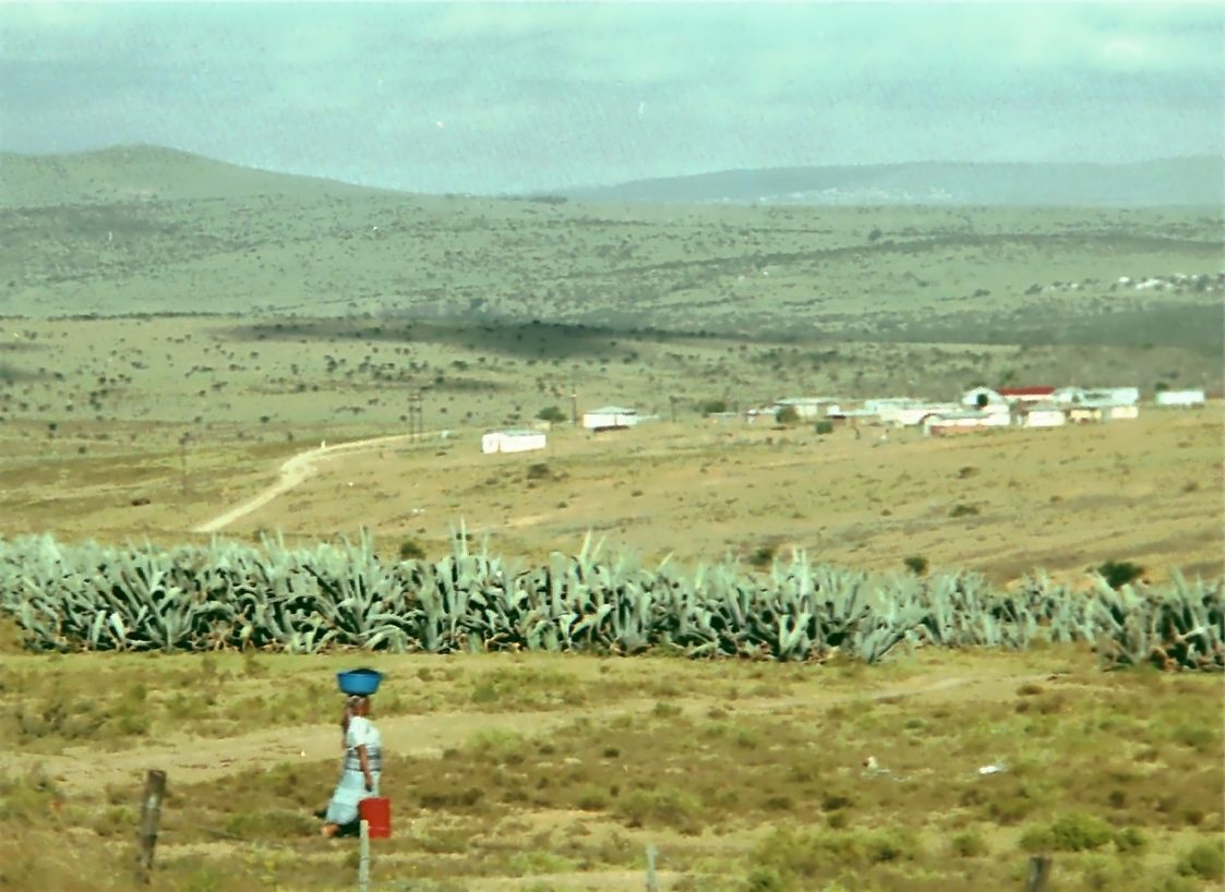
The Eastern Cape is one of the provinces of South Africa. Its capital is Bhisho, but its two largest cities are East London and Gqeberha. The second largest province in the country (at 168,966 km2) after Northern Cape, it was formed in 1994 out of the Xhosa homelands or bantustans of Transkei and Ciskei, together with the eastern portion of the Cape Province. The central and eastern part of the province is the traditional home of the indigenous Xhosa people. In 1820 this area which was known as the Xhosa Kingdom began to be settled by Europeans who originally came from England and some from Scotland and Ireland. Since South Africa's early years, many Xhosas believed in Africanism and figures such as Walter Rubusana believed that the rights of Xhosa people and Africans in general, could not be protected unless Africans mobilized and worked together. As a result, the Eastern Cape is home to many anti-apartheid leaders such as Robert Sobukwe, Oliver Tambo, Nelson Mandela, Wal ... [...More Info...] [...Related Items...] OR: [Wikipedia] [Google] [Baidu] |
Bantustan
A Bantustan (also known as Bantu homeland, black homeland, black state or simply homeland; ) was a territory that the National Party administration of South Africa set aside for black inhabitants of South Africa and South West Africa (now Namibia), as part of its policy of apartheid. By extension, outside South Africa the term refers to regions that lack any real legitimacy, consisting often of several unconnected enclaves, or which have emerged from national or international gerrymandering.Macmillan DictionaryBantustan, "1. one of the areas in South Africa where black people lived during the apartheid system; 2. SHOWING DISAPPROVAL any area where people are forced to live without full civil and political rights." The term, first used in the late 1940s, was coined from Bantu' (meaning "people" in some of the Bantu languages) and '' -stan'' (a suffix meaning "land" in the Persian language and some Persian-influenced languages of western, central, and southern Asia). It subs ... [...More Info...] [...Related Items...] OR: [Wikipedia] [Google] [Baidu] |
Ciskei
Ciskei (, or ) was a Bantustan for the Xhosa people-located in the southeast of South Africa. It covered an area of , almost entirely surrounded by what was then the Cape Province, and possessed a small coastline along the shore of the Indian Ocean. Under South Africa's policy of apartheid, land was set aside for black peoples in self-governing territories. Ciskei was designated as one of two homelands, or "Bantustans", for Xhosa-speaking people. Xhosa people were forcibly resettled in the Ciskei and Transkei, the other Xhosa homeland. In contrast to the Transkei, which was largely contiguous and deeply rural, and governed by hereditary chiefs, the area that became the Ciskei had initially been made up of a patchwork of "reserves", interspersed with pockets of white-owned farms. In Ciskei, there were elected headmen and a relatively educated working-class populace, but there was a tendency of the region's black residents—who often worked in East London, Queenstown, and Kin ... [...More Info...] [...Related Items...] OR: [Wikipedia] [Google] [Baidu] |


.jpg)


