|
Maryland Route 281
Maryland Route 281 (MD 281) is a state highway in the U.S. state of Maryland. Known for most of its length as Red Hill Road, the state highway runs from MD 7 east to the Delaware state line in Elkton in northeastern Cecil County. MD 281 and its continuation in Delaware were originally blazed in the 18th century as part of the Old Post Road between Baltimore and Philadelphia. The route was part of the Elk and Christiana Turnpike in the early 19th century and later the Old Baltimore Pike, but it was replaced as the main highway east from Elkton by U.S. Route 40 (US 40) in the early 20th century. MD 281 was constructed in Elkton in the early 1930s. The highway designation was extended east to the state line in the late 1950s; that extension was reconstructed in the early 1960s. Route description MD 281 begins at an intersection with MD 7 in the town of Elkton. MD 7 continues west as Main Street and heads southeast as Delaware Avenue toward US 40. MD 281 heads east as two-lane u ... [...More Info...] [...Related Items...] OR: [Wikipedia] [Google] [Baidu] |
Elkton, Maryland
Elkton is a town in and the county seat of Cecil County, Maryland, Cecil County, Maryland, United States. The population was 15,443 at the 2010 United States Census, 2010 census. It was formerly called Head of Elk because it sits at the head of navigation on the Elk River (Maryland), Elk River, which flows into the nearby Chesapeake Bay. Elkton was once known as the Gretna Green of the East of the US because of its popularity as a place for Elopement, eloping couples to marry. History The town was founded by New Sweden, Swedish mariners and fisherman from Fort Casimir who settled the area in 1694. They called their settlement Head of Elk, as it was the head of navigation of the Elk River (Maryland), Elk River. The town saw several actions during the American Revolutionary War. On August 25, 1777, Sir William Howe, 5th Viscount Howe, William Howe's Anglo-German army (13,000 British soldiers and 5,000 Germans) landed on the Elk River and marched 11 miles north to Head of Elk. Howe ... [...More Info...] [...Related Items...] OR: [Wikipedia] [Google] [Baidu] |
Roundabout
A roundabout is a type of circular intersection or junction in which road traffic is permitted to flow in one direction around a central island, and priority is typically given to traffic already in the junction.''The New Shorter Oxford English Dictionary,'' Volume 2, Clarendon Press, Oxford (1993), page 2632 Engineers use the term modern roundabout to refer to junctions installed after 1960 that incorporate various design rules to increase safety. Both modern and non-modern roundabouts, however, may bear street names or be identified colloquially by local names such as rotary or traffic circle. Compared to stop signs, traffic signals, and earlier forms of roundabouts, modern roundabouts reduce the likelihood and severity of collisions greatly by reducing traffic speeds and minimizing T-bone and head-on collisions. Variations on the basic concept include integration with tram or train lines, two-way flow, higher speeds and many others. For pedestrians, traffic exiting th ... [...More Info...] [...Related Items...] OR: [Wikipedia] [Google] [Baidu] |
Glasgow, Delaware
Glasgow is a census-designated place (CDP) in New Castle County, Delaware, United States. The population was 14,303 at the 2010 census. History La Grange and the James Stewart House are listed on the National Register of Historic Places. Geography Glasgow is located at (39.6048338, -75.7452119). According to the United States Census Bureau, the CDP has a total area of , all land. Demographics As of the census of 2000, there were 12,840 people, 4,517 households, and 3,478 families living in the CDP. The population density was . There were 4,629 housing units at an average density of . The racial makeup of the CDP was 77.98% White, 17.02% African American, 0.22% Native American, 2.33% Asian, 0.02% Pacific Islander, 1.06% from other races, and 1.37% from two or more races. Hispanic or Latino of any race were 3.01% of the population. There were 4,517 households, out of which 44.5% had children under the age of 18 living with them, 62.9% were married couples living together ... [...More Info...] [...Related Items...] OR: [Wikipedia] [Google] [Baidu] |
Maryland State Roads Commission
The Maryland State Highway Administration (abbreviated MDOT SHA or simply SHA) is the state transportation business unit responsible for maintaining Maryland's numbered highways outside Baltimore City. Formed originally under authority of the General Assembly of Maryland in 1908 as the State Roads Commission (S.R.C.), under the direction of the executive branch of state government headed by the Governor of Maryland, it is tasked with maintaining non-tolled/free bridges throughout the State, removing snow from the state's major thoroughfares, administering the State's "adopt-a-highway" program, and both developing and maintaining the State's freeway/expressway system. Since the reorganization of the several commissions, bureaus, boards, and assorted minor agencies with departments of the executive branch and establishment of the Governor's Cabinet in the early 1970s following the adoption of several individual reorganization recommendations after the rejection by the voters in a N ... [...More Info...] [...Related Items...] OR: [Wikipedia] [Google] [Baidu] |
Toll Road
A toll road, also known as a turnpike or tollway, is a public or private road (almost always a controlled-access highway in the present day) for which a fee (or ''toll'') is assessed for passage. It is a form of road pricing typically implemented to help recoup the costs of road construction and maintenance. Toll roads have existed in some form since antiquity, with tolls levied on passing travelers on foot, wagon, or horseback; a practice that continued with the automobile, and many modern tollways charge fees for motor vehicles exclusively. The amount of the toll usually varies by vehicle type, weight, or number of axles, with freight trucks often charged higher rates than cars. Tolls are often collected at toll plazas, toll booths, toll houses, toll stations, toll bars, toll barriers, or toll gates. Some toll collection points are automatic, and the user deposits money in a machine which opens the gate once the correct toll has been paid. To cut costs and minimise time delay, ... [...More Info...] [...Related Items...] OR: [Wikipedia] [Google] [Baidu] |
American Revolutionary War
The American Revolutionary War (April 19, 1775 – September 3, 1783), also known as the Revolutionary War or American War of Independence, was a major war of the American Revolution. Widely considered as the war that secured the independence of the United States, fighting began on April 19, 1775, followed by the Lee Resolution on July 2, 1776, and the Declaration of Independence on July 4, 1776. The American Patriots were supported by the Kingdom of France and, to a lesser extent, the Dutch Republic and the Spanish Empire, in a conflict taking place in North America, the Caribbean, and the Atlantic Ocean. Established by royal charter in the 17th and 18th centuries, the American colonies were largely autonomous in domestic affairs and commercially prosperous, trading with Britain and its Caribbean colonies, as well as other European powers via their Caribbean entrepôts. After British victory over the French in the Seven Years' War in 1763, tensions between the motherland and he ... [...More Info...] [...Related Items...] OR: [Wikipedia] [Google] [Baidu] |
Yorktown, Virginia
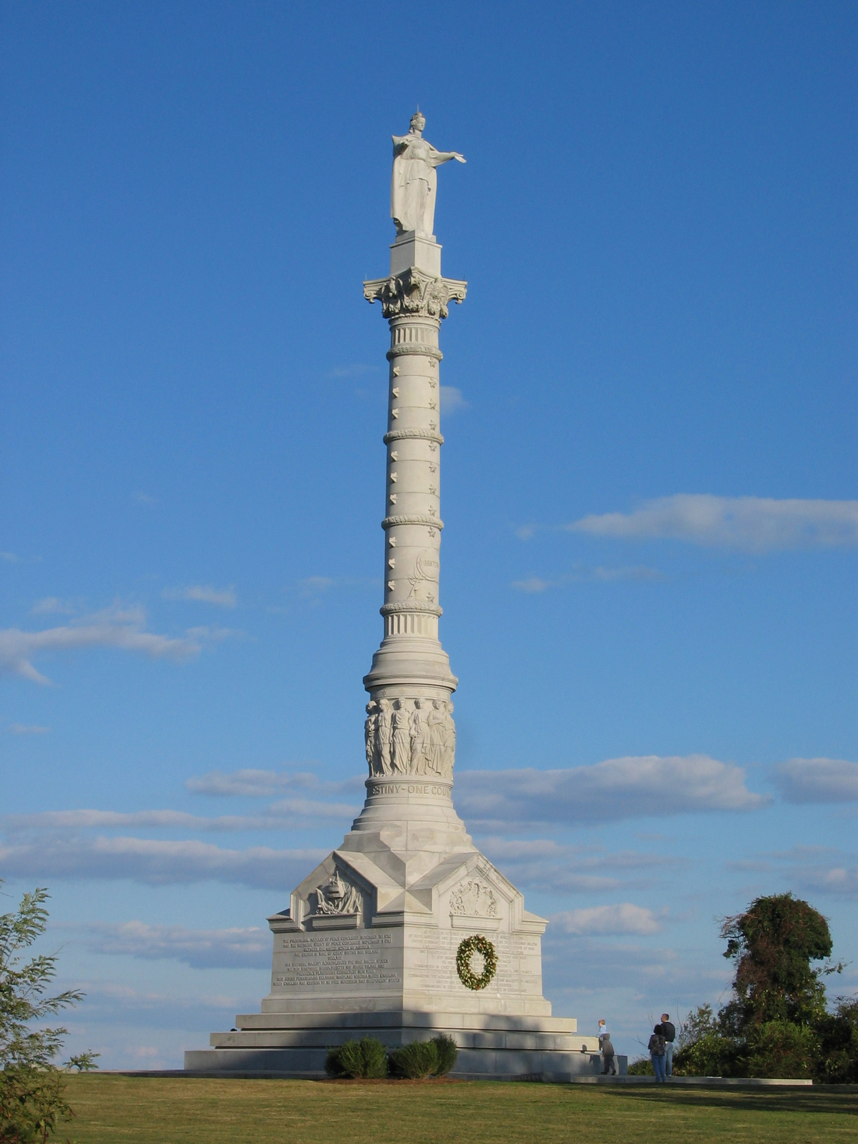
Yorktown is a census-designated place (CDP) in York County, Virginia. It is the county seat of York County, one of the eight original shires formed in colonial Virginia in 1682. Yorktown's population was 195 as of the 2010 census, while York County's population was 66,134 in the 2011 census estimate. The town is most famous as the site of the siege and subsequent surrender of General Charles Cornwallis to General George Washington and the French Fleet during the American Revolutionary War on October 19, 1781. Although the war would last for another year, this British defeat at Yorktown effectively ended the war in North America. Yorktown also figured prominently in the American Civil War (1861–1865), serving as a major port to supply both northern and southern towns, depending upon who held Yorktown at the time. Yorktown is one of three sites of the Historic Triangle, which also includes Jamestown and Williamsburg as important colonial-era settlements. It is the eastern te ... [...More Info...] [...Related Items...] OR: [Wikipedia] [Google] [Baidu] |
Newport, Rhode Island
Newport is an American seaside city on Aquidneck Island in Newport County, Rhode Island. It is located in Narragansett Bay, approximately southeast of Providence, Rhode Island, Providence, south of Fall River, Massachusetts, south of Boston, and northeast of New York City. It is known as a New England summer resort and is famous for its historic Newport Mansions, mansions and its rich sailing history. It was the location of the first U.S. Open tournaments in both US Open (tennis), tennis and US Open (golf), golf, as well as every challenge to the America's Cup between 1930 and 1983. It is also the home of Salve Regina University and Naval Station Newport, which houses the United States Naval War College, the Naval Undersea Warfare Center, and an important Navy training center. It was a major 18th-century port city and boasts many buildings from the Colonial history of the United States, Colonial era. The city is the county seat of Newport County, Rhode Island, Newport County ... [...More Info...] [...Related Items...] OR: [Wikipedia] [Google] [Baidu] |
Washington–Rochambeau Revolutionary Route
The Washington–Rochambeau Revolutionary Route is a series of roads used in 1781 by the Continental Army under the command of George Washington and the Expédition Particulière under the command of Jean-Baptiste de Rochambeau during their 14-week march from Newport, Rhode Island, to Yorktown, Virginia. 4,000 French and 3,000 American soldiers began the march. French forces left Rhode Island in June 1781 and joined Washington's force on the Hudson River the following month. In August, the combined American and French armies headed south, marching through New Jersey, Pennsylvania, Delaware, and Maryland, a route that allowed them to evade British troops. They reached Williamsburg, Virginia, in late September 1781, several weeks after the French royal fleet had won the Battle of the Chesapeake, preventing the British from reinforcing or evacuating General Cornwallis's army. On September 22, they combined with troops commanded by the Gilbert du Motier, marquis de La Fayette, Marqu ... [...More Info...] [...Related Items...] OR: [Wikipedia] [Google] [Baidu] |
Christiana, Delaware
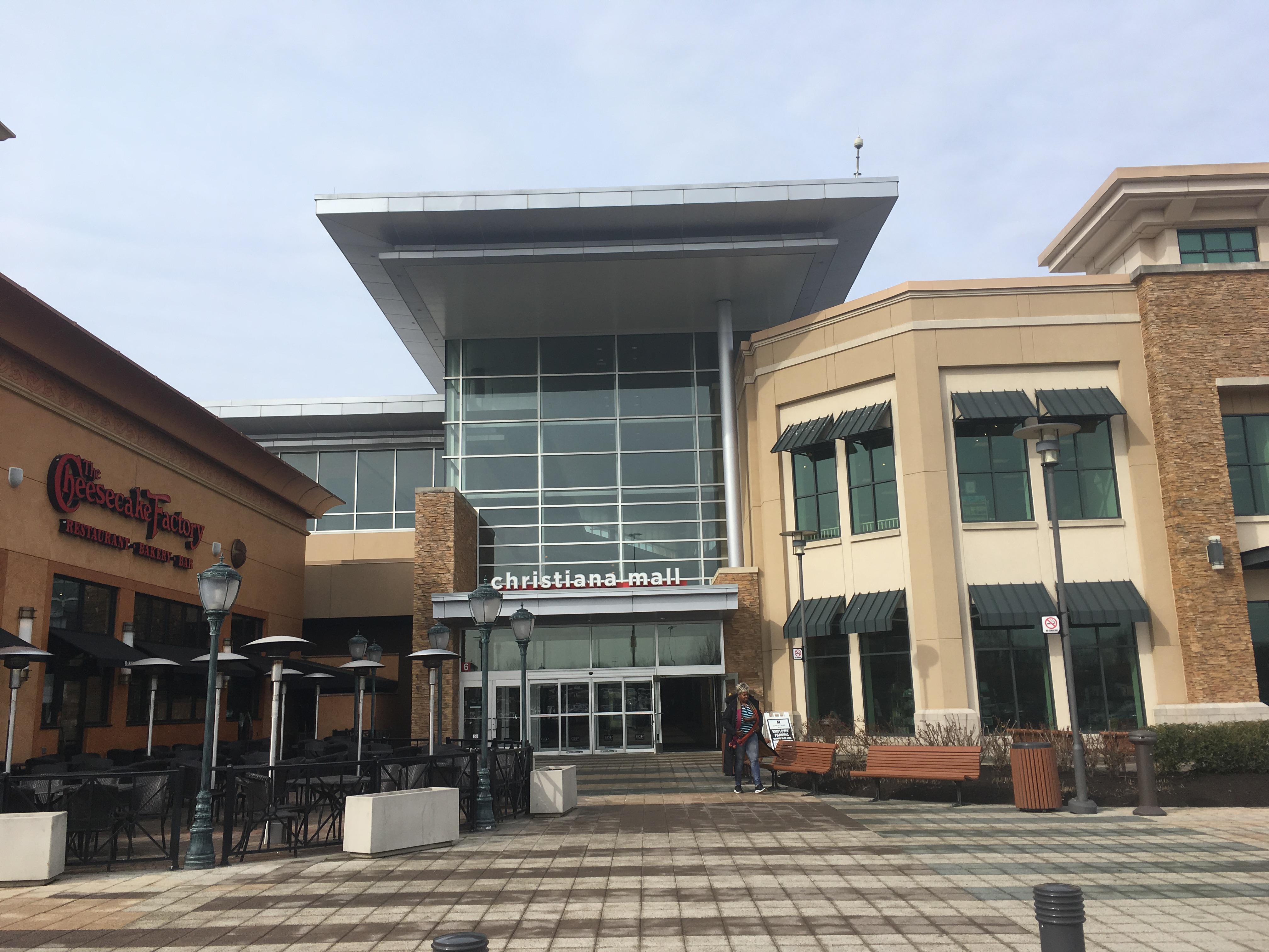
Christiana is an unincorporated community in New Castle County, Delaware, United States, located on the Christina River, 12 miles southwest of Wilmington. It is home to the Christiana Hospital and the Christiana Mall and is the location of the northern terminus of Delaware Route 1 at an interchange with Interstate 95. Despite sharing a name with Christiana Hundred, the community of Christiana is located in White Clay Creek Hundred. History It is named after the Christina River, which is in turn named after Christina, Queen of Sweden who oversaw the founding of New Sweden in 1638. The Christiana Historic District, Charles Allen House, John Lewden House, Old Fort Church, Public School No. 111-C, and James Stewart Jr. House and George Hillis Sr. House are listed on the National Register of Historic Places. Christiana's population was 400 in 1890, 381 in 1900, 411 in 1925, and 500 in 1960. Notable people * Rebecca Lee (Davis) Crumpler (1831-1895), first African-American ... [...More Info...] [...Related Items...] OR: [Wikipedia] [Google] [Baidu] |
Maryland Route 781
Maryland Route 781 (MD 781) is a state highway in the U.S. state of Maryland. Known as Delancy Road, the state highway runs from U.S. Route 40 (US 40) north to MD 281 in Elkton close to the Delaware state line. Delancy Road was brought into the state highway system as MD 781 in 1984. Route description MD 781 begins at an intersection with US 40 (Pulaski Highway) in the town of Elkton west of the U.S. Highway's crossing of the Delaware state line. The highway heads north as a two-lane undivided road to the west of the state line and to the east of Grays Hill. MD 781 leaves the town of Elkton about halfway through its course, but the route follows a finger of unincorporated area between sections of the town to its northern terminus. That terminus is at MD 281 (Red Hill Road) west of that highway's crossing of the state line. History Delancy Road long predates being a part of the state highway system, the road having existed since at least 1898. The highway was designated MD ... [...More Info...] [...Related Items...] OR: [Wikipedia] [Google] [Baidu] |
Elk River (Maryland)
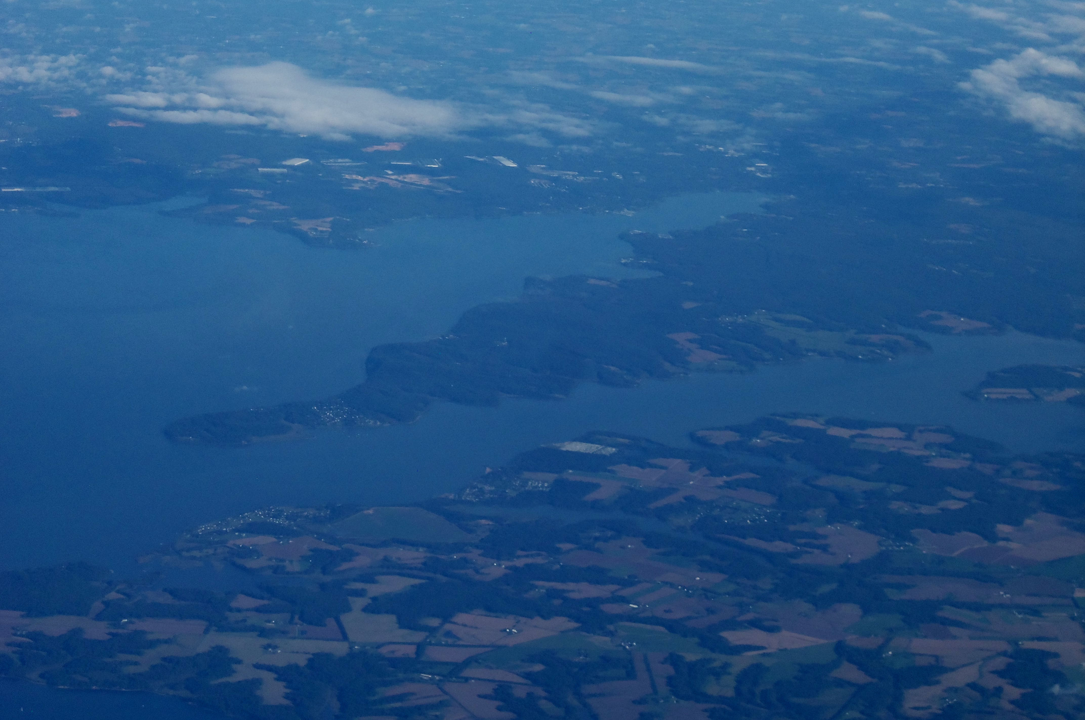
The Elk River is a tidal tributary of the Chesapeake Bay on the Eastern Shore of Maryland and on the northern edge of the Delmarva Peninsula. It is about long.U.S. Geological Survey. National Hydrography Dataset high-resolution flowline dataThe National Map , accessed April 1, 2011 As the most northeastern extension of the Chesapeake Bay estuary, it has served as one entrance to the Chesapeake & Delaware Canal since the 19th century. The canal and river now serve as one boundary of the Elk Neck Peninsula. The river flows through Cecil County, Maryland, with its watershed extending into New Castle County, Delaware and Chester County, Pennsylvania. Elkton, the county seat of Cecil County, is located at its head. Its total watershed area is (including the Bohemia River), with of open water, so its watershed is 15% open water. It is south and east of the North East River, and north of the Sassafras River. Course The Elk River begins at the confluence of Big Elk Creek and Littl ... [...More Info...] [...Related Items...] OR: [Wikipedia] [Google] [Baidu] |


