|
Maryland Route 244
Maryland Route 244 (MD 244) is a state highway in the U.S. state of Maryland. Known for most of its length as Medleys Neck Road, the state highway runs from MD 5 near Leonardtown south to MD 249 in Valley Lee. MD 244 parallels MD 5 in central St. Mary's County, serving several communities on Medleys Neck between Breton Bay and the St. Mary's River, including Beauvue. The state highway was constructed as part of three different state highways—MD 244 from Leonardtown, MD 250 from Valley Lee, and MD 251 through Drayden—between the late 1920s and late 1930s. MD 244 assumed the courses of MD 250 and MD 251 in the mid-1940s. The portion of MD 244 east of MD 249 was removed from the state highway system in the mid-1980s. Route description MD 244 begins at an intersection with MD 5 north of Leonardtown High School and Leonardtown Middle School and west of the St. Mary's County Fairgrounds. The state highway heads south from the Leonardtown area as two-lane undiv ... [...More Info...] [...Related Items...] OR: [Wikipedia] [Google] [Baidu] |
Leonardtown, Maryland
Leonardtown is a town in and the county seat of St. Mary's County, Maryland, United States. The population was 4,563 at the 2020 census. Leonardtown is perhaps most famous for the national oyster-shucking championship that is held annually at the St. Mary's County fairgrounds. Historic Leonardtown includes both a large public high school and a public middle school Leonardtown Middle School as well as a Catholic high school and an elementary school Leonardtown Elementary School, offices of the county government, and St. Mary's Hospital which serves the healthcare needs of the county. The College of Southern Maryland maintains a growing satellite campus within city limits, including an aquatic center. An upscale home development located in the Breton Bay area is just outside town, notable for both its country club golf course and swimming pool. Leonardtown's population has grown significantly since 1990 as a result of the town's proximity to Patuxent River Naval Air Station and th ... [...More Info...] [...Related Items...] OR: [Wikipedia] [Google] [Baidu] |
Valley Lee, Maryland
Valley Lee is an unincorporated community in St. Mary's County, Maryland, United States. The St. George's Episcopal Church was listed on the National Register of Historic Places The National Register of Historic Places (NRHP) is the United States federal government's official list of districts, sites, buildings, structures and objects deemed worthy of preservation for their historical significance or "great artistic v ... in 1973. Another landmark of Valley Lee is the 100-year-old Russells Store, a country store, barber/beautyshop, and local tavern. The ZIP Code for Valley Lee is 20692. References Unincorporated communities in St. Mary's County, Maryland Unincorporated communities in Maryland {{StMarysCountyMD-geo-stub ... [...More Info...] [...Related Items...] OR: [Wikipedia] [Google] [Baidu] |
State Highway
A state highway, state road, or state route (and the equivalent provincial highway, provincial road, or provincial route) is usually a road that is either ''numbered'' or ''maintained'' by a sub-national state or province. A road numbered by a state or province falls below numbered national highways (Canada being a notable exception to this rule) in the hierarchy (route numbers are used to aid navigation, and may or may not indicate ownership or maintenance). Roads maintained by a state or province include both nationally numbered highways and un-numbered state highways. Depending on the state, "state highway" may be used for one meaning and "state road" or "state route" for the other. In some countries such as New Zealand, the word "state" is used in its sense of a sovereign state or country. By this meaning a state highway is a road maintained and numbered by the national government rather than local authorities. Countries Australia Australia's State Route system covers u ... [...More Info...] [...Related Items...] OR: [Wikipedia] [Google] [Baidu] |
Maryland
Maryland ( ) is a state in the Mid-Atlantic region of the United States. It shares borders with Virginia, West Virginia, and the District of Columbia to its south and west; Pennsylvania to its north; and Delaware and the Atlantic Ocean to its east. Baltimore is the largest city in the state, and the capital is Annapolis. Among its occasional nicknames are '' Old Line State'', the ''Free State'', and the '' Chesapeake Bay State''. It is named after Henrietta Maria, the French-born queen of England, Scotland, and Ireland, who was known then in England as Mary. Before its coastline was explored by Europeans in the 16th century, Maryland was inhabited by several groups of Native Americans – mostly by Algonquian peoples and, to a lesser degree, Iroquoian and Siouan. As one of the original Thirteen Colonies of England, Maryland was founded by George Calvert, 1st Baron Baltimore, a Catholic convert"George Calvert and Cecilius Calvert, Barons Baltimore" William Hand Browne, ... [...More Info...] [...Related Items...] OR: [Wikipedia] [Google] [Baidu] |
Maryland Route 5
Maryland Route 5 (MD 5) is a long state highway that runs north–south in the U.S. state of Maryland. The highway runs from Point Lookout in St. Mary's County north to the Washington, D.C. border in Suitland, Prince George's County. MD 5 begins as two-lane undivided Point Lookout Road which runs from Point Lookout to an intersection with MD 235 in the northern part of St. Mary's County. Point Lookout Road passes through rural areas as well as the county seat of Leonardtown. After the MD 235 intersection, the route becomes four-lane divided Three Notch Road and continues into Charles County, where it becomes Leonardtown Road. Here, the route bypasses Hughesville and continues north toward the Waldorf area, which it bypasses to the east on Mattawoman Beantown Road. The route merges onto U.S. Route 301 (US 301, Crain Highway) and enters Prince George's County, splitting from US 301 at an interchange in Brandywine. From here, MD 5 continues north on Branch Avenue, runni ... [...More Info...] [...Related Items...] OR: [Wikipedia] [Google] [Baidu] |
Maryland Route 249
Maryland Route 249 (MD 249) is a state highway in the U.S. state of Maryland. Known as Piney Point Road, the state highway runs from St. George Island north to MD 5 in Callaway. MD 249 is the primary access to St. George Island and the communities of Piney Point, Tall Timbers, and Valley Lee on the Piney Point peninsula between the Potomac River and St. George's Creek in southern St. Mary's County. The state highway was constructed on the mainland in the early 1920s; the portion of the highway on St. George Island was completed in the early 1930s. MD 249 was reconstructed in the 1950s, including a new St. George Island Bridge. Route description MD 249 begins south of the state highway's intersection with Sheaffer Road on St. George Island. Piney Point Road continues as a county highway toward the southern end of the island. Just north of its terminus, MD 249 is a two-lane undivided road and begins to closely parallel a riprap along the Potomac River side of the isla ... [...More Info...] [...Related Items...] OR: [Wikipedia] [Google] [Baidu] |
Beauvue, Maryland
Beauvue is an unincorporated community in St. Mary's County, Maryland, United States. Mulberry Fields was listed on the National Register of Historic Places The National Register of Historic Places (NRHP) is the United States federal government's official list of districts, sites, buildings, structures and objects deemed worthy of preservation for their historical significance or "great artistic ... in 1973. References Unincorporated communities in St. Mary's County, Maryland Unincorporated communities in Maryland {{StMarysCountyMD-geo-stub ... [...More Info...] [...Related Items...] OR: [Wikipedia] [Google] [Baidu] |
Drayden, Maryland
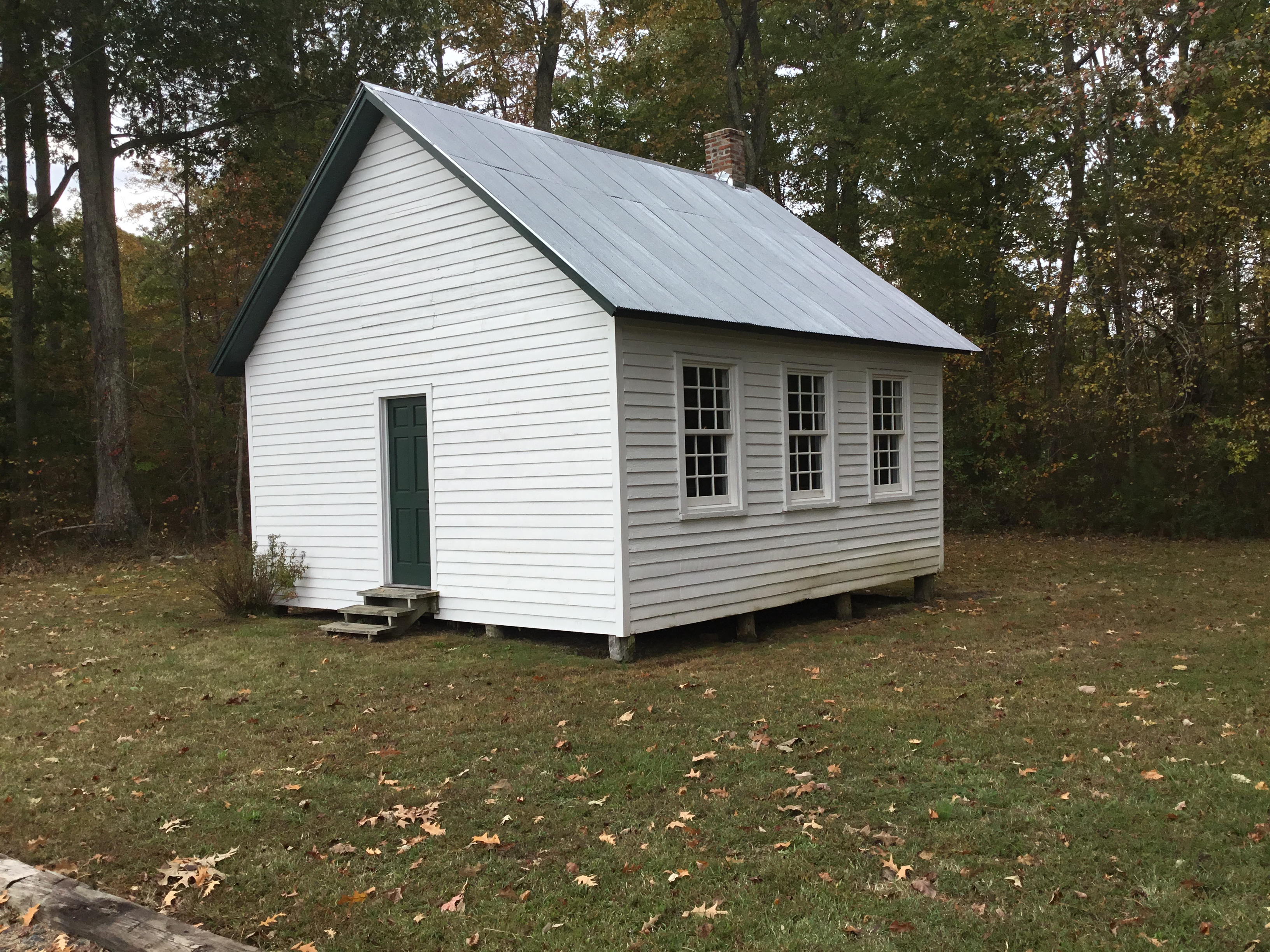
Drayden is an unincorporated community in St. Mary's County, Maryland, United States. West St. Mary's Manor was listed on the National Register of Historic Places The National Register of Historic Places (NRHP) is the United States federal government's official list of districts, sites, buildings, structures and objects deemed worthy of preservation for their historical significance or "great artistic ... in 1970. Porto Bello was listed in 1972. The Drayden Schoolhouse was a small, one-room African American children's school featuring grades 1–7. It was open and operational from 1890 to 1944. The land was donated by Mary Ellen and Daniel A. Gross in 1889. The schoolhouse was a one-room design based on a Victorian design like other one-room schools already operational in St. Mary's County. The original green paint is still inside the structure. Exterior paint was added in 2000 to preserve the original sliding planks. The Drayden schoolhouse was one of three for African ... [...More Info...] [...Related Items...] OR: [Wikipedia] [Google] [Baidu] |
Leonardtown High School
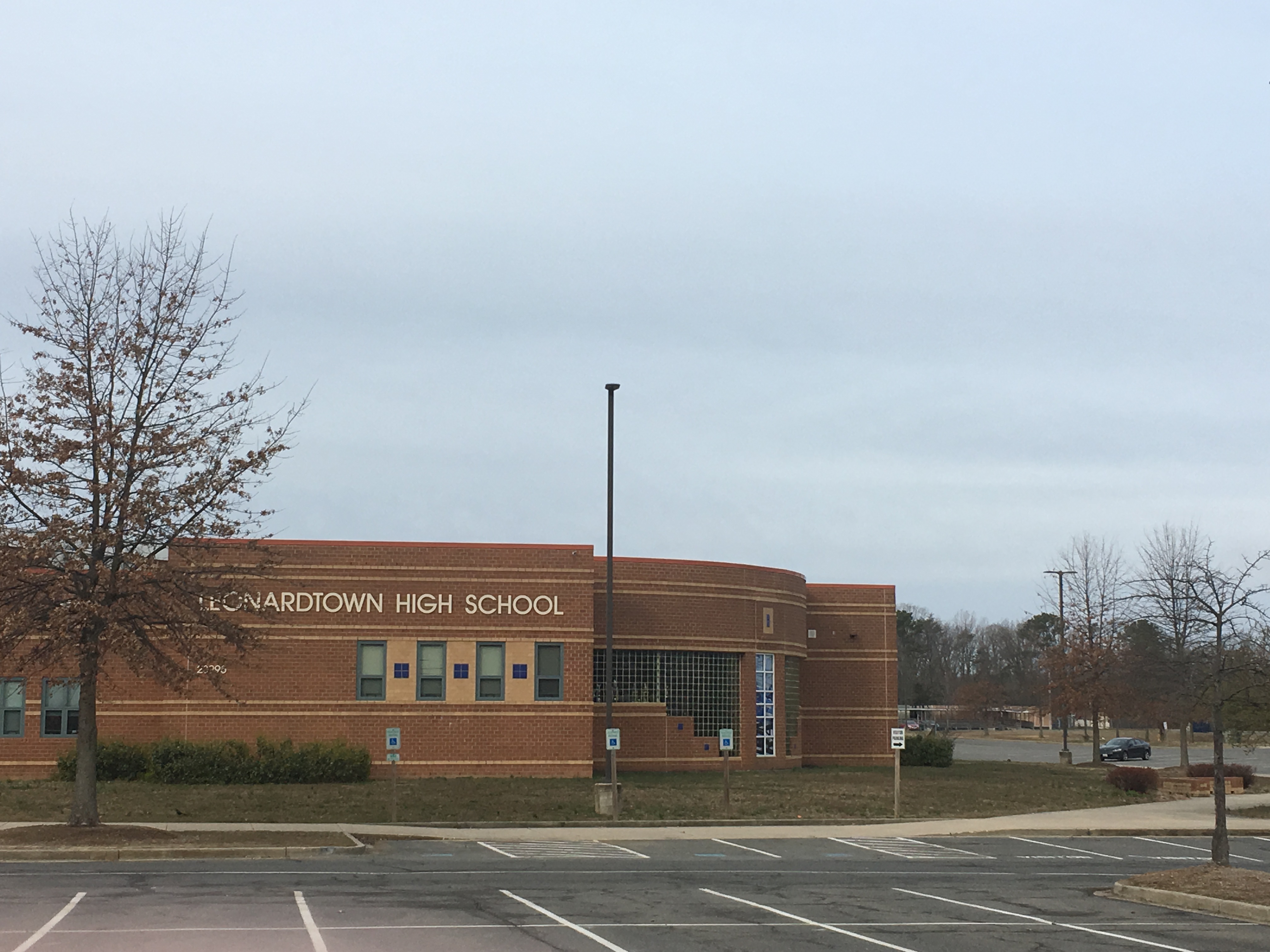
Leonardtown High School is a comprehensive public high school in Leonardtown, Maryland, United States, for students in grades 9–12. It offers college preparatory programs and programs that prepare students for business and technical occupations. It serves the community in the central portion of St. Mary's County, Maryland, between the Potomac River and Patuxent River. The area is a mixture of rural and suburban communities. Many of the families are employed by NAS Patuxent River, government contractors, St. Mary's College of Maryland, St Mary's County government and others involved in the traditional agriculture and water related businesses. Leonardtown High School is accredited by the Middle States Association of Colleges and Secondary Schools and the Maryland State Department of Education. Leonardtown High School belongs to the St. Mary's County Public Schools system, and is associated with two other county high school rivals, Great Mills High School and Chopticon High Scho ... [...More Info...] [...Related Items...] OR: [Wikipedia] [Google] [Baidu] |
Potomac River
The Potomac River () drains the Mid-Atlantic United States, flowing from the Potomac Highlands into Chesapeake Bay. It is long,U.S. Geological Survey. National Hydrography Dataset high-resolution flowline dataThe National Map. Retrieved August 15, 2011 with a drainage area of 14,700 square miles (38,000 km2), and is the fourth-largest river along the East Coast of the United States and the 21st-largest in the United States. Over 5 million people live within its watershed. The river forms part of the borders between Maryland and Washington, D.C. on the left descending bank and between West Virginia and Virginia on the right descending bank. Except for a small portion of its headwaters in West Virginia, the North Branch Potomac River is considered part of Maryland to the low-water mark on the opposite bank. The South Branch Potomac River lies completely within the state of West Virginia except for its headwaters, which lie in Virginia. Course The Potomac River runs ... [...More Info...] [...Related Items...] OR: [Wikipedia] [Google] [Baidu] |
Mulberry Fields
Mulberry Fields is a historic home located at Beauvue, St. Mary's County, Maryland, United States. It was built about 1763, and is a large -story, 5-bay by 2-bay, hip-roofed brick house. On the front is a two-story Doric portico, built about 1820. The house is the only remaining Georgian "mansion-type" home in an area and has a panoramic view of the Potomac River, with a mile-long allee stretching downhill to the riverbank. Mulberry Fields was listed on the National Register of Historic Places The National Register of Historic Places (NRHP) is the United States federal government's official list of districts, sites, buildings, structures and objects deemed worthy of preservation for their historical significance or "great artistic v ... in 1973. References External links *, including undated photo, at Maryland Historical Trust * Houses on the National Register of Historic Places in Maryland Houses in St. Mary's County, Maryland Houses completed in 1763 Georgia ... [...More Info...] [...Related Items...] OR: [Wikipedia] [Google] [Baidu] |


