|
Mars Ocean Hypothesis
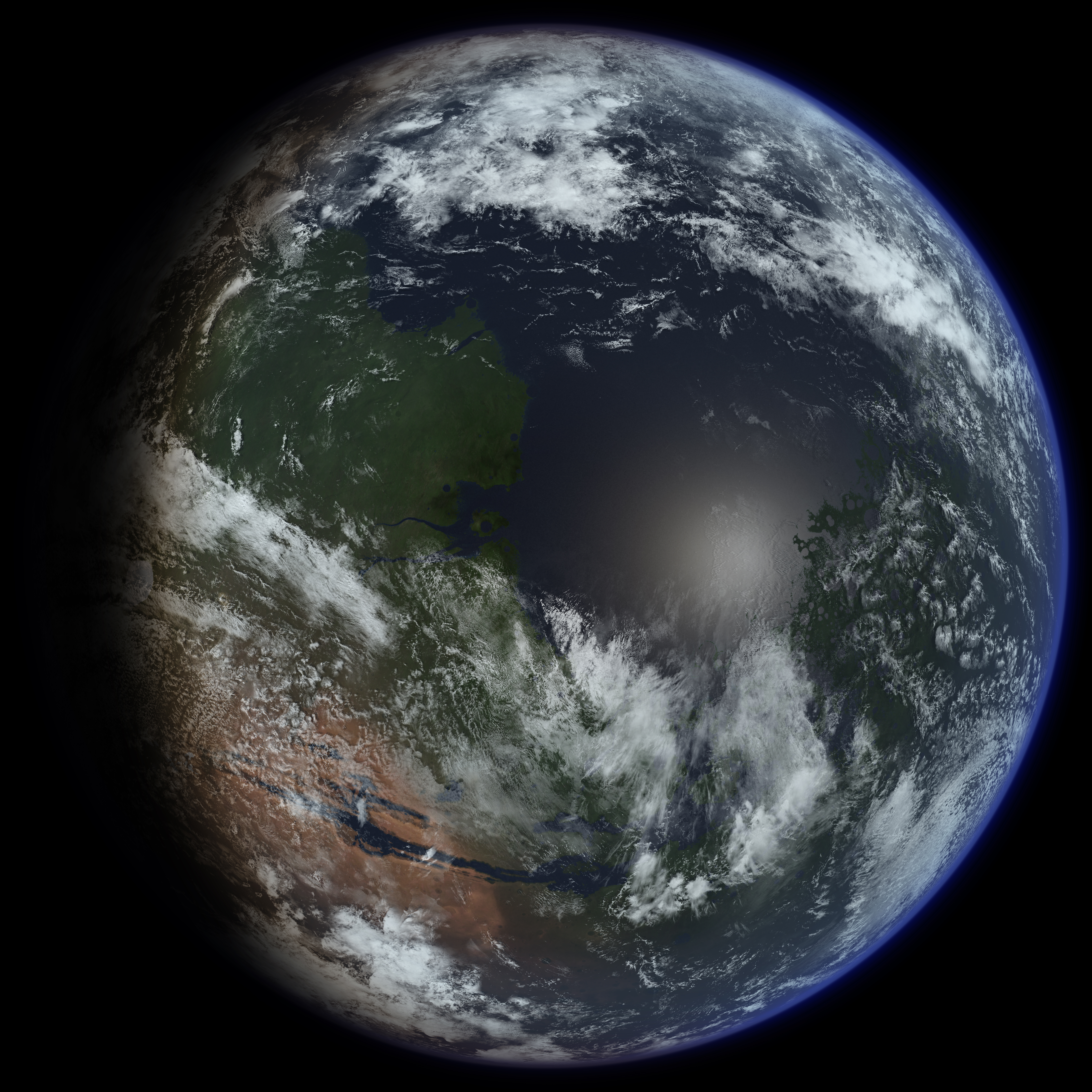
The Mars ocean hypothesis states that nearly a third of the surface of Mars was covered by an ocean of liquid water early in the planet's geologic history. This primordial ocean, dubbed Paleo-Ocean and Oceanus Borealis , would have filled the basin Vastitas Borealis in the northern hemisphere, a region which lies 4–5 km (2.5–3 miles) below the mean planetary elevation, at a time period of approximately 4.1–3.8 billion years ago. Evidence for this ocean includes geographic features resembling ancient shorelines, and the chemical properties of the Martian soil and atmosphere. Early Mars would have required a denser atmosphere and warmer climate to allow liquid water to remain at the surface.Read, Peter L. and S. R. Lewis, "The Martian Climate Revisited: Atmosphere and Environment of a Desert Planet", Praxis, Chichester, UK, 2004. History of observational evidence Features shown by the Viking orbiters in 1976, revealed two possible ancient shorelines near the pole, Arab ... [...More Info...] [...Related Items...] OR: [Wikipedia] [Google] [Baidu] |
Life On Mars
The possibility of life on Mars is a subject of interest in astrobiology due to the planet's proximity and similarities to Earth. To date, no proof of past or present life has been found on Mars. Cumulative evidence suggests that during the ancient Noachian time period, the surface environment of Mars had liquid water and may have been habitable for microorganisms, but habitable conditions do not necessarily indicate life. Scientific searches for evidence of life began in the 19th century and continue today via telescopic investigations and deployed probes. While early work focused on phenomenology and bordered on fantasy, the modern scientific inquiry has emphasized the search for water, chemical biosignatures in the soil and rocks at the planet's surface, and biomarker gases in the atmosphere. Mars is of particular interest for the study of the origins of life because of its similarity to the early Earth. This is especially true since Mars has a cold climate and lacks pl ... [...More Info...] [...Related Items...] OR: [Wikipedia] [Google] [Baidu] |
River Delta
A river delta is a landform shaped like a triangle, created by deposition (geology), deposition of sediment that is carried by a river and enters slower-moving or stagnant water. This occurs where a river enters an ocean, sea, estuary, lake, reservoir, or (more rarely) another river that cannot carry away the supplied sediment. It is so named because its triangle shape resembles the Greek letter Delta. The size and shape of a delta is controlled by the balance between watershed processes that supply sediment, and receiving basin processes that redistribute, sequester, and export that sediment. The size, geometry, and location of the receiving basin also plays an important role in delta evolution. River deltas are important in human civilization, as they are major agricultural production centers and population centers. They can provide Coast, coastline defense and can impact drinking water supply. They are also Ecology, ecologically important, with different species' assemblages ... [...More Info...] [...Related Items...] OR: [Wikipedia] [Google] [Baidu] |
Reuters
Reuters ( ) is a news agency owned by Thomson Reuters Corporation. It employs around 2,500 journalists and 600 photojournalists in about 200 locations worldwide. Reuters is one of the largest news agencies in the world. The agency was established in London in 1851 by the German-born Paul Reuter. It was acquired by the Thomson Corporation of Canada in 2008 and now makes up the media division of Thomson Reuters. History 19th century Paul Reuter worked at a book-publishing firm in Berlin and was involved in distributing radical pamphlets at the beginning of the Revolutions in 1848. These publications brought much attention to Reuter, who in 1850 developed a prototype news service in Aachen using homing pigeons and electric telegraphy from 1851 on, in order to transmit messages between Brussels and Aachen, in what today is Aachen's Reuters House. Reuter moved to London in 1851 and established a news wire agency at the London Royal Exchange. Headquartered in London, Reuter' ... [...More Info...] [...Related Items...] OR: [Wikipedia] [Google] [Baidu] |
Equatorial Bulge
An equatorial bulge is a difference between the equatorial and polar diameters of a planet, due to the centrifugal force exerted by the rotation about the body's axis. A rotating body tends to form an oblate spheroid rather than a sphere. On Earth The Earth has a rather slight equatorial bulge: it is about wider at the equator than pole-to-pole, a difference which is about 1/298 of the equatorial diameter. If the Earth were scaled down to a globe with diameter of 1 meter at the equator, that difference would be only 3 millimeters. While too small to notice visually, that difference is still more than twice the largest deviations of the actual surface from the ellipsoid, including the tallest mountains and deepest oceanic trenches. The rotation of the earth also affects the sea level, the imaginary surface that is used to measure altitudes from. This surface coincides with the mean water surface level in oceans, and is extrapolated over land by taking into account the local g ... [...More Info...] [...Related Items...] OR: [Wikipedia] [Google] [Baidu] |
Centrifugal Force
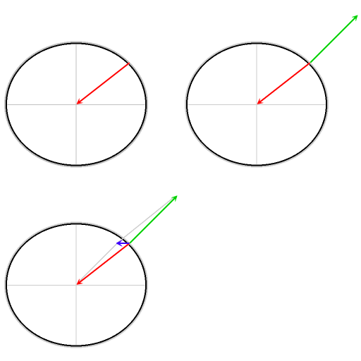
In Newtonian mechanics, the centrifugal force is an inertial force (also called a "fictitious" or "pseudo" force) that appears to act on all objects when viewed in a rotating frame of reference. It is directed away from an axis which is parallel to the axis of rotation and passing through the coordinate system's origin. If the axis of rotation passes through the coordinate system's origin, the centrifugal force is directed radially outwards from that axis. The magnitude of centrifugal force ''F'' on an object of mass ''m'' at the distance ''r'' from the origin of a frame of reference rotating with angular velocity is: F = m\omega^2 r The concept of centrifugal force can be applied in rotating devices, such as centrifuges, centrifugal pumps, centrifugal governors, and centrifugal clutches, and in centrifugal railways, planetary orbits and banked curves, when they are analyzed in a rotating coordinate system. Confusingly, the term has sometimes also been used for the reactiv ... [...More Info...] [...Related Items...] OR: [Wikipedia] [Google] [Baidu] |
Mars's Rotation Axis
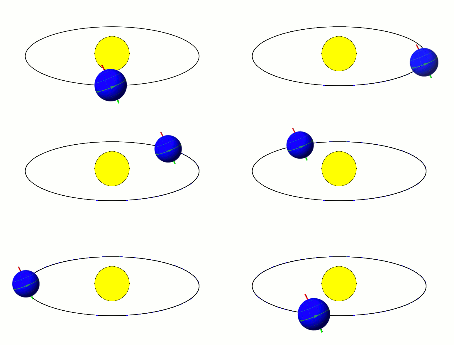
In astronomy, axial tilt, also known as obliquity, is the angle between an object's rotational axis and its orbital axis, which is the line perpendicular to its orbital plane; equivalently, it is the angle between its equatorial plane and orbital plane. It differs from orbital inclination. At an obliquity of 0 degrees, the two axes point in the same direction; that is, the rotational axis is perpendicular to the orbital plane. The rotational axis of Earth, for example, is the imaginary line that passes through both the North Pole and South Pole, whereas the Earth's orbital axis is the line perpendicular to the imaginary plane through which the Earth moves as it revolves around the Sun; the Earth's obliquity or axial tilt is the angle between these two lines. Earth's obliquity oscillates between 22.1 and 24.5 degrees on a 41,000-year cycle. Based on a continuously updated formula (here Laskar, 1986, though since 2006 the IMCCE and the IAU recommend the P03 model), Earth's mean ... [...More Info...] [...Related Items...] OR: [Wikipedia] [Google] [Baidu] |
True Polar Wander
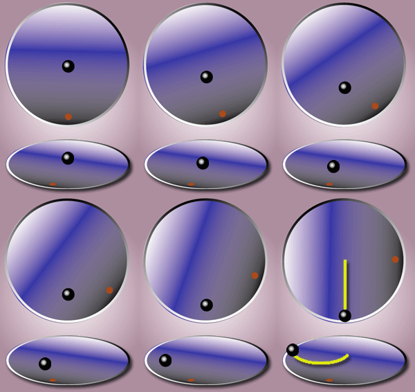
True polar wander is a solid-body rotation of a planet or moon with respect to its spin axis, causing the geographic locations of the north and south poles to change, or "wander". Unless the body is totally rigid (which the Earth is not) its stable state rotation has the largest moment of inertia axis aligned with the spin axis, with the smaller two moments of inertia axes lying in the plane of the equator. If the body is not in this steady state, true polar wander will occur: the planet or moon will rotate as a rigid body to realign the largest moment of inertia axis with the spin axis. (See .) If the body is near the steady state but with the angular momentum not exactly lined up with the largest moment of inertia axis, the pole position will oscillate. Weather and water movements can also induce small changes. These subjects are covered in the article ''Polar motion''. Description in the context of Earth The mass distribution of the Earth is not spherically symmetric, and ... [...More Info...] [...Related Items...] OR: [Wikipedia] [Google] [Baidu] |
Michael Manga
Michael Manga (born July 22, 1968) is a Canadian-American geoscientist who is currently a professor at the University of California, Berkeley. Born in Hamilton, Ontario, Manga grew up in Ottawa. His father is a South African immigrant of Indian descent, and his mother is of German and Polish descent. He has a B.S. in geophysics from McGill University (1990), S.M. in engineering sciences from Harvard University (1992), and Ph.D. in Earth and planetary sciences (1994) from Harvard. In 1994 he was selected as a Miller Fellow at the University of California Berkeley for a two-year term. Following his move to the University of Oregon he returned to Berkeley. In 2008-2009 he was named a Miller Research Professor. He served on the executive committee of the Miller Institute between 2009 and 2016. In 2003, he made Popular Science magazines second annual PopSci Brilliant 10 list and won the Geological Society of America's Young Scientist Award (Donath Medal). A 2005 MacArthur Fellow, he ... [...More Info...] [...Related Items...] OR: [Wikipedia] [Google] [Baidu] |
Journal Of Geophysical Research
The ''Journal of Geophysical Research'' is a peer-reviewed scientific journal. It is the flagship journal of the American Geophysical Union. It contains original research on the physical, chemical, and biological processes that contribute to the understanding of the Earth, Sun, and Solar System. It has seven sections: A (Space Physics), B (Solid Earth), C (Oceans), D (Atmospheres), E (Planets), F (Earth Surface), and G (Biogeosciences). All current and back issues are available online for subscribers. History The journal was originally founded under the name ''Terrestrial Magnetism'' by the American Geophysical Union's president Louis Agricola Bauer in 1896. It was renamed to ''Terrestrial Magnetism and Atmospheric Electricity'' in 1899 and in 1948 it acquired its current name. In 1980, three specialized sections were established: ''A: Space Physics'', ''B: Solid Earth'', and ''C: Oceans''. Subsequently, further sections have been added: ''D: Atmospheres'' in 1984, ''E: Planets'' ... [...More Info...] [...Related Items...] OR: [Wikipedia] [Google] [Baidu] |
Sublimation (chemistry)
Sublimation is the transition of a substance directly from the solid to the gas state, without passing through the liquid state. Sublimation is an endothermic process that occurs at temperatures and pressures below a substance's triple point in its phase diagram, which corresponds to the lowest pressure at which the substance can exist as a liquid. The reverse process of sublimation is deposition or desublimation, in which a substance passes directly from a gas to a solid phase. Sublimation has also been used as a generic term to describe a solid-to-gas transition (sublimation) followed by a gas-to-solid transition ( deposition). While vaporization from liquid to gas occurs as evaporation from the surface if it occurs below the boiling point of the liquid, and as boiling with formation of bubbles in the interior of the liquid if it occurs at the boiling point, there is no such distinction for the solid-to-gas transition which always occurs as sublimation from the surface. At ... [...More Info...] [...Related Items...] OR: [Wikipedia] [Google] [Baidu] |
Mars Orbiter Laser Altimeter
260px, MOLA topographic images of the two hemispheres of Mars. This image appeared on the cover of ''Science'' magazine in May 1999. The Mars Orbiter Laser Altimeter (MOLA) was one of five instruments on the ''Mars Global Surveyor'' (MGS) spacecraft, which operated in Mars orbit from September 1997 to November 2006. However, the MOLA instrument transmitted altimetry data only until June 2001. The MOLA instrument transmitted infrared laser pulses towards Mars at a rate of 10 times per second, and measured the time of flight to determine the range (distance) of the MGS spacecraft to the Martian surface. The range measurements resulted in precise topographic maps of Mars. The precision maps are applicable to studies in geophysics, geology and atmospheric circulation. MOLA also functioned as a passive radiometer, and measured the radiance of the surface of Mars at 1064 nanometers. Planetary laser altimetry A laser altimeter is an instrument that measures the distance from an orbiti ... [...More Info...] [...Related Items...] OR: [Wikipedia] [Google] [Baidu] |


