|
Marmaduke Nixon
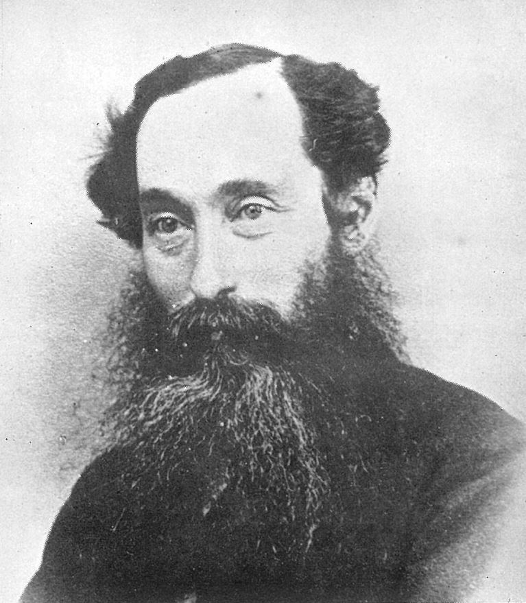
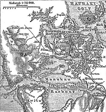
Marmaduke George Nixon (1813 or 1814 – 27 May 1864) was a notable soldier in the New Zealand Wars. Born at Malta, he joined the British Army in 1831, spending most of his career as an officer in British India with the 39th Regiment of Foot. He left the British Army in 1851 and shortly afterwards emigrated to New Zealand to take up farming in South Auckland. In 1860, during one of the main phases of the New Zealand Wars, he formed and led a cavalry unit in defence of South Auckland. He later participated in the Invasion of the Waikato as commander of Nixon's Horse, another cavalry unit. He was one of the highest ranking casualties of the New Zealand Wars when he died on 27 May 1864 from wounds received in an attack earlier in the year on a village at Rangiaowhia. He was also a Member of Parliament, representing the largely rural electorate of Franklin from 1861 up until his death. Early life Marmaduke George Nixon was born in Valletta on the island of Malta in either 1813 or 18 ... [...More Info...] [...Related Items...] OR: [Wikipedia] [Google] [Baidu] |
Valletta
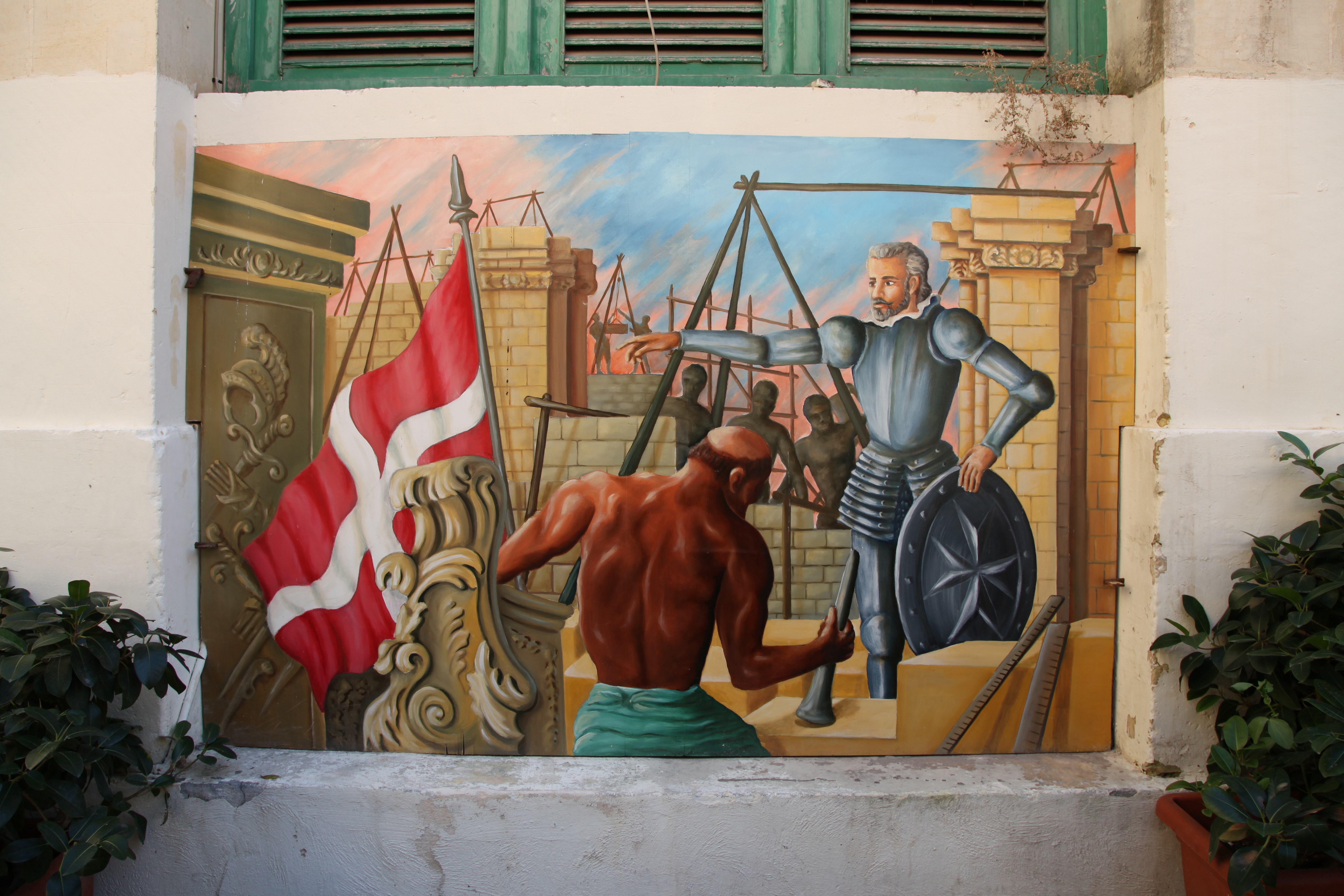
Valletta (, mt, il-Belt Valletta, ) is an Local councils of Malta, administrative unit and capital city, capital of Malta. Located on the Malta (island), main island, between Marsamxett Harbour to the west and the Grand Harbour to the east, its population within administrative limits in 2014 was 6,444. According to the data from 2020 by Eurostat, the Functional Urban Area and metropolitan region covered the whole island and has a population of 480,134. Valletta is the southernmost capital of Europe, and at just , it is the European Union's smallest capital city. Valletta's 16th-century buildings were constructed by the Hospitaller Malta, Knights Hospitaller. The city was named after Jean Parisot de Valette, who succeeded in defending the island from an Ottoman invasion during the Great Siege of Malta. The city is Baroque architecture, Baroque in character, with elements of Mannerist architecture#Mannerist architecture, Mannerist, Neoclassical architecture, Neo-Classical and Mo ... [...More Info...] [...Related Items...] OR: [Wikipedia] [Google] [Baidu] |
39th (Dorsetshire) Regiment Of Foot
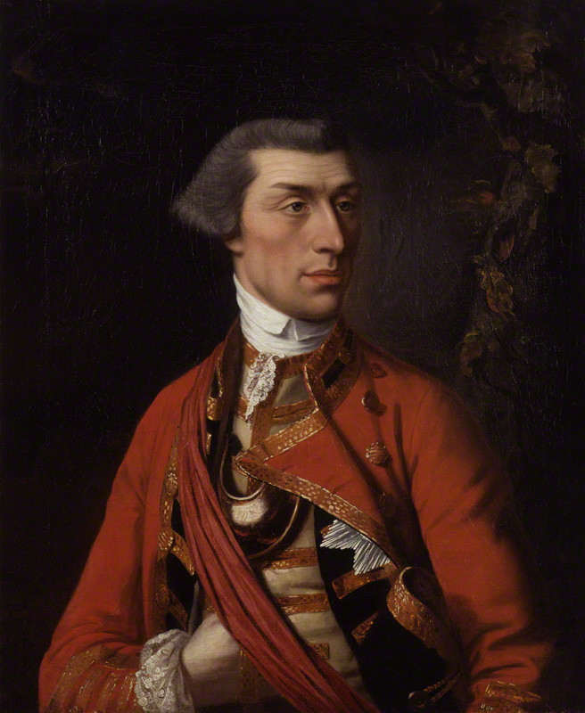
The 39th (Dorsetshire) Regiment of Foot was an infantry regiment of the British Army, raised in 1702. Under the Childers Reforms it amalgamated with the 54th (West Norfolk) Regiment of Foot to form the Dorsetshire Regiment in 1881. History Early years The regiment was first raised by Adam Loftus, 1st Viscount Lisburne as Viscount Lisburne's Regiment of Foot in 1689 but was disbanded in 1697. It was re-raised in Ireland, without lineal connection to the previous regiment, by Colonel Richard Coote as Richard Coote's Regiment of Foot in August 1702. The regiment landed at Lisbon in June 1707 for service in the War of the Spanish Succession.Cannon, p. 3 It saw action at the Battle of La Gudina in May 1709Cannon, p. 5 and then remained in Portugal until 1713 when it embarked for Gibraltar and then moved to Menorca later in the year.Cannon, p. 8 It was posted to Ireland in 1719 and sailed to Gibraltar in 1726 to reinforce the garrison.Cannon, p. 9 The regiment sailed for Jamaica in 1 ... [...More Info...] [...Related Items...] OR: [Wikipedia] [Google] [Baidu] |
1860–1861 New Zealand General Election
The 1860–1861 New Zealand general election was held between 12 December 1860 and 28 March 1861 to elect 53 MPs to the third session of the New Zealand Parliament The New Zealand Parliament ( mi, Pāremata Aotearoa) is the unicameral legislature of New Zealand, consisting of the King of New Zealand (King-in-Parliament) and the New Zealand House of Representatives. The King is usually represented by hi .... 13,196 electors were registered. 1860 was the year gold miners who held a Miner’s Right continuously for at least three months were able to vote without having to own, lease or rent property. Results Notes References * {{DEFAULTSORT:1860-1861 New Zealand general election ... [...More Info...] [...Related Items...] OR: [Wikipedia] [Google] [Baidu] |
New Zealand House Of Representatives
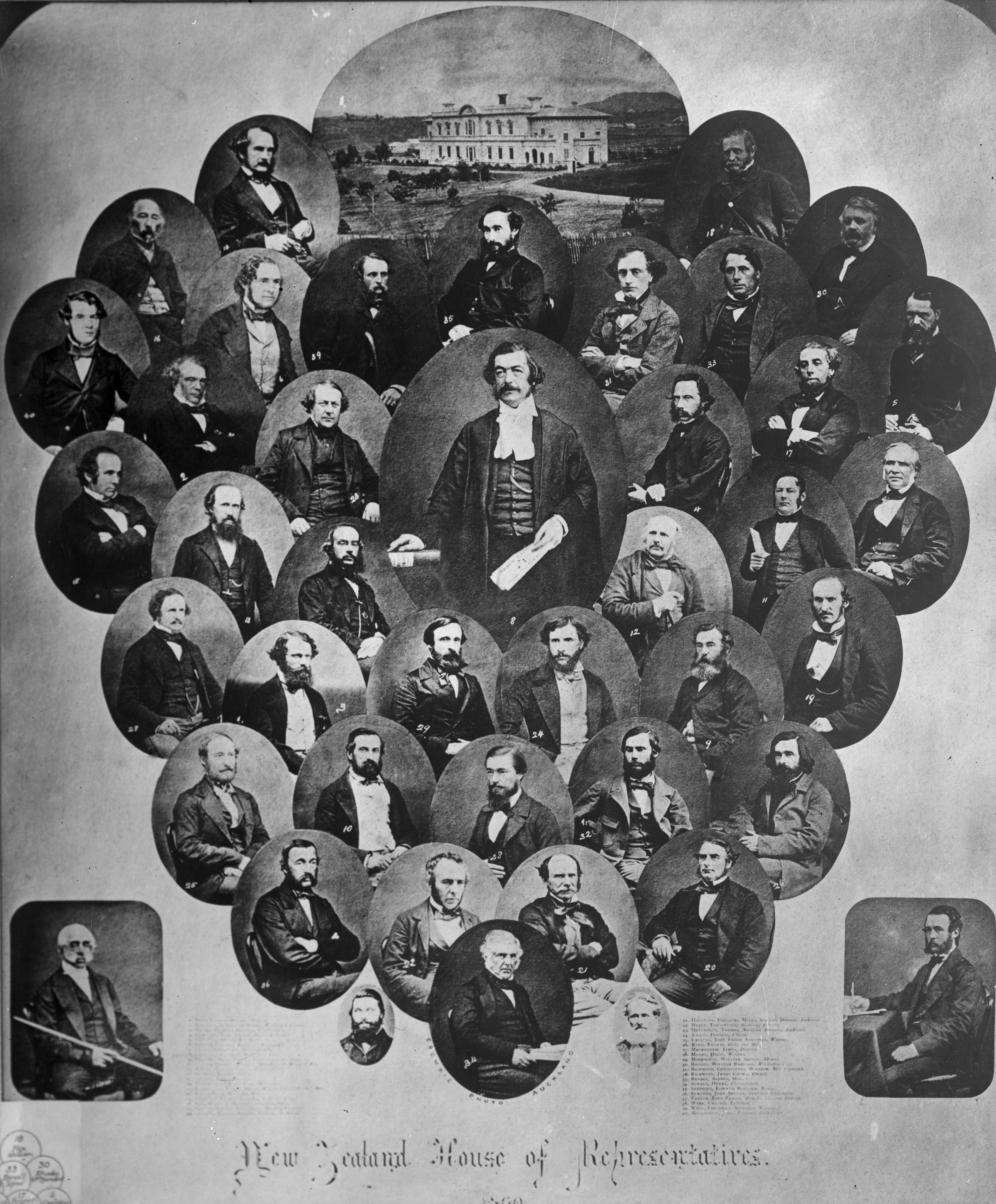
The House of Representatives is the sole chamber of the New Zealand Parliament. The House passes Law of New Zealand, laws, provides Ministers of the New Zealand Government, ministers to form Cabinet of New Zealand, Cabinet, and supervises the work of government. It is also responsible for adopting the state's New Zealand Budget, budgets and approving the state's accounts. The House of Representatives is a Representative democracy, democratic body consisting of representatives known as members of parliament (MPs). There are normally 120 MPs, though this number can be higher if there is an Overhang seat, overhang. Elections in New Zealand, Elections take place usually every three years using a mixed-member proportional representation system which combines First-past-the-post voting, first-past-the-post elected legislative seat, seats with closed party lists. 72 MPs are elected directly in single-member New Zealand electorates, electoral districts and further seats are filled by ... [...More Info...] [...Related Items...] OR: [Wikipedia] [Google] [Baidu] |
Howick, New Zealand
Howick is an eastern suburb of Auckland, New Zealand, forming part of what is sometimes called East Auckland. Modern Howick draws much of its character from the succeeding waves of Asian settlement that it has experienced since New Zealand’s immigration reforms of the 1980s, with a strong Chinese New Zealander presence in the suburb’s business and education sectors. Demographics Howick covers and had an estimated population of as of with a population density of people per km2. Howick had a population of 11,067 at the 2018 New Zealand census, an increase of 555 people (5.3%) since the 2013 census, and an increase of 1,269 people (13.0%) since the 2006 census. There were 3,822 households, comprising 5,325 males and 5,739 females, giving a sex ratio of 0.93 males per female, with 2,199 people (19.9%) aged under 15 years, 2,058 (18.6%) aged 15 to 29, 5,184 (46.8%) aged 30 to 64, and 1,626 (14.7%) aged 65 or older. Ethnicities were 67.6% European/Pākehā, 6.2% Māori, ... [...More Info...] [...Related Items...] OR: [Wikipedia] [Google] [Baidu] |
Panmure, New Zealand
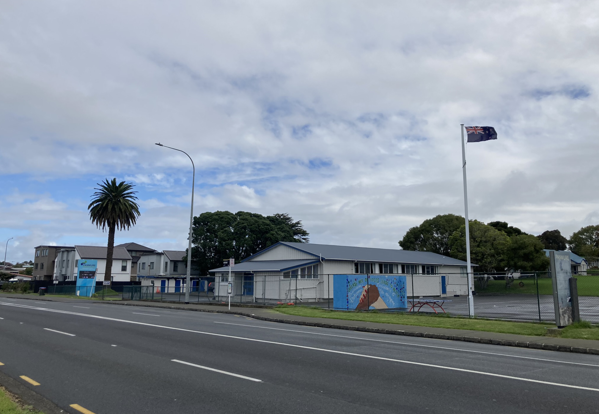
Panmure is an east Auckland suburb, in the North Island of New Zealand. It is located 11 kilometres southeast of the Auckland CBD, close to the western banks of the Tāmaki River and the northern shore of the Panmure Basin (or Kaiahiku). To the north lies the suburb of Tāmaki, and to the west is the cone of Maungarei / Mount Wellington. Demographics Panmure covers and had an estimated population of as of with a population density of people per km2. Panmure West is mostly commercial and industrial. Panmure East is mostly residential. Panmure had a population of 3,651 at the 2018 New Zealand census, an increase of 393 people (12.1%) since the 2013 census, and an increase of 732 people (25.1%) since the 2006 census. There were 1,257 households, comprising 1,839 males and 1,815 females, giving a sex ratio of 1.01 males per female, with 594 people (16.3%) aged under 15 years, 891 (24.4%) aged 15 to 29, 1,644 (45.0%) aged 30 to 64, and 525 (14.4%) aged 65 or older. Ethniciti ... [...More Info...] [...Related Items...] OR: [Wikipedia] [Google] [Baidu] |
First Taranaki War
The First Taranaki War (also known as the North Taranaki War) was an armed conflict over land ownership and sovereignty that took place between Māori people, Māori and the New Zealand government in the Taranaki district of New Zealand's North Island from March 1860 to March 1861. The war was sparked by a dispute between the government and Māori landowners over the sale of a property at Waitara, New Zealand, Waitara, but spread throughout the region. It was fought by more than 3,500 imperial troops brought in from Australia, as well as volunteer soldiers and militia, against Māori forces that fluctuated between a few hundred and about 1,500. Total losses among the imperial, volunteer and militia troops are estimated to have been 238, while Māori casualties totalled about 200, although the proportion of Māori casualties was higher. The war ended in a ceasefire, with neither side explicitly accepting the peace terms of the other. Although there were claims by the British that ... [...More Info...] [...Related Items...] OR: [Wikipedia] [Google] [Baidu] |
2nd New Zealand Parliament
The 2nd New Zealand Parliament was a term of the New Zealand Parliament, Parliament of New Zealand. It opened on 15 April 1856, following New Zealand's 1855 New Zealand general election, 1855 election. It was dissolved on 5 November 1860 in preparation for 1860–1861 New Zealand general election, 1860–61 election. The 2nd Parliament was the first under which New Zealand had responsible government, meaning that unlike previously, the New Zealand Cabinet, Cabinet was chosen (although not officially appointed) by Parliament rather than by the Governor-General of New Zealand, Governor. Historical context At this time political parties had not been established (they were not established until after the 1890 New Zealand general election, 1890 election), meaning that anyone attempting to form an administration had to win support directly from individual MPs. This made forming (and retaining) a government difficult. The Sewell Ministry, 1856, Sewell Ministry, the first responsible gov ... [...More Info...] [...Related Items...] OR: [Wikipedia] [Google] [Baidu] |
Waikato
Waikato () is a Regions of New Zealand, local government region of the upper North Island of New Zealand. It covers the Waikato District, Waipa District, Matamata-Piako District, South Waikato District and Hamilton, New Zealand, Hamilton City, as well as Hauraki Plains, Hauraki, Coromandel Peninsula, the northern King Country, much of the Taupō District, and parts of Rotorua, Rotorua District. It is governed by the Waikato Regional Council. The region stretches from Coromandel Peninsula in the north, to the north-eastern slopes of Mount Ruapehu in the south, and spans the North Island from the west coast, through the Waikato and Hauraki to Coromandel Peninsula on the east coast. Broadly, the extent of the region is the Waikato River catchment. Other major catchments are those of the Waihou River, Waihou, Piako River, Piako, Awakino River (Waikato), Awakino and Mokau River, Mokau rivers. The region is bounded by Auckland Region, Auckland on the north, Bay of Plenty on the east ... [...More Info...] [...Related Items...] OR: [Wikipedia] [Google] [Baidu] |
Pūkaki Creek
The Pūkaki Creek, also known as the Pūkaki Inlet, is an estuarine river of the Auckland Region of New Zealand's North Island. It flows south from its sources in Māngere and Papatoetoe, entering into the Manukau Harbour. The creek is adjacent to Auckland Airport and Pūkaki Marae. Geography The Pūkaki Creek is fed by various waterways in South Auckland, including the Tautauroa Creek, the Waokauri Creek (also known as the Waiokauri Creek) and the Otaimako Creek. Adjacent to the creek is the volcanic Pukaki Lagoon. At the mouth of the Pūkaki Creek is Wiroa Island, which is connected to the Auckland Airport complex by road. History Tāmaki Māori peoples were present along the Māngere-Ihumātao-Pūkaki coastline from at least 1450, establishing settlements later in the 15th century. The creek formed an important part of the Waokauri / Pūkaki portage, connecting the Manukau Harbour and Tāmaki River via Papatoetoe, and was often used by Tāmaki Māori to avoid the Te ... [...More Info...] [...Related Items...] OR: [Wikipedia] [Google] [Baidu] |
Te Ākitai Waiohua
Te Ākitai Waiohua is a Māori iwi of the southern part of the Auckland Region of New Zealand. History Te Ākitai Waiohua are descended from Kiwi Tāmaki, the grandson of Huakaiwaka, himself the ancestor of the Waiohua iwi, who lived in Tāmaki (the Auckland isthmus). The name ''Te Ākitai'' commemorates Kiwi Tāmaki's uncle Huatau, who, in the early 18th century, died at sea in the Manukau Harbour and whose body was dashed up (''āki'') by the sea (''tai'') on Puketutu Island. Kiwi Tāmaki was killed in battle with Te Taoū ''hapū'' (sub-tribe) of Ngāti Whātua in the mid-18th century. Ngāti Whātua settled in Tāmaki and the Waiohua retreated to Drury, Pōkeno, Kirikiri/Papakura, Ramarama and other parts of South Auckland. In the 1780s Te Ākitai Waiohua re-established settlements at Wiri, Pūkaki and Otahuhu. Kiwi Tāmaki had a surviving son named Rangimatoru, who lived in South Auckland with Ngā Oho, a hapū of Ngāti Whātua Ōrākei formed by intermarriages between ... [...More Info...] [...Related Items...] OR: [Wikipedia] [Google] [Baidu] |
Māngere
Māngere () or Mangere is one of the largest suburbs in Auckland, in northern New Zealand. It is located on mainly flat land on the northeastern shore of the Manukau Harbour, to the northwest of Manukau City Centre and 15 kilometres south of the Auckland city centre. It is the location of Auckland Airport, which lies close to the harbour's edge to the south of the suburb. Māngere has three major sub-areas: Māngere Bridge, Māngere Central, and Māngere East, with Favona (in the east) sometimes counted as part of Māngere as well. The suburb is named after Māngere Mountain, one of Auckland's largest volcanic cones. The cone's name comes from the Māori phrase ''hau māngere'', meaning "lazy winds", after the shelter the mountain provides from the prevailing westerly wind. In 2019, the name of the suburb was officially gazetted as Māngere. Demographics Māngere covers and had an estimated population of as of with a population density of people per km2. Māngere had ... [...More Info...] [...Related Items...] OR: [Wikipedia] [Google] [Baidu] |
