|
Mario Ruspoli, 2nd Prince Of Poggio Suasa
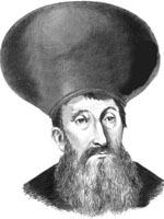
Mario dei Principi Ruspoli (October 16, 1867 – January 16, 1963) was an Italian people, Italian prince, son of Emanuele Ruspoli, 1st Prince of Poggio Suasa and first wife Princess Cocuța Conachi, Caterina Vogoride-Conachi. He was the 2nd Prince of Castelleone di Suasa, Poggio Suasa and Princes of the Holy Roman Empire, Prince of the Holy Roman Empire. He was responsible for the brief development of Chatsworth, New Jersey as a resort in the early 20th century. Marriage and children He married in Paris, September 25, 1890 Pauline Marie ''Palma'' de House of Talleyrand-Périgord, Talleyrand-Périgord (Venice, April 2, 1871 – Rome, October 21, 1952), daughter of the Maurice de Talleyrand-Périgord, the 4th Duke of Dino and Elizabeth Beers-Curtis (a sister of his father's third wife), and great-great-great-niece of Charles Maurice de Talleyrand-Périgord, by whom he had five children: *Costantino Carlo Michele Agostino dei Principi Ruspoli-Poggio Suasa (New York City, July 8, 18 ... [...More Info...] [...Related Items...] OR: [Wikipedia] [Google] [Baidu] |
Castelleone Di Suasa
Castelleone di Suasa is a town and ''comune'' within the Province of Ancona, in the Marche region of Italy. It is well known for the archaeological park of Suasa, an ancient Roman town. Rising on a hill near the river Cesano, Castelleone di Suasa is also called "green town" because of its flourishing nursery activity. Below the medieval castle there are the remains of the Roman municipality of Suasa, that rose along the branch of the via Flaminia that led to ''Sena Gallica'' (Senigallia). Since 1987 the Archaeological Superintendence of the Regione of Marche, has started a programme of excavations that has allowed the discovery of the ancient basalt street, the commercial forum, two sepulchre areas, the amphitheatre and, above all, the rich patrician dwelling that has become Archaeological Park. Main sights *The Compiano-Della Rovere palace, seat of the archaeological museum, is situated in the historical centre. It possesses a beautiful sixteenth century portal and ... [...More Info...] [...Related Items...] OR: [Wikipedia] [Google] [Baidu] |
Rome
, established_title = Founded , established_date = 753 BC , founder = King Romulus (legendary) , image_map = Map of comune of Rome (metropolitan city of Capital Rome, region Lazio, Italy).svg , map_caption = The territory of the ''comune'' (''Roma Capitale'', in red) inside the Metropolitan City of Rome (''Città Metropolitana di Roma'', in yellow). The white spot in the centre is Vatican City. , pushpin_map = Italy#Europe , pushpin_map_caption = Location within Italy##Location within Europe , pushpin_relief = yes , coordinates = , coor_pinpoint = , subdivision_type = Country , subdivision_name = Italy , subdivision_type2 = Region , subdivision_name2 = Lazio , subdivision_type3 = Metropolitan city , subdivision_name3 = Rome Capital , government_footnotes= , government_type = Strong Mayor–Council , leader_title2 = Legislature , leader_name2 = Capitoline Assemb ... [...More Info...] [...Related Items...] OR: [Wikipedia] [Google] [Baidu] |
Chelsea, London
Chelsea is an affluent area in west London, England, due south-west of Charing Cross by approximately 2.5 miles. It lies on the north bank of the River Thames and for postal purposes is part of the south-western postal area. Chelsea historically formed a manor and parish in the Ossulstone hundred of Middlesex, which became the Metropolitan Borough of Chelsea in 1900. It merged with the Metropolitan Borough of Kensington, forming the Royal Borough of Kensington and Chelsea upon the creation of Greater London in 1965. The exclusivity of Chelsea as a result of its high property prices historically resulted in the coining of the term "Sloane Ranger" in the 1970s to describe some of its residents, and some of those of nearby areas. Chelsea is home to one of the largest communities of Americans living outside the United States, with 6.53% of Chelsea residents having been born in the U.S. History Early history The word ''Chelsea'' (also formerly ''Chelceth'', ''Chelchith' ... [...More Info...] [...Related Items...] OR: [Wikipedia] [Google] [Baidu] |
Etterbeek
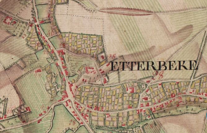
Etterbeek ( French: ; Dutch: ) is one of the 19 municipalities of the Brussels-Capital Region, Belgium. Located in the eastern part of the region, it is bordered by the municipalities of Auderghem, the City of Brussels, Ixelles, Schaerbeek, Woluwe-Saint-Lambert and Woluwe-Saint-Pierre. In common with all of Brussels' municipalities, it is legally bilingual (French–Dutch). The main university campus of Vrije Universiteit Brussel (VUB) is called ''Campus Etterbeek'', although it is geographically not within Etterbeek but in the adjacent Ixelles. History Origins and etymology According to legend, Saint Gertrude of Nivelles, daughter of Pippin of Landen, founded a chapel there in the 8th century. A document by Holy Roman Emperor Otto I, dated 966, mentions the church of ''Iatrebache''. The name ''Ietrebecca''—possibly from the Celtic root ''ett'' meaning "rapid movement" and the Dutch word ''beek'' meaning "stream"—is found for the first time in a document dated 1127. The cur ... [...More Info...] [...Related Items...] OR: [Wikipedia] [Google] [Baidu] |
Ixelles
( French, ) or (Dutch, ), is one of the 19 municipalities of the Brussels-Capital Region, Belgium. Located to the south-east of Brussels' city centre, it is geographically bisected by the City of Brussels. It is also bordered by the municipalities of Auderghem, Etterbeek, Forest, Uccle, Saint-Gilles and Watermael-Boitsfort. , the municipality had a population of 87,632 inhabitants. The total area is , which gives a population density of . In common with all of Brussels' municipalities, it is legally bilingual (French–Dutch). It is generally considered an affluent area of the city and is particularly noted for its communities of European and Congolese immigrants. Geography Ixelles is located in the south-east of Brussels and is divided into two parts by the Avenue Louise/Louizalaan, which is part of the City of Brussels. The municipality's smaller western part includes the Rue du Bailli/Baljuwstraat and extends roughly from the Avenue Louise to the /, whilst its la ... [...More Info...] [...Related Items...] OR: [Wikipedia] [Google] [Baidu] |
Brussels
Brussels (french: Bruxelles or ; nl, Brussel ), officially the Brussels-Capital Region (All text and all but one graphic show the English name as Brussels-Capital Region.) (french: link=no, Région de Bruxelles-Capitale; nl, link=no, Brussels Hoofdstedelijk Gewest), is a region of Belgium comprising 19 municipalities, including the City of Brussels, which is the capital of Belgium. The Brussels-Capital Region is located in the central portion of the country and is a part of both the French Community of Belgium and the Flemish Community, but is separate from the Flemish Region (within which it forms an enclave) and the Walloon Region. Brussels is the most densely populated region in Belgium, and although it has the highest GDP per capita, it has the lowest available income per household. The Brussels Region covers , a relatively small area compared to the two other regions, and has a population of over 1.2 million. The five times larger metropolitan area of Brusse ... [...More Info...] [...Related Items...] OR: [Wikipedia] [Google] [Baidu] |
Egypt
Egypt ( ar, مصر , ), officially the Arab Republic of Egypt, is a transcontinental country spanning the northeast corner of Africa and southwest corner of Asia via a land bridge formed by the Sinai Peninsula. It is bordered by the Mediterranean Sea to the north, the Gaza Strip of Palestine and Israel to the northeast, the Red Sea to the east, Sudan to the south, and Libya to the west. The Gulf of Aqaba in the northeast separates Egypt from Jordan and Saudi Arabia. Cairo is the capital and largest city of Egypt, while Alexandria, the second-largest city, is an important industrial and tourist hub at the Mediterranean coast. At approximately 100 million inhabitants, Egypt is the 14th-most populated country in the world. Egypt has one of the longest histories of any country, tracing its heritage along the Nile Delta back to the 6th–4th millennia BCE. Considered a cradle of civilisation, Ancient Egypt saw some of the earliest developments of writing, agriculture, ur ... [...More Info...] [...Related Items...] OR: [Wikipedia] [Google] [Baidu] |
El Alamein
El Alamein ( ar, العلمين, translit=al-ʿAlamayn, lit=the two flags, ) is a town in the northern Matrouh Governorate of Egypt. Located on the Arab's Gulf, Mediterranean Sea, it lies west of Alexandria and northwest of Cairo. , it had a population of 7,397 inhabitants. The town is located on the site of the ancient city Antiphrai (). Tourism El Alamein war museum El Alamein has a war museum with artifacts from North African battles. Military cemeteries Germany There are Italian and German military cemeteries on Tel el-Eisa Hill outside the town. The German cemetery is an ossuary, built in the style of a medieval fortress. Italy The Italian cemetery is a mausoleum containing 5,200 tombs. Many tombs bear the soldier's names, with others simply marked IGNOTO, i.e. unknown. Greek There is a Greek cemetery at El Alamein. Commonwealth of Nations There is a Commonwealth war cemetery, built and maintained by the Commonwealth War Graves Commission, with graves of sold ... [...More Info...] [...Related Items...] OR: [Wikipedia] [Google] [Baidu] |
Deir El-Munassib
Deir or DEIR may refer to: * Ad Deir or The Monastery, a building in Petra, Jordan *Tell Deir, an archaeological site in Lebanon *Deir ez-Zor or Ad-Deir, a city in Syria * Draft environmental impact report, a document required in United States environmental law People with the surname *Edward Deir (1915–1990), Canadian canoeist See also * , includes many place names and names of buildings, as ''deir'' is Arabic for 'monastery' or 'convent' * * Dair, the seventh letter of the Ogham alphabet * Der (other) Der or DER may refer to: Places * Darkənd, Azerbaijan * Dearborn (Amtrak station) (station code), in Michigan, US * Der (Sumer), an ancient city located in modern-day Iraq * d'Entrecasteaux Ridge, an oceanic ridge in the south-west Pacific Ocean ... * Deyr (other) {{disambiguation, geo, surname ... [...More Info...] [...Related Items...] OR: [Wikipedia] [Google] [Baidu] |
Second Battle Of El Alamein
The Second Battle of El Alamein (23 October – 11 November 1942) was a battle of the Second World War that took place near the Egyptian Railway station, railway halt of El Alamein. The First Battle of El Alamein and the Battle of Alam el Halfa had prevented the Axis powers, Axis from advancing further into Egypt. In August 1942, General (United Kingdom), General Claude Auchinleck had been relieved as Commander-in-Chief Middle East Command and his successor, Lieutenant-General William Gott was killed on his way to replace him as commander of the Eighth Army (United Kingdom), Eighth Army. Lieutenant-general (United Kingdom), Lieutenant-General Bernard Montgomery was appointed and led the Eighth Army offensive. The British victory was the beginning of the end of the Western Desert Campaign, eliminating the Axis threat to Egypt, the Suez Canal and the Middle Eastern and Persian oil fields. The battle revived the morale of the Allies, being the first big success against the Axis sin ... [...More Info...] [...Related Items...] OR: [Wikipedia] [Google] [Baidu] |
Charles Maurice De Talleyrand-Périgord
Charles-Maurice de Talleyrand-Périgord (, ; 2 February 1754 – 17 May 1838), 1st Prince of Benevento, then Prince of Talleyrand, was a French clergyman, politician and leading diplomat. After studying theology, he became Agent-General of the Clergy in 1780. In 1789, just before the French Revolution, he became Bishop of Autun. He worked at the highest levels of successive French governments, most commonly as foreign minister or in some other diplomatic capacity. His career spanned the regimes of Louis XVI, the years of the French Revolution, Napoleon, Louis XVIII, and Louis-Philippe. Those Talleyrand served often distrusted him but, like Napoleon, found him extremely useful. The name "Talleyrand" has become a byword for crafty, cynical diplomacy. He was Napoleon's chief diplomat during the years when French military victories brought one European state after another under French hegemony. However, most of the time, Talleyrand worked for peace so as to consolidate France's g ... [...More Info...] [...Related Items...] OR: [Wikipedia] [Google] [Baidu] |

.jpg)


