|
Marino Curnis
Marino Curnis (born 7 May 1973) is an Italian writer, poet, musician, language student and traveller. He is known mainly because of his travel on foot from Bergamo, Italy, to Iran. His trip was called Eurasia Pedibus Calcantibus. It covered 6.000 kilometres over 13 months (9 January 2006 – 7 February 2007). Early life Marino Curnis was born in Bergamo, Italy. In 2003, he started to learn Esperanto and he earned first and second level diplomas. He has a Nursery Assistant School Diploma and a two-year course at Liceo specializing in humanities. Travelling He has taken many journeys on foot. In the Alps he ascended: Punta Rossa (Aosta, mt.3660), Pizzo Coca, Pizzo Camino, Pizzo Tre Signori and Corno Stella.. He twice trekked "Sentiero delle Orobie Orientali". In 2003, he walked along the "Camino de Santiago do Compostela" in the North of Spain, from St.Jean Pie-du-Port (France) to Santiago do Compostela (1021 km in 37 days). In 2006 he walked from Bergamo, Italy ... [...More Info...] [...Related Items...] OR: [Wikipedia] [Google] [Baidu] |
Pizzo Tre Signori
Pizzo Tre Signori is a mountain in the Bergamo Alps, with an elevation of . Etymology The name stems from the historical division of the area that it marked, between the State of Milan, the Republic of Venice and the Grisons canton of Switzerland. Geography The mountain is located between the Valtellina, Val Brembana and Valsassina. It represents the tripoint between the Italian provinces of Sondrio, Lecco and Bergamo. SOIUSA classification According to the SOIUSA (''International Standardized Mountain Subdivision of the Alps'') the mountain can be classified in the following way: *main part = Eastern Alps *major sector = Southern Limestone Alps *section = Bergamasque Alps and Prealps *subsection = Bergamo Alps *supergroup = Orobie Occidentali *group = Gruppo del Tre Signori *code In communications and information processing, code is a system of rules to convert information—such as a letter, word, sound, image, or gesture—into another form, sometimes shortened o ... [...More Info...] [...Related Items...] OR: [Wikipedia] [Google] [Baidu] |
Leonardo Da Vinci
Leonardo di ser Piero da Vinci (15 April 14522 May 1519) was an Italian polymath of the High Renaissance who was active as a painter, Drawing, draughtsman, engineer, scientist, theorist, sculptor, and architect. While his fame initially rested on his achievements as a painter, he also became known for #Journals and notes, his notebooks, in which he made drawings and notes on a variety of subjects, including anatomy, astronomy, botany, cartography, painting, and paleontology. Leonardo is widely regarded to have been a genius who epitomized the Renaissance humanism, Renaissance humanist ideal, and his List of works by Leonardo da Vinci, collective works comprise a contribution to later generations of artists matched only by that of his younger contemporary, Michelangelo. Born Legitimacy (family law), out of wedlock to a successful Civil law notary, notary and a lower-class woman in, or near, Vinci, Tuscany, Vinci, he was educated in Florence by the Italian painter and sculptor ... [...More Info...] [...Related Items...] OR: [Wikipedia] [Google] [Baidu] |
Nepal
Nepal (; ne, नेपाल ), formerly the Federal Democratic Republic of Nepal ( ne, सङ्घीय लोकतान्त्रिक गणतन्त्र नेपाल ), is a landlocked country in South Asia. It is mainly situated in the Himalayas, but also includes parts of the Indo-Gangetic Plain, bordering the Tibet Autonomous Region of China to the north, and India in the south, east, and west, while it is narrowly separated from Bangladesh by the Siliguri Corridor, and from Bhutan by the Indian state of Sikkim. Nepal has a diverse geography, including fertile plains, subalpine forested hills, and eight of the world's ten tallest mountains, including Mount Everest, the highest point on Earth. Nepal is a multi-ethnic, multi-lingual, multi-religious and multi-cultural state, with Nepali as the official language. Kathmandu is the nation's capital and the largest city. The name "Nepal" is first recorded in texts from the Vedic period of the India ... [...More Info...] [...Related Items...] OR: [Wikipedia] [Google] [Baidu] |
Pokhara
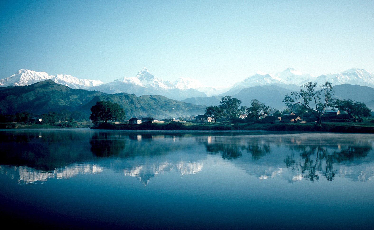
Pokhara ( ne, पोखरा, ) is a metropolis, metropolitan city in Nepal, which serves as the capital of Gandaki Province. It is the List of cities in Nepal, second most populous city of Nepal after Kathmandu, with 518,452 inhabitants living in 101,669 households in 2021 Nepal census, 2021. It is the country's largest metropolitan city in terms of area. The city also serves as the headquarters of Kaski District. Pokhara is located west of the capital, Kathmandu. The city is on the shore of Phewa Lake, and sits at an elevation of approximately 822m. The Annapurna Range, with three out of the ten highest peaks in the world—Dhaulagiri, Annapurna, Annapurna I and Manaslu—is within of the valley. Pokhara is considered the tourism capital of Nepal, being a base for trekkers undertaking the Annapurna Circuit through the Annapurna Conservation Area region of the Annapurna ranges in the Himalayas. The city is also home to many of the elite Gurkha soldiers, soldiers native to So ... [...More Info...] [...Related Items...] OR: [Wikipedia] [Google] [Baidu] |
Besisahar
Besishahar ( ne, बेसीशहर नगरपालिका) is a municipality and the district headquarters of Lamjung District in Gandaki Province, Nepal. The Besishahar Municipality was formed by merging the existing Village Development Committees i.e. Besishahar, Gaunshahar, Udipur, Chandisthan, Baglungpani (wards no. 3,4,7,8 & 9), Bajhakhet, Hiletaksar (wards no. 9) and Chiti and have 11 wards. This municipality has a sub-tropical climate with deciduous forests. Annapurna II, Machhapuchhre, Lamjung Himal can be viewed from north of Besishahar Municipality. Population At the time of the 2011 Nepal census it had a population of 39,356 including Besishahar, Gaunshahar, Udipur, Chiti, Baglungpani, Bajhakhet and Chandisthan. Transportation and communications Dumre–Besishahar–Chame Highway connects the city to various parts of Nepal. The proximity of this city from Kathmandu (178.8 km), Pokhara (108.9 km), Bharatpur (104 km), Birganj (234& ... [...More Info...] [...Related Items...] OR: [Wikipedia] [Google] [Baidu] |
Annapurna Massif
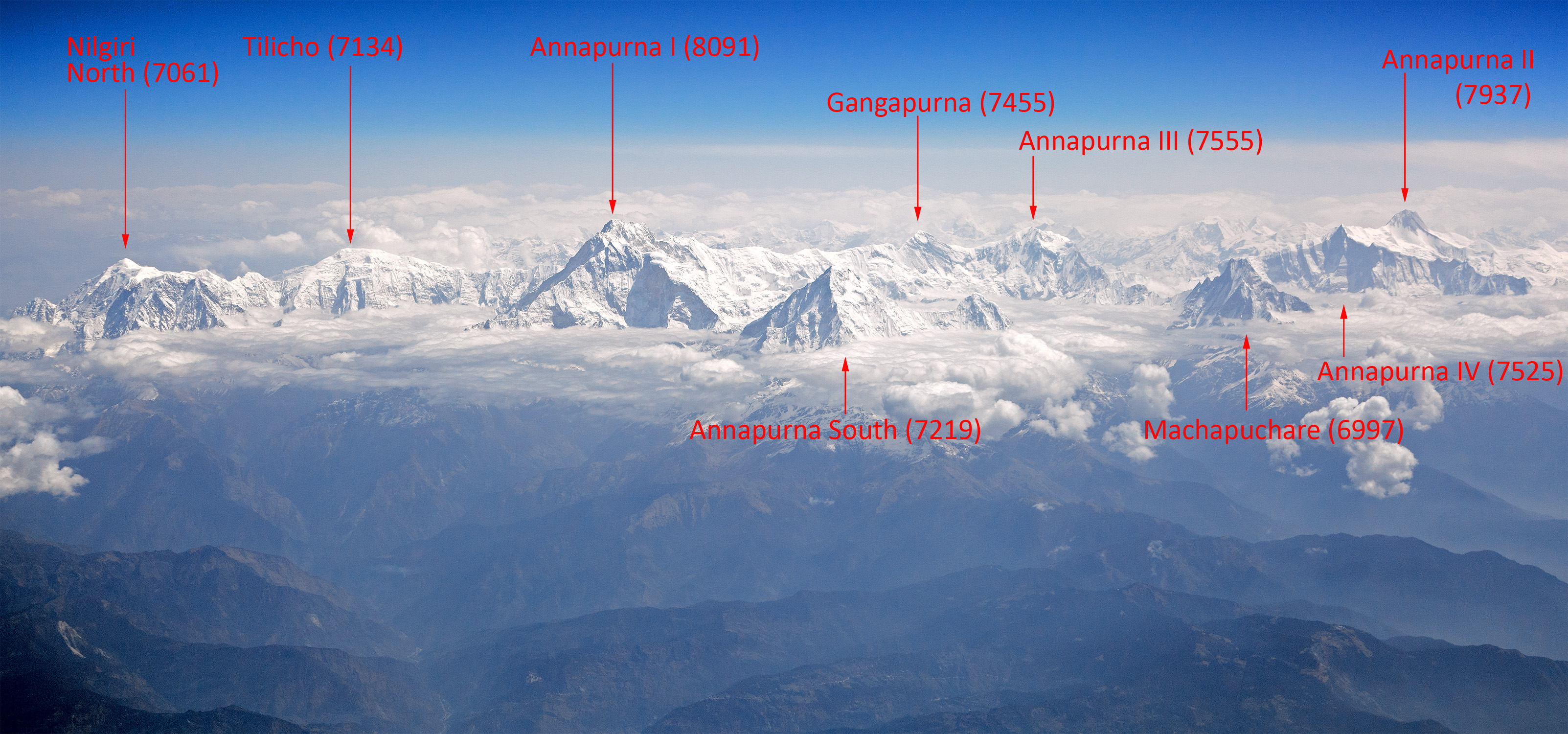
Annapurna (; ne, अन्नपूर्ण) is a massif in the Himalayas in north-central Nepal that includes one peak over , thirteen peaks over , and sixteen more over . The massif is long, and is bounded by the Kali Gandaki Gorge on the west, the Marshyangdi, Marshyangdi River on the north and east, and by Pokhara Valley on the south. At the western end, the massif encloses a high basin called the Annapurna Sanctuary. The highest peak of the massif, Annapurna, Annapurna I Main, is the List of highest mountains#List, tenth highest mountain in the world at above sea level. Maurice Herzog led a 1950 French Annapurna expedition, French expedition to its summit through the north face in 1950, making it the first Eight-thousander, eight-thousand meter peak ever successfully climbed. The name for the range comes from the Hindu deity Annapurna (goddess), Annapurna meaning ''the giver of food and nourishment'' due to the evergreen flowing rivers originating from this mountain range ... [...More Info...] [...Related Items...] OR: [Wikipedia] [Google] [Baidu] |
Corno Stella
Corno Stella is a mountain of Lombardy Lombardy ( it, Lombardia, Lombard language, Lombard: ''Lombardia'' or ''Lumbardia' '') is an administrative regions of Italy, region of Italy that covers ; it is located in the northern-central part of the country and has a population of about 10 ..., Italy. It is located within the Bergamo Alps. Mountains of the Alps Mountains of Lombardy {{Lombardy-geo-stub ... [...More Info...] [...Related Items...] OR: [Wikipedia] [Google] [Baidu] |
Pizzo Camino
Pizzo Camino (Pis Camì) is a mountain in the Bergamo Prealps, with a height of . It belongs to the massif dividing the upper Val di Scleve from the upper Val Camonica, together with the Concarena and the Cimone della Bagozza. It is on the boundaries between the provinces of Brescia and Bergamo. The summit is composed from limestone rocks, formed in the middle Triassic period from the former Tethys Ocean. The lower sides have instead a more sandstone-marl composition. SOIUSA classification According to the SOIUSA (''International Standardized Mountain Subdivision of the Alps'') the mountain can be classified in the following way: * main part = Eastern Alps * major sector = Southern Limestone Alps * section = Bergamasque Alps and Prealps * subsection = Bergamasque Prealps * supergroup = Prealpi Bergamasche Orientali * group = Gruppo Camino-Concarena * subgroup = Gruppo del Pizzo Camino * code In communications and information processing, code is a system of r ... [...More Info...] [...Related Items...] OR: [Wikipedia] [Google] [Baidu] |
Travel
Travel is the movement of people between distant geographical locations. Travel can be done by foot, bicycle, automobile, train, boat, bus, airplane, ship or other means, with or without luggage, and can be one way or round trip. Travel can also include relatively short stays between successive movements, as in the case of tourism. Etymology The origin of the word "travel" is most likely lost to history. The term "travel" may originate from the Old French word ''travail'', which means 'work'. According to the Merriam-Webster dictionary, the first known use of the word ''travel'' was in the 14th century. It also states that the word comes from Middle English , (which means to torment, labor, strive, journey) and earlier from Old French (which means to work strenuously, toil). In English, people still occasionally use the words , which means struggle. According to Simon Winchester in his book ''The Best Travelers' Tales (2004)'', the words ''travel'' and ''travail'' bot ... [...More Info...] [...Related Items...] OR: [Wikipedia] [Google] [Baidu] |
Pizzo Coca
Pizzo Coca ( Lombard: ''Ol Coca'') is a mountain that straddles the Val Seriana and the Valtellina in Lombardy, Italy. It is the highest peak in the Bergamo Alps (also called the Orobie Alps). Its height is 3,050 metres with a prominence height of 1,878 metres and a saddle of 1,172 metres. A post-glacial valley exists near a point called "ometto in sassi" (literally "little man in rock") at 2,400 meters. Geology and orogeny The Alps form a part of a tertiary orogenic belt of mountain chains, called the Alpide belt, that stretches through southern Europe and Asia from the Atlantic stretching eastward to the Himalayas. The Bergamo Alps have three prominent peaks named Pizzo Coca, Punta Scaiss and Pizzo Redorta. As with its parent Alpine belt, Pizzo Coca is composed of "dark-coloured" sedimentary mountain rock with "huge rocky spurs" known as a pyramid type peak. Pizzo Coca, along with the other Bergamo crystalline peaks, exist parallel to the Valtellina Valley. Narrow and vert ... [...More Info...] [...Related Items...] OR: [Wikipedia] [Google] [Baidu] |
Piz Cotschen (Ortler Alps)
Piz Cotschen, also named ''Rötlspitz'' or ''Punta Rosa'', is a mountain of the Ortler Alps, overlooking both the Umbrail and Stelvio Pass. Its summit is located within the Swiss canton of Graubünden, near the border with Italy Italy ( it, Italia ), officially the Italian Republic, ) or the Republic of Italy, is a country in Southern Europe. It is located in the middle of the Mediterranean Sea, and its territory largely coincides with the homonymous geographical re .... References External links Piz Cotschen on Hikr.org Ortler Alps Mountains of Graubünden Mountains of the Alps Alpine three-thousanders Mountains partially in Italy Mountains of Switzerland Val Müstair {{graubünden-mountain-stub ... [...More Info...] [...Related Items...] OR: [Wikipedia] [Google] [Baidu] |

.jpg)


