|
Marietta, Ohio
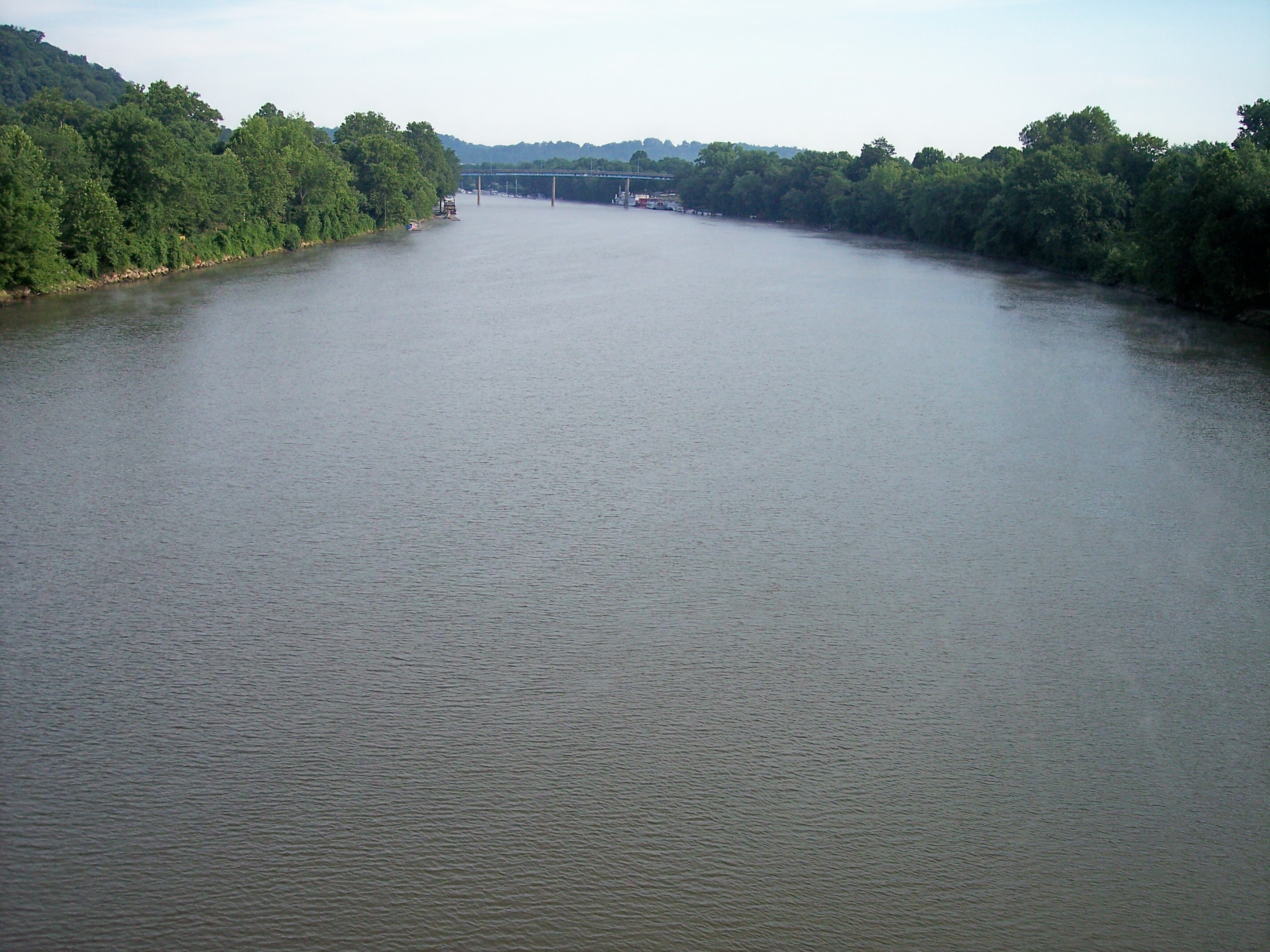
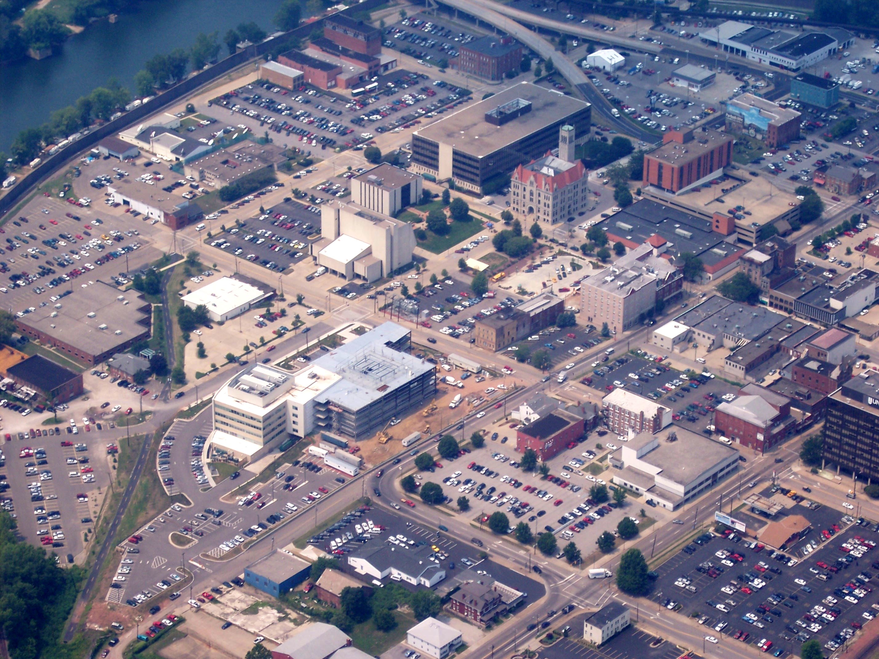
Marietta is a city in, and the county seat of, Washington County, Ohio, United States. It is located in southeastern Ohio at the confluence of the Muskingum and Ohio Rivers, northeast of Parkersburg, West Virginia. As of the 2020 census, Marietta has a population of 13,385 people and is the principal city of the Marietta Micropolitan Statistical Area, which includes all of Washington County, and is the second-largest city in the Parkersburg–Marietta–Vienna, WV–OH Combined Statistical Area. Founded in 1788 by pioneers to the Ohio Country, Marietta was the first permanent U.S. settlement in the newly established Northwest Territory, created in 1787, and what would later become the state of Ohio. It is named for Marie Antoinette, then Queen of France, in honor of French aid in the American Revolution. Prior to American settlement, the area was inhabited by various native tribes of the Hopewell tradition, who built the Marietta Earthworks, a complex more than 1,500 years ... [...More Info...] [...Related Items...] OR: [Wikipedia] [Google] [Baidu] |
City
A city is a human settlement of notable size.Goodall, B. (1987) ''The Penguin Dictionary of Human Geography''. London: Penguin.Kuper, A. and Kuper, J., eds (1996) ''The Social Science Encyclopedia''. 2nd edition. London: Routledge. It can be defined as a permanent and densely settled place with administratively defined boundaries whose members work primarily on non-agricultural tasks. Cities generally have extensive systems for housing, transportation, sanitation, utilities, land use, production of goods, and communication. Their density facilitates interaction between people, government organisations and businesses, sometimes benefiting different parties in the process, such as improving efficiency of goods and service distribution. Historically, city-dwellers have been a small proportion of humanity overall, but following two centuries of unprecedented and rapid urbanization, more than half of the world population now lives in cities, which has had profound consequences for g ... [...More Info...] [...Related Items...] OR: [Wikipedia] [Google] [Baidu] |
Federal Information Processing Standard
The Federal Information Processing Standards (FIPS) of the United States are a set of publicly announced standards that the National Institute of Standards and Technology (NIST) has developed for use in computer systems of non-military, American government agencies and contractors. FIPS standards establish requirements for ensuring computer security and interoperability, and are intended for cases in which suitable industry standards do not already exist. Many FIPS specifications are modified versions of standards the technical communities use, such as the American National Standards Institute (ANSI), the Institute of Electrical and Electronics Engineers (IEEE), and the International Organization for Standardization (ISO). Specific areas of FIPS standardization The U.S. government has developed various FIPS specifications to standardize a number of topics including: * Codes, e.g., FIPS county codes or codes to indicate weather conditions or emergency indications. In 1994, Nat ... [...More Info...] [...Related Items...] OR: [Wikipedia] [Google] [Baidu] |
Marietta Earthworks
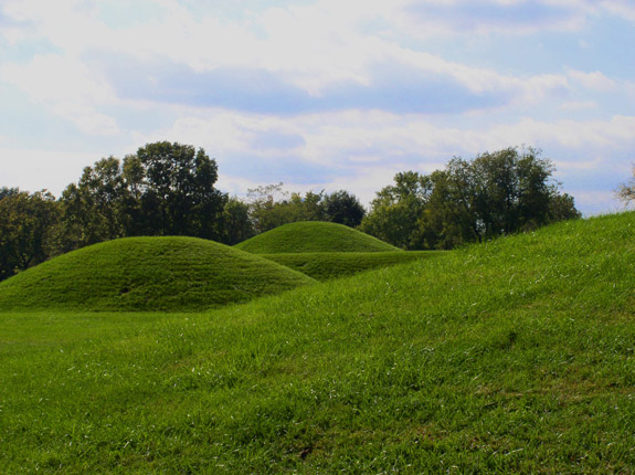
The Marietta Earthworks is an archaeological site located at the confluence of the Muskingum and Ohio Rivers in Washington County, Ohio, United States. Most of this Hopewellian complex of earthworks is now covered by the modern city of Marietta. Archaeologists have dated the ceremonial site's construction to approximately 100 BCE to 500 CE. Description Early European American settlers gave the structures Latin names. The complex includes the ''Sacra Via'' (meaning "sacred way"), three walled enclosures, the ''Quadranaou'', ''Capitolium'' (meaning "capital") and at least two other additional platform mounds, and the ''Conus'' burial mound and its accompanying ditch and embankment. Capitolium The ''Capitolium'' is a truncated pyramidal mound with three ramps leading to its summit. It is slightly smaller than the ''Quadranaou'' mound. Although not in pristine condition, it has been mostly preserved due to the construction of the Washington County Library on its summit in 1916. Acc ... [...More Info...] [...Related Items...] OR: [Wikipedia] [Google] [Baidu] |
Hopewell Tradition
The Hopewell tradition, also called the Hopewell culture and Hopewellian exchange, describes a network of precontact Native American cultures that flourished in settlements along rivers in the northeastern and midwestern Eastern Woodlands from 100 BCE to 500 CE, in the Middle Woodland period. The Hopewell tradition was not a single culture or society but a widely dispersed set of populations connected by a common network of trade routes. At its greatest extent, the Hopewell exchange system ran from the northern shores of Lake Ontario south to the Crystal River Indian Mounds in modern-day Florida. Within this area, societies exchanged goods and ideas, with the highest amount of activity along waterways, which were the main transportation routes. Peoples within the Hopewell exchange system received materials from all over the territory of what now comprises the mainland United States. Most of the items traded were exotic materials; they were delivered to peoples living in the majo ... [...More Info...] [...Related Items...] OR: [Wikipedia] [Google] [Baidu] |
France In The American Revolutionary War
French involvement in the American Revolutionary War of 1775–1783 began in 1776 when the Kingdom of France secretly shipped supplies to the Continental Army of the Thirteen Colonies when it was established in June 1775. France was a long-term historical rival with the Kingdom of Great Britain, from which the Colonies were attempting to separate. A Treaty of Alliance between the French and the Continental Army followed in 1778, which led to French money, matériel and troops being sent to the United States. An ignition of a global war with Britain started shortly thereafter. Subsequently, Spain and the Dutch Republic also began to send assistance, which, along with other political developments in Europe, left the British with no allies during the conflict (excluding the Hessians). Spain openly declared war in 1779, and war between British and Dutch followed soon after. France's help was a major and decisive contribution towards the United States' eventual victory and indepe ... [...More Info...] [...Related Items...] OR: [Wikipedia] [Google] [Baidu] |
Northwest Territory
The Northwest Territory, also known as the Old Northwest and formally known as the Territory Northwest of the River Ohio, was formed from unorganized western territory of the United States after the American Revolutionary War. Established in 1787 by the Congress of the Confederation through the Northwest Ordinance, it was the nation's first post-colonial organized incorporated territory. At the time of its creation, the territory included all the land west of Pennsylvania, northwest of the Ohio River and east of the Mississippi River below the Great Lakes, and what later became known as the Boundary Waters. The region was ceded to the United States in the Treaty of Paris of 1783. Throughout the Revolutionary War, the region was part of the British Province of Quebec. It spanned all or large parts of six eventual U.S. states (Ohio, Indiana, Illinois, Michigan, Wisconsin, and the northeastern part of Minnesota). Reduced to present-day Ohio, eastern Michigan and a sliver of sout ... [...More Info...] [...Related Items...] OR: [Wikipedia] [Google] [Baidu] |
United States Census 2020
The United States census of 2020 was the twenty-fourth decennial United States census. Census Day, the reference day used for the census, was April 1, 2020. Other than a pilot study during the 2000 United States census, 2000 census, this was the first U.S. census to offer options to respond online or by phone, in addition to the paper response form used for previous censuses. The census was taken during the COVID-19 pandemic, which affected its administration. The census recorded a resident population of 331,449,281 in the fifty states and the District of Columbia, an increase of 7.4 percent, or 22,703,743, over the preceding decade. The growth rate was the second-lowest ever recorded, and the net increase was the sixth highest in history. This was the first census where the ten most populous states each surpassed 10 million residents as well as the first census where the ten most populous cities each surpassed 1 million residents. Background As required by the United States Cons ... [...More Info...] [...Related Items...] OR: [Wikipedia] [Google] [Baidu] |
Parkersburg, West Virginia
Parkersburg is a city in and the county seat of Wood County, West Virginia, Wood County, West Virginia. Located at the confluence of the Ohio River, Ohio and Little Kanawha River, Little Kanawha rivers, it is the state's fourth-largest city and the largest city in the Parkersburg-Marietta-Vienna metropolitan area. The population was 29,749 at the 2020 United States census, 2020 census. The city is about south of Marietta, Ohio. The Baltimore and Ohio Railroad reached Parkersburg in 1857, but lacked a crossing over the Ohio River until after the American Civil War. When the B&O completed the Parkersburg Bridge (CSX) 1868–1870 to Belpre, Ohio, Belpre, it was the longest railroad bridge in the world. The Bureau of the Public Debt, an agency of the U.S. Treasury Department, was relocated from the Washington, D.C. metropolitan area in the late 20th century and headquartered in Parkersburg. In October 2012, it was merged with the Financial Management Service to form the Bureau of ... [...More Info...] [...Related Items...] OR: [Wikipedia] [Google] [Baidu] |
County Seat
A county seat is an administrative center, seat of government, or capital city of a county or civil parish. The term is in use in Canada, China, Hungary, Romania, Taiwan, and the United States. The equivalent term shire town is used in the US state of Vermont and in some other English-speaking jurisdictions. County towns have a similar function in the Republic of Ireland and the United Kingdom, as well as historically in Jamaica. Function In most of the United States, counties are the political subdivisions of a state. The city, town, or populated place that houses county government is known as the seat of its respective county. Generally, the county legislature, county courthouse, sheriff's department headquarters, hall of records, jail and correctional facility are located in the county seat, though some functions (such as highway maintenance, which usually requires a large garage for vehicles, along with asphalt and salt storage facilities) may also be located or conducted ... [...More Info...] [...Related Items...] OR: [Wikipedia] [Google] [Baidu] |


